|
Valiyaparamba Panchayath
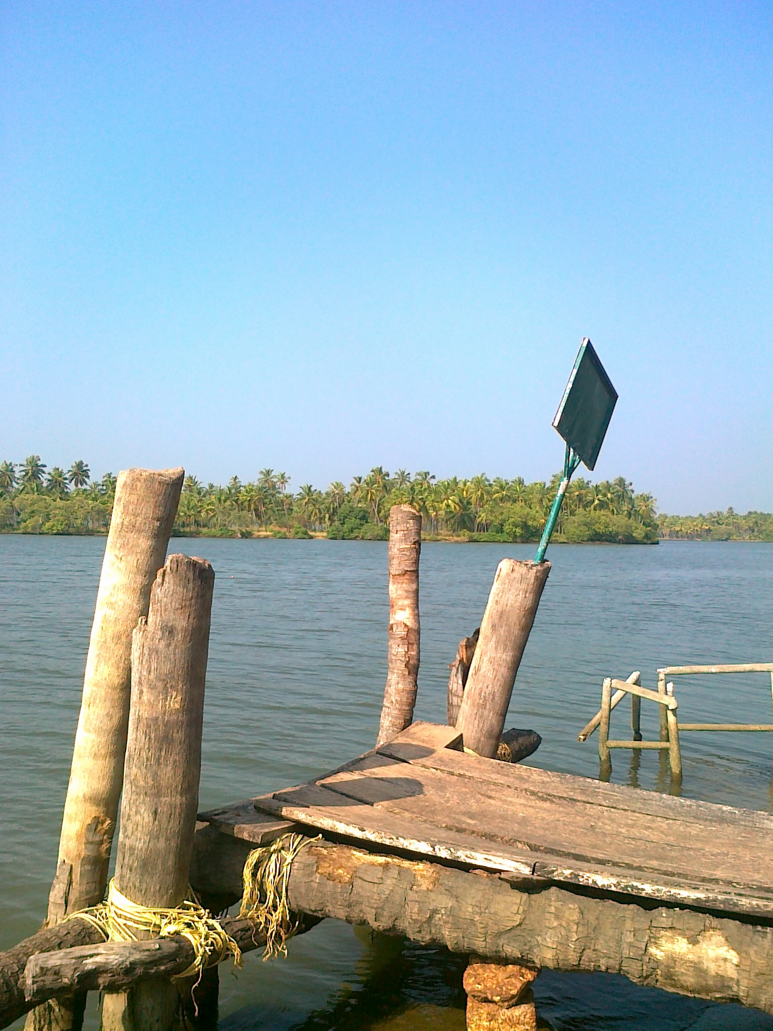
Valiyaparamba (Malayalam: ''വലിയപറമ്പ'') is a coastal island in Hosdurg taluk, Kasaragod district, Kerala state, India. Location Valiyaparamba is one of the fastest growing tourism destination and longest island of Kerala. Island is separated from the mainland by Kavvayi Backwater. It is located southwest of Cheruvathur and about from Bekal, Kasaragod, north Kerala. The island is approximately in size, and had a population of 11,917 in 1991. The island's main source of income is from Tourii, agriculture and fishing. The island has 13 wards ruling by each ward member to leading the Valiyaparamba Panchayat. Geography Valiyaparamba is fed by four rivers and dotted with numerous little islands. Valiyaparamba, a hinterland separated from the mainland, is a noted fishing centre in the district. A Bekal Fort stands on a headland that runs into the sea. A List of National Waterways in India, National Waterway passes through the island. Education The island has ... [...More Info...] [...Related Items...] OR: [Wikipedia] [Google] [Baidu] |
Karnataka State
Karnataka ( ) is a States and union territories of India, state in the southwestern region of India. It was Unification of Karnataka, formed as Mysore State on 1 November 1956, with the passage of the States Reorganisation Act, 1956, States Reorganisation Act, and renamed ''Karnataka'' in 1973. The state is bordered by the Lakshadweep Sea to the west, Goa to the northwest, Maharashtra to the north, Telangana to the northeast, Andhra Pradesh to the east, Tamil Nadu to the southeast, and Kerala to the southwest. With 61,130,704 inhabitants at the 2011 census, Karnataka is the List of states and union territories of India by population, eighth-largest state by population, comprising 31 List of districts in India, districts. With 15,257,000 residents, the state capital Bengaluru is the largest city of Karnataka. The economy of Karnataka is among the most productive in the country with a gross state domestic product (GSDP) of and a per capita GSDP of for the financial year 2023– ... [...More Info...] [...Related Items...] OR: [Wikipedia] [Google] [Baidu] |
Padne
Padne is a village in the southernmost part of the Kasaragod district, state of Kerala, India. Administration Padne village is administered by Padne Grama Panchayat under Nileshwaram Block Panchayat. Padne Panchayat composed of the villages of Padne and Udinoor. Padne Panchayat is politically a part of Thrikaripur (State Assembly constituency) in Kasaragod (Lok Sabha constituency). Demographics As of 2011 Census, Padne village had a population of 21,009 with 9,568 males and 11,441 females. Padne village has an area of with 3,776 families residing in it. The average male female sex ratio was 1196 higher than the state average of 1084. In Padne, 13.7% of the population was under 6 years of age. Padne village had an average literacy of 92.6% higher than the national average of 74% and lower than state average of 94%: male literacy was 96.2% and female literacy was 89.7%. Economy One major industry in Padanna is mussel farming, originally popularized by the CMFR Institute. ... [...More Info...] [...Related Items...] OR: [Wikipedia] [Google] [Baidu] |
Trikarpur
Thrikaripur a small town located in south part of Kasaragod District in the state of Kerala, India. Its southernmost end Olavara touches Payyannur, Kannur District. Demographics The 2001 Census of India determined that the population of Trikaripur had a population of 32,626. Geography Thrikaripur lies along the coast of Arabian Sea, at This Panchayat serves as the separating border for Kasaragod District and Kannur District. Educational Institutions Colleges * Rajiv Gandhi Institute of Pharmacy * Trikaripur Arts & Science College (TASC) *SMMKT School of Information Technology & Commerce (SMMKT SITC) Places of worship * Sri Chakrapani Temple, Thrikaripur, temple dedicated to Vishnu. Notable people * Arya (Jamshad Cethirakath) * Asif Kottayil * Muhammed Rafi * Muttah Suresh * Sathya (Shahir Cethirakath) See also * Payyannur 8 km from Trikkaripur * Peringome 21 km from Payyanur * Ezhimala 12 km from Payyanur * Kunhimangalam 5 km from Payyan ... [...More Info...] [...Related Items...] OR: [Wikipedia] [Google] [Baidu] |
Karivellur
Karivellur is a census town and a Gram Panchayat in the Kannur district of Kerala state, India. Location Karivellur is located 47 km north of the district headquarters, Kannur; 10 km from the taluk headquarters, Payyanur; and 535 km from the state capital, Thiruvananthapuram. Etymology The word karivellur was originated from the Malayalam word "karivellon" (കരിവെള്ളോൻ ), a dialect name of Hindu deity Shiva. There is Shiva temple in the town and the land of Shiva is later named as Karivellur. Demographics As of 2011 India census, Karivellur census town had population of 13,498 which constitutes 6,252 males and 7,246 females. Karivellur town spreads over an area of 11.33 km2 with 3,463 families residing in it. The male female sex ratio was 1000:1159. Population in the age group 0-6 was 1,194 (8.8%) where 575 are males and 619 are females. Karivellur had overall literacy of 95.5% where male literacy stands at 98% and female literacy was 93.4%. Karivel ... [...More Info...] [...Related Items...] OR: [Wikipedia] [Google] [Baidu] |
Ramanthali
Ramanthali is a village in Kannur district in the Indian state of Kerala. It contains the gateway for the Indian Naval Academy in Ezhiamala. Demographics India census, Ramanthali had a population of 21,937, with 10,173 males and 11,764 females. Anjaneyagiri, famous Hanuman statue is situated here. Ettikkulam The southern side of Ramanthali village is called Ettikkulam. There is a lighthouse here. This village is Muslim-dominated. Transportation The national highway passes through Perumba junction. Goa and Mumbai can be accessed on the northern side and Cochin and Thiruvananthapuram can be accessed on the southern side. The road to the east of Iritty connects to Mysore and Bangalore. The nearest railway station is Payyanur on Mangalore-Palakkad line. Trains are available to almost all parts of India subject to advance booking over the internet. There are airports at Kannur, Mangalore and Calicut Kozhikode (), also known as Calicut, is a city along the Malabar Co ... [...More Info...] [...Related Items...] OR: [Wikipedia] [Google] [Baidu] |
Kavvayi
Kavvayi Backwaters, located near Payyanur, is the third largest backwater in Kerala and the largest one in north Kerala. The Kavvayi Kayal (backwaters) is dotted with several islands of various size. Valiyaparamba is the largest among them at over . Islands of Kavvayi Backwaters * Kavvayi Islands * Valiyaparamba * Padannakkadappuram * Vadakkekkadu * Kokkal * Edayilakkad * Madakkal * Kannuveed * Kavvayikkadappuram * Udumbanthala * Kochen * Vadakkumbad Geography The Kavvayi Backwaters, located near Payyannur, are the third largest backwaters in Kerala and the largest one in north Kerala. Locally called as Kavvayi Kayal or the backwaters of Kavvayi, this lesser known lake of northern Kerala is fed by the River Kavvayi and its tributary streams: Kankol, Vannathichal, Kuppithodu, and Kuniyan. The Kavvayi Backwaters are named after the Kavvayi Islands close to Payyannur. Kavvayi used to be an inland port and a major administrative center during the past centuries and during ... [...More Info...] [...Related Items...] OR: [Wikipedia] [Google] [Baidu] |
Kunhimangalam
Kunhimangalam is a census town situated in the northern coastal part of Kannur District in Kerala state on the outskirt of Payyanur. The population in 2011 was around 19,000 including Hindus, Christians and Muslim residents. The village lies in an agricultural region. History The local myth of the origin of Kunhimangalam is that a Namboodiri family known as "Kunhaangalam Taravadu" were the village leaders. They ruled the village in an acceptable manner but over the time the family line ended, there was only a mother and son left. One day, the mother and son went to the Kaveri river to pray for their deceased relatives. On their way back to the village, they saw from the Gadikuzhi hills some soldiers of the ruler of Chirakkal town taking Kunhimangalam. The mother and son ended their life in fire. The mother emerged as the Goddess "Veerachamundi" and the son as the God "Veeran". The local people built a temple, the "Kunhimangalam Molom" at the site of the "tharavad" (ancestral ho ... [...More Info...] [...Related Items...] OR: [Wikipedia] [Google] [Baidu] |
Ezhimala
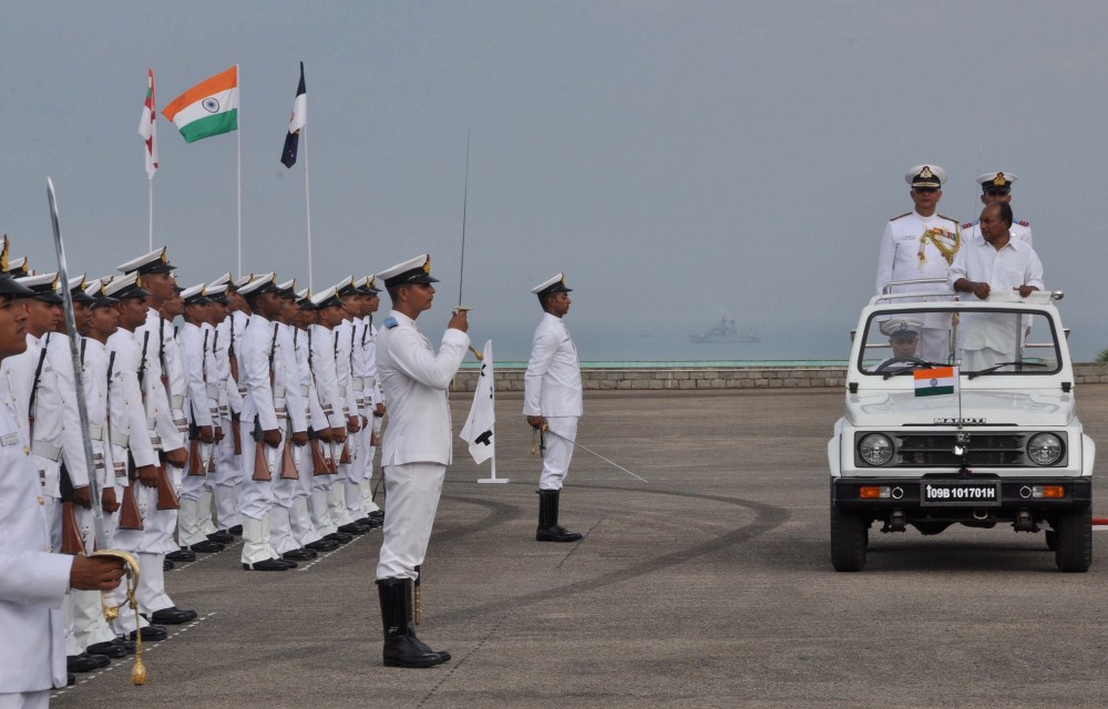
Ezhimala, a hill reaching a height of , is located near Payyanur, in Kannur district of Kerala, South India. It is a part of a conspicuous and isolated cluster of hills, forming a promontory, north of Kannur (Cannanore). The Indian Naval Academy at Ezhimala is Asia's largest, and the world's third-largest, naval academy. As the former capital of the ancient Kolathunadu Kingdom of the Mushikas, Ezhimala is considered to be an important historical site. A flourishing seaport and center of trade around the beginning of the Common Era, it was also one of the major battlefields of the Chola-Chera Wars in the 11th century. It is believed by some that Buddha had visited Ezhimala. The Kolathunadu (Kannur) Kingdom at the peak of its power, reportedly extended from Netravati River (Mangalore) in the north to Korapuzha (Kozhikode) in the south with Arabian Sea on the west and Kodagu hills on the eastern boundary, also including the isolated islands of Lakshadweep in the Arabian Sea. Et ... [...More Info...] [...Related Items...] OR: [Wikipedia] [Google] [Baidu] |
Peringome
Peringome is a town in Kannur district in the Indian state of Kerala. It is 60 km north-east of Kannur town. Demographics India census A census (from Latin ''censere'', 'to assess') is the procedure of systematically acquiring, recording, and calculating population information about the members of a given Statistical population, population, usually displayed in the form of stati ..., Peringome had a population of 13261 with 6388 males and 6873 females. Education * Government College, Peringome * Government ITI, Peringome References Villages near Payyanur {{Kannur-geo-stub ... [...More Info...] [...Related Items...] OR: [Wikipedia] [Google] [Baidu] |
Payyannur
Payyanur (), is a municipal town and a taluk, a sub-district administrative unit, in the Kannur district of Kerala, India. Payyanur is the first municipality in Kerala to establish libraries in all its wards. On 10 March 2018, Kerala Chief Minister Pinarayi Vijayan inaugurated Payyanur as the fifth taluk in the district. Payyanur taluk comprises 22 villages including 16 de-linked from the Taliparamba taluk and six from the Kannur taluk. The town is situated on the banks of the Perumba River. Location Payyanur is located 36 km North of District HQ Kannur city, 501 km away from State capital Thiruvananthapuram city, 301 km North of Ernakulam city, 126 km North of Kozhikode city, 56 km South of Kasaragod town and 112 km away from Mangalore city. The town lies by the side of three rivers - Perumba River, Punnakka river (Payyanur river) and Kavvayi river (Thattar river). Demographics As of 2011 census, Payyanur had a population of 72,111, with m ... [...More Info...] [...Related Items...] OR: [Wikipedia] [Google] [Baidu] |
Karipur International Airport
Kozhikode International Airport , also known as Calicut International Airport (locally referred to as Karipur Airport), is an international airport serving the cities of Kozhikode and Malappuram in the state of Kerala, India. It also serves other cities and districts of the Malabar region, Wayanad and Palakkad. It is situated away from Kozhikode. The airport opened on 13 April 1988, and serves as an operating base for Air India Express and operates Hajj Pilgrimage services to Medina and Jeddah. It is tied with Hyderabad in terms of international traffic. It received the international airport status on 2 February 2006. It is one of the few airports in the country with a tabletop runway. History Early years The airport was inaugurated on 13 April 1988. In 1977, the airport was sanctioned due to long periods of struggle under the leadership of the late freedom fighter, K. P. Kesava Menon. In the 1990s, Gulf Malayalis played an important role in the development of the ai ... [...More Info...] [...Related Items...] OR: [Wikipedia] [Google] [Baidu] |


