|
Kunhimangalam
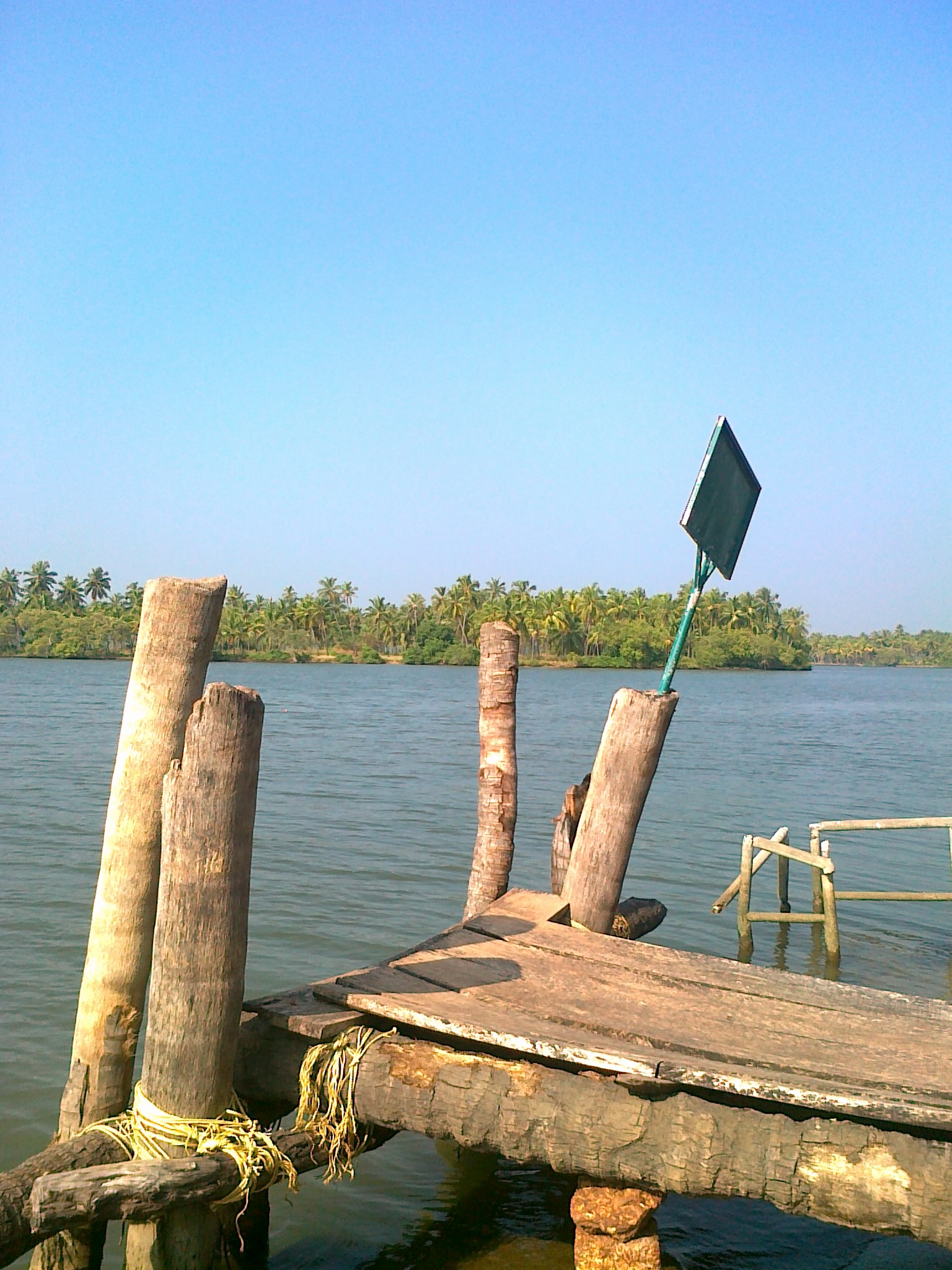
Kunhimangalam is a census town situated in the northern coastal part of Kannur District in Kerala state on the outskirt of Payyanur. The population in 2011 was around 19,000 including Hindus, Christians and Muslim residents. The village lies in an agricultural region. History The local myth of the origin of Kunhimangalam is that a Namboodiri family known as "Kunhaangalam Taravadu" were the village leaders. They ruled the village in an acceptable manner but over the time the family line ended, there was only a mother and son left. One day, the mother and son went to the Kaveri river to pray for their deceased relatives. On their way back to the village, they saw from the Gadikuzhi hills some soldiers of the ruler of Chirakkal town taking Kunhimangalam. The mother and son ended their life in fire. The mother emerged as the Goddess "Veerachamundi" and the son as the God "Veeran". The local people built a temple, the "Kunhimangalam Molom" at the site of the "tharavad" (ancestral ho ... [...More Info...] [...Related Items...] OR: [Wikipedia] [Google] [Baidu] |
Payyannur
Payyanur (), is a municipal town and a taluk, a sub-district administrative unit, in the Kannur district of Kerala, India. Payyanur is the first municipality in Kerala to establish libraries in all its wards. On 10 March 2018, Kerala Chief Minister Pinarayi Vijayan inaugurated Payyanur as the fifth taluk in the district. Payyanur taluk comprises 22 villages including 16 de-linked from the Taliparamba taluk and six from the Kannur taluk. The town is situated on the banks of the Perumba River. Location Payyanur is located 36 km North of District HQ Kannur city, 501 km away from State capital Thiruvananthapuram city, 301 km North of Ernakulam city, 126 km North of Kozhikode city, 56 km South of Kasaragod town and 112 km away from Mangalore city. The town lies by the side of three rivers - Perumba River, Punnakka river (Payyanur river) and Kavvayi river (Thattar river). Demographics As of 2011 census, Payyanur had a population of 72,111, with m ... [...More Info...] [...Related Items...] OR: [Wikipedia] [Google] [Baidu] |
Perumba River
The Perumba River is a 51 km long river which flows through the Kannur and Kasargod districts of the Malabar region in Kerala, India. The town of Payyannur is situated on the banks of this river subsequently the river is locally known as Payyannur River. Course The Perumba River originates in the foothills of the Western Ghats near Thimiry in the hilly eastern part of the Kannur district. The river then flows through several hilly towns of Kannur district namely, Vellora, Palathadathil, Panapuzha, Kuttur and Mathamangalam. Then it enters into the Malabar plains where it flows through the towns of Kadannappally, Kanayi, Kandankaly and Kungimangalam. At reaching Kungimangalam it splits into two distributaries, one flows towards north passing through Payyannur and empties into the Kavvai estuary along with the Kuppam river.The second distributary turns south flowing through Theckumbad, Palakode, Madayi and eventually emptying into the Arabian Sea near the Ezhim ... [...More Info...] [...Related Items...] OR: [Wikipedia] [Google] [Baidu] |
Census Town
In India and some other countries, a census town is designated as a town that satisfies certain characteristics. India In India, a census town is one which is not statutorily notified and administered as a town, but nevertheless whose population has attained urban characteristics. They are characterized by the following: * Population exceeds 5,000 * At least 75% of main male working population is employed outside the agricultural sector * Minimum population density Population density (in agriculture: Standing stock (other), standing stock or plant density) is a measurement of population per unit land area. It is mostly applied to humans, but sometimes to other living organisms too. It is a key geog ... of 400 persons per km2 Census 2011 The number of census towns (CTs) in India grew from 1,362 in 2001 to 3,894 in 2011. As per Pradhan (2013), these CTs account for 30% of the urban growth in the last decade. Pradhan also notes that the largest increase in the number o ... [...More Info...] [...Related Items...] OR: [Wikipedia] [Google] [Baidu] |
Ezhimala
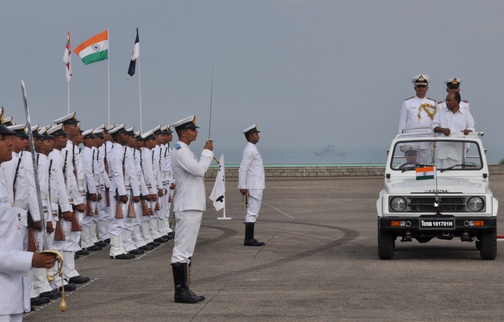
Ezhimala, a hill reaching a height of , is located near Payyanur, in Kannur district of Kerala, South India. It is a part of a conspicuous and isolated cluster of hills, forming a promontory, north of Kannur (Cannanore). The Indian Naval Academy at Ezhimala is Asia's largest, and the world's third-largest, naval academy. As the former capital of the ancient Kolathunadu Kingdom of the Mushikas, Ezhimala is considered to be an important historical site. A flourishing seaport and center of trade around the beginning of the Common Era, it was also one of the major battlefields of the Chola-Chera Wars in the 11th century. It is believed by some that Buddha had visited Ezhimala. The Kolathunadu (Kannur) Kingdom at the peak of its power, reportedly extended from Netravati River (Mangalore) in the north to Korapuzha (Kozhikode) in the south with Arabian Sea on the west and Kodagu hills on the eastern boundary, also including the isolated islands of Lakshadweep in the Arabian Sea. Et ... [...More Info...] [...Related Items...] OR: [Wikipedia] [Google] [Baidu] |
National Highway 66 (India)
National Highway 66, commonly referred to as NH 66 (erstwhile NH-17 and a part of NH-47), is a mostly 4 lane 1640 km (1020 miles) long busy National Highway (India), National Highway that runs roughly north–south along the western coast of India, parallel to the western ghats, Western Ghats. It connects Panvel, a city east of Mumbai (Bombay) to Cape Comorin (Kanyakumari) via Mangalore, passing through the states of Maharashtra, Goa, Karnataka, Kerala and Tamil Nadu. The highway is undergoing a major overhaul in Karnataka, where the state government has accepted the NHAI's request of international standard, 60-metre-wide national highway with grade separators. The complete stretch from the Goa border (near Karwar) to the Kerala border (near Talapady) is being widened to four lanes, with space to accommodate future expansion to six lanes. There were protests from the people, who will lose lands, for a narrower stretch. But the Karnataka government has not heeded to the pr ... [...More Info...] [...Related Items...] OR: [Wikipedia] [Google] [Baidu] |
Marco Polo
Marco Polo (; ; ; 8 January 1324) was a Republic of Venice, Venetian merchant, explorer and writer who travelled through Asia along the Silk Road between 1271 and 1295. His travels are recorded in ''The Travels of Marco Polo'' (also known as ''Book of the Marvels of the World '' and ''Il Milione'', ), a book that described the then-mysterious culture and inner workings of the Eastern world, including the wealth and great size of the Mongol Empire and China under the Yuan dynasty, giving Europeans their first comprehensive look into China, Persia, India, Japan, and other Asian societies. Born in Venice, Marco learned the mercantile trade from his father and his uncle, Niccolò and Maffeo Polo, Niccolò and Maffeo, who travelled through Asia and met Kublai Khan. In 1269, they returned to Venice to meet Marco for the first time. The three of them embarked on an epic journey to Asia, exploring many places along the Silk Road until they reached "Cathay". They were received by the ... [...More Info...] [...Related Items...] OR: [Wikipedia] [Google] [Baidu] |
Lighthouse
A lighthouse is a tower, building, or other type of physical structure designed to emit light from a system of lamps and lens (optics), lenses and to serve as a beacon for navigational aid for maritime pilots at sea or on inland waterways. Lighthouses mark dangerous coastlines, hazardous shoals, reefs, rocks, and safe entries to harbors; they also assist in aerial navigation. Once widely used, the number of operational lighthouses has declined due to the expense of maintenance and the advent of much cheaper, more sophisticated, and more effective electronic navigational systems. History Ancient lighthouses Before the development of clearly defined ports, mariners were guided by fires built on hilltops. Since elevating the fire would improve visibility, placing the fire on a platform became a practice that led to the development of the lighthouse. In antiquity, the lighthouse functioned more as an entrance marker to ports than as a warning signal for reefs and promontory, prom ... [...More Info...] [...Related Items...] OR: [Wikipedia] [Google] [Baidu] |
Ezhimala (hill, Kannur)
Ezhimala, a hill reaching a height of , is located near Payyanur, in Kannur District, Kannur district of Kerala, South India. It is a part of a conspicuous and isolated cluster of hills, forming a promontory, north of Kannur (Cannanore). The Indian Naval Academy at Ezhimala is Asia's largest, and the world's third-largest, naval academy. As the former capital of the ancient Kolathunadu Kingdom of the Mushikas, Ezhimala is considered to be an important historical site. A flourishing seaport and center of trade around the beginning of the Common Era, it was also one of the major battlefields of the Chola Dynasty, Chola-Chera dynasty, Chera Wars in the 11th century. It is believed by some that Buddha had visited Ezhimala. The Kolathunadu (Kannur) Kingdom at the peak of its power, reportedly extended from Netravati River (Mangalore) in the north to Korapuzha (Kozhikode) in the south with Arabian Sea on the west and Kodagu hills on the eastern boundary, also including the isolated ... [...More Info...] [...Related Items...] OR: [Wikipedia] [Google] [Baidu] |
Lanka
Lanka (; ) is the name given in Hindu epics to the island fortress capital of the legendary Rakshasa king Ravana in the epics of the ''Ramayana'' and the ''Mahabharata''. The fortress was situated on a plateau between three mountain peaks known as the Trikuta Mountains. The ancient city of Lankapura is said to have been burnt down by Hanuman. After its king, Ravana was killed by Rama with the help of Ravana's brother Vibhishana, the latter was crowned king of Lankapura. His descendants were said to still rule the kingdom during the period of the Pandavas. According to the ''Mahabharata'', the Pandava Sahadeva visited this kingdom during his southern military campaign for the rajasuya of Yudhishthira. The palaces of Ravana were said to be guarded by four-tusked elephants. Ramayana Rulers of Lanka According to both the ''Ramayana'' and the ''Mahabharata'', Lanka was originally ruled by a rakshasa named Sumali. According to Uttara Kanda, Vishwakarma, the divine architect of ... [...More Info...] [...Related Items...] OR: [Wikipedia] [Google] [Baidu] |
Hanuman
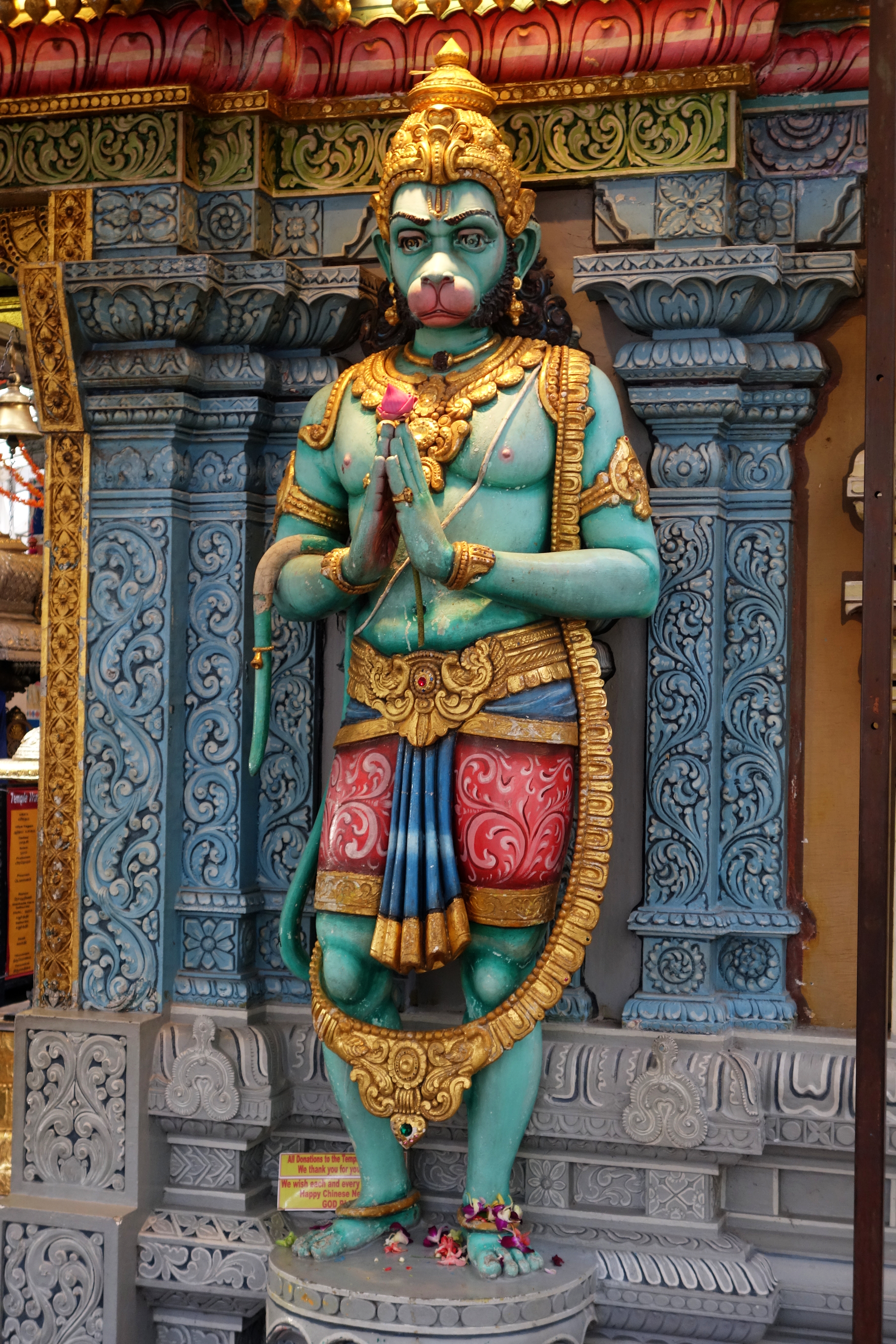
Hanuman (; , ), also known as Maruti, Bajrangabali, and Anjaneya, is a deity in Hinduism, revered as a divine ''vanara'', and a devoted companion of the deity Rama. Central to the ''Ramayana'', Hanuman is celebrated for his unwavering devotion to Rama and is considered a '' chiranjivi''. He is traditionally believed to be the spiritual offspring of the wind deity Vayu, who is said to have played a significant role in his birth. In Shaiva tradition, he is regarded to be an incarnation of Shiva, while in most of the Vaishnava traditions he is the son and incarnation of Vayu. His tales are recounted not only in the ''Ramayana'' but also in the '' Mahabharata'' and various ''Puranas''. Devotional practices centered around Hanuman were not prominent in these texts or in early archaeological evidence. His theological significance and the cultivation of a devoted following emerged roughly a millennium after the ''Ramayana'' was composed, during the second millennium CE.Paula Richman ... [...More Info...] [...Related Items...] OR: [Wikipedia] [Google] [Baidu] |


