|
Torridonian
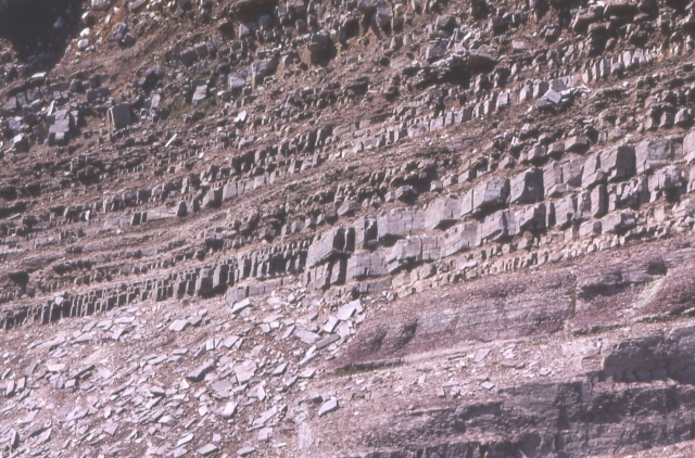
In geology, the term Torridonian is the informal name for the Torridonian Group, a series of Mesoproterozoic to Neoproterozoic arenaceous and argillaceous sedimentary rocks, which occur extensively in the Northwest Highlands of Scotland. The strata of the Torridonian Group are particularly well exposed in the district of upper Loch Torridon, a circumstance which suggested the name Torridon Sandstone, first applied to these rocks by James Nicol. Stratigraphically, they lie unconformably on gneisses of the Lewisian complex and their outcrop extent is restricted to the Hebridean Terrane. Rock type The rocks are mainly red and brown sandstones, arkoses and shales with coarse conglomerates locally at the base. Some of the materials of these rocks were derived from the underlying Lewisian gneiss, upon the uneven surface of which they rest, but the bulk of the material was obtained from rocks that are nowhere now exposed. Upon this ancient denuded land surface the Torridonian strata ... [...More Info...] [...Related Items...] OR: [Wikipedia] [Google] [Baidu] |
Torridonian Sandstone
In geology, the term Torridonian is the informal name for the Torridonian Group, a series of Mesoproterozoic to Neoproterozoic arenaceous and argillaceous sedimentary rocks, which occur extensively in the Northwest Highlands of Scotland. The strata of the Torridonian Group are particularly well exposed in the district of upper Loch Torridon, a circumstance which suggested the name Torridon Sandstone, first applied to these rocks by James Nicol. Stratigraphically, they lie unconformably on gneisses of the Lewisian complex and their outcrop extent is restricted to the Hebridean Terrane. Rock type The rocks are mainly red and brown sandstones, arkoses and shales with coarse conglomerates locally at the base. Some of the materials of these rocks were derived from the underlying Lewisian gneiss, upon the uneven surface of which they rest, but the bulk of the material was obtained from rocks that are nowhere now exposed. Upon this ancient denuded land surface the Torridonian st ... [...More Info...] [...Related Items...] OR: [Wikipedia] [Google] [Baidu] |
Hebridean Terrane
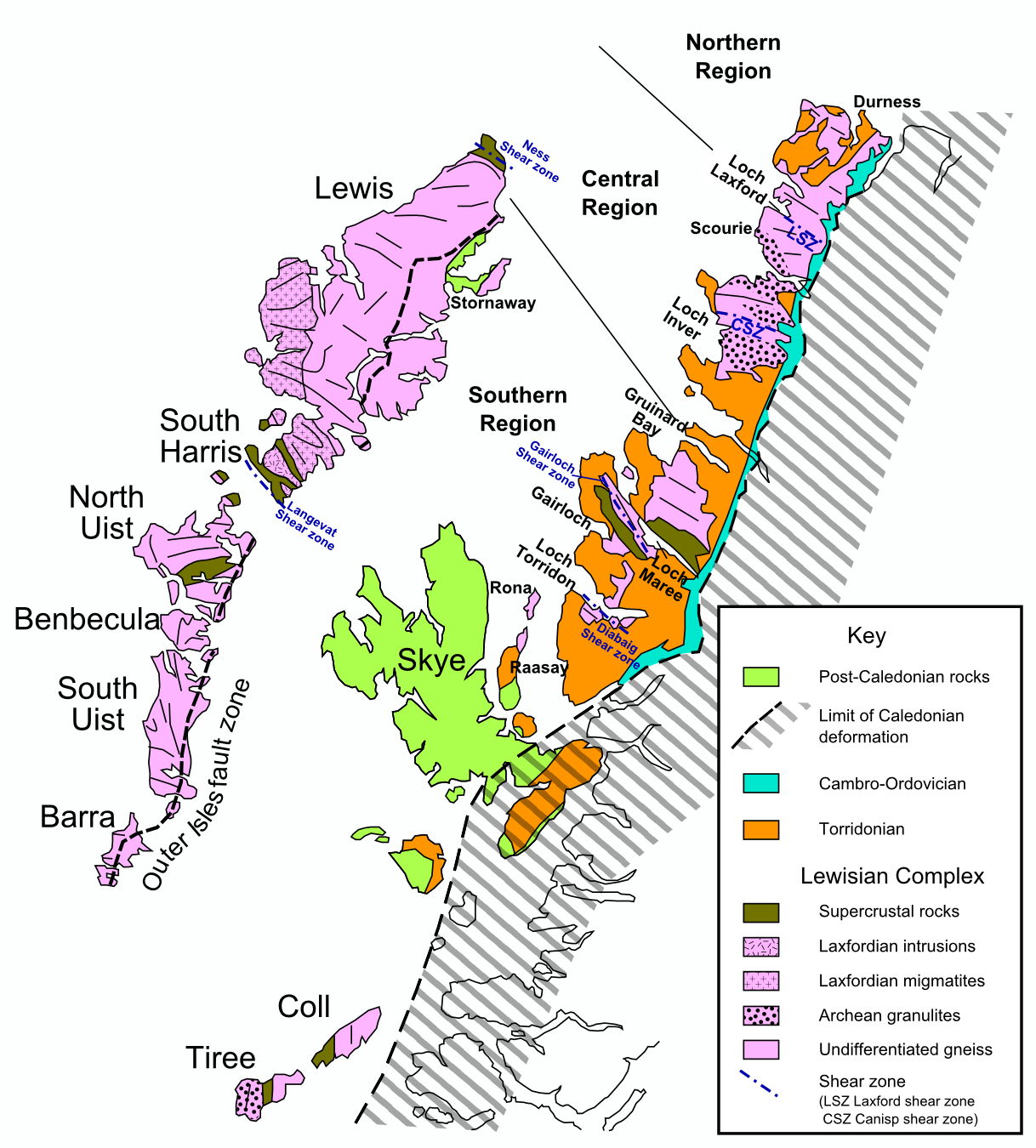
The Hebridean Terrane is one of the terranes that form part of the Caledonian orogenic belt in northwest Scotland. Its boundary with the neighbouring Northern Highland Terrane is formed by the Moine Thrust Belt. The basement is formed by Archaean and Paleoproterozoic gneisses of the Lewisian complex, unconformably overlain by the Neoproterozoic Torridonian sediments, which in turn are unconformably overlain by a sequence of Cambro–Ordovician sediments. It formed part of the Laurentian foreland during the Caledonian continental collision. Extent The Hebridean Terrane forms the westernmost strip of mainland Scotland, most of the Inner Hebrides and all of the Outer Hebrides. Similar rocks are also thought to be present in Shetland and have been proved west and north of the Outer Hebrides by BGS shallow boreholes and hydrocarbon exploration wells. The full extent of this terrane to the west is obscured by the effects of Mesozoic rifting. Rock units Lewisian complex The ... [...More Info...] [...Related Items...] OR: [Wikipedia] [Google] [Baidu] |
Northwest Highlands
The Northwest Highlands are located in the northern third of Scotland that is separated from the Grampian Mountains by the Great Glen (Glen More). The region comprises Wester Ross, Assynt, Sutherland and part of Caithness. The Caledonian Canal, which extends from Loch Linnhe in the south-west, via Loch Ness to the Moray Firth in the north-east splits this area from the rest of the country. The city of Inverness and the town of Fort William serve as gateways to the region from the south. Geology The geology of the Highlands is complex. Along the western coastal margin it is characterised by Lewisian gneiss, the oldest rock in Scotland. Liathach, Beinn Alligin, Suilven, Cùl Mòr, Cùl Beag, and Quinag are just some of the impressive rock islands of the significantly younger rich brown-coloured Torridonian sandstone which rests on the gneiss. Some of the peaks, such as Beinn Eighe and Canisp, are topped with later light grey or white Cambrian quartzite. Cambro-Ordovician limest ... [...More Info...] [...Related Items...] OR: [Wikipedia] [Google] [Baidu] |
Lewisian Complex
The Lewisian complex or Lewisian gneiss is a suite of Precambrian metamorphic rocks that outcrop in the northwestern part of Scotland, forming part of the Hebridean Terrane and the North Atlantic Craton. These rocks are of Archaean and Paleoproterozoic age, ranging from 3.0–1.7 billion years ( Ga). They form the basement on which the Torridonian and Moine Supergroup sediments were deposited. The Lewisian consists mainly of granitic gneisses with a minor amount of supracrustal rocks. Rocks of the Lewisian complex were caught up in the Caledonian orogeny, appearing in the hanging walls of many of the thrust faults formed during the late stages of this tectonic event. Distribution The main outcrops of the Lewisian complex are on the islands of the Outer Hebrides, including Lewis, from which the complex takes its name. It is also exposed on several islands of the Inner Hebrides, small islands north of the Scottish mainland and forms a coastal strip on the mainland ... [...More Info...] [...Related Items...] OR: [Wikipedia] [Google] [Baidu] |
James Nicol (geologist)
James Nicol FRSE FGS (12 August 1810 – 8 April 1879) was a Scottish geologist. Life He was born at Traquair, near Innerleithen in Peeblesshire, the son of Rev. James Nicol (1769–1819), and his wife Agnes Walker. He studied Arts and Divinity at Edinburgh University from 1825. He also attended the lectures of Robert Jameson, having gained a keen interest in geology and mineralogy. He further pursued these studies in the universities of Bonn and Berlin. After returning home Nicol worked at local geology and obtained prizes from the Highland Society for essays on the geology of Peeblesshire and Roxburghshire, now areas of the Scottish Borders. He subsequently extended his researches over other parts of Scotland, and in 1844 published ''Guide to the Geology of Scotland''. In 1847 Nicol was appointed assistant secretary to the Geological Society of London, being appointed a Fellow of the Society in the same year. He was also elected a Fellow of the Royal Society of Edinburgh h ... [...More Info...] [...Related Items...] OR: [Wikipedia] [Google] [Baidu] |
Loch Torridon
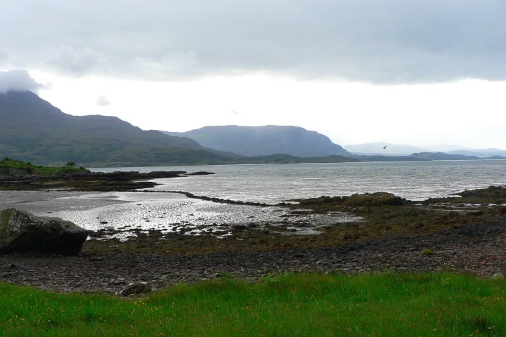
Loch Torridon ( gd, Loch Thoirbheartan) is a sea loch on the west coast of Scotland in the Northwest Highlands. The loch was created by glacial processes and is in total around 15 miles (25 km) long. It has two sections: Upper Loch Torridon to landward, east of Rubha na h-Airde Ghlaise, at which point it joins Loch Sheildaig; and the main western section of Loch Torridon proper. Loch a' Chracaich and Loch Beag are small inlets on the southern shores of the outer Loch, which joins the Inner Sound between the headlands of Rubha na Fearna to the south and Red Point to the north. The name ''Thoirbhearta'' has a similar root to '' Tarbert'' and indicates a place where boats were dragged overland. Islands The islets in the loch include: * in Loch Shieldaig: Eilean an Inbhire Bhàin, Eilean Dùghaill and Shieldaig Island. * in Upper Loch Torridon: Eilean à Chaoil, Eilean Cnapach, both of which are tidal. * in outer Loch Torridon: Eilean Mòr, Eilean Tioram, Sgeir Ghlas, ... [...More Info...] [...Related Items...] OR: [Wikipedia] [Google] [Baidu] |
Beinn Eighe
Beinn Eighe () is a mountain massif in the Torridon area of Wester Ross in the Northwest Highlands of Scotland. Lying south of Loch Maree, it forms a long ridge with many spurs and summits, two of which are classified as Munros: Ruadh-stac Mòr at and Spidean Coire nan Clach at . Unlike most other hills in the area it has a cap of Cambrian basal quartzite which gives the peaks of Beinn Eighe a distinctive light colour. Its complex topography has made it popular with both hillwalkers and climbers and the national nature reserve on its northern side makes it an accessible mountain for all visitors. Geography Located between Loch Maree and Glen Torridon on the west coast of Scotland, Beinn Eighe is a complex mountain. The main ridge runs on a line extending from close to the village of Kinlochewe in the north-east to the narrow glen of the Coire Dubh Mòr, which separates it from the neighbouring mountain of Liathach to the south-west. The slopes into Glen Torri ... [...More Info...] [...Related Items...] OR: [Wikipedia] [Google] [Baidu] |
Slioch From Loch Maree
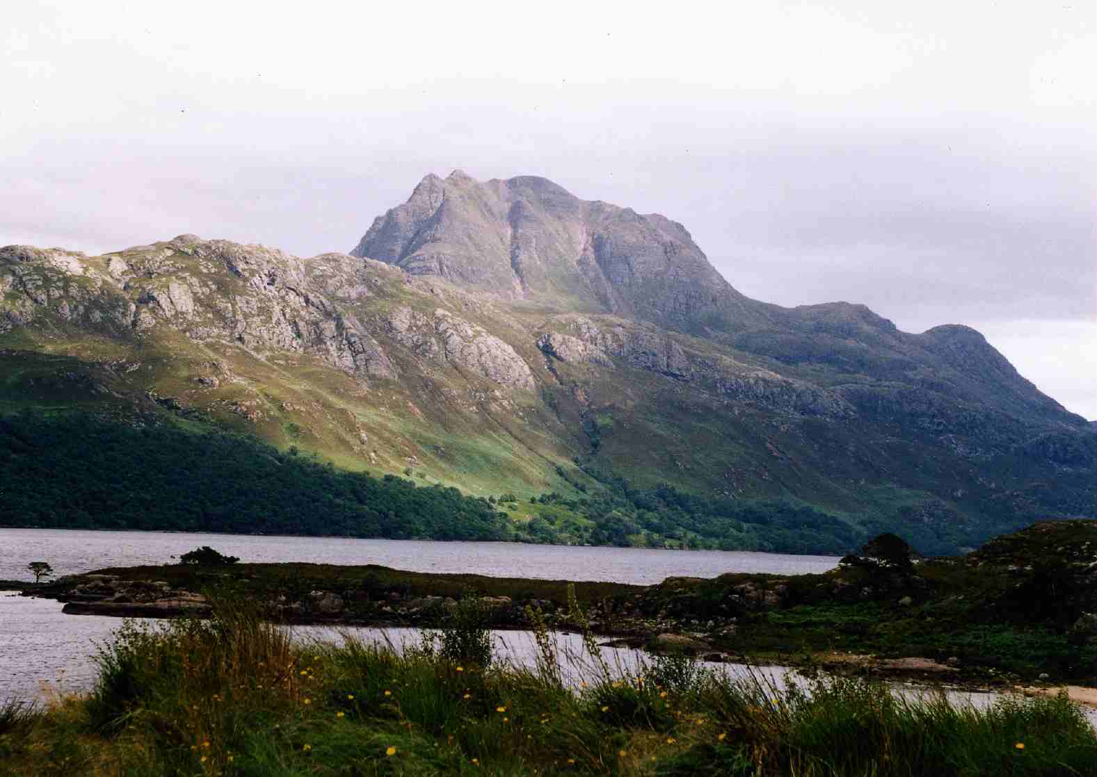
, photo = Slioch_from_Loch_Maree.jpg , photo_caption = Slioch seen from the shores of Loch Maree. , elevation_m = 981 , elevation_ref = , prominence_m = 626 , prominence_ref = , parent_peak = Sgurr Mor , listing = Munro, Marilyn , translation = the spear , language = Gaelic , pronunciation = , location = Wester Ross, Scotland , range = , grid_ref_UK = NH004688 , topo = OS ''Landranger'' 19, OS ''Explorers'' 433, 435 , first_ascent = , easiest_route = Slioch ( gd, Sleaghach) is a mountain in the Scottish Highlands situated in Wester Ross, eight kilometres north of the village of Kinlochewe. Slioch reaches a height of 981 metres (3218 feet) and towers above the south east end of Loch Maree to give one of the best known and most photographed sights (from the A832 road) in the Highlands. VisitScotland, the Scottish national tourist agency, has used video footage of Slioch in its television advertisements. The mountain is composed of Torridonian sands ... [...More Info...] [...Related Items...] OR: [Wikipedia] [Google] [Baidu] |
Neoproterozoic
The Neoproterozoic Era is the unit of geologic time from 1 billion to 538.8 million years ago. It is the last era of the Precambrian Supereon and the Proterozoic Eon; it is subdivided into the Tonian, Cryogenian, and Ediacaran periods. It is preceded by the Mesoproterozoic Era and succeeded by the Paleozoic Era of the Phanerozoic Eon. The most severe glaciation known in the geologic record occurred during the Cryogenian, when ice sheets may have reached the equator and formed a " Snowball Earth". The earliest fossils of complex multicellular life are found in the Ediacaran Period. These organisms make up the Ediacaran biota, including the oldest definitive animals in the fossil record. According to Rino and co-workers, the sum of the continental crust formed in the Pan-African orogeny and the Grenville orogeny makes the Neoproterozoic the period of Earth's history that has produced most continental crust. Geology At the onset of the Neoproterozoic the supercon ... [...More Info...] [...Related Items...] OR: [Wikipedia] [Google] [Baidu] |
Arkose
Arkose () or arkosic sandstone is a detrital sedimentary rock, specifically a type of sandstone containing at least 25% feldspar. Arkosic sand is sand that is similarly rich in feldspar, and thus the potential precursor of arkose. Quartz is commonly the dominant mineral component, and some mica is often present. Apart from the mineral content, rock fragments may also be a significant component. Arkose usually contains small amounts of calcite cement, which causes it to effervesce (fizz) slightly in dilute hydrochloric acid; sometimes the cement also contains iron oxide. Arkose is typically grey to reddish in colour. The sand grains making up an arkose may range from fine to very coarse, but tend toward the coarser end of the scale. Fossils are rare in arkose, due to the depositional processes that form it, although bedding is frequently visible. Arkose is generally formed from the weathering of feldspar-rich igneous or metamorphic, most commonly granitic, rocks, which are p ... [...More Info...] [...Related Items...] OR: [Wikipedia] [Google] [Baidu] |
Glacial
A glacial period (alternatively glacial or glaciation) is an interval of time (thousands of years) within an ice age that is marked by colder temperatures and glacier advances. Interglacials, on the other hand, are periods of warmer climate between glacial periods. The Last Glacial Period ended about 15,000 years ago. The Holocene is the current interglacial. A time with no glaciers on Earth is considered a greenhouse climate state. Quaternary Period Within the Quaternary, which started about 2.6 million years before present, there have been a number of glacials and interglacials. At least eight glacial cycles have occurred in the last 740,000 years alone. Penultimate Glacial Period The Penultimate Glacial Period (PGP) is the glacial period that occurred before the Last Glacial Period. It began about 194,000 years ago and ended 135,000 years ago, with the beginning of the Eemian interglacial. Last Glacial Period The last glacial period was the most recent glacial period ... [...More Info...] [...Related Items...] OR: [Wikipedia] [Google] [Baidu] |
Landscape
A landscape is the visible features of an area of land, its landforms, and how they integrate with natural or man-made features, often considered in terms of their aesthetic appeal.''New Oxford American Dictionary''. A landscape includes the physical elements of geophysically defined landforms such as (ice-capped) mountains, hills, water bodies such as rivers, lakes, ponds and the sea, living elements of land cover including indigenous vegetation, human elements including different forms of land use, buildings, and structures, and transitory elements such as lighting and weather conditions. Combining both their physical origins and the cultural overlay of human presence, often created over millennia, landscapes reflect a living synthesis of people and place that is vital to local and national identity. The character of a landscape helps define the self-image of the people who inhabit it and a sense of place that differentiates one region from other regions. It is t ... [...More Info...] [...Related Items...] OR: [Wikipedia] [Google] [Baidu] |


.png)


