|
Loch Torridon
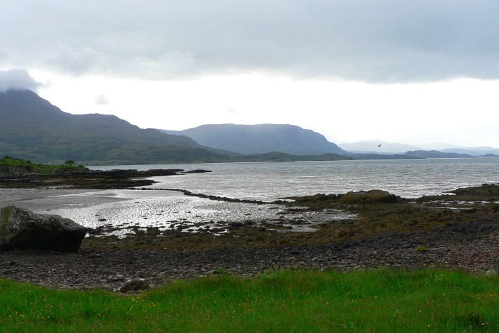
Loch Torridon ( gd, Loch Thoirbheartan) is a sea loch on the west coast of Scotland in the Northwest Highlands. The loch was created by glacial processes and is in total around 15 miles (25 km) long. It has two sections: Upper Loch Torridon to landward, east of Rubha na h-Airde Ghlaise, at which point it joins Loch Sheildaig; and the main western section of Loch Torridon proper. Loch a' Chracaich and Loch Beag are small inlets on the southern shores of the outer Loch, which joins the Inner Sound between the headlands of Rubha na Fearna to the south and Red Point to the north. The name ''Thoirbhearta'' has a similar root to '' Tarbert'' and indicates a place where boats were dragged overland. Islands The islets in the loch include: * in Loch Shieldaig: Eilean an Inbhire Bhàin, Eilean Dùghaill and Shieldaig Island. * in Upper Loch Torridon: Eilean à Chaoil, Eilean Cnapach, both of which are tidal. * in outer Loch Torridon: Eilean Mòr, Eilean Tioram, Sgeir Ghlas, ... [...More Info...] [...Related Items...] OR: [Wikipedia] [Google] [Baidu] |
Scotland
Scotland (, ) is a country that is part of the United Kingdom. Covering the northern third of the island of Great Britain, mainland Scotland has a border with England to the southeast and is otherwise surrounded by the Atlantic Ocean to the north and west, the North Sea to the northeast and east, and the Irish Sea to the south. It also contains more than 790 islands, principally in the archipelagos of the Hebrides and the Northern Isles. Most of the population, including the capital Edinburgh, is concentrated in the Central Belt—the plain between the Scottish Highlands and the Southern Uplands—in the Scottish Lowlands. Scotland is divided into 32 administrative subdivisions or local authorities, known as council areas. Glasgow City is the largest council area in terms of population, with Highland being the largest in terms of area. Limited self-governing power, covering matters such as education, social services and roads and transportation, is devolved from the ... [...More Info...] [...Related Items...] OR: [Wikipedia] [Google] [Baidu] |
Scots Pine
''Pinus sylvestris'', the Scots pine (UK), Scotch pine (US) or Baltic pine, is a species of tree in the pine family Pinaceae that is native to Eurasia. It can readily be identified by its combination of fairly short, blue-green leaves and orange-red bark. Description ''Pinus sylvestris'' is an evergreen coniferous tree growing up to in height and in trunk diameter when mature, exceptionally over tall and in trunk diameter on very productive sites. The tallest on record is a tree over 210 years old tree growing in Estonia which stands at . The lifespan is normally 150–300 years, with the oldest recorded specimens in Lapland, Northern Finland over 760 years. The bark is thick, flaky and orange-red when young to scaly and gray-brown in maturity, sometimes retaining the former on the upper portion.Trees for LifeSpecies profile: Scots pine/ref> The habit of the mature tree is distinctive due to its long, bare and straight trunk topped by a rounded or flat-topped mass ... [...More Info...] [...Related Items...] OR: [Wikipedia] [Google] [Baidu] |
Torridonian Sandstone
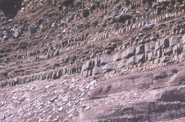
In geology, the term Torridonian is the informal name for the Torridonian Group, a series of Mesoproterozoic to Neoproterozoic arenaceous and argillaceous sedimentary rocks, which occur extensively in the Northwest Highlands of Scotland. The strata of the Torridonian Group are particularly well exposed in the district of upper Loch Torridon, a circumstance which suggested the name Torridon Sandstone, first applied to these rocks by James Nicol. Stratigraphically, they lie unconformably on gneisses of the Lewisian complex and their outcrop extent is restricted to the Hebridean Terrane. Rock type The rocks are mainly red and brown sandstones, arkoses and shales with coarse conglomerates locally at the base. Some of the materials of these rocks were derived from the underlying Lewisian gneiss, upon the uneven surface of which they rest, but the bulk of the material was obtained from rocks that are nowhere now exposed. Upon this ancient denuded land surface the Torridonian st ... [...More Info...] [...Related Items...] OR: [Wikipedia] [Google] [Baidu] |
Beinn Eighe
Beinn Eighe () is a mountain massif in the Torridon area of Wester Ross in the Northwest Highlands of Scotland. Lying south of Loch Maree, it forms a long ridge with many spurs and summits, two of which are classified as Munros: Ruadh-stac Mòr at and Spidean Coire nan Clach at . Unlike most other hills in the area it has a cap of Cambrian basal quartzite which gives the peaks of Beinn Eighe a distinctive light colour. Its complex topography has made it popular with both hillwalkers and climbers and the national nature reserve on its northern side makes it an accessible mountain for all visitors. Geography Located between Loch Maree and Glen Torridon on the west coast of Scotland, Beinn Eighe is a complex mountain. The main ridge runs on a line extending from close to the village of Kinlochewe in the north-east to the narrow glen of the Coire Dubh Mòr, which separates it from the neighbouring mountain of Liathach to the south-west. The slopes into Glen Torri ... [...More Info...] [...Related Items...] OR: [Wikipedia] [Google] [Baidu] |
Beinn Alligin
Beinn Alligin ( gd, Beinn Àilleagan) is one of the classic mountains of the Torridon region of Scotland, lying to the north of Loch Torridon, in the Highlands. The name Beinn Alligin is from the Scottish Gaelic, meaning ''Jewelled Hill''. The mountain has two peaks of Munro status: Tom na Gruagaich () to the south, and Sgùrr Mhòr at to the north. One of the most prominent features of Beinn Alligin is a great cleft known as Eag Dhubh na h-Eigheachd (''black gash of the wailing'') or Leum na Caillich, which cuts into the ridge south of the summit. It is the scar of the most spectacular rockslide or rock avalanche in Britain, which runs out into the corrie of Toll a' Mhadaidh Mor. It occurred around 3750 years ago and is around 3.5 million cubic metres in volume. According to local folklore shepherds on the mountain would hear cries from the gash; those who investigated the source of these cries would inevitably fall to their deaths. Beinn Alligin lies on the Nationa ... [...More Info...] [...Related Items...] OR: [Wikipedia] [Google] [Baidu] |
Liathach
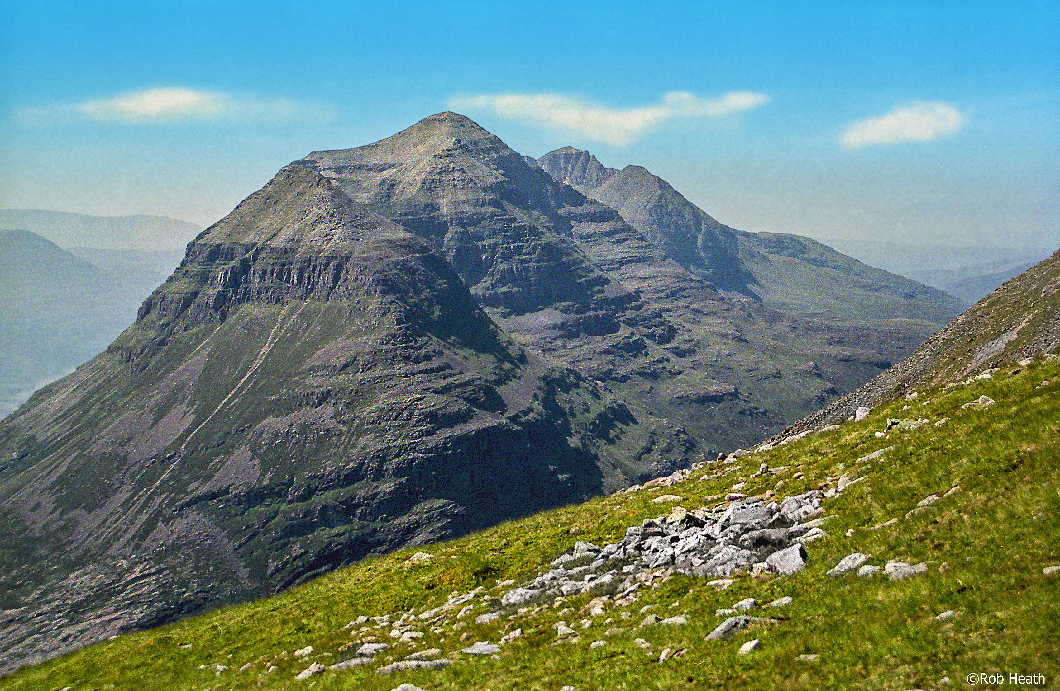
Liathach (pronounced , ) is a mountain in the Torridon Hills, in the Northwest Highlands of Scotland. It stands between Loch Torridon and the neighbouring mountain Beinn Eighe. The mountain is a ridge running east–west, with several peaks, and its upper half is made up of many steep rocky terraces. The highest peak is the Munro of Spidean a' Choire Lèith ('peak of the grey corrie') at high. The other Munro peak is Mullach an Rathain at high. Geology The mountain is composed of Torridonian sandstone which forms massive near-horizontal strata. They form the numerous terraces that are obvious from afar. The rocks are mainly red and chocolate sandstones, arkoses, flagstones and shales with coarse conglomerates locally at the base. Some of the materials of these rocks were derived from the underlying Lewisian gneiss, upon the uneven surface of which they rest, but the bulk of the material was obtained from rocks that are nowhere now exposed. Upon this ancient denuded land surfa ... [...More Info...] [...Related Items...] OR: [Wikipedia] [Google] [Baidu] |
View From An Ruadh-stac Summit
A view is a sight or prospect or the ability to see or be seen from a particular place. View, views or Views may also refer to: Common meanings * View (Buddhism), a charged interpretation of experience which intensely shapes and affects thought, sensation, and action * Graphical projection in a technical drawing or schematic ** Multiview orthographic projection, standardizing 2D images to represent a 3D object * Opinion, a belief about subjective matters * Page view, a visit to a World Wide Web page * Panorama, a wide-angle view * Scenic viewpoint, an elevated location where people can view scenery * World view, the fundamental cognitive orientation of an individual or society encompassing the entirety of the individual or society's knowledge and point-of-view Places * View, Kentucky, an unincorporated community in Crittenden County * View, Texas, an unincorporated community in Taylor County Arts, entertainment, and media Music * ''View'' (album), the 2003 debut album b ... [...More Info...] [...Related Items...] OR: [Wikipedia] [Google] [Baidu] |
Shieldaig
Shieldaig ( gd, Sìldeag; on, síld- vík, lit=herring bay)W. J. Watson''Place-names of Ross and Cromarty'' 1904, p. 208. is a village in Wester Ross in the Northwest Highlands and is in the Scottish council area of Highland. Geography and history The village was founded in 1800 Undiscovered Scotland with a view to training up seamen for war against Napoleon. After his (initial) defeat and exile to , the community found itself a new role as a fishing village. The small just offshore never ... [...More Info...] [...Related Items...] OR: [Wikipedia] [Google] [Baidu] |
Alligin Shuas
Inveralligin ( gd, Inbhir Àiliginn) is a remote crofting township which lies on the north shore of Loch Torridon in Wester Ross and is in the Scottish council area of Highland. ''Inbhir Àiliginn'' means "at the mouth of the River Alligin". Torridon lies to the east and Lower Diabaig about to the west. Alligin Shuas lies immediately to the west. This name is also of Gaelic Gaelic is an adjective that means "pertaining to the Gaels". As a noun it refers to the group of languages spoken by the Gaels, or to any one of the languages individually. Gaelic languages are spoken in Ireland, Scotland, the Isle of Man, and Ca ... origin: ''alligin'' may be from ''àilleag'' meaning "jewel" and ''shuas'' means "western" or "upper". References Populated places in Ross and Cromarty Torridon {{Highland-geo-stub ... [...More Info...] [...Related Items...] OR: [Wikipedia] [Google] [Baidu] |
Lower Diabaig
Diabaig ( gd, Dìobaig) is a remote coastal fishing and crofting township in Wester Ross, in the Northwest Highlands of Scotland. Diabaig lies on the north shore of the sea loch of Loch Diabaig, an inlet off the north side of Loch Torridon, and is in the Highland council area. The main part of the settlement is known as ''Lower Diabaig''. ''Upper Diabaig'' is a few houses, about to the east. The village of Torridon, with its junction with the A896 road, is located from Diabaig. Geography Diabaig is at the end of a minor road, the C1083, which runs along the north side of Loch Torridon, from the village of Torridon. The villages of Alligin Shuas and Inveralligin lie to the southeast along this road. A footpath continues along the coast from Diabaig, running to the small settlement of Redpoint, near Gairloch. Filming Loch Diabaig played the part of Loch Ness in the 1996 film of the same name, in which Ted Danson Edward Bridge "Ted" Danson III (born December 29, 1947) is a ... [...More Info...] [...Related Items...] OR: [Wikipedia] [Google] [Baidu] |
Redpoint
Redpoint ( gd, An Rubha Dearg) is a small settlement in the north west of Highland, Scotland. It takes its name from Red Point, a low promontory to the south, which marks a turn in the coastline from facing west to south east as it becomes Loch Torridon. Redpoint lies about {{convert, 10, mi, km south west of Gairloch, at the end of the B8056 road. A path leading from the road leads to a viewpoint from which it is possible (on a clear day) to see almost all of the north eastern coast of the Isle of Skye. The villages of South Erradale, Opinan and Port Henderson are north along the B8056 coast road. Scottish electronic music band Boards of Canada released the album ''Geogaddi ''Geogaddi'' is the second studio album by Scottish electronic music duo Boards of Canada. It was released on 13 February 2002 in Japan, then five days later in Europe, by Warp. The album is aesthetically and stylistically darker than the approa ...'' in 2002 that contains the track "The Beach at Redp ... [...More Info...] [...Related Items...] OR: [Wikipedia] [Google] [Baidu] |
Torridon Hills
The Torridon Hills surround Torridon village in the Northwest Highlands of Scotland. The name is usually applied to the mountains to the north of Glen Torridon. They are among the most dramatic and spectacular peaks in the British Isles and made of some of the oldest rocks in the world. Many are over 3000 feet high, so are considered Munros. Rock types These are mainly made of a type of sandstone, known as Torridonian sandstone (see Geology of Great Britain), which over time has become eroded to produce the unique characteristics of the Torridon Hills. In geology, Torridonian describes a series of proterozoic arenaceous sedimentary rocks of Precambrian age. They are amongst the oldest rocks in Britain, and sit on yet older rocks, Lewisian gneiss. Some of the highest peaks, such as Beinn Eighe are crowned by white Cambrian quartzite, which gives those peaks a distinctive appearance. Some of the quartzite contains fossilized worm burrows and known as pipe rock. It is circ ... [...More Info...] [...Related Items...] OR: [Wikipedia] [Google] [Baidu] |


