|
Kondelwald
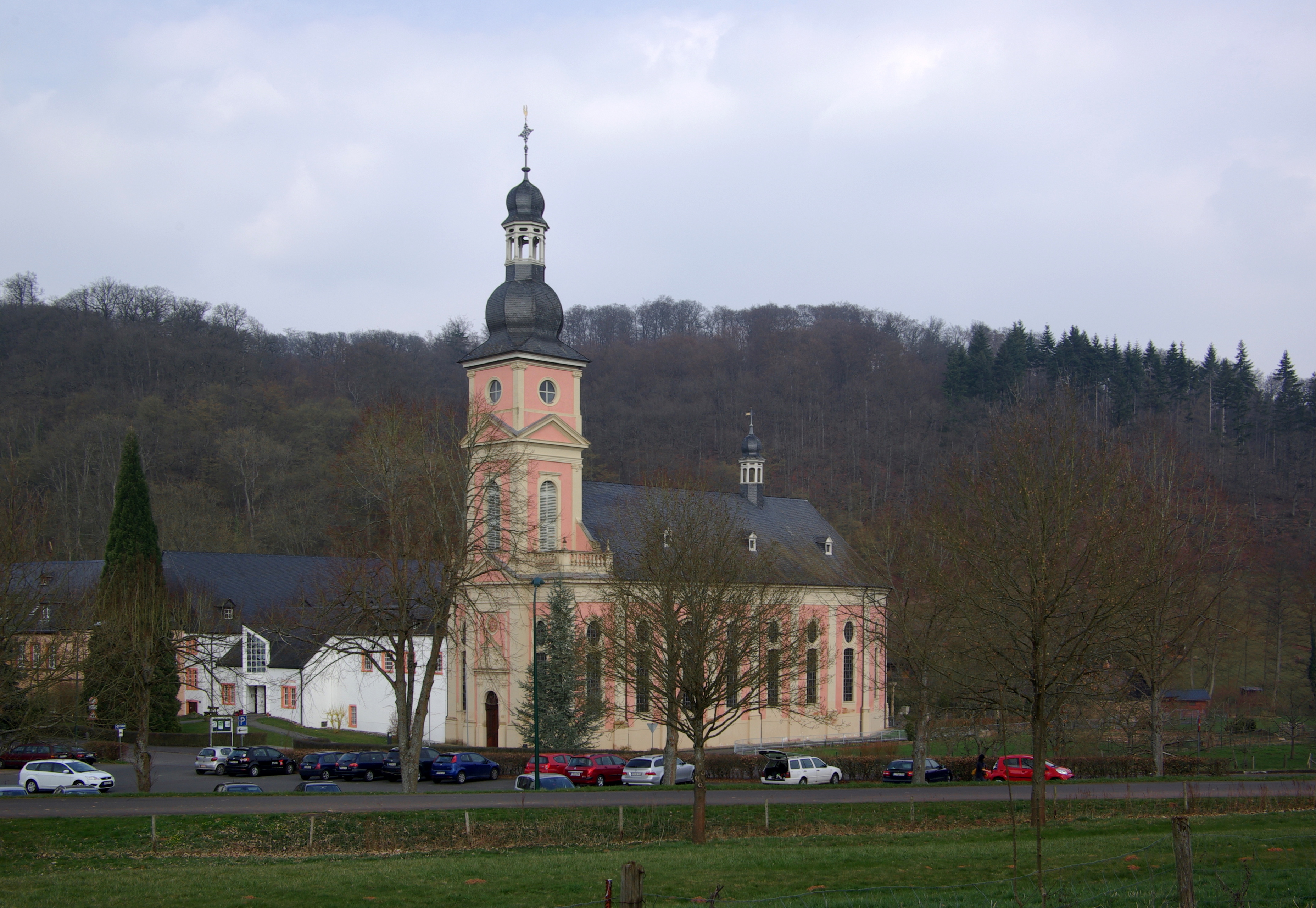
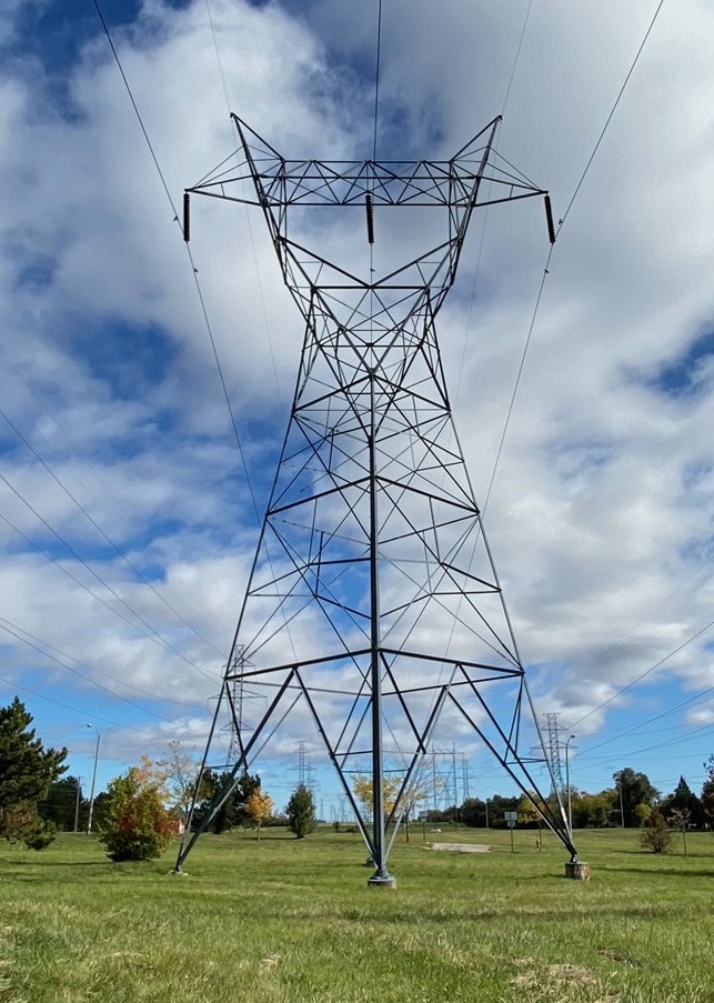
The Kondelwald, also known as the Kondel, is a forest, about 2,500 hectares in area and up to , that forms part of the Moselle Eifel. It lies within the counties of Bernkastel-Wittlich and Cochem-Zell in the German state of Rhineland-Palatinate. It used to belong to the imperial Carolingian estate of ''Kröver Reich''. Geography Location The Kondelwald is located east-northeast of Wittlich between the villages of Bengel on the Moselle tributary of Alf in the south and Bad Bertrich on the Alf tributary of Üßbach in the north. Its highest point lies between Bengel and the Hontheim village of Bonsbeuren about 750 metres as the crow flies west of the '' Waidmannsheil'' hunting lodge on the Reudelheck hill, near the road from Bengel to Bonsbeuren (Kreisstraßen 35 and 9). Near this point is a 77 metre high transmission tower (). To the south, at Bengel, is Springiersbach Abbey. Natural regions The Kondelwald forms the subunit of ''Kondelwald'' (270.2) i ... [...More Info...] [...Related Items...] OR: [Wikipedia] [Google] [Baidu] |
Moselle Eifel
The Moselle Eifel (german: Moseleifel) forms the southeastern strip of the East Eifel to the left of the Moselle from the city of Trier downstream as far as Moselkern; in the southeast it does not reach as far as the Moselle Valley. It lies exclusively within the German state of Rhineland-Palatinate and is a truncated highland, roughly half of which is forested. Geography Location The Moselle Eifel runs in a southwest to northeast direction, northwest along the Moselle river, sometimes away from the river, between Trier-Ehrang, at the confluence of the Kyll and the Moselle, and Moselkern at the confluence of the Elzbach with the same Rhine tributary. The hills of the Moselle Eifel are lower than those of the adjacent and very ancient Volcanic Eifel to the north and only exceed in a few places, reaching a maximum of at Schafstall near Bremm. On the far, southeastern side of the Moselle Valley with its many meanders and well known castles rises the somewhat higher hill ra ... [...More Info...] [...Related Items...] OR: [Wikipedia] [Google] [Baidu] |
Bengel (Mosel)
Bengel is an ''Ortsgemeinde'' – a municipality belonging to a ''Verbandsgemeinde'', a kind of collective municipality – in the Bernkastel-Wittlich district in Rhineland-Palatinate, Germany. Geography Location The municipality lies at the foot of the Eifel on the river Alf near the Moselle valley, has some 900 inhabitants and is found in the Middle Moselle-Kondelwald holiday region. The municipal area is 78% wooded. It belongs to the ''Verbandsgemeinde'' of Traben-Trarbach. Constituent communities Bengel's ''Ortsteile'' are Springiersbach and Neithof. History In Springiersbach in 1102, the Augustinian Springiersbach Monastery was founded, to which the village of Bengel and also Neithof were assigned. Beginning in 1794, Bengel lay under French hegemony. In 1802, the church and the monastery in Springiersbach were secularized. To save the almost new church from being torn down, the Bishop of Trier raised it to Parish Church of Bengel. In 1815, the municipality was assigned ... [...More Info...] [...Related Items...] OR: [Wikipedia] [Google] [Baidu] |
Alf (river)
The Alf is a small river in Rhineland-Palatinate, Germany, a left tributary of the Moselle. It rises in the Eifel, near Darscheid, east of Daun. The Alf flows south through Mehren, Gillenfeld and Bausendorf, where it turns east to flow into the Moselle at the village of Alf. Geography Course The Alf rises about northeast of Hörscheid in the Volcanic Eifel. From its source at a height of , the Alf initially flows in a southerly direction to the village of Darscheid, from which it flows to the east through the villages of Gillenfeld and Strohn. The next section of the Alf, to Bausendorf, is very winding; it then turns towards the east and cuts through the south of the forest of Kondelwald, passing the villages of Kinderbeuern and Bengel. Around beyond Bengel it changes course abruptly and swings north. A ridge prevents it from flowing further east unto the Moselle, here just away. After breaking through the Moselle Hills the Alf finally reaches the Moselle at Alf ... [...More Info...] [...Related Items...] OR: [Wikipedia] [Google] [Baidu] |
East Eifel
The Eifel (; lb, Äifel, ) is a low mountain range in western Germany and eastern Belgium. It occupies parts of southwestern North Rhine-Westphalia, northwestern Rhineland-Palatinate and the southern area of the German-speaking Community of Belgium. The Eifel is part of the Rhenish Massif; within its northern portions lies the Eifel National Park. Geography Location The Eifel lies between the cities of Aachen to the north, Trier to the south and Koblenz to the east. It descends in the northeast along a line from Aachen via Düren to Bonn into the Lower Rhine Bay. In the east and south it is bounded by the valleys of the Rhine and the Moselle. To the west it transitions in Belgium and Luxembourg into the geologically related Ardennes and the Luxembourg Ösling. In the north it is limited by the Jülich-Zülpicher Börde. Within Germany it lies within the states of Rhineland-Palatinate and North Rhine-Westphalia; in the Benelux the area of Eupen, St. Vith and Luxembourg ... [...More Info...] [...Related Items...] OR: [Wikipedia] [Google] [Baidu] |
Natural Region
A natural region (landscape unit) is a basic geographic unit. Usually, it is a region which is distinguished by its common natural features of geography, geology, and climate. From the ecological point of view, the naturally occurring flora and fauna of the region are likely to be influenced by its geographical and geological factors, such as soil and water availability, in a significant manner. Thus most natural regions are homogeneous ecosystems. Human impact can be an important factor in the shaping and destiny of a particular natural region. Main terms The concept "natural region" is a large basic geographical unit, like the vast boreal forest region. The term may also be used generically, like in alpine tundra, or specifically to refer to a particular place. The term is particularly useful where there is no corresponding or coterminous official region. The Fens of eastern England, the Thai highlands, and the Pays de Bray in Normandy, are examples of this. Others mig ... [...More Info...] [...Related Items...] OR: [Wikipedia] [Google] [Baidu] |
Springiersbach Abbey
Springiersbach Abbey is a former Augustinian (Canons Regular) monastery, and currently a Carmelite monastery in Bengel municipality, in the Eifel region of Rhineland-Palatinate, Germany. It was founded in 1102 by Bruno of Lauffen, archbishop of Trier under the patronage of count palatine Siegfried of Ballenstedt. The first abbot was Richard I (provost from 1118, abbot from 1129, died 1158). In 1107, the monastery became independent of the archbishopric, allowing the monks to elect their abbots freely. Entrance into the monastery was reserved for nobility, who would typically bequeath their lands to the monastery on entry. The Augustinian convent was dissolved in the Napoleonic era The Napoleonic era is a period in the history of France and Europe. It is generally classified as including the fourth and final stage of the French Revolution, the first being the National Assembly, the second being the Legislativ .... The Carmelite convent was established in 1922. R ... [...More Info...] [...Related Items...] OR: [Wikipedia] [Google] [Baidu] |
Transmission Tower
A transmission tower, also known as an electricity pylon or simply a pylon in British English and as a hydro tower in Canadian English, is a tall structure, usually a steel lattice tower, used to support an overhead power line. In electrical grids, they are generally used to carry high-voltage transmission lines that transport bulk electric power from generating stations to electrical substations; utility poles are used to support lower-voltage subtransmission and distribution lines that transport power from substations to electric customers. They come in a wide variety of shapes and sizes. Typical height ranges from , though the tallest are the towers of a span between the islands Jintang and Cezi in China's Zhejiang province. The longest span of any hydroelectric crossing ever built belongs to the powerline crossing of Ameralik fjord with a length of . In addition to steel, other materials may be used, including concrete and wood. There are four major categories of ... [...More Info...] [...Related Items...] OR: [Wikipedia] [Google] [Baidu] |
Kreisstraße
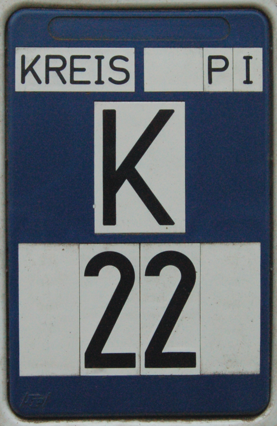
A Kreisstraße (literally: "district road" or "county road") is a class of road in Germany. It carries traffic between the towns and villages within a '' Kreis'' or district or between two neighbouring districts. In importance, the ''Kreisstraße'' ranks below a '' Landesstraße'' (or, in Bavaria and Saxony, a ''Staatstraße'', i.e. a state road), but above a '' Gemeindestraße'' or "local road". ''Kreisstraßen'' are usually the responsibility of the respective rural district ('' Landkreis'') or urban district ('' Kreisfreie Stadt''), with the exception of high streets through larger towns and villages. Kreisstraßen are usually dual-lane roads but, in a few cases, can be built as limited-access dual carriageways in densely populated areas. Numbering Unlike local roads (''Gemeindestraßen'') the ''Kreisstraßen'' are invariably numbered, but their numbering is not shown on signs. The abbreviation is a prefixed capital letter K followed by a serial number. In most states the c ... [...More Info...] [...Related Items...] OR: [Wikipedia] [Google] [Baidu] |
As The Crow Flies
__NOTOC__ The expression ''as the crow flies'' is an idiom for the most direct path between two points, rather similar to "in a beeline". This meaning is attested from the early 19th century, and appeared in Charles Dickens's 1838 novel '' Oliver Twist'': Crows do conspicuously fly alone across open country, but neither crows nor bees (as in "beeline") fly in particularly straight lines.Villazon, Luis.“Do crows actually fly in a straight line?” BBC Focus (August 30, 2017). While crows do not swoop in the air like swallows or starlings, they often circle above their nests. One suggested origin of the term is that before modern navigational methods were introduced, cages of crows were kept upon ships and a bird would be released from the crow's nest when required to assist navigation, in the hope that it would fly directly towards land. However, the earliest recorded uses of the term are not nautical in nature, and the crow's nest of a ship is thought to derive from its ... [...More Info...] [...Related Items...] OR: [Wikipedia] [Google] [Baidu] |
Üßbach
The Üßbach (also UeßbachFor its entry in the Geoexplorer the spelling ''Ueßbach'' has to be used. or Üssbach) is a stream, just under long in the Eifel in the German state of Rhineland-Palatinate. It rises near Mosbruch in the county of Vulkaneifel and empties near Alf (Cochem-Zell) into the eponymous river, just before the Alf discharges into the river Moselle. The spa resort of Bad Bertrich lies on the Üßbach. See also *List of rivers of Rhineland-Palatinate A list of rivers of Rhineland-Palatinate, Germany: A * Aar * Adenauer Bach *Ahr * Alf * Alfbach *Appelbach *Asdorf * Aubach B * Birzenbach *Blattbach * Breitenbach * Brexbach * Brohlbach, tributary of the Moselle * Brohlbach, tributary of the R ... Footnotes References Rivers of the Eifel Rivers of Rhineland-Palatinate Vulkaneifel Cochem-Zell Rivers of Germany {{RhinelandPalatinate-river-stub ... [...More Info...] [...Related Items...] OR: [Wikipedia] [Google] [Baidu] |
Moselle
The Moselle ( , ; german: Mosel ; lb, Musel ) is a river that rises in the Vosges mountains and flows through north-eastern France and Luxembourg to western Germany. It is a bank (geography), left bank tributary of the Rhine, which it joins at Koblenz. A small part of Belgium is in its drainage basin, basin as it includes the Sauer and the Our River, Our. Its lower course "twists and turns its way between Trier and Koblenz along one of Germany's most beautiful river valleys."''Moselle: Holidays in one of Germany's most beautiful river valleys'' at www.romantic-germany.info. Retrieved 23 Jan 2016. In this section the land to the north is the Eifel which stretches into Belgium; to the south lies the Hunsrück. The river flows through a region that was cultivated by the Ro ... [...More Info...] [...Related Items...] OR: [Wikipedia] [Google] [Baidu] |


