Kondelwald on:
[Wikipedia]
[Google]
[Amazon]
The Kondelwald, also known as the Kondel, is a forest, about 2,500 hectares in area and up to , that forms part of the

Wine and holiday region of Middle Moselle-Kondelwald
at mittelmosel-kondelwald.de {{Authority control Landscapes of Rhineland-Palatinate Forests and woodlands of Rhineland-Palatinate
Moselle Eifel
The Moselle Eifel () forms the southeastern strip of the East Eifel to the left of the Moselle from the city of Trier downstream as far as Moselkern; in the southeast it does not reach as far as the Moselle Valley. It lies exclusively within the G ...
. It lies within the counties of Bernkastel-Wittlich
Bernkastel-Wittlich (German language, German: ''Landkreis Bernkastel-Wittlich'') is a district in Rhineland-Palatinate, Germany. It is bounded by (from the north and clockwise) the districts of Vulkaneifel, Cochem-Zell, Rhein-Hunsrück, Birkenfeld ...
and Cochem-Zell
Cochem-Zell (German: ''Landkreis Cochem-Zell'') is a district (''Kreis'') in the north-west of Rhineland-Palatinate, Germany. Neighboring districts are Mayen-Koblenz, Rhein-Hunsrück, Bernkastel-Wittlich, and Vulkaneifel.
History
In 1816 the di ...
in the German state of Rhineland-Palatinate
Rhineland-Palatinate ( , ; ; ; ) is a western state of Germany. It covers and has about 4.05 million residents. It is the ninth largest and sixth most populous of the sixteen states. Mainz is the capital and largest city. Other cities are ...
. It used to belong to the imperial Carolingian
The Carolingian dynasty ( ; known variously as the Carlovingians, Carolingus, Carolings, Karolinger or Karlings) was a Frankish noble family named after Charles Martel and his grandson Charlemagne, descendants of the Arnulfing and Pippinid c ...
estate of ''Kröver Reich''.
Geography

Location
The Kondelwald is located east-northeast ofWittlich
Wittlich (; Moselle Franconian language, Moselle Franconian: ''Wittlech'') is a town in Rhineland-Palatinate, in western Germany, the seat of the Bernkastel-Wittlich Districts of Germany, district. Its historic town centre and the beauty of the sur ...
between the villages of Bengel on the Moselle
The Moselle ( , ; ; ) is a river that rises in the Vosges mountains and flows through north-eastern France and Luxembourg to western Germany. It is a bank (geography), left bank tributary of the Rhine, which it joins at Koblenz. A sm ...
tributary of Alf in the south and Bad Bertrich
Bad Bertrich is an '' Ortsgemeinde'' – a municipality belonging to a ''Verbandsgemeinde'', a kind of collective municipality – in the Cochem-Zell district in Rhineland-Palatinate, Germany. It belongs to the ''Verbandsgemeinde'' of Ulmen, wh ...
on the Alf tributary of Üßbach
The Üßbach (also UeßbachFor its entry in the Geoexplorer the spelling ''Ueßbach'' has to be used. or Üssbach) is a stream, just under long in the Eifel in the German state of Rhineland-Palatinate. It rises near Mosbruch in the county of Vul ...
in the north. Its highest point lies between Bengel and the Hontheim village of Bonsbeuren about 750 metres as the crow flies
The expression ''as the crow flies'' is an idiom for the most direct path between two points.
Etymology
The meaning of the expression is attested from the early 19th century, and appeared in the Charles Dickens novel ''Oliver Twist'' (1838):
...
west of the '' Waidmannsheil'' hunting lodge on the Reudelheck hill, near the road from Bengel to Bonsbeuren (Kreisstraße
A Kreisstraße (, or 'county road') is a class of road in Germany. It carries traffic between the towns and villages within a ''Districts of Germany, Kreis'' or district or between two neighbouring districts. In importance, the ''Kreisstraße'' ...
n 35 and 9). Near this point is a 77 metre high transmission tower
A transmission tower (also electricity pylon, hydro tower, or pylon) is a tall structure, usually a lattice tower made of steel that is used to support an overhead power line. In electrical grids, transmission towers carry high-voltage transmis ...
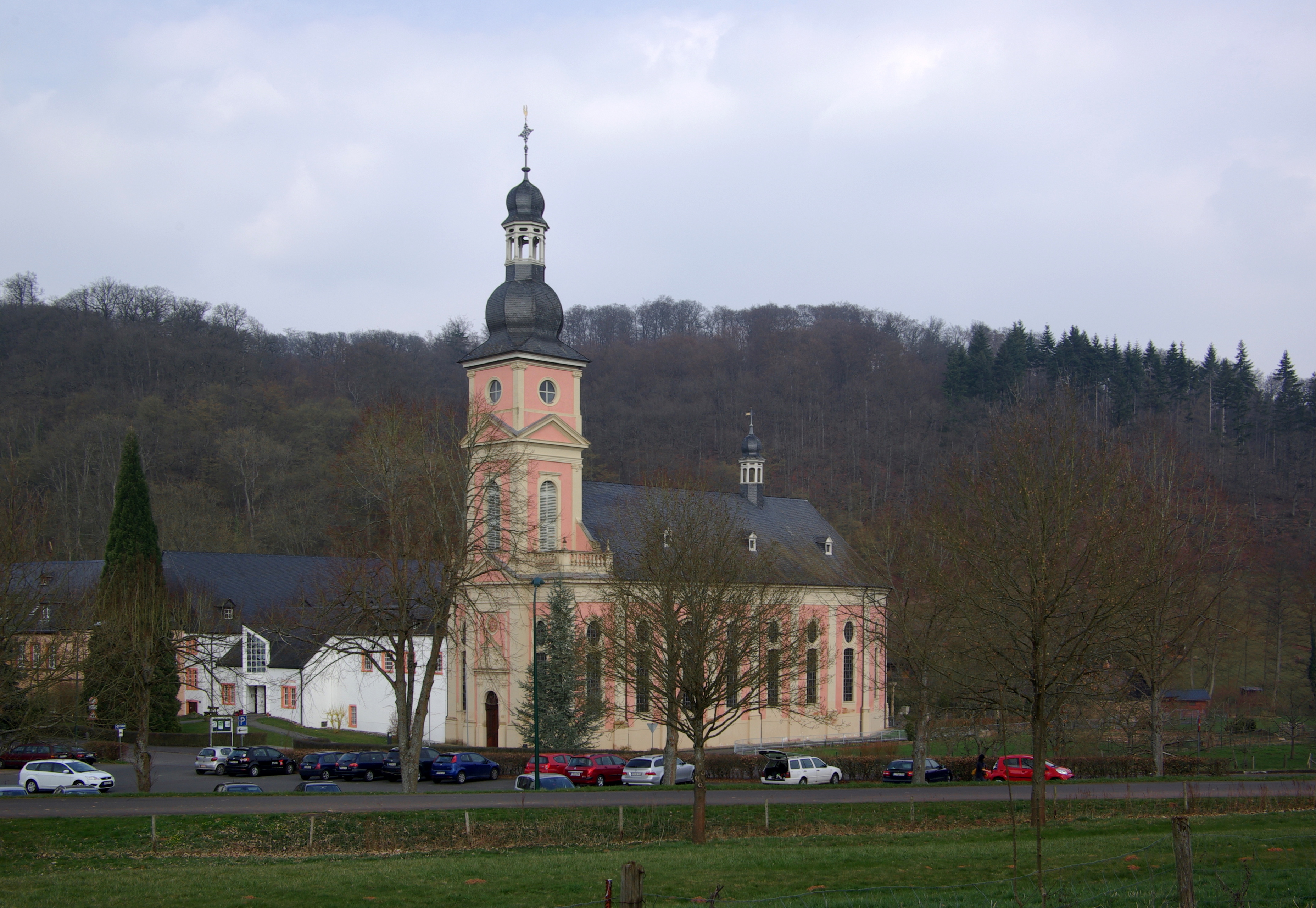
(). To the south, at Bengel, is Springiersbach Abbey
Springiersbach Abbey is a former Augustinian (Canons Regular) monastery, and currently a Carmelite monastery in Bengel (Mosel), Bengel municipality, in the Eifel region of Rhineland-Palatinate, Germany.
History
It was founded around 1102 by Bru ...
.
Natural regions
The Kondelwald forms the subunit of ''Kondelwald'' (270.2) in thenatural region
A natural region (landscape unit) is a basic geographic unit. Usually, it is a region which is distinguished by its common natural features of geography, geology, and climate.
From the ecological point of view, the naturally occurring flora and ...
al major unit group of East Eifel
The Eifel (; , ) is a low mountain range in western Germany, eastern Belgium and northern Luxembourg. It occupies parts of southwestern North Rhine-Westphalia, northwestern Rhineland-Palatinate and the southern area of the German-speaking Com ...
(No. 27) and major unit Moselle Eifel
The Moselle Eifel () forms the southeastern strip of the East Eifel to the left of the Moselle from the city of Trier downstream as far as Moselkern; in the southeast it does not reach as far as the Moselle Valley. It lies exclusively within the G ...
(270).
References
External links
Wine and holiday region of Middle Moselle-Kondelwald
at mittelmosel-kondelwald.de {{Authority control Landscapes of Rhineland-Palatinate Forests and woodlands of Rhineland-Palatinate