|
Charles Thomas (historian)
Antony Charles Thomas, (26 April 1928 – 7 April 2016)''Who's Who'' was a British historian and archaeologist who was Professor of Cornish Studies at Exeter University, and the first Director of the Institute of Cornish Studies, from 1971 until his retirement in 1991. He was recognised as a Bard of the Cornish Gorseth with the name ''Gwas Godhyan'' in 1953. Birth, early life and education He was born 26 April 1928 in Camborne, Cornwall, the son of Donald Woodroffe Thomas and Viva (née Warrington) Thomas. He attended Elmhirst Preparatory day school, Camborne and Upcott House School, Okehampton. In 1940 he received a scholarship to Bradfield College, but on the advice of a family friend was instead sent to Winchester College on a 'Headmaster's Nomination'. In 1945 at the age of 17 he joined the army as a Young Soldier and later was an ammunition examiner in the Royal Army Ordnance Corps; he would serve in Northern Ireland, Portsmouth, Scotland and Egypt, the latter of whi ... [...More Info...] [...Related Items...] OR: [Wikipedia] [Google] [Baidu] |
Camborne
Camborne (from Cornish language, Cornish ''Cambron'', "crooked hill") is a town in Cornwall, England. The population at the 2011 Census was 20,845. The northern edge of the parish includes a section of the South West Coast Path, Hell's Mouth, Cornwall, Hell's Mouth and Deadman's Cove. Camborne was formerly one of the richest Mining in Cornwall and Devon, tin mining areas in the world and home to the Camborne School of Mines. Geography Camborne is in the western part of the largest urban and industrial area in Cornwall with the town of Redruth east. It is the ecclesiastical centre of a large civil parish and has a town council. Camborne-Redruth is on the northern side of the Carn Brea, Redruth, Carn Brea/Carnmenellis granite upland which slopes northwards to the sea. The two towns are linked by the A3047 road which was Toll road, turnpiked in 1839 and the villages along the road (from the west) were Roskear, Tuckingmill, Pool and Illogan. Running north-south are a number of s ... [...More Info...] [...Related Items...] OR: [Wikipedia] [Google] [Baidu] |
University Of Leicester
The University of Leicester ( ) is a public university, public research university based in Leicester, England. The main campus is south of the city centre, adjacent to Victoria Park, Leicester, Victoria Park. The university's predecessor, University College, Leicester, gained university status in 1957. The university had an income of £384.6 million in 2023/24, of which £74.5 million was from research grants. The university is known for the invention of genetic fingerprinting, and for partially funding the discovery and the DNA identification of the remains of exhumation of Richard III, King Richard III in Leicester. History Desire for a university The first serious suggestions for a university in Leicester began with the Leicester Literary and Philosophical Society (founded at a time when "philosophical" broadly meant what "scientific" means today). With the success of Owens College in Manchester, and the establishment of the University of Birmingham in 1900, and then o ... [...More Info...] [...Related Items...] OR: [Wikipedia] [Google] [Baidu] |
Islands Of Fleet
The Islands of Fleet are a group of small islands in Galloway, Scotland. They are in Fleet Bay, which is part of Wigtown Bay, and is in turn part of the Solway Firth in the Irish Sea. There are three main islands. * Murray Isles, owned by the National Trust for Scotland, with the small rock "Horse Mark" off it. * Ardwall Isle (Ard Bhaile - high town), which has a cairn and the remains of a chapel on it, and has the "Old Man of Fleet" off it. The largest of the three, it is approximately in extent.Rick Livingstone's Tables of the Islands of Scotland (pdf) Argyll Yacht Charters. Retrieved 12 December 2011. * Barlocco Island, with the "Three Brethren" off it. Barlocco Island is about . It has a pebble beach where a boat can be anchored or beached. At low tide it is accessible on foot, by ... [...More Info...] [...Related Items...] OR: [Wikipedia] [Google] [Baidu] |
Iona Abbey
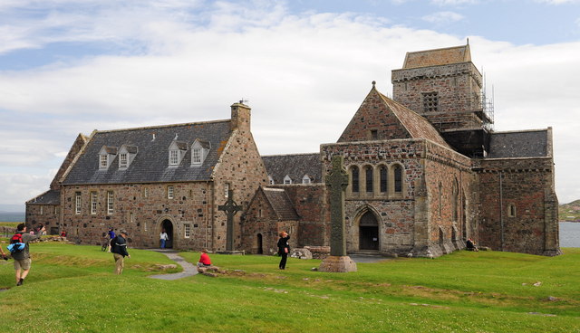
Iona Abbey is an abbey located on the island of Iona, just off the Isle of Mull on the West Coast of Scotland. It is one of the oldest History of early Christianity, Christian religious centres in Western Europe. The abbey was a focal point for the spread of Christianity throughout Scotland and marks the foundation of a monastic community by Columba, St. Columba, when Iona was part of the Kingdom of Dál Riata. Aidan of Lindisfarne, Saint Aidan served as a monk at Iona, before helping to reestablish Christianity in Northumberland, on the island of Lindisfarne. In the 12th century, the Macdonald lords of Clan Donald made Iona the ecclesiastical capital of the Royal Family of Macdonald, and subsequent Lords of the Isles into the early 16th century endowed and maintained the abbey, church and nunnery. Two of the Macdonalds (each named Angus) became Bishops of the Isles with the bishop's seat at Iona. St. Oran's chapel was the burial place for the Lords as evidenced by their gra ... [...More Info...] [...Related Items...] OR: [Wikipedia] [Google] [Baidu] |
Teän
Teän ( , sometimes written ''Tean'' without the Diaeresis (diacritic), diaeresis; ) is an uninhabited island to the north of the Isles of Scilly archipelago between Tresco, Isles of Scilly, Tresco, to the west, and St Martin's, Isles of Scilly, St Martin's, to the east. Approximately in area, the island consists of a series of granite Tor (rock formation), tors with the highest point, Great Hill, rising to at its eastern end. The low-lying land is overlain with glacial till and outwash gravels with glacial erratics abundant on the north coast beaches, which indicates the southern limit of outwash from an ice sheet for which it is designated a Geological Conservation Review site. There is evidence of occupation from the Bronze Age Britain, Bronze Age to the early 19th century and the island was still being grazed in 1945.Parslow, R. (2007) ''The Isles of Scilly''. New Naturalist Library. London: HarperCollins An early Christian chapel exists on the island; it was possibly de ... [...More Info...] [...Related Items...] OR: [Wikipedia] [Google] [Baidu] |
Nendrum Monastery
Nendrum Monastery (Irish: ''Naondroim'') was a Christian monastery on Mahee Island in Strangford Lough, County Down, Northern Ireland. Medieval records say it was founded in the 5th century, but this is uncertain. The monastery came to an end at some time between 974 and 1178, but its church served a parish until the site was abandoned in the 15th century. Some remains of the monastery can still be seen. History The island monastery of Nendrum was traditionally founded in the 5th century by Mochaoi, after whom Mahee Island is named, although a later date for the foundation has been suggested. Mo Chaoi, like the name of many Irish saints, is a pet name. His proper name was Caolán (Mochaoi) and according to tradition he was appointed by St. Patrick.Halpin, Andrew, & Conor Newman, ''Ireland: An Oxford Archaeological Guide to Sites from Earliest Times to AD 1600'' (Oxford University Press, 2006, , )pp. 99-100at books.google.comMacdonald, Philip, of Centre for Archaeological Fieldwork, ... [...More Info...] [...Related Items...] OR: [Wikipedia] [Google] [Baidu] |
Gwithian
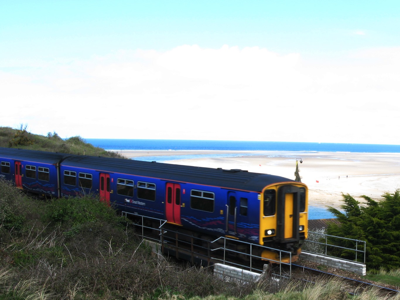
Gwithian () is a coastal village and former civil parish, now in the parish of Gwinear-Gwithian, in the Cornwall district, in west Cornwall, England. It is three miles (5 km) north-east of Hayle and four miles (6.5 km) east of St Ives, Cornwall across St Ives Bay. In 1931 the parish had a population of 634. On 1 April 1934 the parish was abolished to form "Gwinear Gwithian". Gwithian has a pub, the Red River Inn, which was formerly named the Pendarves Arms. The pub takes its name from the nearby Red River which, in turn, got its name from the discolouration caused by mining effluent. The river's earlier name was Dowr Coner. History Gwithian Towans cover the site of a Bronze Age farm which has been excavated although no remains are visible. The church and relics of St Gwithian or Gocianus, built in 490, were uncovered from the beach and dunes during the early part of the 19th century, but were then allowed to be reclaimed by the shifting sands. Gwithian is t ... [...More Info...] [...Related Items...] OR: [Wikipedia] [Google] [Baidu] |
St Ives Bay
St Ives Bay (, meaning "Ia's anchorage") is a bay on the Atlantic coast of north-west Cornwall, England, United Kingdom. It is in the form of a shallow crescent, some 4 miles or 6 km across, between St Ives in the west and Godrevy Head in the east. At the most southerly point of St Ives Bay, the River Hayle flows into the sea through sand dunes and across the beach. Behind the dunes, the river forms a broad tidal estuary which includes an area of salt marsh and a largely disused port (see article on the industrial history of Hayle). The estuary is a popular place for birdwatching and the Royal Society for the Protection of Birds maintains a reserve there. The eastern coast of the bay is a three-mile (5 km) unbroken sandy beach backed by a substantial system of coastal dunes known as The Towans which stretches from Porth Kidney Sands in the west to Godrevy Head in the east. This stretch of beach is popular for surfing, particularly in the Gwithian area. The weste ... [...More Info...] [...Related Items...] OR: [Wikipedia] [Google] [Baidu] |
Godrevy
Godrevy (, meaning ''small farms'') ( ) is an area on the eastern side of St Ives Bay, west Cornwall, England, United Kingdom, which faces the Atlantic Ocean. It is popular with both the surfing community and walkers. It is part owned by the National Trust, and offshore on Godrevy Island is a Godrevy Lighthouse, lighthouse maintained by Trinity House which is said to be the inspiration for Virginia Woolf, Virginia Woolf's novel ''To the Lighthouse''. Godrevy lies within the Cornwall Area of Outstanding Natural Beauty (AONB) and the South West Coast Path runs around the whole promontory. There are several public car parks on the western side where the National Trust owns and operates a café. Godrevy Head The headland () is on the Atlantic Ocean, Atlantic coast in Cornwall on the eastern side of St Ives, Cornwall, St Ives Bay and about three miles (5 km) northeast of the town of Hayle. The nearest village is Gwithian, half a mile west beyond Godrevy Bridge across the Re ... [...More Info...] [...Related Items...] OR: [Wikipedia] [Google] [Baidu] |
National University Of Ireland
The National University of Ireland (NUI) () is a federal university system of ''constituent universities'' (previously called '' constituent colleges'') and ''recognised colleges'' set up under the Irish Universities Act 1908, and significantly amended by the Universities Act, 1997. The constituent universities are for all essential purposes independent universities, except that the degrees and diplomas are those of the National University of Ireland with its seat in Dublin. In post-nominals, the abbreviation ''NUI'' is used for degrees from all the constituent universities of the National University of Ireland. History Queen's Colleges at Belfast, Cork, and Galway were established in 1845. In 1849 teaching commenced and a year later they were united under the Queen's University of Ireland. The Catholic University of Ireland was created as an independent university on 3 November 1854 for the education of Catholics; that university was not a recognised university ... [...More Info...] [...Related Items...] OR: [Wikipedia] [Google] [Baidu] |
Sir John Rhys Fellow
''Sir'' is a formal honorific address in English for men, derived from Sire in the High Middle Ages. Both are derived from the old French "" (Lord), brought to England by the French-speaking Normans, and which now exist in French only as part of "", with the equivalent "My Lord" in English. Traditionally, as governed by law and custom, Sir is used for men who are knights and belong to certain orders of chivalry, as well as later applied to baronets and other offices. As the female equivalent for knighthood is damehood, the ''suo jure'' female equivalent term is typically Dame. The wife of a knight or baronet tends to be addressed as Lady, although a few exceptions and interchanges of these uses exist. Additionally, since the late modern period, Sir has been used as a respectful way to address a man of superior social status or military rank. Equivalent terms of address for women are Madam (shortened to Ma'am), in addition to social honorifics such as Mrs, Ms, or Miss. Etym ... [...More Info...] [...Related Items...] OR: [Wikipedia] [Google] [Baidu] |
Cornish Studies
The Institute of Cornish Studies (, ICS) is a research institute affiliated with the University of Exeter. Formerly located at Pool, near Redruth, then in Truro, it is now on the University's Penryn Campus near Penryn, Cornwall. History The Institute of Cornish Studies (ICS) was founded in 1971. Originally based in Pool, halfway between Camborne and Redruth, its first director was Charles Thomas who led the institute with Oliver Padel and Myrna Combellack in research into archaeology, Cornish place-names and Cornish medieval dramas. After Thomas retired, Philip Payton took over as director from 1991 and changed the direction of research towards contemporary matters, publishing a collection of essays on modern Cornwall in 1993 entitled ''Cornwall Since the War''. In 1994 the institute moved to Truro, at the university's Department of Lifelong Learning. In 2000 Garry Tregidga and Bernard Deacon joined the institute, which moved again in 2004 to the Tremough campus. The cam ... [...More Info...] [...Related Items...] OR: [Wikipedia] [Google] [Baidu] |


