|
Bhanu Chowk
Bhanu Chowk is a local landmark in Dharan, Sunsari of Eastern Nepal. Bhanu Chowk is regarded as the Centre of Dharan, and is one of the most iconic landmarks of Dharan and is also one of the busiest landmark in Dharan, Eastern Nepal. The Dharan Clock Tower is also located near the area of Bhanu Chowk. Bhanu Chowk is also the major transportation hub of Dharan. The local bus stand(s) present nearby depart several hundreds of buses, vans and such that are headed to several different parts of Nepal including Kathmandu and Pokhara, on a daily basis. Several Citi Safaris and Tempos are a source of local transport available from Bhanu Chowk to various parts of the city. References External links BhanuChowk.com on |
Neighbourhood
A neighbourhood (Commonwealth English) or neighborhood (American English) is a geographically localized community within a larger town, city, suburb or rural area, sometimes consisting of a single street and the buildings lining it. Neighbourhoods are often social communities with considerable face-to-face interaction among members. Researchers have not agreed on an exact definition, but the following may serve as a starting point: "Neighbourhood is generally defined spatially as a specific geographic area and functionally as a set of social networks. Neighbourhoods, then, are the Neighbourhood unit, spatial units in which face-to-face social interactions occur—the personal settings and situations where residents seek to realise common values, socialise youth, and maintain effective social control." Preindustrial cities In the words of the urban scholar Lewis Mumford, "Neighborhoods, in some annoying, inchoate fashion exist wherever human beings congregate, in permanent famil ... [...More Info...] [...Related Items...] OR: [Wikipedia] [Google] [Baidu] |
Eastern Development Region, Nepal
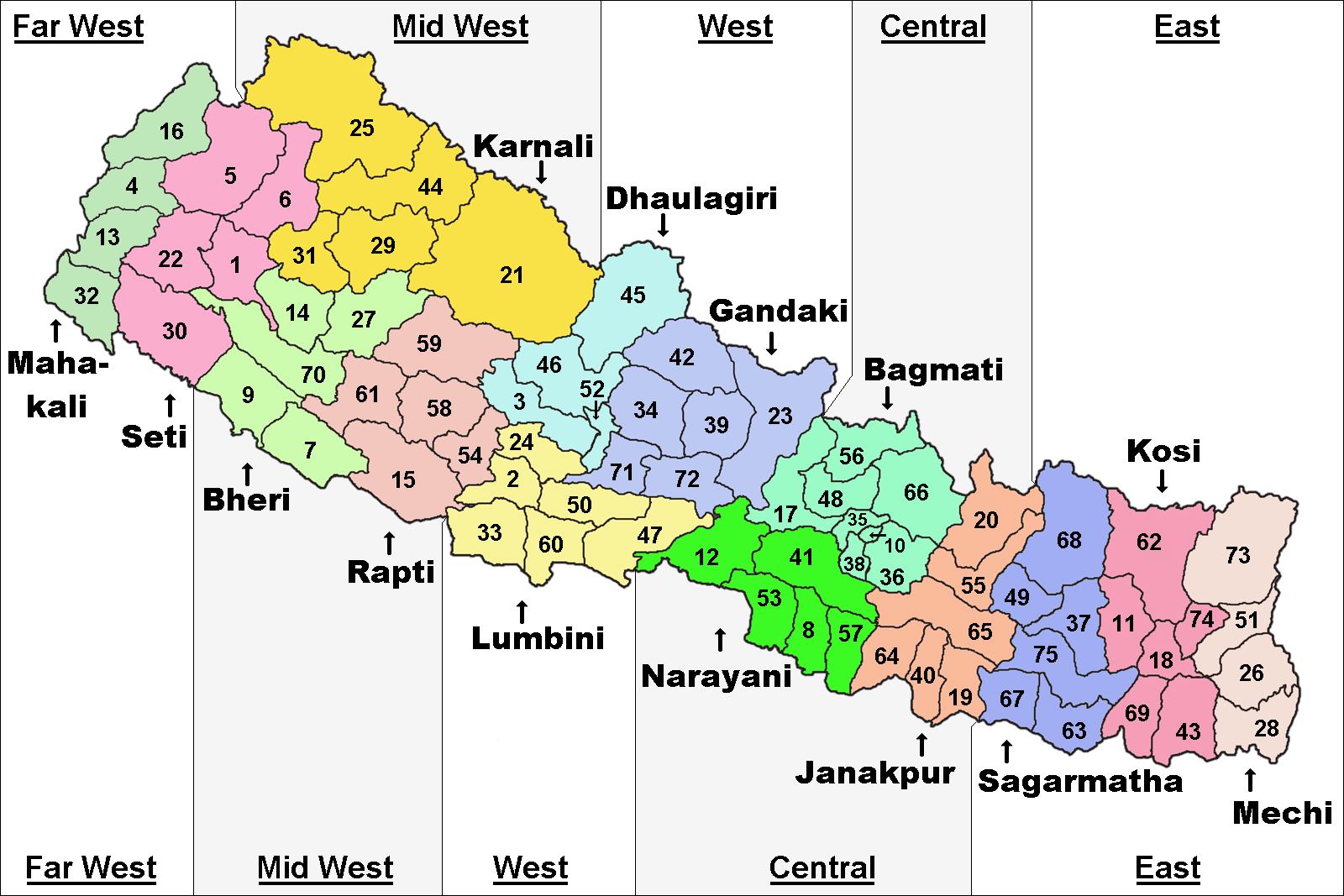
The Eastern Development Region ( Nepali: पुर्वाञ्चल विकास क्षेत्र, ''Purwānchal Bikās Kshetra'') was one of Nepal's five development regions. It is also known as Kirata region. It was located at the eastern end of the country with its headquarters at Dhankuta. The town of Dhankuta was the headquarter of the Eastern Region, as well as the headquarter of the Dhankuta District. History On April 13, 1961 Mahendra, the king of Nepal, divided the existing 35 districts into 75 districts and grouped them into 14 administrative zones. In 1972, the King of Nepal grouped 14 zones into total 4 development regions, thus Eastern Development Region came into existence. On 20 September 2015, Eastern Development Region including all other development regions of Nepal were abolished, when the new Constitution of Nepal-2015 was proclaimed. The total area of the region was 28,456 km². Administrative divisions The region administratively was d ... [...More Info...] [...Related Items...] OR: [Wikipedia] [Google] [Baidu] |
Electric Rickshaw
Electric rickshaws (also known as electric tuk-tuks, Totos, e-rickshaws, and e-tricycles) are small three-wheeled vehicles powered by an electric battery and motor. These small electric vehicles do not require petroleum fuel like auto rickshaws but still offer greater mobility than traditional cycle rickshaws and pulled rickshaws. This has led to their popularity and use expanding in some cities since 2008. Electric rickshaws are primarily manufactured in India, Bangladesh, Nepal, and China. Development of the E-Rickshaw market in India Share of production During 2020–23, the registration of e-rickshaws saw a significant increase, with around 300,000 vehicles registration in 2022–23, up from 78,700 in 2020–21. Although a host of unorganised producers dominate this segment, established manufacturers have also identified their growth opportunities and are expected to enter into the segment. Sales trends In the early 2010s, E-Rickshaws were introduced to several ... [...More Info...] [...Related Items...] OR: [Wikipedia] [Google] [Baidu] |
Pokhara
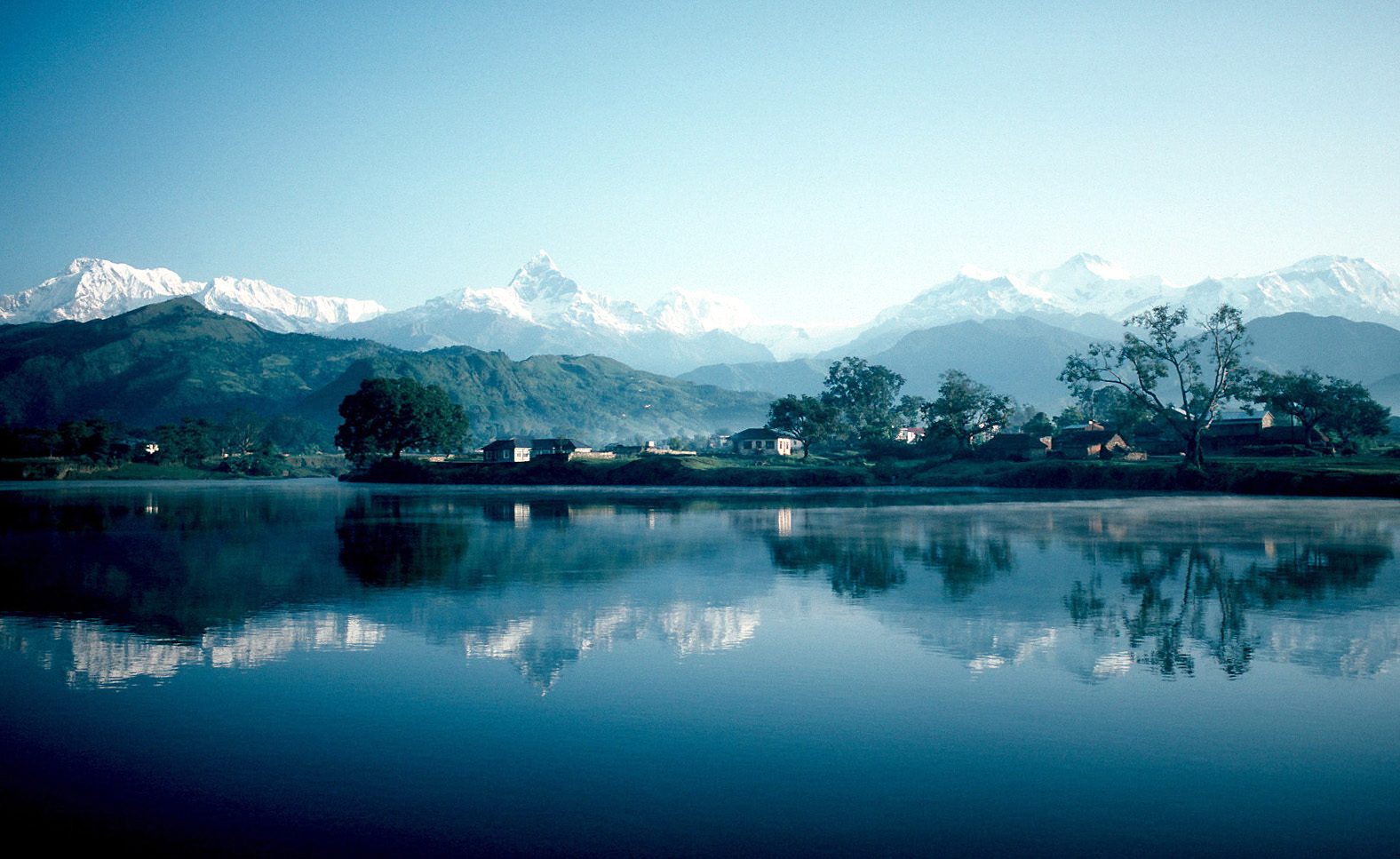
Pokhara ( ) is a metropolis, metropolitan city located in central Nepal, which serves as the capital of Gandaki Province. Named the country's "capital of tourism" it is the List of cities in Nepal, second largest city after Kathmandu, with 599,504 inhabitants living in 120,594 households as of 2021 Nepal census, 2021 census. Pokhara is located west of the capital, Kathmandu, on the shore of Phewa Lake, and sits at an average elevation of approximately 822 m above sea level. The Annapurna Range, with three out of the ten highest peaks in the world—Dhaulagiri, Annapurna, Annapurna I and Manaslu—is within aerial range from the valley. In 2024, Pokhara was declared as the tourism capital of Nepal, being a base for trekkers undertaking the Annapurna Circuit through the Annapurna Conservation Area region of the Annapurna ranges in the Himalayas. The city is also home to many of the elite Gurkha soldiers, soldiers native to South Asia of Nepalis, Nepalese nationality recrui ... [...More Info...] [...Related Items...] OR: [Wikipedia] [Google] [Baidu] |
Kathmandu
Kathmandu () is the capital and largest city of Nepal, situated in the central part of the country within the Kathmandu Valley. As per the 2021 Nepal census, it has a population of 845,767 residing in 105,649 households, with approximately 4 million people in the surrounding metropolitan area. The city stands at an elevation of 4,344 feet (1,324 metres) above sea level. Recognized as one of the oldest continuously inhabited places in the world, Kathmandu's history dates back to the 2nd century AD. Historically known as the ''Nepal Mandala'', the valley has been the cultural and political hub for the Newar people, a significant Civilization, urban civilization in the Himalayas, Himalayan region. Kathmandu served as the royal capital of the Kingdom of Nepal and is home to numerous palaces, temples, and gardens reflecting its rich heritage. Since 1985, it has hosted the headquarters of the South Asian Association for Regional Cooperation (SAARC). Today, Kathmandu remains the epice ... [...More Info...] [...Related Items...] OR: [Wikipedia] [Google] [Baidu] |
Nepal
Nepal, officially the Federal Democratic Republic of Nepal, is a landlocked country in South Asia. It is mainly situated in the Himalayas, but also includes parts of the Indo-Gangetic Plain. It borders the Tibet Autonomous Region of China China–Nepal border, to the north, and India India–Nepal border, to the south, east, and west, while it is narrowly separated from Bangladesh by the Siliguri Corridor, and from Bhutan by the States and union territories of India, Indian state of Sikkim. Nepal has a Geography of Nepal, diverse geography, including Terai, fertile plains, subalpine forested hills, and eight of the world's ten List of highest mountains#List, tallest mountains, including Mount Everest, the highest point on Earth. Kathmandu is the nation's capital and List of cities in Nepal, its largest city. Nepal is a multi-ethnic, multi-lingual, multi-religious, and multi-cultural state, with Nepali language, Nepali as the official language. The name "Nepal" is first record ... [...More Info...] [...Related Items...] OR: [Wikipedia] [Google] [Baidu] |
Dharan Clock Tower
Dharan Clock Tower (also known as ''Ghantaghar or घन्टाघर'' ) is located in Bhanu Chowk, Dharan, Nepal, Dharan, Nepal. The tower was constructed under the twenty-year plan of the city at the cost of NPR 5,639,000. The financial support was collected through The Dharan Hong Kong Manch, a forum of Nepalese Immigrants (most of the contributors from Dharan) from Hong Kong and Macao. The Amrit Nirman Sewa (Pvt.) Ltd., a local construction company, is built the Tower. The tower was opened to public on . The Tower is designed after the Clock Tower, Hong Kong, Clock Tower in Hong Kong. It is 76.5 feet tall and has five stories. On the top, there is an observation platform. The platform around the tower is made so that almost 50 people can view the city at the same time. A memorial has also been constructed in the periphery of the tower, in memory of the victims of the 1988 Nepal earthquake (). References Clock towers in Nepal 1991 establishments in Nepal {{Nepa ... [...More Info...] [...Related Items...] OR: [Wikipedia] [Google] [Baidu] |
Eastern Nepal
The Eastern Development Region ( Nepali: पुर्वाञ्चल विकास क्षेत्र, ''Purwānchal Bikās Kshetra'') was one of Nepal's five development regions. It is also known as Kirata region. It was located at the eastern end of the country with its headquarters at Dhankuta. The town of Dhankuta was the headquarter of the Eastern Region, as well as the headquarter of the Dhankuta District. History On April 13, 1961 Mahendra, the king of Nepal, divided the existing 35 districts into 75 districts and grouped them into 14 administrative zones. In 1972, the King of Nepal grouped 14 zones into total 4 development regions, thus Eastern Development Region came into existence. On 20 September 2015, Eastern Development Region including all other development regions of Nepal were abolished, when the new Constitution of Nepal-2015 was proclaimed. The total area of the region was 28,456 km². Administrative divisions The region administratively was d ... [...More Info...] [...Related Items...] OR: [Wikipedia] [Google] [Baidu] |
Dharan
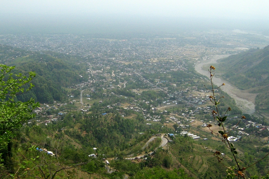
Dharan () is a sub-metropolitan city in Sunsari District of Koshi Province, in eastern Nepal, which was established as a fourth municipality in the Kingdom in 1958. It is the third most populous city in eastern Nepal after Biratnagar and Itahari. The Nepali word "dharan" means a saw pit. In 1960, a British Gurkha camp was also established near the city. The use of the camp by British Gurkhas finished in the mid-1990s. Dharan has an estimated city population of 173,096 living in 34,834 households as per the 2021 Nepal census. It is one of the cities of the ''Greater Birat Development Area'' which incorporates the cities of Biratnagar- Itahari-Gothgau- Biratchowk-Dharan primarily located on the Koshi Highway in Eastern Nepal, with an estimated total urban agglomerated population of 804,300 people living in 159,332 households. It is the largest city in the Koshi Province by Area. It covers 192.61 square kilometers while Biratnagar and Itahari are the second- and third-larg ... [...More Info...] [...Related Items...] OR: [Wikipedia] [Google] [Baidu] |
Provinces Of Nepal
The Provinces of Nepal, officially the Autonomous Nepalese Provinces (), were formed on 20 September 2015 in accordance with Schedule 4 of the Constitution of Nepal. The seven provinces were formed by grouping the existing List of districts of Nepal, districts. The current system of seven provinces replaced an earlier system where Nepal was divided into 14 List of zones of Nepal, administrative zones which were grouped into five Development regions of Nepal, development regions. History A committee was formed to restructure administrative divisions of Nepal on 23 December 1956 and in two weeks, a report was submitted to the government. In accordance with The ''Report On Reconstruction Of Districts Of Nepal, 2013'' (), the country was first divided into seven ''Kshetras'' (areas). #Arun Kshetra #Janakpur Kshetra #Kathmandu Kshetra #Gandaki Kshetra #Kapilavastu Kshetra #Karnali Kshetra #Mahakali Kshetra In 1962, all ''Kshetras'' were dissolved and the country was restructured i ... [...More Info...] [...Related Items...] OR: [Wikipedia] [Google] [Baidu] |
Nepal Time
Nepal Standard Time (NPT) is the time zone for Nepal. With a time offset from Coordinated Universal Time (UTC) of UTC+05:45 all over Nepal, it is one of only three time zones with a 45-minute offset from UTC.The others are Chatham Island Standard Time, with an offset of UTC+12:45, and the unofficial Australian Central Western Time, with an offset of UTC+08:45. Calculation NPT is an approximation of Kathmandu mean time, which is 5 hours, 41 minutes, and 16 seconds ahead of UTC. The standard meridian passes through the peak of Gaurishankar mountain about east of Kathmandu. History Nepal used local solar time until the year 1920, in Kathmandu UTC+05:41:16. In 1920, Nepal adopted Indian Standard Time Indian Standard Time (IST), sometimes also called India Standard Time, is the time zone observed throughout the Republic of India, with a time offset of UTC+05:30. India does not observe daylight saving time or other seasonal adjustments. I ..., UTC+05:30. In 1986 ... [...More Info...] [...Related Items...] OR: [Wikipedia] [Google] [Baidu] |
Dharan, Nepal
Dharan () is a sub-metropolitan city in Sunsari District of Koshi Province, in eastern Nepal, which was established as a fourth municipality in the Kingdom in 1958. It is the third most populous city in eastern Nepal after Biratnagar and Itahari. The Nepali word "dharan" means a saw pit. In 1960, a British Gurkha camp was also established near the city. The use of the camp by British Gurkhas finished in the mid-1990s. Dharan has an estimated city population of 173,096 living in 34,834 households as per the 2021 Nepal census. It is one of the cities of the ''Greater Birat Development Area'' which incorporates the cities of Biratnagar-Itahari-Gothgau- Biratchowk-Dharan primarily located on the Koshi Highway in Eastern Nepal, with an estimated total urban agglomerated population of 804,300 people living in 159,332 households. It is the largest city in the Koshi Province by Area. It covers 192.61 square kilometers while Biratnagar and Itahari are the second- and third-largest cit ... [...More Info...] [...Related Items...] OR: [Wikipedia] [Google] [Baidu] |


