|
Eastern Nepal
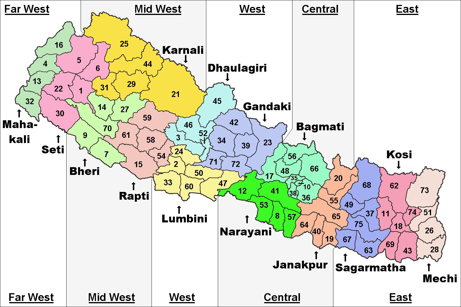
The Eastern Development Region ( Nepali: पुर्वाञ्चल विकास क्षेत्र, ''Purwānchal Bikās Kshetra'') was one of Nepal's five development regions. It is also known as Kirata region. It was located at the eastern end of the country with its headquarters at Dhankuta. The town of Dhankuta was the headquarter of the Eastern Region, as well as the headquarter of the Dhankuta District. History On April 13, 1961 Mahendra, the king of Nepal, divided the existing 35 districts into 75 districts and grouped them into 14 administrative zones. In 1972, the King of Nepal grouped 14 zones into total 4 development regions, thus Eastern Development Region came into existence. On 20 September 2015, Eastern Development Region including all other development regions of Nepal were abolished, when the new Constitution of Nepal-2015 was proclaimed. The total area of the region was 28,456 km². Administrative divisions The region administratively was d ... [...More Info...] [...Related Items...] OR: [Wikipedia] [Google] [Baidu] |
Mount Everest
Mount Everest (), known locally as Sagarmatha in Nepal and Qomolangma in Tibet, is Earth's highest mountain above sea level. It lies in the Mahalangur Himal sub-range of the Himalayas and marks part of the China–Nepal border at its summit. Its height was most recently measured in 2020 by Chinese and Nepali authorities as . Mount Everest attracts many climbers, including highly experienced mountaineers. There are two main climbing routes, one approaching the summit from the southeast in Nepal (known as the standard route) and the other from the north in Tibet. While not posing substantial technical climbing challenges on the standard route, Everest presents dangers such as altitude sickness, weather, and wind, as well as hazards from avalanches and the Khumbu Icefall. As of May 2024, 340 people have died on Everest. Over 200 bodies remain on the mountain and have not been removed due to the dangerous conditions. Climbers typically ascend only part of Mount Eve ... [...More Info...] [...Related Items...] OR: [Wikipedia] [Google] [Baidu] |
Nepali Language
Nepali (; , ), or ''Gorkhali'' is an Indo-Aryan languages, Indo-Aryan language native to the Himalayas region of South Asia. It is the official and most widely spoken Languages of Nepal, language of Nepal, where it also serves as a ''lingua franca''. Nepali has Languages with official status in India, official status in the Indian state of Sikkim and in the Gorkhaland Territorial Administration of West Bengal. It is spoken by about a quarter of Bhutan's population. Nepali also has a significant number of speakers in the Indian states of Arunachal Pradesh, Assam, Himachal Pradesh, Manipur, Meghalaya, Mizoram and Uttarakhand. In Myanmar it is spoken by the Burmese Gurkhas. The Nepali diaspora in the Middle East, Brunei, Australia and worldwide also use the language. Nepali is spoken by approximately 19 million native speakers and another 14 million as a second language. Nepali is commonly classified within the Eastern Pahari group of the Northern Indo-Aryan languages, Northern zo ... [...More Info...] [...Related Items...] OR: [Wikipedia] [Google] [Baidu] |
Panchthar District
Panthar District () is one of 14 districts of Koshi Province in the eastern hilly region of Nepal. It is a Hill district of eastern Nepal. The district covers of area. The 2011 census counted 191,817 population. Phidim is the district headquarters. History Panthar was a part of Old Dhankuta District during Rana era and until 1962. Dhankuta district had two subdivisions Chhathum and Tehrathum. Panchthar was a thum (county) under the Terhathum subvision. It became a separate district in 1962 when the old 32 traditional districts divided into 75 district. Geography and climate Demographics At the 2021 Nepal census, Panchthar District had 42,495 households and a population of 172,400. 8.11% of the population was under 5 years of age. Panchthar had a literacy rate of 82.48% and a sex ratio of 1012 females per 1,000 males. 12,336 (7.16%) lived in urban areas. Ethnicity/caste: Janjatis make up the majority in the district at 73%. Limbu people make up over 43% of the populatio ... [...More Info...] [...Related Items...] OR: [Wikipedia] [Google] [Baidu] |
List Of Zones Of Nepal
Until the establishment of seven new Provinces of Nepal, provinces in 2015, Nepal was divided into 14 administrative zones (Nepali language, Nepali: अञ्चल; ''anchal'') and 77 List of districts of Nepal, districts (Nepali language, Nepali: जिल्ला; ''jillā''). The 14 administrative zones were grouped into five Development Regions of Nepal, development regions (Nepali language, Nepali: विकास क्षेत्र; ''vikās kṣetra''). Each district was headed by a chief district officer (CDO), who was responsible for maintaining law and order and coordinating the work of field agencies of the various government ministries. List From east to west: *Eastern Development Region, Nepal, Eastern Development Region: **Mechi Zone, named after the Mechi River **Kosi Zone, named after the Kosi River **Sagarmatha Zone, named after Mount Everest, Sagarmatha (Mount Everest) *Central Development Region, Nepal, Central Development Region: **Janakpur Zone, named af ... [...More Info...] [...Related Items...] OR: [Wikipedia] [Google] [Baidu] |
Village Development Committee (Nepal)
A village development committee (; ''gāum̐ vikās samiti'') in Nepal was the lower administrative part of its Ministry of Federal Affairs and Local Development. Each district had several VDCs, similar to municipalities but with greater public-government interaction and administration. There were 3,157 village development committees in Nepal. Each village development committee was further divided into several wards () depending on the population of the district, the average being nine wards. Purpose The purpose of village development committees is to organise the village people structurally at a local level and creating a partnership between the community and the public sector for improved service delivery system. A village development committee has the status of an autonomous institution and the authority to interact with the more centralised institutions of governance in Nepal. In doing so, the village development committee gives the village people an element of contr ... [...More Info...] [...Related Items...] OR: [Wikipedia] [Google] [Baidu] |
Cities Of Nepal
Cities and towns in Nepal are incorporated under municipality. A municipality in Nepal is a sub-unit of a district. The Government of Nepal has set-out a minimum criteria for municipalities. These criteria include a certain population, infrastructure and revenues. Presently, there are 293 municipalities in Nepal among which 6 are metropolis, 11 are sub-metropolis and 276 are municipal councils. Other than that there are 460 rural municipalities totaling 753 local level government within Nepal. Kathmandu, the capital, is also the largest city. In terms of area, Pokhara is the largest metropolitan city covering a subtotal of 464.28 km2 while Lalitpur is the smallest, with an area of 36.12 km2. Ghorahi is the largest sub-metropolitan city with an area of 522.21 km2 where as Dhangadhi is the largest sub-metropolitan city by a population of 204,788. Budhanilkantha with a population of 179,688 is the largest municipality followed by Birendranagar with a population o ... [...More Info...] [...Related Items...] OR: [Wikipedia] [Google] [Baidu] |
Districts Of Nepal
Districts in Nepal are second level of administrative divisions after provinces. Districts are subdivided into municipalities and rural municipalities. There are seven provinces and 77 districts in Nepal. After the 2015 reform of administrative divisions, Nawalparasi District and Rukum District were respectively divided into Parasi District and Nawalpur District, and Eastern Rukum District and Western Rukum District. District officials District official include: * Chief District Officer, an official under Ministry of Home Affairs is appointed by the government as the highest administrative officer in a district. The C.D.O is responsible for proper inspection of all the departments in a district such as health, education, security and all other government offices. * District Coordination Committee acts as an executive to the District Assembly. The DCC coordinates with the Provincial Assembly to establish coordination between the Provincial Assembly and rural muni ... [...More Info...] [...Related Items...] OR: [Wikipedia] [Google] [Baidu] |
Subdivisions Of Nepal EN
Subdivision may refer to: Arts and entertainment * Subdivision (metre), in music * ''Subdivision'' (film), 2009 * "Subdivision", an episode of ''Prison Break'' (season 2) * ''Subdivisions'' (EP), by Sinch, 2005 * "Subdivisions" (song), by Rush, 1982 Science, technology and mathematics * Subdivision (rank), a taxonomic rank * Subdivision (botany), or subphylum, a taxonomic rank * Subdivision (graph theory), adding new vertices to some edges of a graph, whereby replacing the edges by paths * Subdivision (simplicial complex) * Subdivision (simplicial set) * Subdivision surface, in computer graphics Other uses * Subdivision, an administrative division, a portion of a country * Subdivision (India), an administrative division in India * Subdivision (land), the act of dividing land into smaller pieces See also * * * Division (other) Division may refer to: Mathematics *Division (mathematics), the inverse of multiplication *Division algorithm, a method for computing the ... [...More Info...] [...Related Items...] OR: [Wikipedia] [Google] [Baidu] |
Constitution Of Nepal
The Constitution of Nepal () is the present governing Constitution of Nepal. Nepal is governed according to the Constitution which came into effect on 20 September 2015, replacing the Interim Constitution of 2007. The constitution of Nepal is divided into 35 parts, 308 Articles and 9 Schedules. The Constitution was drafted by the Second Constituent Assembly following the failure of the First Constituent Assembly to produce a constitution in its mandated period after the earthquake in April 2015. The constitution was endorsed by 90% of the total legislators. Out of 598 Constituent Assembly members, 538 voted in favour of the constitution while 60 people voted against it, including a few Terai-based political parties which refrained from the voting process. Its institutions were put in place in 2010 and 2018 through a series of direct and indirect elections in all governing levels. History The Interim Constitution provided for a Constituent Assembly, which was charged with wri ... [...More Info...] [...Related Items...] OR: [Wikipedia] [Google] [Baidu] |
Dhankuta
Dhankuta ( ) is a hill town and the headquarters of Dhankuta District in Koshi Province in Eastern Nepal. According to 2011 Nepal census, it has population of 26,440 inhabitants. History Until about 1963, Dhankuta Bazaar (the town) was the administrative headquarters for the whole of north-eastern Nepal. Located a half-mile above the town were the buildings of the Bada Hakim, the feudal district which governed the whole north-eastern region. The town also held the regional jail and army post. Because of Dhankuta's isolation from the lowland Terai and from Kathmandu, it was in many ways a self-governing area.Personal experience of Professor Dick Mayer, Nepal 2 Peace Corps Volunteer, 1963–65 Income to purchase items (cloth, kerosene, batteries, medicines, etc.) that could not be produced locally came from a combination of sales of hill produce (tangerines, potatoes, etc.) and funds repatriated back into the hills by Gorkha soldiers serving first in the British and then more ... [...More Info...] [...Related Items...] OR: [Wikipedia] [Google] [Baidu] |
Kirati People
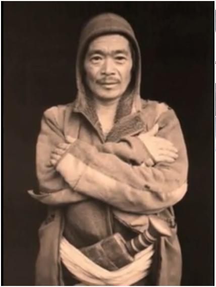
The Kirati people, also spelled as Kirat or Kirant or Kiranti, are Tibeto-Burman ethnolinguistic groups living in the Himalayas, mostly the Eastern Himalaya extending eastward from Nepal to North East India (predominantly in the Indian state of Sikkim and the northern hilly regions of West Bengal, that is, Darjeeling and Kalimpong districts). Etymology The term "Kirat" has a rich and complex etymology rooted in the cultural and historical contexts of the eastern Himalayas. The Kirat people, who are indigenous to the region encompassing parts of Nepal, India, and Bhutan, trace their name back to ancient traditions and languages. The etymology of "Kirat" is believed to derive from the Sanskrit term "Kirāta," which originally referred to the indigenous tribes of the region, particularly those living in the hilly and mountainous areas of ancient India. In Sanskrit and classical texts, "Kirāta" was used to describe the people inhabiting the rugged terrains of the eastern Himalaya ... [...More Info...] [...Related Items...] OR: [Wikipedia] [Google] [Baidu] |


