|
Zenting
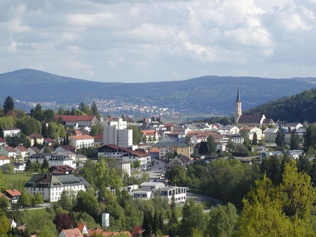
Zenting is a municipality in the district of Freyung-Grafenau in Bavaria in Germany. Location The municipality lies in the region of Danube Forest (''Donau-Wald'') in the middle of the Bavarian Forest. The village nestles in a sunny, south-facing bowl, above which the Brotjacklriegel (1,016 m) and Aschenstein (945 m) tower to the north. Zenting is located around 35 km NW of Passau, 13 km from Tittling, 18 km SW of Grafenau, 26 km N of Vilshofen an der Donau and 15 km from the A 3 (Iggensbach Iggensbach is a municipality in the district of Deggendorf in Bavaria in Germany Germany,, officially the Federal Republic of Germany, is a country in Central Europe. It is the second most populous country in Europe after Russia, a ... exit). References Freyung-Grafenau {{FreyungGrafenau-geo-stub ... [...More Info...] [...Related Items...] OR: [Wikipedia] [Google] [Baidu] |
Aschenstein
{{Infobox mountain , name = Aschenstein , photo = , photo_size = 282px , photo_alt = , photo_caption = , elevation = {{Höhe, 945, , link=false ({{convert, 945, m, ft, disp=output only, abbr=on) , elevation_ref = , isolation = , isolation_ref = , prominence = , prominence_ref = , listing = , range = Bavarian Forest , parent_peak = , location = Bavaria, Germany , map = Germany Bavaria , map_image = , map_alt = , map_caption = , map_relief = , map_size = , label = , label_position = , coordinates = {{coord, 48.8184, 13.2567, type:mountain_region:DE-BY, format=dms, display=inline,title , topo = , type = , geology = Gneiss , volcanic_arc/belt = , age = , last_eruption = , first_ascent = ... [...More Info...] [...Related Items...] OR: [Wikipedia] [Google] [Baidu] |
Brotjacklriegel
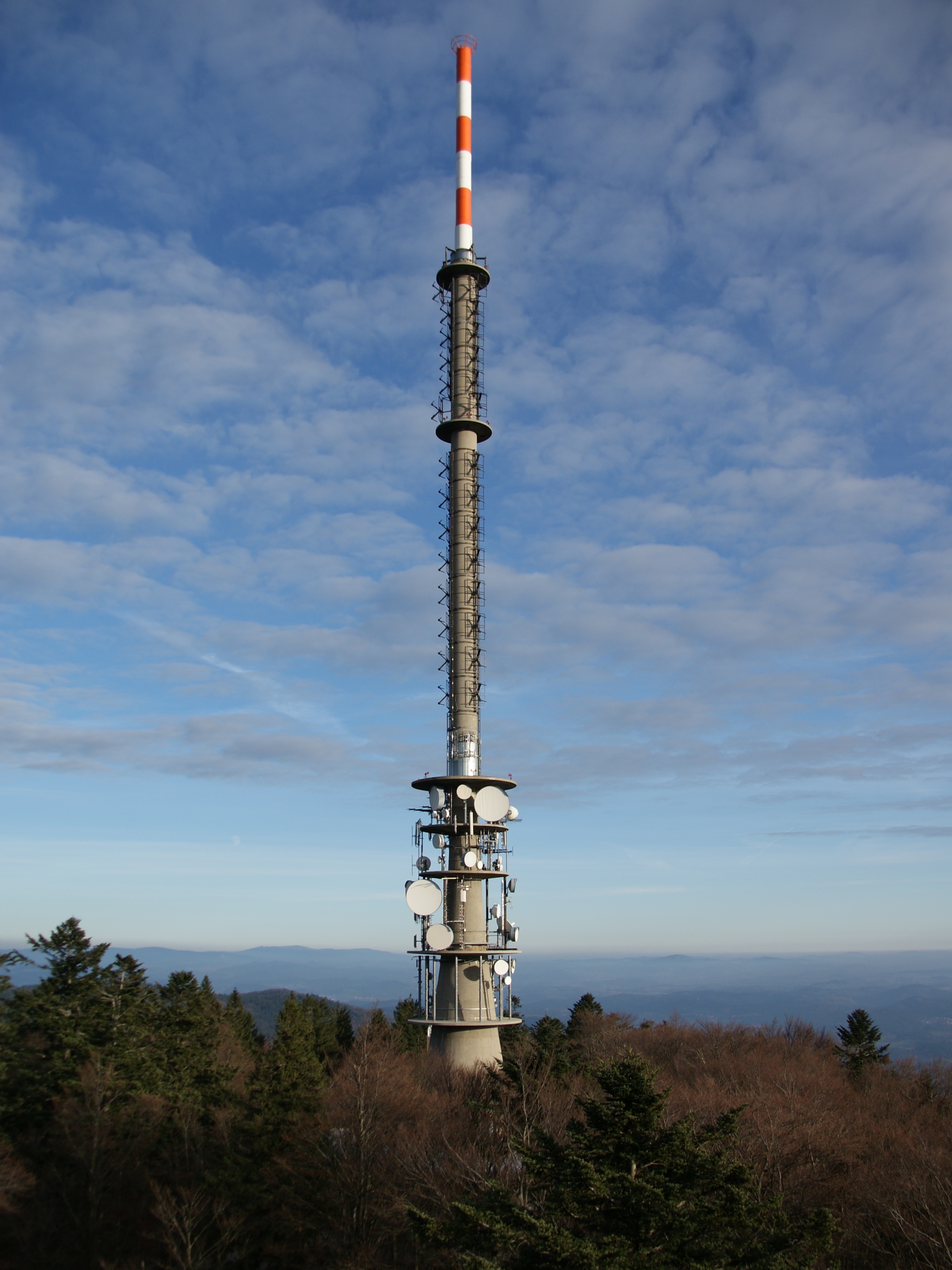
Seen from the River Danube, the Brotjacklriegel is the first high mountain in the Bavarian Forest. It is and lies in the county of Freyung-Grafenau in the German federal state of Bavaria. It is a symbol of the Sonnenwald region which comprises the municipalities of Schöfweg, Zenting, Innernzell, Grattersdorf and Market Schöllnach. Name According to legend, the Brotjacklriegel owes its name to a baker, ''Brotjackl'' (EN: "Bread-Jacky"), who is supposed to have hidden on the mountain during the Thirty Years' War. However, the name probably only came into being later during survey work by the French under Napoleon when because of a misunderstanding of the Bavarian "Broada Jaga-Riegl" (Breiter Jägerriegel; EN: Broad Hunter's Sill) the name ''Brotjacklriegel'' was written down. History As early as 1839 the parish priest and two publicans from Langfurth built the first viewing tower. In 1924 the present 27-metre-high construction was built. Description On the east ... [...More Info...] [...Related Items...] OR: [Wikipedia] [Google] [Baidu] |
Freyung-Grafenau
Freyung-Grafenau is a ''Landkreis'' (district) in Bavaria, Germany. It is bounded by (from the south and clockwise) the districts of Passau, Deggendorf and Regen, the Czech Republic and by Austria. History The district was established in 1972, by merging the former districts of Grafenau and Wolfstein. In medieval times Wolfstein (east of the Ilz River) was the property of the bishop of Passau and the site of Wolfstein Castle, now a '' schloss''. Grafenau (west of the Ilz River) successively belonged to different countries, before it was annexed by Bavaria in 1438. Wolfstein became a part of Bavaria two years after the dissolution of the clerical states in Germany (1803). Geography Freyung-Grafenau is the easternmost district of Bavaria. It is located in the southern parts of the Bavarian Forest and is partially occupied by the Bavarian Forest National Park. The source of the Ilz River is situated in the district. Coat of arms The wolf represents the area of Wolfstein, while the ... [...More Info...] [...Related Items...] OR: [Wikipedia] [Google] [Baidu] |
Bavarian Forest
The village of Zell in the Bavarian Forest The Bavarian Forest (German: ' or ''Bayerwald''; bar, Boarischa Woid) is a wooded, low-mountain region in Bavaria, Germany that is about 100 kilometres long. It runs along the Czech border and is continued on the Czech side by the Bohemian Forest (Czech: ''Šumava''). Most of the Bavarian Forest lies within the province of Lower Bavaria, but the northern part lies within Upper Palatinate. In the south it reaches the border with Upper Austria. Geologically and geomorphologically, the Bavarian Forest is part of the Bohemian Forest - the highest of the truncated highlands of the Bohemian Massif. The area along the Czech border has been designated as the Bavarian Forest National Park (240 km2), established in 1970 as the first national park in Germany. Another 3,008 km2 has been designated as the Bavarian Forest Nature Park, established 1967, and another 1,738 km2 as the Upper Bavarian Forest Nature Park, established in ... [...More Info...] [...Related Items...] OR: [Wikipedia] [Google] [Baidu] |
Geißlstein
The Geißlstein, at 906 metres, is one of the smaller mountains in the Bavarian Forest. It lies east of the Brotjacklriegel and next to the Aschenstein {{Infobox mountain , name = Aschenstein , photo = , photo_size = 282px , photo_alt = , photo_caption = , elevation = {{Höhe, 945, , link=false ({{convert, 945, m, ft, disp=output only .... Its summit has no views. It may only be reached through trackless terrain. Mountains under 1000 metres Mountains of Bavaria Mountains of the Bavarian Forest Regen (district) {{Bavaria-geo-stub ... [...More Info...] [...Related Items...] OR: [Wikipedia] [Google] [Baidu] |
Bayerisches Landesamt Für Statistik ...
The statistical offices of the German states ( German: ''Statistische Landesämter'') carry out the task of collecting official statistics in Germany together and in cooperation with the Federal Statistical Office. The implementation of statistics according to Article 83 of the constitution is executed at state level. The federal government has, under Article 73 (1) 11. of the constitution, the exclusive legislation for the "statistics for federal purposes." There are 14 statistical offices for the 16 states: See also * Federal Statistical Office of Germany References {{Reflist Germany Statistical offices Germany Germany,, officially the Federal Republic of Germany, is a country in Central Europe. It is the second most populous country in Europe after Russia, and the most populous member state of the European Union. Germany is situated betwe ... [...More Info...] [...Related Items...] OR: [Wikipedia] [Google] [Baidu] |
Municipalities Of Germany
MunicipalitiesCountry Compendium. A companion to the English Style Guide European Commission, May 2021, pages 58–59. (german: Gemeinden, singular ) are the lowest level of official territorial division in . This can be the second, third, fourth or fifth level of territorial division, depending on the status of the municipality and the '''' (federal state) it is part of. The city-states Berl ... [...More Info...] [...Related Items...] OR: [Wikipedia] [Google] [Baidu] |
Bavaria
Bavaria ( ; ), officially the Free State of Bavaria (german: Freistaat Bayern, link=no ), is a state in the south-east of Germany. With an area of , Bavaria is the largest German state by land area, comprising roughly a fifth of the total land area of Germany. With over 13 million inhabitants, it is second in population only to North Rhine-Westphalia, but due to its large size its population density is below the German average. Bavaria's main cities are Munich (its capital and largest city and also the third largest city in Germany), Nuremberg, and Augsburg. The history of Bavaria includes its earliest settlement by Iron Age Celtic tribes, followed by the conquests of the Roman Empire in the 1st century BC, when the territory was incorporated into the provinces of Raetia and Noricum. It became the Duchy of Bavaria (a stem duchy) in the 6th century AD following the collapse of the Western Roman Empire. It was later incorporated into the Holy Roman Empire, be ... [...More Info...] [...Related Items...] OR: [Wikipedia] [Google] [Baidu] |
Germany
Germany,, officially the Federal Republic of Germany, is a country in Central Europe. It is the second most populous country in Europe after Russia, and the most populous member state of the European Union. Germany is situated between the Baltic and North seas to the north, and the Alps to the south; it covers an area of , with a population of almost 84 million within its 16 constituent states. Germany borders Denmark to the north, Poland and the Czech Republic to the east, Austria and Switzerland to the south, and France, Luxembourg, Belgium, and the Netherlands to the west. The nation's capital and most populous city is Berlin and its financial centre is Frankfurt; the largest urban area is the Ruhr. Various Germanic tribes have inhabited the northern parts of modern Germany since classical antiquity. A region named Germania was documented before AD 100. In 962, the Kingdom of Germany formed the bulk of the Holy Roman Empire. During the 16th ce ... [...More Info...] [...Related Items...] OR: [Wikipedia] [Google] [Baidu] |
Passau
Passau (; bar, label= Central Bavarian, Båssa) is a city in Lower Bavaria, Germany, also known as the Dreiflüssestadt ("City of Three Rivers") as the river Danube is joined by the Inn from the south and the Ilz from the north. Passau's population is approx. 50,000, of whom about 12,000 are students at the University of Passau, renowned in Germany for its institutes of economics, law, theology, computer science and cultural studies. History In the 2nd century BC, many of the Boii tribe were pushed north across the Alps out of northern Italy by the Romans. They established a new capital called Boiodurum by the Romans (from Gaulish ''Boioduron''), now within the Innstadt district of Passau. Passau was an ancient Roman colony called Batavis, Latin for "for the ''Batavi''." The Batavi were an ancient Germanic tribe often mentioned by classical authors, and they were regularly associated with the Suebian marauders, the Heruli. ''Batavis'' (Passau-Altstadt) was a Roman cast ... [...More Info...] [...Related Items...] OR: [Wikipedia] [Google] [Baidu] |
Tittling
Tittling is a municipality in the district of Passau in Bavaria in Germany Germany,, officially the Federal Republic of Germany, is a country in Central Europe. It is the second most populous country in Europe after Russia, and the most populous member state of the European Union. Germany is situated betwe .... It is home to the Bavarian Forest Museum Village. References Passau (district) {{Passaudistrict-geo-stub ... [...More Info...] [...Related Items...] OR: [Wikipedia] [Google] [Baidu] |


