|
Mentone, Victoria
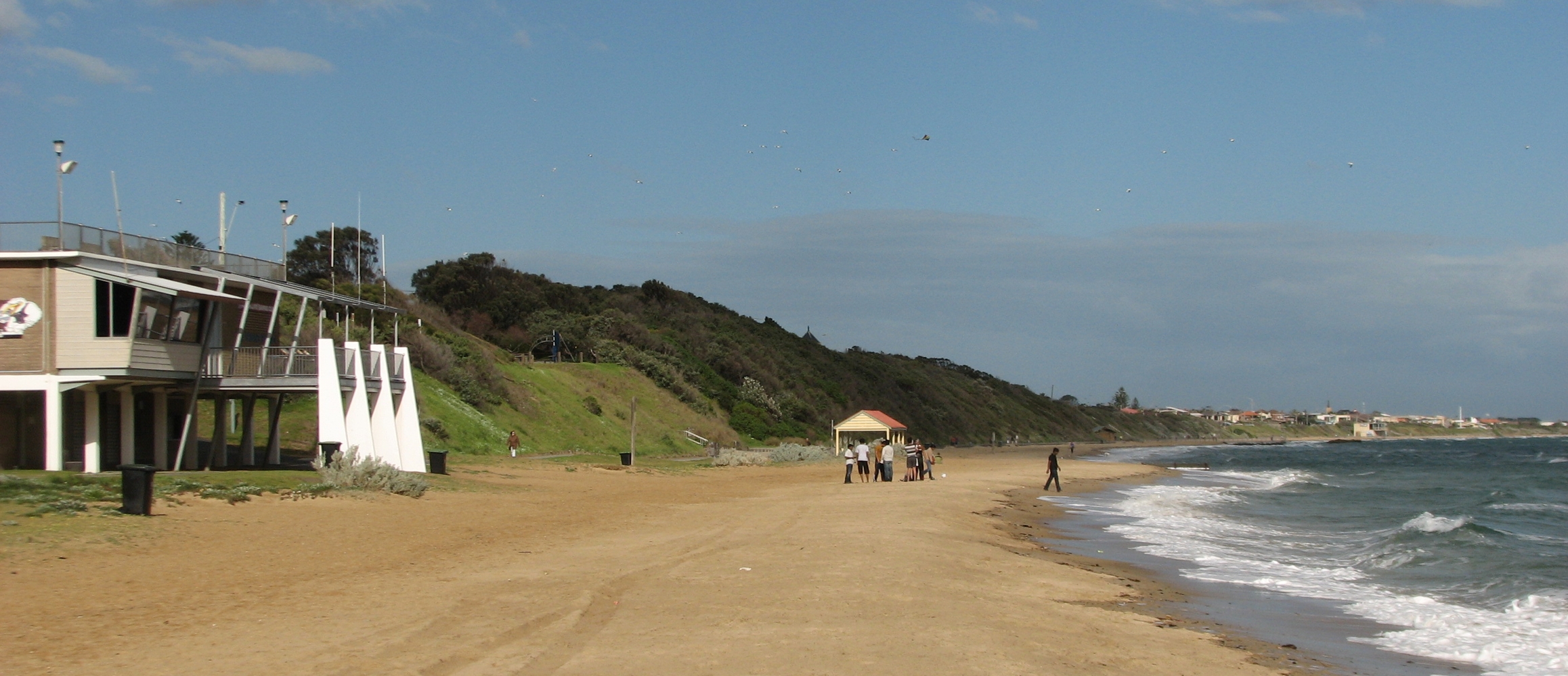
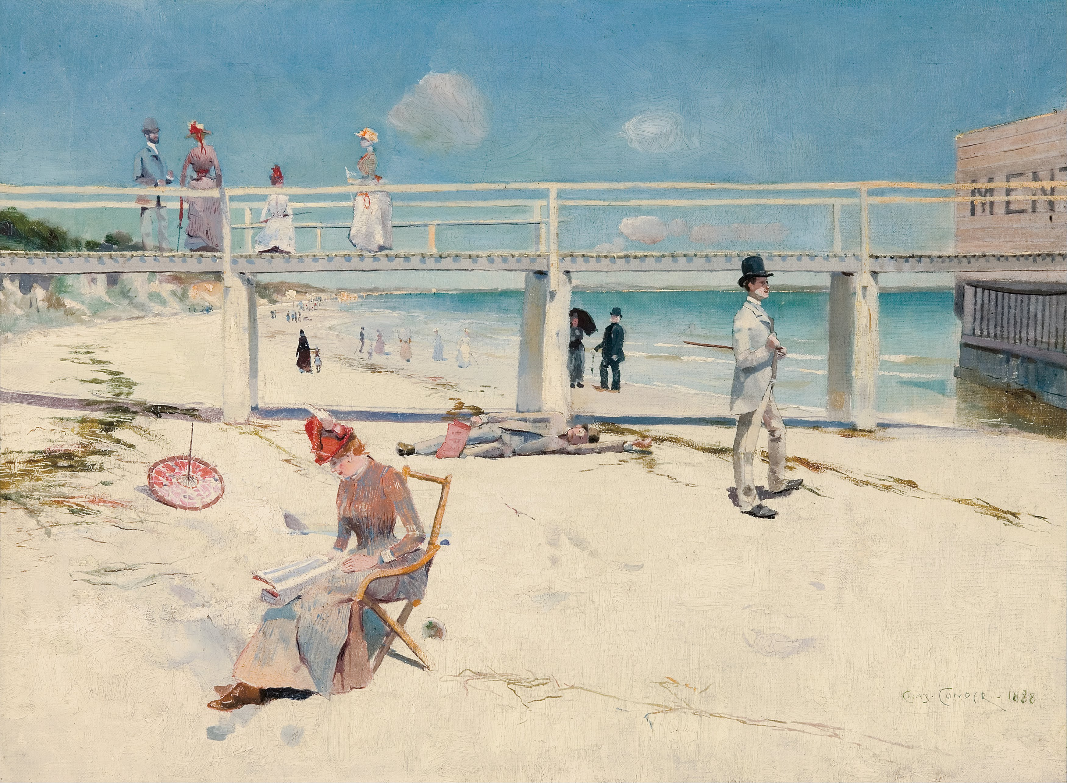
Mentone is a suburb in Melbourne, Victoria, Australia, 21 km south-east of Melbourne's Central Business District, located within the City of Kingston local government area. Mentone recorded a population of 13,197 at the . It is known locally for Mentone Beach, which extends alongside Beaumaris Bay from the cliffs in Beaumaris and ends at Warrigal Road where it meets Parkdale. Mentone is associated with the Heidelberg School of Australian artists. History File:Charles Conder - A holiday at Mentone - Google Art Project.jpg, '' A holiday at Mentone'', 1888, oil on canvas by Charles Conder. File:Tom Roberts - Slumbering sea, Mentone - Google Art Project.jpg, Tom Roberts, ''Slumbering Sea, Mentone'' (1887) National Gallery of Victoria File:Tom Roberts - Mentone, 1889.jpg, Tom Roberts, ''Mentone'', (1889), National Gallery of Victoria. File:Mentone Vic Australia-Dragan Jankovic Fazan - panoramio.jpg, Mentone street scene (2009). File:Mentone Beach 1, Mentone, Vic, jjr ... [...More Info...] [...Related Items...] OR: [Wikipedia] [Google] [Baidu] |
Mentone Beach
Mentone Beach is a beach located in Mentone, on Port Phillip Bay, Victoria, Australia, 21 kilometres south from the Melbourne City Centre. Mentone beach is the northern section of a beach that extends alongside Beaumaris Bay from the cliffs at Rickett's Point in Beaumaris to Frankston in the south on the eastern shoreline of Port Phillip Bay. Mentone Beach is one of the Port Phillip Bay beaches associated with the Heidelberg School of Australian artists. Geology Mentone Beach was formed when Port Phillip sunklands in southern Victoria were inundated to form Port Phillip Bay. The inundation was triggered in part by the Selwyn Fault on the east and the Rowsley Fault on the west side of the bay. The Beaumaris Monocline is a geological feature which is expressed in the cliffs near Beaumaris and Rickett's Point at the northern end of Mentone Beach. This structure controls the coastal indentation, and therefore the Mentone and Mordialloc beaches, which lie due south of Rickett's P ... [...More Info...] [...Related Items...] OR: [Wikipedia] [Google] [Baidu] |
Australia
Australia, officially the Commonwealth of Australia, is a Sovereign state, sovereign country comprising the mainland of the Australia (continent), Australian continent, the island of Tasmania, and numerous List of islands of Australia, smaller islands. With an area of , Australia is the largest country by area in Oceania and the world's List of countries and dependencies by area, sixth-largest country. Australia is the oldest, flattest, and driest inhabited continent, with the least fertile soils. It is a Megadiverse countries, megadiverse country, and its size gives it a wide variety of landscapes and climates, with Deserts of Australia, deserts in the centre, tropical Forests of Australia, rainforests in the north-east, and List of mountains in Australia, mountain ranges in the south-east. The ancestors of Aboriginal Australians began arriving from south east Asia approximately Early human migrations#Nearby Oceania, 65,000 years ago, during the Last Glacial Period, last i ... [...More Info...] [...Related Items...] OR: [Wikipedia] [Google] [Baidu] |
National Gallery Of Victoria
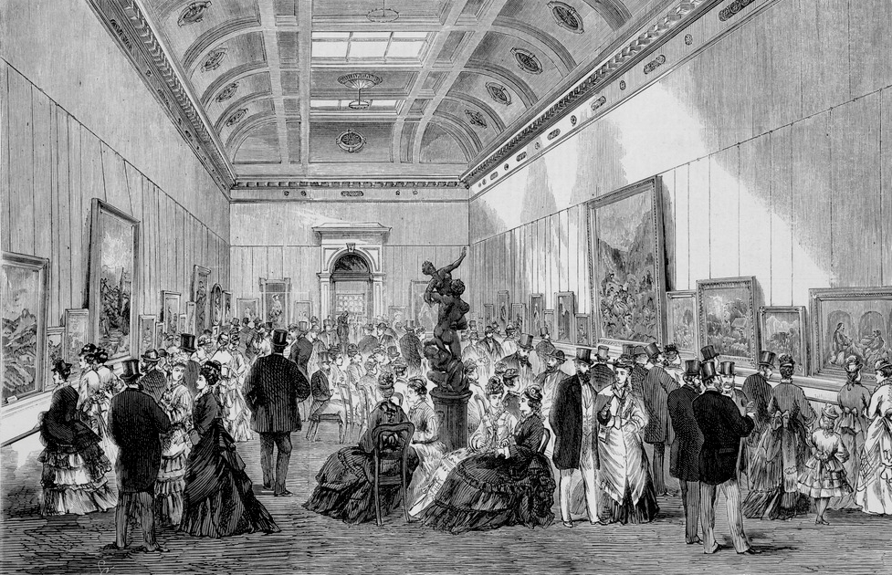
The National Gallery of Victoria, popularly known as the NGV, is an art museum in Melbourne, Victoria, Australia. Founded in 1861, it is Australia's oldest and most visited art museum. The NGV houses an encyclopedic art collection across two sites: NGV International, located on St Kilda Road in the Melbourne Arts Precinct of Southbank, and the Ian Potter Centre: NGV Australia, located nearby at Federation Square. The NGV International building, designed by Sir Roy Grounds, opened in 1968, and was redeveloped by Mario Bellini before reopening in 2003. It houses the gallery's international art collection and is on the Victorian Heritage Register. The Ian Potter Centre: NGV Australia, designed by Lab Architecture Studio, opened in 2002 and houses the gallery's Australian art collection. A third site, The Fox: NGV Contemporary, is planned to open in 2028, and will be Australia's largest contemporary gallery. History 19th century In 1850, the Port Phillip District of N ... [...More Info...] [...Related Items...] OR: [Wikipedia] [Google] [Baidu] |
Tom Roberts
Thomas William Roberts (8 March 185614 September 1931) was an English-born Australian artist and a key member of the Heidelberg School art movement, also known as Australian impressionism. After studying in Melbourne, he travelled to Europe in 1881 to further his training, and returned home in 1885, "primed with whatever was the latest in art". A leading proponent of painting ''en plein air'', he joined Frederick McCubbin in founding the Box Hill artists' camp, the first of several ''plein air'' camps frequented by members of the Heidelberg School. He also encouraged other artists to capture the national life of Australia, and while he is best known today for his "national narratives"—among them '' Shearing the Rams'' (1890), '' A break away!'' (1891) and '' Bailed Up'' (1895)—he earned a living as a portraitist, and in 1903 completed the commissioned work '' The Big Picture'', the most famous visual representation of the first Australian Parliament. Life Roberts was b ... [...More Info...] [...Related Items...] OR: [Wikipedia] [Google] [Baidu] |
Charles Conder
Charles Edward Conder (24 October 1868 – 9 February 1909) was an English-born painter, lithographer and designer. He emigrated to Australia and was a key figure in the Heidelberg School, arguably the beginning of a distinctively Australian tradition in Western art. Early life Conder was born in Tottenham, Middlesex, the second son, of six children, of James Conder, civil engineer and Mary Ann Ayres. He spent several years as a young child in India until the death of his mother (aged 31 years) on 14 May 1873 in Bombay, when Charles was four; he was then sent back to England and attended a number of schools including a boarding school at Eastbourne, which he attended from 1877. He left school at 15, and his very religious, non-artistic father, against Charles's natural artistic inclinations, decided that he should follow in his footsteps as a civil engineer. In 1884, at the age of 16, he was sent to Sydney, Australia, where he worked for his uncle, a land surveyor for t ... [...More Info...] [...Related Items...] OR: [Wikipedia] [Google] [Baidu] |
A Holiday At Mentone
''A holiday at Mentone'' is an 1888 painting by the Australian artist Charles Conder. The painting depicts a beach in the Melbourne suburb of Mentone on a bright and sunny day. Conder's depiction of people engaged in seaside activities and the brilliant noonday sunshine mark the painting as distinctively Australian in character. The painting was first exhibited at Victorian Artists' Society Spring exhibition in November 1888, one month after Conder, aged only 20, arrived in Melbourne from Sydney. Conder had met Tom Roberts in Sydney the previous year and again at Easter 1888, where the pair had painted together at Coogee Beach. On arrival in Melbourne, Conder initially based himself at Roberts' Grosvenor Chambers studio and ''A Holiday at Mentone'' was Conder's first Melbourne painting. The work shows evidence of being influenced by Japanese art while a similar bridge motif was commonly used by the influential American painter James McNeill Whistler. One of Arthur Streeton's d ... [...More Info...] [...Related Items...] OR: [Wikipedia] [Google] [Baidu] |
Heidelberg School
The Heidelberg School was an Australian art movement of the late 19th century. It has latterly been described as Australian impressionism. Melbourne art critic Sidney Dickinson coined the term in an 1891 review of works by Arthur Streeton and Walter Withers, two local artists who painted ''en plein air'' in Heidelberg on the city's rural outskirts. The term has since evolved to cover painters who worked together at "artists' camps" around Melbourne and Sydney in the 1880s and 1890s. Along with Streeton and Withers, Tom Roberts, Charles Conder and Frederick McCubbin are considered key figures of the movement. Drawing on naturalist and impressionist ideas, they sought to capture Australian life, the bush, and the harsh sunlight that typifies the country. The movement emerged at a time of strong nationalist sentiment in Australia, then a group of colonies on the cusp of federating. The artists' paintings, not unlike the bush poems of the Bulletin School, were celebrated for ... [...More Info...] [...Related Items...] OR: [Wikipedia] [Google] [Baidu] |
Warrigal Road
Warrigal Road is a major inner urban road in southeastern Melbourne, Australia. On weekdays, it is heavily trafficked as it runs through many major suburbs along its route, traversing some of Melbourne's eastern and south-eastern suburbs. These suburbs include Chadstone, Oakleigh, and Cheltenham. The Chadstone Shopping Centre can be accessed directly from Warrigal Road at its eastern entrance. Route Warrigal Road begins at the intersection with Canterbury Road in Surrey Hills and runs south as a four-lane, single-carriageway road with a speed limit at 60 km/h, up and down steep gradients, through the intersection with Toorak Road and Burwood Highway at Burwood (where the highway declaration starts) and continues south to the intersection with High Street Road at Ashwood, where the road widens to a six-lane, dual-carriageway road with bus lanes. Continuing south, it crosses under the Glen Waverley railway line (where the bus lanes end) and the Monash Freeway in Chadsto ... [...More Info...] [...Related Items...] OR: [Wikipedia] [Google] [Baidu] |
Beaumaris Bay
Beaumaris Bay ( ) is a bay in the east of Port Phillip, Victoria, Australia. Beaumaris Bay commences at the cliffs at Rickett's Point in the south of the suburb of Beaumaris Beaumaris ( ; cy, Biwmares ) is a town and community on the Isle of Anglesey in Wales, of which it is the former county town of Anglesey. It is located at the eastern entrance to the Menai Strait, the tidal waterway separating Anglesey from th ..., then stretches alongside Mentone Beach in Mentone through a string of suburban beaches south to Frankston. The northern shore is covered by Bayside and Kingston councils and the southern reaches are in Frankston council. The main streams and tributaries supplying the bay are Mordialloc Creek, Patterson River, and Kananook Creek. References Geography of Melbourne Port Phillip {{Melbourne-geo-stub ... [...More Info...] [...Related Items...] OR: [Wikipedia] [Google] [Baidu] |
Local Government Areas Of Victoria
This is a list of local government areas (LGAs) in Victoria, sorted by region. Also referred to as municipalities, the 79 Victorian LGAs are classified as cities (34), shires (38), rural cities (6) and boroughs (1). In general, an urban or suburban LGA is called a city and is governed by a city council, while a rural LGA covering a larger rural area is usually called a shire and is governed by a shire council. Local councils have the same administrative functions and similar political structures, regardless of their classification. Greater Melbourne Regional Victoria Barwon South West Grampians Gippsland Hume Loddon Mallee See also * Government of Australia *Australian Local Government Association *Municipal Association of Victoria The Municipal Association of Victoria (MAV) is the legislated peak body for representing the local governments in Victoria. Aims The overall purpose of the MAV is to represent the interests of the 79 local gov ... [...More Info...] [...Related Items...] OR: [Wikipedia] [Google] [Baidu] |
City Of Kingston
The City of Kingston is a local government area in Victoria, Australia in the south-eastern suburbs of Melbourne, its northern boundary lying approximately 15 km from the Melbourne city centre along the north-eastern shorelines of Port Phillip. It covers an area of 91 km² and has an estimated population of 163,431 people. Suburbs * Aspendale * Aspendale Gardens * Bonbeach * Braeside * Carrum * Chelsea * Chelsea Heights * Cheltenham (shared with the City of Bayside) * Clarinda * Clayton South * Dingley Village * Edithvale * Heatherton * Highett (shared with the City of Bayside) * Mentone * Moorabbin * Mordialloc * Oakleigh South (shared with the City of Monash) * Parkdale * Patterson Lakes * Waterways History The City of Kingston area was originally governed by the Moorabbin Roads Board, which formed in 1862 and became a shire council in 1871, covering a large area of mixed agricultural and semi-urban land. After years of agitation, in 1917 the seaside ... [...More Info...] [...Related Items...] OR: [Wikipedia] [Google] [Baidu] |
Victoria (Australia)
Victoria is a state in southeastern Australia. It is the second-smallest state with a land area of , the second most populated state (after New South Wales) with a population of over 6.5 million, and the most densely populated state in Australia (28 per km2). Victoria is bordered by New South Wales to the north and South Australia to the west, and is bounded by the Bass Strait to the south (with the exception of a small land border with Tasmania located along Boundary Islet), the Great Australian Bight portion of the Southern Ocean to the southwest, and the Tasman Sea (a marginal sea of the South Pacific Ocean) to the southeast. The state encompasses a range of climates and geographical features from its temperate coastal and central regions to the Victorian Alps in the northeast and the semi-arid north-west. The majority of the Victorian population is concentrated in the central-south area surrounding Port Phillip Bay, and in particular within the metropolit ... [...More Info...] [...Related Items...] OR: [Wikipedia] [Google] [Baidu] |


