|
Landkreis Leipzig
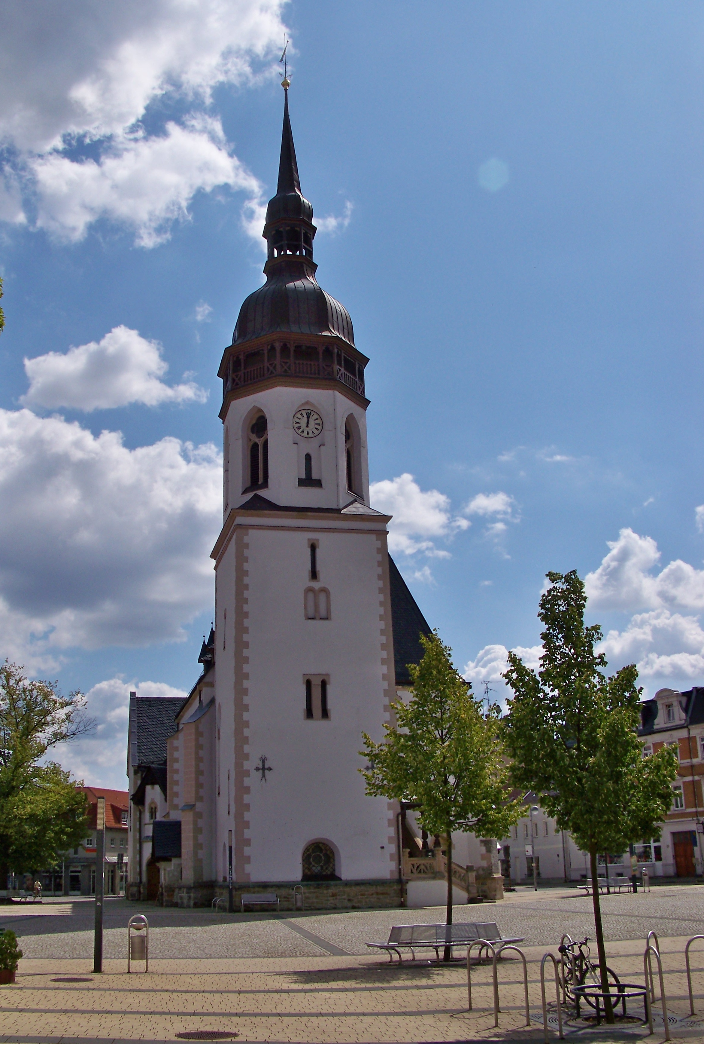
Leipzig (official name: ''Landkreis Leipzig'') is a district ('' Kreis'') in the Free State of Saxony, Germany. It is named after the city Leipzig, which is partly surrounded by the district, but not part of it. It borders (from the west and clockwise) the state Saxony-Anhalt, the urban district Leipzig, the districts Nordsachsen and Mittelsachsen, and the state Thuringia. Geography The district is located in the Leipzig Bay and is rather flat. Individual hills are found in the north (Hohburg Hills) and south of the district. Its larger rivers are the Mulde, Pleiße and White Elster. Also worth mentioning are the many lakes of the Leipzig Neuseenland in the west of the county, that were formed by flooding old brown coal pits. History The district was established by merging the former districts Muldentalkreis and Leipziger Land as part of the district reform of August 2008. Geography The district is located in the lowlands around Leipzig. The main rivers of the district ... [...More Info...] [...Related Items...] OR: [Wikipedia] [Google] [Baidu] |
Borna, Leipzig
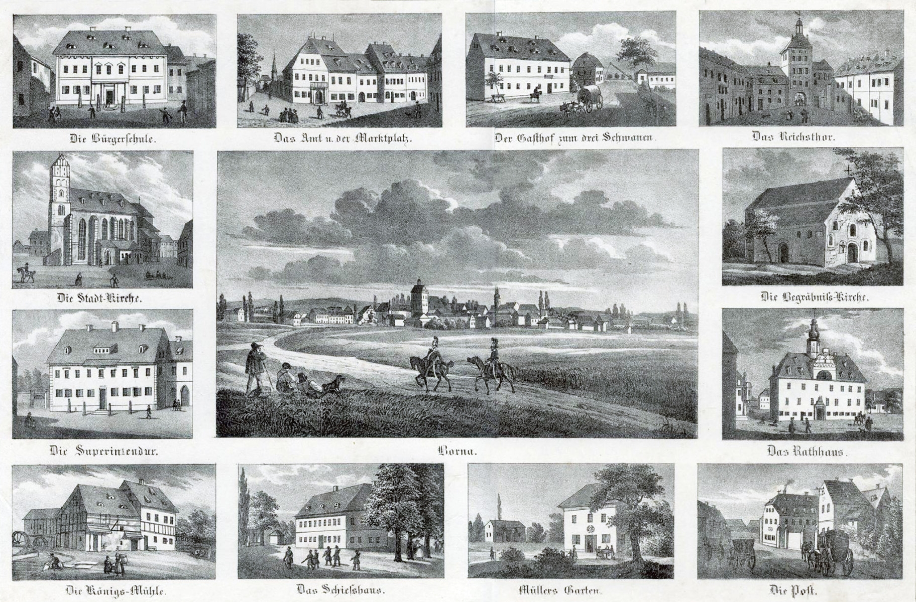
Borna () is a town in Saxony, Germany, capital of the Leipzig district. It is situated approximately 30 km southeast of Leipzig city. It has approx. 19,000 inhabitants. The town is the district seat of the district of Leipzig. Geography Borna is located about south of Leipzig. The river Wyhra flows through the town. The surrounding landscape has been influenced by open-cast coal mining. The town lies in the middle of Central German Metropolitan Region, with Leipzig distant, Gera , Chemnitz , Halle , and Dresden . Neighboring large towns are Altenburg, away, Grimma, and Zeitz . History Pre-history and Middle Ages The current site of Borna town was originally two settlements; Altstadt (the old town) and Wenigborn. Before the foundation of the town, there had been a water castle since the 9th Century. The first written mention of the town of Borna was recorded in 1251. Borna was burnt to the ground five times during the wars of the Middle Ages. 19th Century Onwards Si ... [...More Info...] [...Related Items...] OR: [Wikipedia] [Google] [Baidu] |
Leipziger Land
Leipziger Land is a former district in Saxony, Germany. It was bounded by (from the north and clockwise) the districts of Delitzsch, the district-free city Leipzig, Muldentalkreis, Mittweida, the district Altenburger Land in Thuringia, and the districts Burgenlandkreis, Saalekreis in Saxony-Anhalt. History The history of the region is influenced by the city of Leipzig. See there for more information. The district was established in 1994 by merging the former districts of , and . In 1999, the towns of Schkeuditz and Taucha were reassigned to the Delitzsch district. In August 2008, it became a part of the new district of Leipzig. Geography The main river of the district is the White Elster, which also flows through the city of Leipzig itself. The area south of Leipzig is a big lignite day mining area, which will be recultivated as a lakeland in the near future. The lignite also made the area the main industrial area of East Germany East Germany, officially the German D ... [...More Info...] [...Related Items...] OR: [Wikipedia] [Google] [Baidu] |
Pegau
Pegau () is a town in the Leipzig district in Saxony, Germany, situated in a fertile plain, on the White Elster, 18 m. S.W. from Leipzig by the railway to Zeitz. It has two Evangelical churches, that of St. Lawrence being a fine Gothic structure, a 16th-century town-hall; a very old hospital and an agricultural school. In the 19th Century, its industries included the manufacture of felt, boots and metal wares. Rathaus The ''Rathaus'' (town hall) is located in the middle of the city and has a distinctive character. It was built from 1559 to 1561 by Paul Widemann and Hieronymus Lotter in the style of the German Renaissance. It is extremely similar to Leipzig's ''Altes Rathaus'' (built-in 1556/57), which Widemann and Lotter had previously worked on. The ''Rathausturm'' (town hall tower) can be climbed during the summer season. At a height of 30 meters, the tower offers a panoramic view in which the viewer can sometimes see to Leipzig. The town hall is the seat of the city admi ... [...More Info...] [...Related Items...] OR: [Wikipedia] [Google] [Baidu] |
Naunhof
Naunhof is a town in the Leipzig district, in the Free State of Saxony, Germany. It is situated on the river Parthe, 11 km northwest of Grimma, and 16 km southeast of Leipzig Leipzig ( , ; Upper Saxon: ) is the most populous city in the German state of Saxony. Leipzig's population of 605,407 inhabitants (1.1 million in the larger urban zone) as of 2021 places the city as Germany's eighth most populous, as ... (centre). Personalities * Ernst Knebel (1892-1945), German general * Ludwig Külz (1875-1938), German tropical physician * Paul Horst-Schulze (1876-1937), German painter, graphic artist and handicraftsman Coat of arms In red a continuous seven zinnige silver wall with open passage and seated cornered tower with two open windows on each side and pointed roof and golden orb as a knob. References Leipzig (district) {{Leipzig-geo-stub ... [...More Info...] [...Related Items...] OR: [Wikipedia] [Google] [Baidu] |
Markranstädt
Markranstädt () is a town in the Leipzig district, in Saxony, Germany. It is situated 11 km southwest of the city of Leipzig and has close to 15,000 inhabitants. Geography Location Markranstädt is located about south-west of Leipzig city centre, between Saxony-Anhalt and the Leipzig housing estate , to the west of the ''Kulkwitzer See''. It is the only municipality in the ''Landkreis Leipzig'' that lies west of the city. Divisions Markranstädt is a municipality consisting of the town itself and the following six ''Ortschaften'' (localities), each containing several ''Ortsteile'' or divisions:Hauptsatzung der Stadt Markranstädt September 2016. *Frankenheim (incl. Lindennaundorf and Priesteblich) *Großlehna (incl. [...More Info...] [...Related Items...] OR: [Wikipedia] [Google] [Baidu] |
Markkleeberg
Markkleeberg is an affluent suburb of Leipzig (district), Leipzig, located in the Leipzig (district), Leipzig district of the Saxony, Free State of Saxony, Germany. The river Pleiße runs through the city, which borders Leipzig to the north and to the west. Markkleeberg is known to be the entry point to a region of recultivated open-cast mining lakes south of Leipzig dubbed the Neuseenland, ''Leipziger Neuseenland''. History The town now called Markkleeberg has its origins in several towns that have been merged over the years. The center of modern-day Markkleeberg used to be called Oetzsch. It was merged with the smaller outlying district Markkleeberg in 1911 and renamed Oetzsch-Markkleeberg. Oetzsch-Markkleeberg was in turn merged with Gautzsch and the whole town was called "Markkleeberg", although Markkleeberg was the smallest, because it sounded most Germanic at a time of Nazi-led Germanisation. The etymology of Markkleeberg may be "clover hill market town". The name of Oet ... [...More Info...] [...Related Items...] OR: [Wikipedia] [Google] [Baidu] |
Kitzscher
Kitzscher () is a town in the Leipzig district, in Saxony, Germany. Geography Kitzscher is situated in the Leipziger Tieflandsbucht, at the perimeter of the Central Saxon Hills. The town is situated 6 km northeast of Borna, and 24 km southeast of Leipzig. A nearby slagheap from open cast mining called the 'Halde Trages' is one of the highest points in the vicinity and the main sight of interest in the locality. History The village was first mentioned in a charter document in the abbey at Grimma Grimma ( hsb, Grima) is a town in Saxony, Central Germany, on the left bank of the Mulde, southeast of Leipzig. Founded in 1170, it is part of the Leipzig district. Location The town is in northern Saxony, southeast of Leipzig and south o ... in the year 1251 which referred to a noble family, ''Guntherus de Kiczschere'', which ultimately died out in 1676. The oldest structure in the town is the church the origins of which date back to 1200. References ... [...More Info...] [...Related Items...] OR: [Wikipedia] [Google] [Baidu] |
Groitzsch
Groitzsch () is a town in the Leipzig district, in Saxony, Germany. Geography and transport The town is situated at the southern edge of the Leipzig Bay east of the White Elster river on the confluence of Schwennigke and Schnauder rivers, 20 km northeast of Zeitz, and 25 km southwest of Leipzig. A transition to the Central German low mountain ranges is notable in several elevated places within the municipal boundaries. Bundesstraße B176 passes through Groitzsch itself, and Bundesstraße 2 traverses the subdistricts Kobschütz and Audigast. The latter leads to a junction with new Bundesautobahn 38 about 15 km northeast of the town. The nearest railway station is in Pegau on the Leipzig–Probstzella railway. Public transport is provided by buses of Mitteldeutscher Verkehrsverbund with direct services to Pegau, Zwenkau, Leipzig, Neukieritzsch, Böhlen, and Altenburg. The nearest international airport is Flughafen Leipzig/Halle. History The original Sorbi ... [...More Info...] [...Related Items...] OR: [Wikipedia] [Google] [Baidu] |
Grimma
Grimma ( hsb, Grima) is a town in Saxony, Central Germany, on the left bank of the Mulde, southeast of Leipzig. Founded in 1170, it is part of the Leipzig district. Location The town is in northern Saxony, southeast of Leipzig and south of Wurzen. Flooding The river Mulde flows through the town, a significant section of which is situated in a floodplain. Massive floods in 2002 washed away the old Pöppelmannbrücke bridge and caused significant damage to buildings in the town. In the summer of 2013 there was further flood damage. Suburbs * Großbardau (merged with Grimma January 2006) * Döben * Hohnstädt * Höfgen * Beiersdorf * Kaditzsch * Schkortitz * Naundorf * Neunitz * Grechwitz * Dorna * Kleinbardau (merged with Grimma January 2006) * Bernbruch (merged with Grimma 2006) * Waldbardau (merged with Grimma 2006) * Nerchau (merged with Grimma 2011) * Thümmlitzwalde (merged with Grimma 2011) * Großbothen (merged with Grimma 2011) * Mutzschen (merged with Gri ... [...More Info...] [...Related Items...] OR: [Wikipedia] [Google] [Baidu] |
Geithain
Geithain is a town in the Leipzig district, in Saxony, Germany. Geography Geithain is northwest of Chemnitz and southeast of Leipzig. It lies in hilly country by the wooded area Wickershain and the river Eula. History The first documented mention of the town was in the year 1186 in a document, which described the donation of earnings from the Wickershainer Marion Church to the Bishop of Merseburg through the Duke Dedo of Rochlitz. The name of the town has its origins in the Old Sorbian word "Chytan" (Chyten) and describes the place of Chyten, where "Chyt" (Chit) is a Sorbian first name. In 1209 there was another documented mention of Geithain and the already established Nicolai Church. In this year the establishment of a hospital and a chapel (of St. James) was ordered by Lord Randall of the Guests Keep (1190–1210), the Margrave of Lausitz. Also, although Geithain is described as a town in this document, a charter with the first mayor (Wiebke Drechsler) is first evident fo ... [...More Info...] [...Related Items...] OR: [Wikipedia] [Google] [Baidu] |
Frohburg
Frohburg is a town in the Leipzig district, in Saxony, Germany. It is situated 11 km northeast of Altenburg, and 34 km southeast of Leipzig. It includes the village of Flößberg and the town Kohren-Sahlis. History Frohburg castle was first mentioned in documents at the end of the 10th century, the first documentary mention of the settlement itself dates from 1198, and in 1233 it is known as a town ('' oppidum''), although it had no explicit town privileges and was directly ruled by the lord of the castle, which at this time was the burgrave of Altenburg. Town privileges were only awarded to Frohburg in 1831, and the first mayor elected three years later. Until the mid-16th century, Frohburg was part of '' Pflege'' Altenburg, and from then on until 1856 of Amt Borna. From then on it was the centre of the judicial district (''Gerichtsamt'') Frohburg, until it passed to ''Amtshauptmannschaft'' (district) Borna. Following a recession in the 19th century, the establi ... [...More Info...] [...Related Items...] OR: [Wikipedia] [Google] [Baidu] |
Colditz
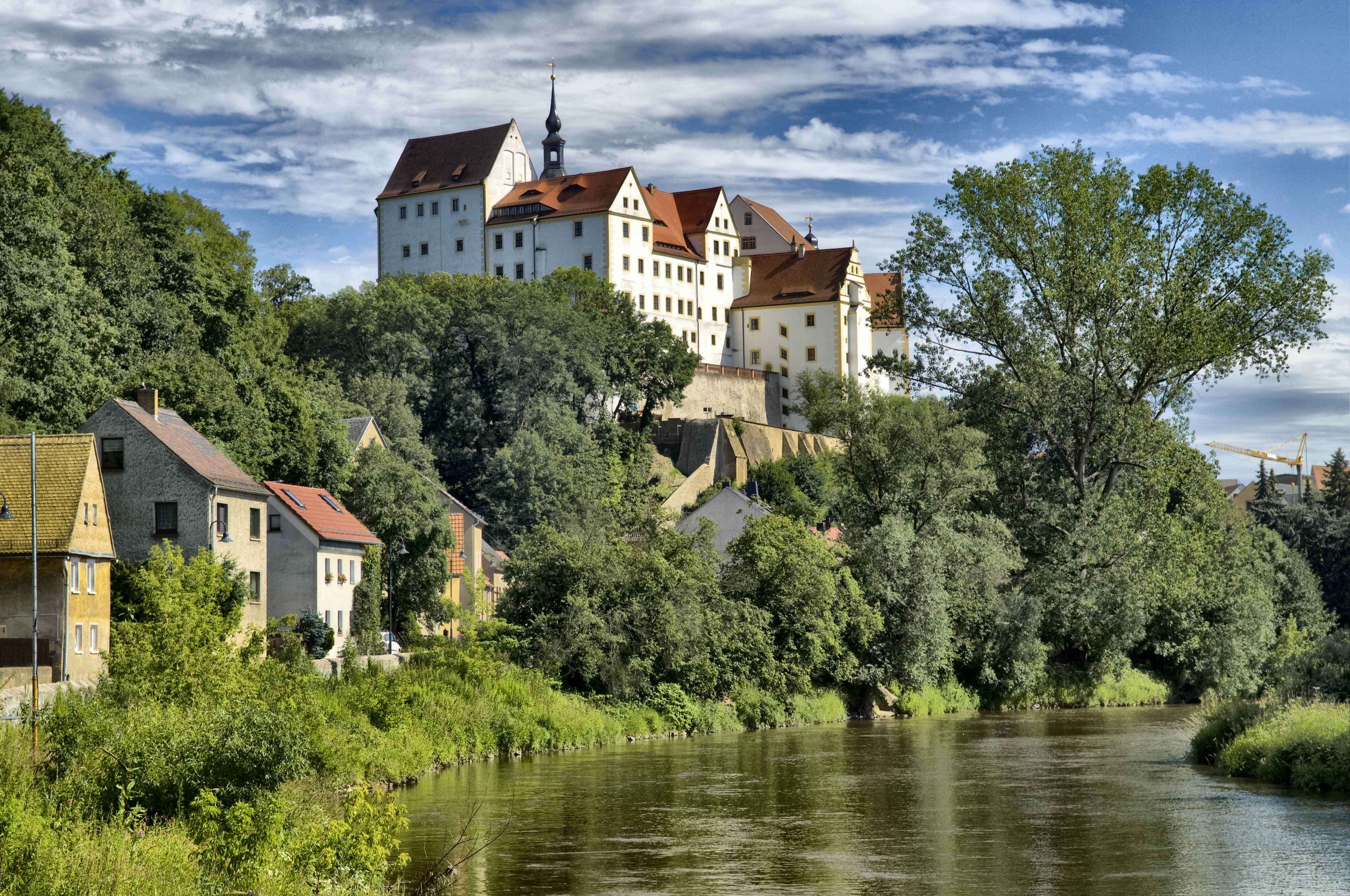
Colditz () is a small town in the district of Leipzig, in Saxony, Germany. It is best known for Colditz Castle, the site of the Oflag IV-C POW camp for officers in World War II. Geography Colditz is situated in the Leipzig Bay, southeast of the city of Leipzig. The town centre is located on the banks of Zwickau Mulde river, south of its confluence with the Freiberg Mulde. The municipality had a population of 8,374 in 2020. The town Colditz consists of Colditz proper and the ''Ortsteile'' (divisions) Bockwitz, Collmen, Commichau, Erlbach, Erlln, Hausdorf, Hohnbach, Kaltenborn, Koltzschen, Lastau, Leisenau, Maaschwitz, Meuselwitz, Möseln, Podelwitz, Raschütz, Schönbach, Sermuth, Skoplau, Tanndorf, Terpitzsch, Zollwitz, Zschadraß, Zschetzsch and Zschirla. History The first record of a burgward on the Mulde river, called ''Cholidistcha'', dates to the year 1046, when Emperor Henry III dedicated it to his consort Agnes of Poitou. The name is possibly of Slavic origin. In 1 ... [...More Info...] [...Related Items...] OR: [Wikipedia] [Google] [Baidu] |


