Debin on:
[Wikipedia]
[Google]
[Amazon]
Debin ( rus, Де́бин, p=ˈdʲebʲɪn) is an urban locality (an
 Debin is located on the
urban-type settlement
Urban-type settlement, abbreviated: ; , abbreviated: ; ; ; ; . is an official designation for lesser urbanized settlements, used in several Central and Eastern Europe, Central and Eastern European countries. The term was primarily used in the So ...
) in Yagodninsky District
Yagodninsky District () is an administrativeLaw #1292-OZ and municipalLaw #511-OZ district (raion), one of the eight in Magadan Oblast, Russia. It is located in the western central part of the oblast. The area of the district is . Its administrati ...
of Magadan Oblast
Magadan Oblast is a federal subjects of Russia, federal subject (an oblast) of Russia. It is geographically located in the Russian Far East, Far East region of the country, and is administratively part of the Far Eastern Federal District. Magadan ...
, Russia
Russia, or the Russian Federation, is a country spanning Eastern Europe and North Asia. It is the list of countries and dependencies by area, largest country in the world, and extends across Time in Russia, eleven time zones, sharing Borders ...
. Population:
Geography
upstream is Sinegorye and the Kolyma dam.History
Debin was founded in 1935 with the creation of a ferry point over theKolyma
Kolyma (, ) or Kolyma Krai () is a historical region in the Russian Far East that includes the basin of Kolyma River and the northern shores of the Sea of Okhotsk, as well as the Kolyma Mountains (the watershed of the two). It is bounded to ...
, initially under the name ''Pereprava''. In 1937 it was renamed for the Debin River, which joins the Kolyma a few kilometers upstream from the settlement. During the era of the Gulag
The Gulag was a system of Labor camp, forced labor camps in the Soviet Union. The word ''Gulag'' originally referred only to the division of the Chronology of Soviet secret police agencies, Soviet secret police that was in charge of runnin ...
network, it was the base for one of the larger prison camps administered by Dalstroy
Dalstroy (, ), also known as Far North Construction Trust, was an organization set up in 1931 in order to manage road construction and the mining of gold in the Russian Far East, including the Magadan Region, Chukotka, parts of Yakutia and parts ...
in the Kolyma
Kolyma (, ) or Kolyma Krai () is a historical region in the Russian Far East that includes the basin of Kolyma River and the northern shores of the Sea of Okhotsk, as well as the Kolyma Mountains (the watershed of the two). It is bounded to ...
region, centred on using forced labour for gold mining.
Infrastructure
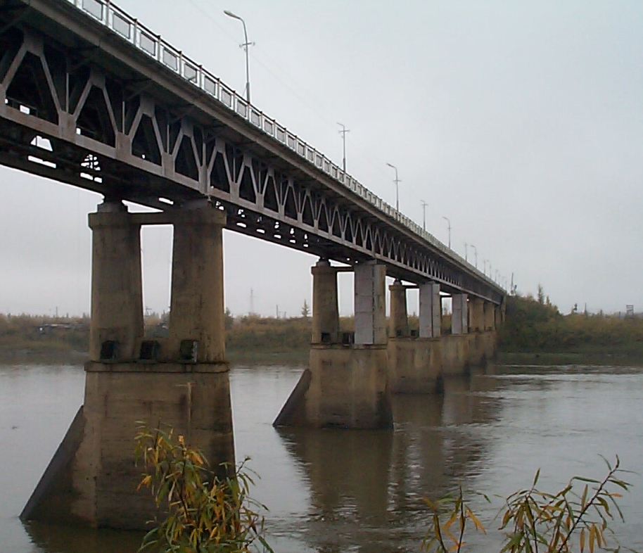
 Debin is located on the
 Kolyma Highway
The R504 Kolyma Highway (, ''Federal'naya Avtomobil'naya Doroga «Kolyma»,'' "Federal Automobile Highway 'Kolyma'"), part of the M56 route, is a road through the Russian Far East. It connects Magadan with the town of Nizhny Bestyakh, located ...
, at the point where it crosses the Kolyma River
The Kolyma (, ; ) is a river in northeastern Siberia, whose basin covers parts of the Sakha Republic, Chukotka Autonomous Okrug, and Magadan Oblast of Russia.
The Kolyma is frozen to depths of several metres for about 250 days each year, b ...
. From here, roads also lead to Sinegorye and to other smaller localities such as Taskan, Elgen and Verkhny At-Uryakh
Verkhny At-Uryakh () is an urban locality (an urban-type settlement) in Yagodninsky District of Magadan Oblast, Russia
Russia, or the Russian Federation, is a country spanning Eastern Europe and North Asia. It is the list of countries an ...
.
References
{{Use mdy dates, date=March 2013 Urban-type settlements in Magadan Oblast Kolyma basin