|
Zaqatala (rayon)
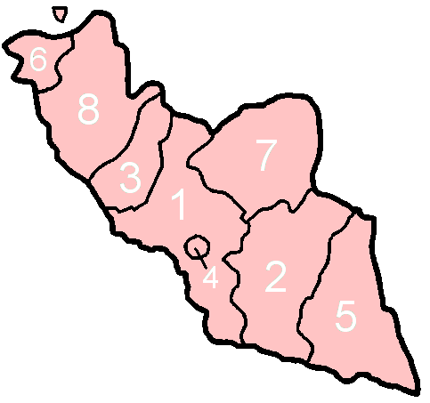
Zagatala District (; ; ) is one of the 66 districts of Azerbaijan. It is located in the north of the country and belongs to the Shaki-Zagatala Economic Region. The district borders the districts of Balakan, Qakh, as well as the Kakheti region of Georgia and the Russian Republic of Dagestan. Its capital and largest city is Zagatala. As of 2020, the district had a population of 129,800. Overview The Zagatala district has not suffered the intense environmental damage of other, nearby areas. Zagatala is famous for its hazelnuts and walnuts. Mulberry trees are well adapted to the area, allowing Zaqatala to preserve the ancient tradition of silkworm breeding, brought with the hordes of Timur. North of the town there is an important wildlife and nature preserve, the Zagatala Nature Reserve, which is home to brown bears, boars and west Caucasian tur. The Caucasus Mountains provide it with natural protection from the north winds. The wooded mountainsides, with frequent waterfalls, off ... [...More Info...] [...Related Items...] OR: [Wikipedia] [Google] [Baidu] |
Administrative Divisions Of Azerbaijan
Azerbaijan is administratively divided into 67 districts () and 11 cities () that are subordinate to the Republic. Out of these districts and cities, 7 districts and 1 city are located within the Nakhchivan Autonomous Republic. The districts are further divided into Municipalities of Azerbaijan, municipalities (). Additionally, the districts of Azerbaijan are grouped into 14 Economic regions of Azerbaijan, Economic Regions (). On 7 July 2021, President of Azerbaijan Ilham Aliyev signed a decree "On the new division of economic regions in the Republic of Azerbaijan". Administrative divisions Contiguous Azerbaijan The list below represents the districts of contiguous Azerbaijan. For those of the Nakhchivan exclave, see further below. Nakhchivan Autonomous Republic The seven districts and one municipality of the Nakhchivan Autonomous Republic are listed below. Economic regions Nagorno-Karabakh The territory of former Nagorno-Karabakh Autonomous Oblast presently ... [...More Info...] [...Related Items...] OR: [Wikipedia] [Google] [Baidu] |
Walnuts
A walnut is the edible seed of any tree of the genus ''Juglans'' (family Juglandaceae), particularly the Persian or English walnut, '' Juglans regia''. They are accessory fruit because the outer covering of the fruit is technically an involucre and thus not morphologically part of the carpel; this means it cannot be a drupe but is instead a drupe-like nut. After full ripening, the shell is discarded, and the kernel is eaten. Nuts of the eastern black walnut ('' Juglans nigra'') and butternuts ('' Juglans cinerea'') are less commonly consumed. Description Walnuts are the round, single-seed stone fruits of the walnut tree. They ripen between September and November in the northern hemisphere. The brown, wrinkly walnut shell is enclosed in a husk. Shells of walnuts available in commerce usually have two segments (but three or four-segment shells can also form). During the bumming process, the husk becomes brittle and the shell hard. The shell encloses the kernel or meat, wh ... [...More Info...] [...Related Items...] OR: [Wikipedia] [Google] [Baidu] |
Abalı, Zaqatala
Abalı is a village in the municipality of Maqov in the Zaqatala Rayon of Azerbaijan Azerbaijan, officially the Republic of Azerbaijan, is a Boundaries between the continents, transcontinental and landlocked country at the boundary of West Asia and Eastern Europe. It is a part of the South Caucasus region and is bounded by .... References Populated places in Zaqatala District {{Zaqatala-geo-stub ... [...More Info...] [...Related Items...] OR: [Wikipedia] [Google] [Baidu] |
Voytala
Voytala (also, Voitala and Votala) is a village in the Zaqatala Rayon of Azerbaijan Azerbaijan, officially the Republic of Azerbaijan, is a Boundaries between the continents, transcontinental and landlocked country at the boundary of West Asia and Eastern Europe. It is a part of the South Caucasus region and is bounded by .... The village forms part of the municipality of Maqov. It is renowned locally for its wheat and stern mothers. References External links * Populated places in Zaqatala District {{Zaqatala-geo-stub ... [...More Info...] [...Related Items...] OR: [Wikipedia] [Google] [Baidu] |
Paşan
Paşan (also, Pashan) is a village in the Zaqatala Rayon of Azerbaijan Azerbaijan, officially the Republic of Azerbaijan, is a Boundaries between the continents, transcontinental and landlocked country at the boundary of West Asia and Eastern Europe. It is a part of the South Caucasus region and is bounded by .... The village forms part of the municipality of Maqov. References External links * Populated places in Zaqatala District {{Zaqatala-geo-stub ... [...More Info...] [...Related Items...] OR: [Wikipedia] [Google] [Baidu] |
Yolayrıc
Yolayrıc (also, Yel-Ayridzh and Yëlayrydzh) is a village in the Zaqatala Rayon of Azerbaijan Azerbaijan, officially the Republic of Azerbaijan, is a Boundaries between the continents, transcontinental and landlocked country at the boundary of West Asia and Eastern Europe. It is a part of the South Caucasus region and is bounded by .... The village forms part of the municipality of Maqov. References External links * Populated places in Zaqatala District {{Zaqatala-geo-stub ... [...More Info...] [...Related Items...] OR: [Wikipedia] [Google] [Baidu] |
Maqov
Maqov (also, Makov) is a village and municipality in the Zaqatala Rayon of Azerbaijan. It has a population of 4,321. The municipality consists of the villages of Maqov, Abalı, Paşan, Yolayrıc, Oytala, and Voytala Voytala (also, Voitala and Votala) is a village in the Zaqatala Rayon of Azerbaijan Azerbaijan, officially the Republic of Azerbaijan, is a Boundaries between the continents, transcontinental and landlocked country at the boundary of Wes .... References External links * Populated places in Zaqatala District {{Zaqatala-geo-stub ... [...More Info...] [...Related Items...] OR: [Wikipedia] [Google] [Baidu] |
Əliabad, Zaqatala
Aliabad is a village and the most populous municipality, except for the capital Zaqatala, in the Zaqatala District of Azerbaijan Azerbaijan, officially the Republic of Azerbaijan, is a Boundaries between the continents, transcontinental and landlocked country at the boundary of West Asia and Eastern Europe. It is a part of the South Caucasus region and is bounded by .... It has a population of 10,700. The majority of population are ethnic Georgians References * Populated places in Zaqatala District {{Zaqatala-geo-stub ... [...More Info...] [...Related Items...] OR: [Wikipedia] [Google] [Baidu] |
Mosque
A mosque ( ), also called a masjid ( ), is a place of worship for Muslims. The term usually refers to a covered building, but can be any place where Salah, Islamic prayers are performed; such as an outdoor courtyard. Originally, mosques were simple places of prayer for the early Muslims, and may have been open spaces rather than elaborate buildings. In the first stage of Islamic architecture (650–750 CE), early mosques comprised open and closed covered spaces enclosed by walls, often with minarets, from which the Adhan, Islamic call to prayer was issued on a daily basis. It is typical of mosque buildings to have a special ornamental niche (a ''mihrab'') set into the wall in the direction of the city of Mecca (the ''qibla''), which Muslims must face during prayer, as well as a facility for ritual cleansing (''wudu''). The pulpit (''minbar''), from which public sermons (''khutbah'') are delivered on the event of Friday prayer, was, in earlier times, characteristic of the central ... [...More Info...] [...Related Items...] OR: [Wikipedia] [Google] [Baidu] |
Hiking
A hike is a long, vigorous walk, usually on trails or footpaths in the countryside. Walking for pleasure developed in Europe during the eighteenth century. Long hikes as part of a religious pilgrimage have existed for a much longer time. "Hiking" is the preferred term in Canada and the United States; the term "walking" is used in these regions for shorter, particularly urban walks. In the United Kingdom and Ireland, the word "walking" describes all forms of walking, whether it is a walk in the park or backpacking in the Alps. The word hiking is also often used in the UK, along with rambling, hillwalking, and fell walking (a term mostly used for hillwalking in northern England). The term bushwalking is endemic to Australia, having been adopted by the Sydney Bush Walkers Club in 1927. In New Zealand a long, vigorous walk or hike is called tramping. It is a popular activity with numerous hiking organizations worldwide, and studies suggest that all forms of walking have health b ... [...More Info...] [...Related Items...] OR: [Wikipedia] [Google] [Baidu] |
Caucasus Mountains
The Caucasus Mountains * * Azerbaijani: , * * * * * * * * * * * is a mountain range at the intersection of Asia and Europe. Stretching between the Black Sea and the Caspian Sea, they are surrounded by the Caucasus region and are home to Mount Elbrus, the highest peak in Europe at above sea level. The Caucasus Mountains include the Greater Caucasus in the north and the Lesser Caucasus in the south. The Greater Caucasus runs west-northwest to east-southeast, from the Western Caucasus on the northeastern shore of the Black Sea to close to Baku on the Caspian Sea, in Azerbaijan. The Lesser Caucasus runs parallel to the Greater about south. The Greater and Lesser Caucasus ranges are connected by the Likhi Range, and to the west and east of the Likhi Range lie the Colchis Plain and the Kur-Araz Lowland respectively. The Meskheti Range is a part of the Lesser Caucasus system. In the southeast, the Aras River separates the Lesser Caucasus from the Tal ... [...More Info...] [...Related Items...] OR: [Wikipedia] [Google] [Baidu] |
West Caucasian Tur
The West Caucasian tur (''Capra caucasica'') is a mountain-dwelling goat-antelope native to the western half of the Caucasus Mountains range, in Georgia and European Russia. Names and taxonomy It is also known by the names "zebuder," "zac" and "Caucasian ibex." The East Caucasian tur is sometimes considered a subspecies of this species, though some separate the two out as different species. There is a third intermediate form that lives between the two called the Mid-Caucasian tur. Description West Caucasian turs stand up to tall at the shoulder and weigh around . They have large but narrow bodies and short legs. West Caucasian turs have a chestnut coat with a yellow underbelly and darker legs. Their horns are scimitar-shaped and heavily ridged. In males, these horns are around , while in females they are much smaller. They are sexually dimorphic, with the males larger than the females. Habitat West Caucasian turs live in rough mountainous terrain between above sea level, ... [...More Info...] [...Related Items...] OR: [Wikipedia] [Google] [Baidu] |


