|
Yalu
The Yalu River () or Amnok River () is a river on the border between China and North Korea. Together with the Tumen River to its east, and a small portion of Paektu Mountain, the Yalu forms the border between China and North Korea. Its valley has been the scene of several military conflicts in the past centuries. It borders North Korea to the south and China to the north. Name The Chinese name ''Yalu'' ("duck-green") was first attested during the Tang dynasty. According to the ''Tongdian'' (8th century), the river was named after its color, which resembled that of a mallard's head. The Korean name "Amnok" follows the Sino-Korean reading of the same name. In ancient times, the river was known as ''Peishui'' (''Paesu'', 浿水) or ''Mazishui'' (''Majasu'', 馬訾水). Historically, it was also known by the Korean name of ''Arinarye'' (아리나례강, 阿利那禮江). ''Ari'', a word from Old Korean used to refer to the 'spirituality (신령성; 神靈性) of the sun'. The se ... [...More Info...] [...Related Items...] OR: [Wikipedia] [Google] [Baidu] |
China–North Korea Border
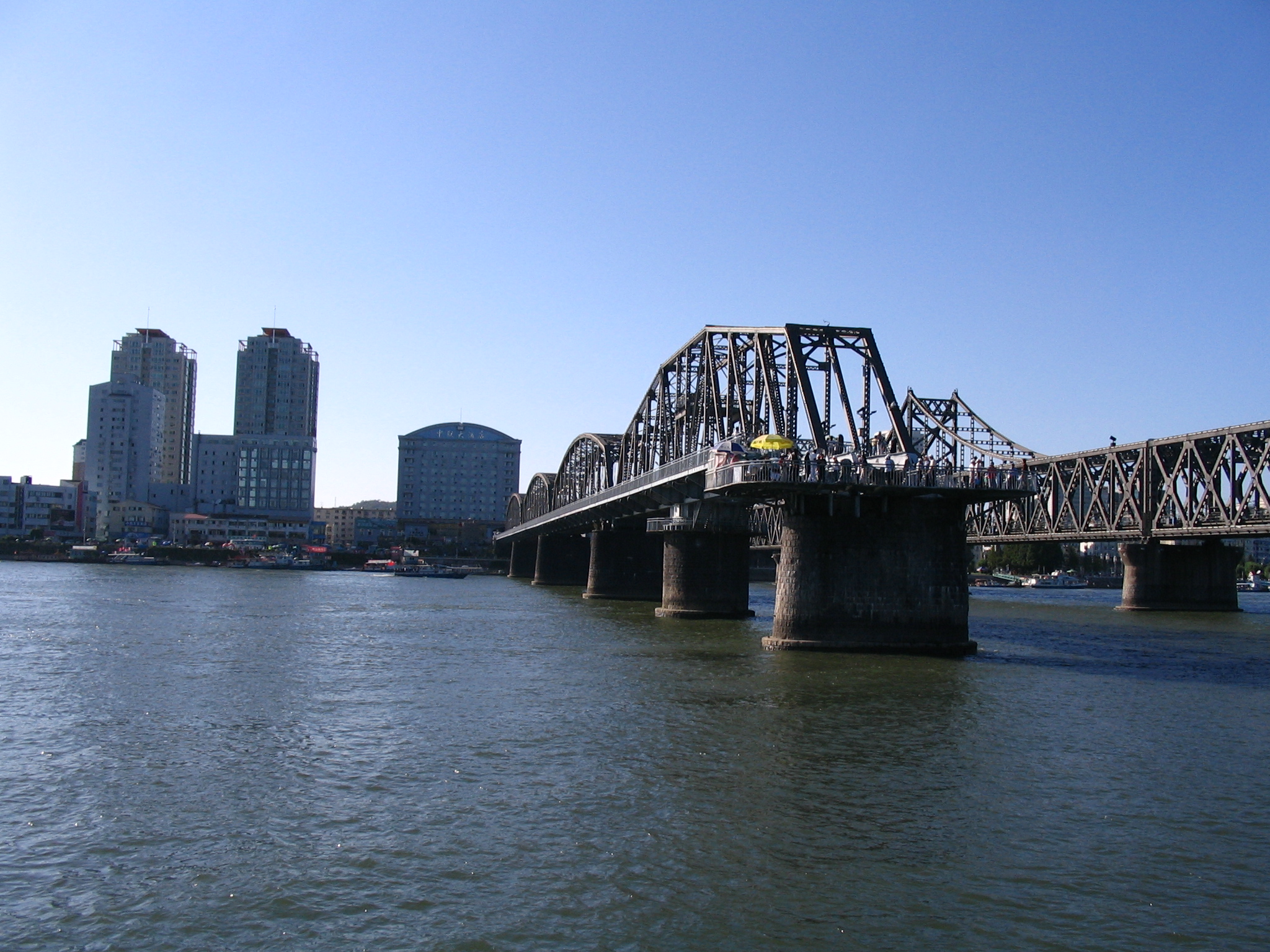
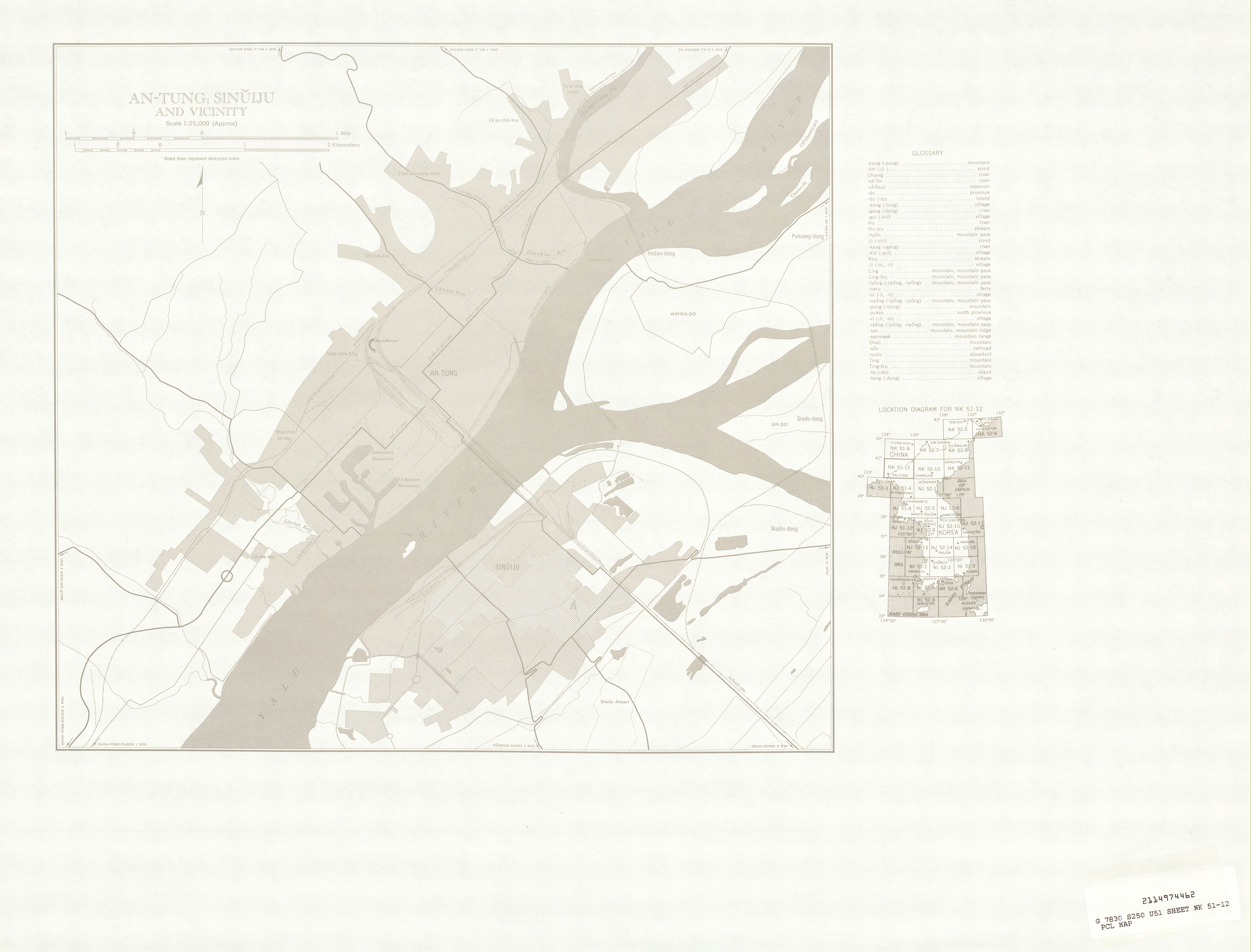
The China–North Korea border is an Border, international border separating China and North Korea, extending from Korea Bay in the west to a China–North Korea–Russia tripoint, tripoint with Russia in the east. The total length of the border is 1,352 kilometers (840 mi). The current border was created by Sino–North Korean Border Treaty, two secret treaties signed between China and North Korea in 1962 and 1964. Geography From west to east, the two countries are divided by three significant geographical features: the Yalu River, Paektu Mountain, and the Tumen River. Dandong, in the Liaoning Province of China, on the Yalu River delta, is the largest city on the border. On the other side of the river is the city of Sinuiju in North Pyongan Province, North Korea. The two cities are situated on the Yalu river delta at the western end of the border, near the Yellow Sea. Their waterfronts face each other and are connected by the Sino-Korean Friendship Bridge. There ar ... [...More Info...] [...Related Items...] OR: [Wikipedia] [Google] [Baidu] |
Dandong
Dandong ( zh, s=丹东 , t=丹東 , p=Dāndōng; lit. "Red East"), formerly known as Andong, is a coastal prefecture-level city in southeastern Liaoning province, in the northeastern region of the People's Republic of China. It is the largest Chinese border city, facing Sinuiju, North Korea, across the Yalu River, which demarcates the Sino-North Korean border. To the southwest of the city, the river flows into Korea Bay. Dandong has therefore had a dynamic history because of its strategic location for the northeast's rich natural resources and because of its convenient access to the ocean. It is designated as a major export production centre for the province, and is a port city connected by rail with Shenyang and Sinuiju. A significant amount of trade with North Korea flows through the city. Kanto, Dick K. and Mark E. Manyin. ''China-North Korea Relations''. DIANE Publishing. December 28, 2010.10 Retrieved from Google Books on October 23, 2012. , 9781437985115. The si ... [...More Info...] [...Related Items...] OR: [Wikipedia] [Google] [Baidu] |
Sino–North Korean Border Treaty
The Sino-Korean Border Agreement ( zh, s=中朝边界条约; ) was signed by China and North Korea on October 12, 1962, in Pyongyang. This agreement and a subsequent agreement in 1964 define the modern border between the two countries. The agreement is widely viewed by both modern scholars and by contemporaries as being favorable to North Korea. As a result of the agreement, North Korea acquired of territory on and around Paektu Mountain, and 54.5% of the mountain's Heaven Lake. The previous practice of using the Yalu River and Tumen River for the rest of the border was affirmed. A subsequent agreement followed on March 20, 1964, called the Protocols on the Sino-Korean Border ( zh, s=中朝边界议定书, links=no; ). It was signed in Beijing and determined the sovereignty of 451 islands and islets (264 to North Korea, 187 to China). Both agreements were made in secret, never registered with the United Nations Secretariat, and never publicly confirmed. However, in 2000, the ... [...More Info...] [...Related Items...] OR: [Wikipedia] [Google] [Baidu] |
Paektu Mountain
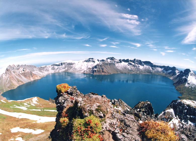
Paektu Mountain or Baekdu Mountain () is an active stratovolcano on the Chinese–North Korean border. In China, it is known as Changbai Mountain (). At , it is the tallest mountain in North Korea and Northeast China and the tallest mountain of the Baekdu-daegan and Changbai mountain ranges. The highest peak, called Janggun Peak, belongs to North Korea. The mountain notably has a caldera that contains a large crater lake called Heaven Lake, and is also the source of the Songhua, Tumen, and Yalu rivers. Korean and Manchu people assign a mythical quality to the mountain and its lake, and consider the mountain to be their ancestral homeland. The mountain's caldera was formed by an eruption in 946 that released about of tephra. The eruption was among the largest and most powerful eruptions on Earth in the last 5,000 years. The volcano last erupted in 1903, and is expected to erupt around every hundred years. In the 2010s, concerns over an upcoming eruption prompted sev ... [...More Info...] [...Related Items...] OR: [Wikipedia] [Google] [Baidu] |
Hyesan
Hyesan () is a city in the northern part of Ryanggang province of North Korea. It is a hub of river transportation as well as a product distribution centre. It is also the administrative centre of Ryanggang Province. As of 2008, the population of the city is 192,680. Area Around the 1940s, this city included the nearby Paektu Mountains. However, due to several changes, the area of this city was reduced, and now it only includes the nearby Yalu River. Due to the division between the two Koreas, Hyesan is also claimed by South Korea, following the boundaries of 1940s, not the one used by North Korea. Therefore, according to South Korea, Hyesan still includes the nearby Paektu Mountains. South Korea has a conflict with the People's Republic of China because of the Paekdu Mountains. The mountain is actually divided in two: the south parts are ruled by North Korea while the north parts are ruled by the PRC. However, South Korea still claims the northern parts. It is not officiall ... [...More Info...] [...Related Items...] OR: [Wikipedia] [Google] [Baidu] |
Liaoning
) , image_skyline = , image_alt = , image_caption = Clockwise: Mukden Palace in Shenyang, Xinghai Square in Dalian, Dalian coast, Yalu River at Dandong , image_map = Liaoning in China (+all claims hatched).svg , mapsize = 275px , map_alt = Map showing the location of Liaoning Province , map_caption = Map showing the location of Liaoning Province , coordinates = , subdivision_type = Country , subdivision_name = China , named_for = —"Liao River, Liao (River)" —"pacification" "Pacified of the Liao (River)" , seat_type = Capital , seat = Shenyang , seat1_type = , seat1 = , parts_type = Divisions , parts_style = para , p1 = 14 Prefectures of China, prefectures , p2 = 100 Counties of China, counties , p3 = 1511 Townships of China, townships , government_type = Provinces of ... [...More Info...] [...Related Items...] OR: [Wikipedia] [Google] [Baidu] |
Sinuiju
Sinŭiju (; ) is a city in North Korea which faces Dandong, Liaoning, China, across the international border of the Yalu River. It is the capital of North Pyongan Province, North P'yŏngan province. Part of the city is included in the Sinuiju Special Administrative Region, Sinŭiju Special Administrative Region, which was established in 2002 to experiment with introducing a market economy. In recent years, the city, despite lagging behind the development in the capital Pyongyang, has seen a small construction boom and increasing tourism from China. Geography Sinŭiju is bordered by the Amnok River, and by Pihyon County, P'ihyŏn and Ryongchon County, Ryongch'ŏn counties. The city's altitude is 1 metre (4 feet) above sea level. There are several islands at the mouth of the Amnok River - Wihwado Island, Wihwa-do, Imdo Island, Rim-do, Ryuchodo Island, Ryuch'o-do and East Ryuchodo Island, Tongryuch'o-do. Administrative divisions Sinuiju city is the heart of the Sinuiju Special Ad ... [...More Info...] [...Related Items...] OR: [Wikipedia] [Google] [Baidu] |
Ai River (Dandong)
The Ai River (, also ; originally and in the Tang dynasty) in Dangdong, Liaoning, China, is the largest tributary on the right (Chinese) side of the Yalu River that flows between China and North Korea. It starts in the mountains of Kuandian Manchu Autonomous County, runs through Fengcheng City and Zhen'an District, and empties into the Yalu River at Jiulianshan, just south of the Hushan Great Wall The Hushan or Tiger Mountain Great Wall (), is a section of the Ming Great Wall in Kuandian Manchu Autonomous County, Liaoning, China. The wall runs for about 1,200 metres over Hushan ("Tiger Mountain"). The wall starts 15 km northeast of D .... (in Chinese) References {{coord missing, Liaoning[...More Info...] [...Related Items...] OR: [Wikipedia] [Google] [Baidu] |
Tongjia River
The Hun River () in Northeast China, is the largest tributary on the right (Chinese) side of the Yalu River. It starts in the Longgang mountains of northwest Jiangyuan District, Baishan, Jilin Province, runs 446.5 kilometres through Tonghua and Huanren Manchu Autonomous County of Liaoning Province, and empties into the Yalu River at Hunjiang Village of Kuandian Manchu Autonomous County. Name The Hun River Basin is the place of origin of the Manchu people, Manchu Tunggiya clan. Thus the river is known as the ''Tunggiya ula'' in the Manchu language. History The Hun River's drainage basin is the birthplace of the Goguryeo. References {{Commonscat, Hunjiang (Yalu) Rivers of Jilin Rivers of Liaoning ... [...More Info...] [...Related Items...] OR: [Wikipedia] [Google] [Baidu] |
Amrok River Estuary Important Bird Area
The Amrok River estuary Important Bird Area comprises the North Korean part of the Amrok, or Yalu, estuary, with an area of 7,000 ha, abutting the border with China on the north-eastern coast of the Yellow Sea. The site has been identified by BirdLife International as an Important Bird Area (IBA) because it supports up to 20,000 waterbirds. Birds for which the site is significant include swan geese, Baikal teal, black-faced spoonbills, white-naped cranes, red-crowned crane The red-crowned crane (''Grus japonensis''), also called the Manchurian crane (; the Chinese character '丹' means 'red', '頂/顶' means 'crown (anatomy), crown' and '鶴/鹤' means 'crane'), is a large East Asian Crane (bird), crane among the ...s and Far Eastern curlews. Only 1000 ha of the site is protected in a nature reserve. References Important Bird Areas of North Korea Rivers of North Korea North Pyongan Wetlands of North Korea {{NorthKorea-geo-stub ... [...More Info...] [...Related Items...] OR: [Wikipedia] [Google] [Baidu] |
Korea Bay
Korea(n) Bay, sometimes West Korea(n) Bay (; ; or ), is a bight and the northern extension of the Yellow Sea, between the southeastern coastline of China's Liaoning Province and the western coastline of North Korea's North Pyongan, South Pyongan and South Hwanghae provinces. It is separated from the Bohai Sea by the Liaodong Peninsula, with Dalian's Lüshunkou District marking its western end, and westernmost tip of North Korea's Ryongyon County as its eastern end. The Yalu (Amnok) River, which marks the western two-thirds of the China–North Korea border, empties into the Korea Bay between Dandong (China) and Sinŭiju (North Korea). The Chongchon River and Taedong River also drains into the Korea Bay at Sinanju and Nampo Nampo (North Korean official spelling: Nampho; ), also spelled Namp'o, is a major city in North Korea which is the country's List of cities in North Korea, fourth-largest by population. The city is an important seaport in the country as it lies ... [...More Info...] [...Related Items...] OR: [Wikipedia] [Google] [Baidu] |
Jilin
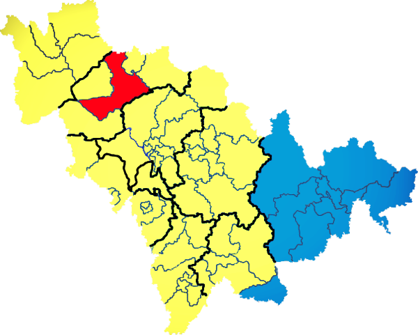
) , image_skyline = Changbaishan Tianchi from western rim.jpg , image_alt = , image_caption = View of Heaven Lake , image_map = Jilin in China (+all claims hatched).svg , mapsize = 275px , map_alt = Map showing the location of Jilin Province , map_caption = Map showing the location of Jilin Province , coordinates = , subdivision_type = Country , subdivision_name = China , named_for = from ''girin ula'', a Manchu language, Manchu phrase meaning "along the river" , seat_type = Capital , seat = , seat1_type = , seat1 = , parts_type = Divisions , parts_style = para , p1 = 9 Prefectures of China, prefectures , p2 = 60 Counties of China, counties , p3 = 1006 Townships of China, townships , government_type = Provinces of China, Province , governing_body = Jilin Provinci ... [...More Info...] [...Related Items...] OR: [Wikipedia] [Google] [Baidu] |


