|
Korea Bay
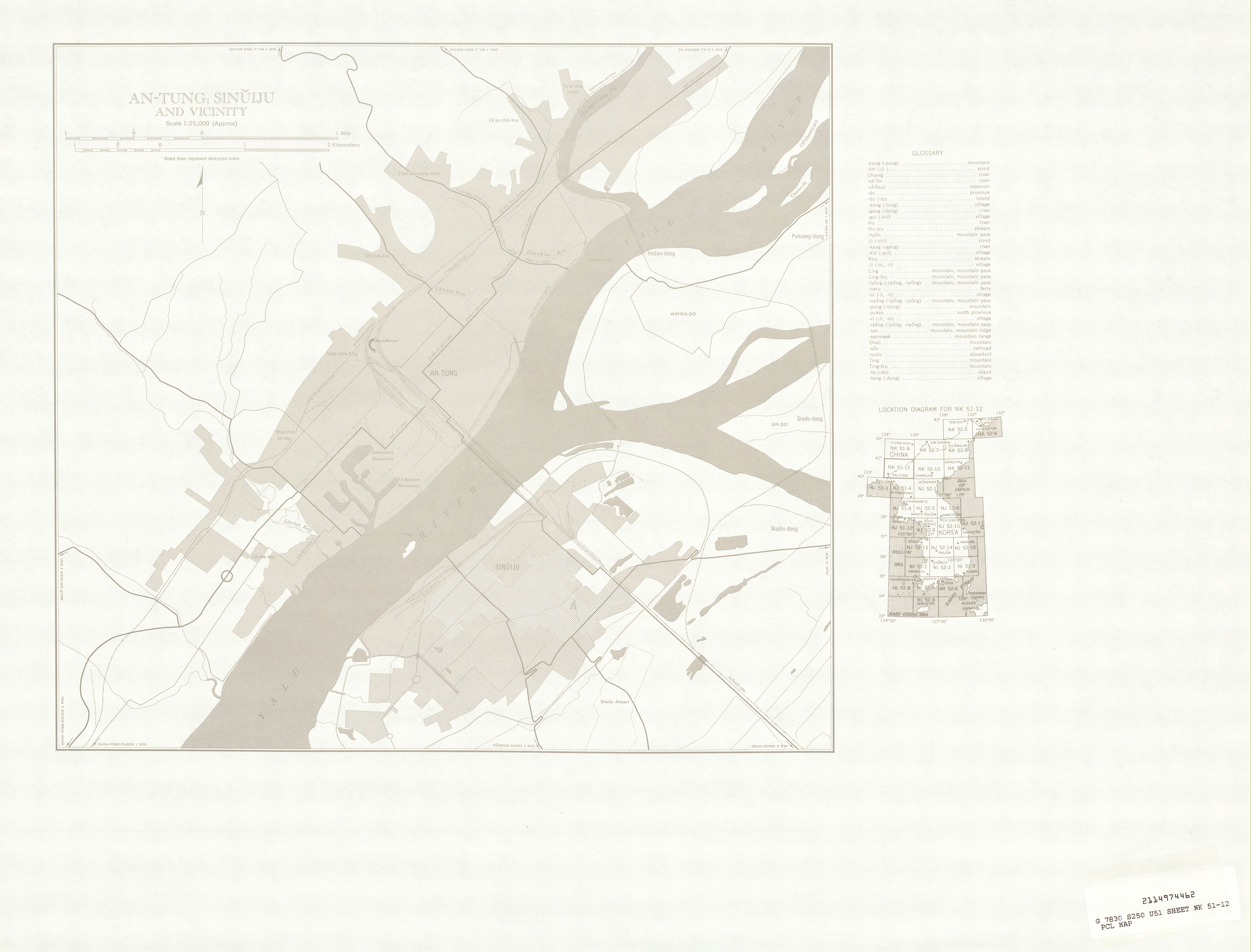
Korea(n) Bay, sometimes West Korea(n) Bay (; ; or ), is a bight and the northern extension of the Yellow Sea, between the southeastern coastline of China's Liaoning Province and the western coastline of North Korea's North Pyongan, South Pyongan and South Hwanghae provinces. It is separated from the Bohai Sea by the Liaodong Peninsula, with Dalian's Lüshunkou District marking its western end, and westernmost tip of North Korea's Ryongyon County as its eastern end. The Yalu (Amnok) River, which marks the western two-thirds of the China–North Korea border, empties into the Korea Bay between Dandong (China) and Sinŭiju (North Korea). The Chongchon River and Taedong River also drains into the Korea Bay at Sinanju and Nampo Nampo (North Korean official spelling: Nampho; ), also spelled Namp'o, is a major city in North Korea which is the country's List of cities in North Korea, fourth-largest by population. The city is an important seaport in the country as it lies ... [...More Info...] [...Related Items...] OR: [Wikipedia] [Google] [Baidu] |
Bight (geography)
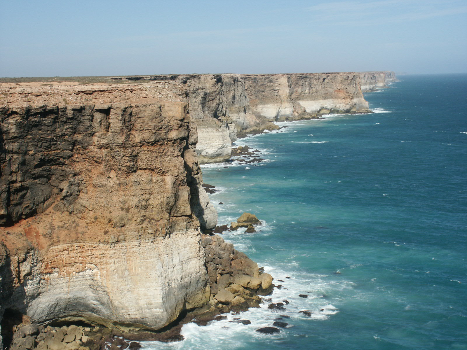
In geography, a bight () is a concave bend or curvature in a coastline, river or other geographical feature, or it may refer to a very open bay formed by such a feature. Such bays are typically broad, open, shallow and only slightly recessed. Description The size of bights differs greatly, which may be as small as a bend in a river or large like a sound. Large bights are shallower than sounds. Traditionally, explorers defined a bight as a bay that could be sailed out of on a single tack in a square-rigged sailing vessel, regardless of the direction of the wind (typically meaning the apex of the bight is less than 25 degrees from the edges). According to the United Nations Convention on the Law of the Sea, an indentation with an area as large as (or larger than) that of the semi-circle whose diameter is a line drawn across the mouth of that indentation, can be regarded as a bay not merely a bight. [...More Info...] [...Related Items...] OR: [Wikipedia] [Google] [Baidu] |
Ryongyon County
Ryongyŏn County is a county in western South Hwanghae province, North Korea. Its Yellow Sea coast is known for its natural environment and as an important habitat for plants and birds. Ryongyŏn was the first place in which Protestant Christianity was established in Korea, in the late 19th century. Geography Ryongyŏn is a coastal county of 463 km2, facing the Yellow Sea to the south and northwest. It also borders Changyon county to the northeast, and Taetan county to the east. Its territory includes several islands to the south: Wollaedo (), Ojakdo (오작도), and Yukdo (육도). Ryongyŏn is separated from the South Korean Baengnyeong Island by a strait 12 km wide, and can be clearly seen from South Korean resorts on clear days. The Pult'a Mountains (불타산맥) run through the county from east to west. The western part of the chain projects into the Yellow Sea, forming the Ryongyŏn Peninsula, with Changsan Cape at its western end (장산곶). The territory i ... [...More Info...] [...Related Items...] OR: [Wikipedia] [Google] [Baidu] |
Nampo
Nampo (North Korean official spelling: Nampho; ), also spelled Namp'o, is a major city in North Korea which is the country's List of cities in North Korea, fourth-largest by population. The city is an important seaport in the country as it lies on the northern shore of the Taedong River estuary, 15 km east of the estuary's mouth. Formerly known as Chinnamp'o, it was a provincial-level "Directly Governed City" ("Chikhalsi") from 1980 to 2004, and was designated a Special cities of North Korea, "Special City" ("T'ŭkpyŏlsi", 특별시; 特別市) in 2010. Nampo is approximately 50 km southwest of Pyongyang, at the mouth of the Taedong River. Since North Korean independence, the city has developed a wide range of industry and has seen significant recent redevelopment. History Before formation of North Korea The city belonged to Gojoseon until the Three Kingdoms of Korea, Three Kingdoms era, when it was taken by Goguryeo. During this time, the city was part of Sogyong ... [...More Info...] [...Related Items...] OR: [Wikipedia] [Google] [Baidu] |
Sinanju
Sinanju is a region (신안주) in Anju city, South Pyongan Province, North Korea. The name literally means "Comfortable New Village." When Anju County was raised to the status of a city in August 1987, Sinanju Workers' District was divided into Sinwon-dong, Wonhung-dong, Yokchon-dong. History On May 9, 1951, the U.S. Air Force conducted the most massive airstrike of the Korean war to date - at least 300 planes converged on a city on the Yalu River. Sinanju's bridges and railways were bombed by the United States Air Force during the Korean War to halt the transport of supplies to North Korea. During the second Korean winter, railways and bridges leading from Sinanju to Chongju were bombed by the U.S. on January 25, 1952, but were repaired five days later. During the last week of March 1952, U.S. forces began using B-29 Superfortresses through April to destroy bridges between Sinanju and Pyongyang. During the third Korean winter of the war, the USAF targeted five railroad b ... [...More Info...] [...Related Items...] OR: [Wikipedia] [Google] [Baidu] |
Taedong River
The Taedong River () is a large river in North Korea. The river rises in the Rangrim Mountains of the country's north where it then flows southwest into Korea Bay at Namp'o.Suh, Dae-Sook (1987) "North Korea in 1986: Strengthening the Soviet Connection" ''Asian Survey'' 27(1): pp. 56-63, page 62 In between, it runs through the country's capital, Pyongyang. Along the river are landmarks such as the Juche Tower and Kim Il-sung Square. The river is in length, and is generally deep. It is the fifth-longest river on the Korean peninsula and the second-longest in North Korea. Pyongyang is approximately 110 km upstream from the mouth, Sunchon 192 km upstream, and Taehŭng 414 km upstream. Because of its depth, it is widely used for river transport; it is navigable by large ships up to 65 km inland, although most commercial traffic stops at Songrim. History The kingdom of Koguryo was founded on its shores. Many archeological sites dating to the Neolithic and ... [...More Info...] [...Related Items...] OR: [Wikipedia] [Google] [Baidu] |
Chongchon River
The Ch'ŏngch'ŏn is a river in North Korea having its source in the Rangrim Mountains of Chagang Province and emptying into the Yellow Sea at Sinanju. The river flows past Myohyang-san and through the city of Anju, South P'yŏngan Province. Its total length is , and it drains a basin of . History In 612, at the Battle of Salsu (Salsu - the former name of the Cheongcheong River), the troops of the Korean kingdom of Goguryeo utterly defeated the Chinese army of the Sui Empire that had invaded Korea. In November–December 1950, in the Battle of the Ch'ongch'on River, detachments of the Korean People's Army and Chinese volunteers won a major victory over the troops of the Americans and their allies during the Korean War. Important Bird Area The river's estuary has been identified by BirdLife International as an Important Bird Area (IBA) because it supports significant numbers of the populations of various bird species. These include swan geese, bean geese, whooper ... [...More Info...] [...Related Items...] OR: [Wikipedia] [Google] [Baidu] |
Sinuiju
Sinŭiju (; ) is a city in North Korea which faces Dandong, Liaoning, China, across the international border of the Yalu River. It is the capital of North Pyongan Province, North P'yŏngan province. Part of the city is included in the Sinuiju Special Administrative Region, Sinŭiju Special Administrative Region, which was established in 2002 to experiment with introducing a market economy. In recent years, the city, despite lagging behind the development in the capital Pyongyang, has seen a small construction boom and increasing tourism from China. Geography Sinŭiju is bordered by the Amnok River, and by Pihyon County, P'ihyŏn and Ryongchon County, Ryongch'ŏn counties. The city's altitude is 1 metre (4 feet) above sea level. There are several islands at the mouth of the Amnok River - Wihwado Island, Wihwa-do, Imdo Island, Rim-do, Ryuchodo Island, Ryuch'o-do and East Ryuchodo Island, Tongryuch'o-do. Administrative divisions Sinuiju city is the heart of the Sinuiju Special Ad ... [...More Info...] [...Related Items...] OR: [Wikipedia] [Google] [Baidu] |
Dandong
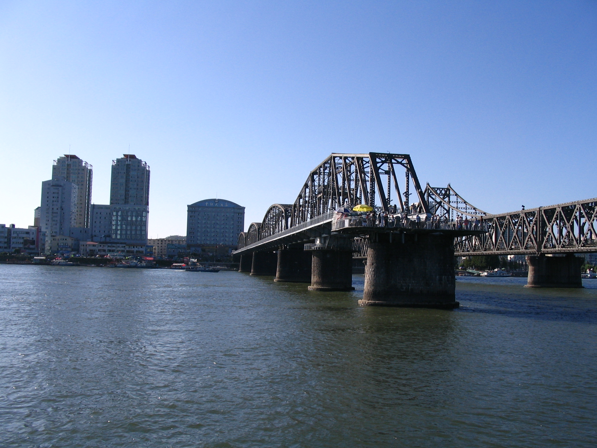
Dandong ( zh, s=丹东 , t=丹東 , p=Dāndōng; lit. "Red East"), formerly known as Andong, is a coastal prefecture-level city in southeastern Liaoning province, in the northeastern region of the People's Republic of China. It is the largest Chinese border city, facing Sinuiju, North Korea, across the Yalu River, which demarcates the Sino-North Korean border. To the southwest of the city, the river flows into Korea Bay. Dandong has therefore had a dynamic history because of its strategic location for the northeast's rich natural resources and because of its convenient access to the ocean. It is designated as a major export production centre for the province, and is a port city connected by rail with Shenyang and Sinuiju. A significant amount of trade with North Korea flows through the city. Kanto, Dick K. and Mark E. Manyin. ''China-North Korea Relations''. DIANE Publishing. December 28, 2010.10 Retrieved from Google Books on October 23, 2012. , 9781437985115. The si ... [...More Info...] [...Related Items...] OR: [Wikipedia] [Google] [Baidu] |
China–North Korea Border
The China–North Korea border is an Border, international border separating China and North Korea, extending from Korea Bay in the west to a China–North Korea–Russia tripoint, tripoint with Russia in the east. The total length of the border is 1,352 kilometers (840 mi). The current border was created by Sino–North Korean Border Treaty, two secret treaties signed between China and North Korea in 1962 and 1964. Geography From west to east, the two countries are divided by three significant geographical features: the Yalu River, Paektu Mountain, and the Tumen River. Dandong, in the Liaoning Province of China, on the Yalu River delta, is the largest city on the border. On the other side of the river is the city of Sinuiju in North Pyongan Province, North Korea. The two cities are situated on the Yalu river delta at the western end of the border, near the Yellow Sea. Their waterfronts face each other and are connected by the Sino-Korean Friendship Bridge. There ar ... [...More Info...] [...Related Items...] OR: [Wikipedia] [Google] [Baidu] |
Yalu River
The Yalu River () or Amnok River () is a river on the border between China and North Korea. Together with the Tumen River to its east, and a small portion of Paektu Mountain, the Yalu forms the border between China and North Korea. Its valley has been the scene of several military conflicts in the past centuries. It borders North Korea to the south and China to the north. Name The Chinese name ''Yalu'' ("duck-green") was first attested during the Tang dynasty. According to the '' Tongdian'' (8th century), the river was named after its color, which resembled that of a mallard's head. The Korean name "Amnok" follows the Sino-Korean reading of the same name. In ancient times, the river was known as ''Peishui'' (''Paesu'', 浿水) or ''Mazishui'' (''Majasu'', 馬訾水). Historically, it was also known by the Korean name of ''Arinarye'' (아리나례강, 阿利那禮江). ''Ari'', a word from Old Korean used to refer to the 'spirituality (신령성; 神靈性) of the sun'. Th ... [...More Info...] [...Related Items...] OR: [Wikipedia] [Google] [Baidu] |
Yellow Sea
The Yellow Sea, also known as the North Sea, is a marginal sea of the Western Pacific Ocean located between mainland China and the Korean Peninsula, and can be considered the northwestern part of the East China Sea. Names It is one of four seas named after color terms (the others being the Black Sea, the Red Sea and the White Sea), and its name is descriptive of the golden-yellow color of the silt-ridden water discharged from major rivers. The innermost bay of northwestern Yellow Sea is called the Bohai Sea (previously Gulf of Zhili / Beizhili), into which flow some of the most important rivers of northern China, such as the Yellow River (through Shandong province and its capital Jinan), the Hai River (through Beijing and Tianjin) and the Liao River (through Liaoning province). The northeastern extension of the Yellow Sea is called the Korea Bay, into which flow the Yalu River, the Chongchon River and the Taedong River. Geography Extent The International Hydrographi ... [...More Info...] [...Related Items...] OR: [Wikipedia] [Google] [Baidu] |


