|
Węgorapa
The Angrapa (, , , ) is a river that begins in northeastern Poland and ends in the Kaliningrad Oblast of Russia. Originating in Lake Mamry, it joins the 101-km-long Instruch at a point near Chernyakhovsk – variously assessed as lying 140, 169, or 172 km from its source – to form the Pregolya. Its largest tributaries are the 89-km-long Gołdapa, which joins just before the border, and the Pissa (98 km). The name Angrapa is derived from the Old Prussian words ''anguris'' (eel) and ''apis'' (river). The towns of Węgorzewo, Ozyorsk and Chernyakhovsk as well as the village of Mayakovskoye, are situated along the course of the Angrapa. References See also * Rivers of Poland * Rivers of Russia * List of rivers of Europe This article lists the principal rivers of Europe with their main tributaries. Scope The border of Europe and Asia is here defined as from the Kara Sea, along the Ural Mountains and Ural River to the Caspian Sea. While the crest of the Ca ... R ... [...More Info...] [...Related Items...] OR: [Wikipedia] [Google] [Baidu] |
Lake Mamry
Mamry (, ) is a lake in the Masurian Lake District of Poland's Warmia-Mazury Province. It is the second largest lake in Poland, with an area of . The lake's maximum depth is with an average depth of . It actually comprises six connected lakes: Mamry, Kirsajty, Kisajno, Dargin, Święcajty and Dobskie. Mamry features 33 islands, totaling , some of which are ornithological reserves. Lake Mamry is a popular tourist destination. It is connected to the Pregolya and the Baltic Sea by the disused Masurian Canal. The largest town on the lake shore is Giżycko. The lake bottom is diversified, with numerous depressions and shallows, while the northern part is considerably deeper, and the bottom is overgrown with raised vegetation and underwater meadows with horsetails. The shores of the lake are mostly low and marshy, partly overgrown with forest. History In the past, the lakes of the Mamry complex formed separate bodies of water connected by streams. The water level in the lakes ro ... [...More Info...] [...Related Items...] OR: [Wikipedia] [Google] [Baidu] |
Mieduniszki Wielkie
Mieduniszki Wielkie is a village in the administrative district of Gmina Banie Mazurskie, within Gołdap County, Warmian-Masurian Voivodeship, in northern Poland, close to the border with the Kaliningrad Oblast of Russia. It lies approximately north of Banie Mazurskie, west of Gołdap, and north-east of the regional capital Olsztyn Olsztyn ( , ) is a city on the Łyna River in northern Poland. It is the capital of the Warmian-Masurian Voivodeship, and is a city with powiat rights, city with county rights. The population of the city was estimated at 169,793 residents Olsz .... References Villages in Gołdap County {{Gołdap-geo-stub ... [...More Info...] [...Related Items...] OR: [Wikipedia] [Google] [Baidu] |
Rivers Of Kaliningrad Oblast
A river is a natural stream of fresh water that flows on land or inside caves towards another body of water at a lower elevation, such as an ocean, lake, or another river. A river may run dry before reaching the end of its course if it runs out of water, or only flow during certain seasons. Rivers are regulated by the water cycle, the processes by which water moves around the Earth. Water first enters rivers through precipitation, whether from rainfall, the runoff of water down a slope, the melting of glaciers or snow, or seepage from aquifers beneath the surface of the Earth. Rivers flow in channeled watercourses and merge in confluences to form drainage basins, or catchments, areas where surface water eventually flows to a common outlet. Rivers have a great effect on the landscape around them. They may regularly overflow their banks and flood the surrounding area, spreading nutrients to the surrounding area. Sediment or alluvium carried by rivers shapes the landscape ar ... [...More Info...] [...Related Items...] OR: [Wikipedia] [Google] [Baidu] |
List Of Rivers Of Europe
This article lists the principal rivers of Europe with their main tributaries. Scope The border of Europe and Asia is here defined as from the Kara Sea, along the Ural Mountains and Ural River to the Caspian Sea. While the crest of the Caucasus Mountains is the geographical border with Asia in the south, Georgia, and to a lesser extent Armenia and Azerbaijan, are politically and culturally often associated with Europe; rivers in these countries are therefore included. The list is at the outset limited to those rivers that are at least 250 km long from the most distant source, have a drainage basin (catchment area, watershed) of at least , or have a mean discharge (volume, flow) of at least . Also included are a number of rivers (currently 47) that do not meet these criteria, but are very well known and/or nearly make the mark. Examples of these are the Arno, Ruhr, Saar, and Clyde. See the lists of rivers for individual countries linked to at the bottom of the page ... [...More Info...] [...Related Items...] OR: [Wikipedia] [Google] [Baidu] |
Rivers Of Russia
Russia can be divided into a European and an Asian part. The dividing line is generally considered to be the Ural Mountains. The European part is drained into the Arctic Ocean, Baltic Sea, Black Sea, and Caspian Sea. The Asian part is drained into the Arctic Ocean and the Pacific Ocean. Notable rivers of Russia in Europe are the Volga (which is the longest river in Europe), Pechora, Don, Kama, Oka and the Northern Dvina, while several other rivers originate in Russia but flow into other countries, such as the Dnieper (flowing through Russia, then Belarus and Ukraine and into the Black Sea) and the Western Dvina (flowing through Russia, then Belarus and Latvia into the Baltic Sea). In Asia, important rivers are the Ob, the Irtysh, the Yenisei, the Angara, the Lena, the Amur, the Yana, the Indigirka, and the Kolyma. In the list below, the rivers are grouped by the seas or oceans into which they flow. Rivers that flow into other rivers are ordered by the proximity of their poin ... [...More Info...] [...Related Items...] OR: [Wikipedia] [Google] [Baidu] |
Rivers Of Poland
Following is a list of rivers, which are at least partially, if not predominantly located within Poland.KSNG (2002–2014)List of Names of Flowing Waters (Wykaz nazw wód płynacych)(PDF file, direct download 1.47 MB), Komisja Standaryzacji Nazw Geograficznych poza Granicami Rzeczypospolitej Polskiej: Nazwy geograficzne. Pages: 1/348. Statistics Poland, p. 85-86 Rivers by length ''For list of rivers in alphabetical order, please use table-sort buttons.''River system |
Mayakovskoye
Mayakovskoye (; ; ) is a types of inhabited localities in Russia, rural locality (a settlement) in Gusevsky District of Kaliningrad Oblast, Russia, located on the banks of the Angrapa River. It lies approximately south-west of Gusev, Kaliningrad Oblast, Gusev. The village became known during World War II on October 22, 1944 as the site of the first Soviet war crimes, Soviet war crime on German territory against German women, French and Belgian POWs—the Nemmersdorf massacre. History The first documented mention of Nemmersdorf was in 1515 in a decree of the Chernyakhovsk, Insterburg Central Office. At that time, it was part of the Crown of the Kingdom of Poland, Kingdom of Poland as a fief held by the Teutonic Order, and from 1525 held by Ducal Prussia. A prehistoric cemetery was located near the village. Lithuanian church services were held at the local church. From the 18th century it was part of the Kingdom of Prussia, and from 1871 to 1945 it was also part of Germany. ... [...More Info...] [...Related Items...] OR: [Wikipedia] [Google] [Baidu] |
Chernyakhovsk
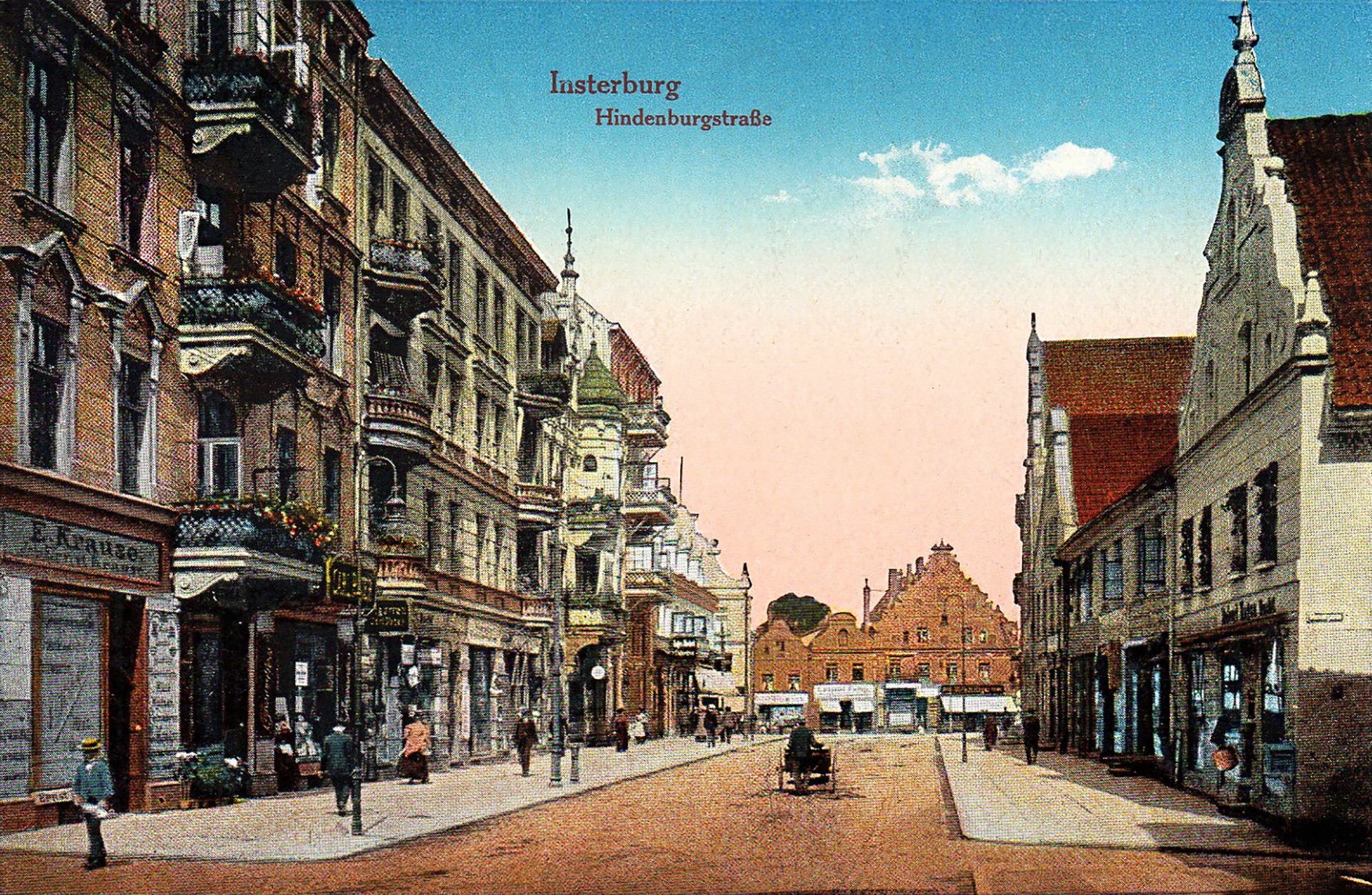
Chernyakhovsk (; German: Insterburg) is a town in Kaliningrad Oblast, Russia, and the administrative center of Chernyakhovsky District. Located at the confluence of the Instruch and Angrapa rivers, which unite to become the Pregolya river below Chernyakhovsk, the town had a population in 2017 of 36,423. History Medieval period Insterburg was founded in 1337 by the Teutonic Knights on the site of a former Old Prussian fortification when Dietrich von Altenburg, the Grand Master of the Teutonic Knights, built a castle called ''Insterburg'' following the Prussian Crusade. During the Teutonic Knights' Northern Crusades campaign against the Grand Duchy of Lithuania, the town was devastated in 1376. The castle had been rebuilt as the seat of a Procurator and a settlement also named ''Insterburg'' grew up to serve it. In 1454, Polish King Casimir IV Jagiellon incorporated the region to the Kingdom of Poland upon the request of the anti-Teutonic Prussian Confederation. During the ... [...More Info...] [...Related Items...] OR: [Wikipedia] [Google] [Baidu] |
Ozyorsk, Kaliningrad Oblast
Ozyorsk (, until 1938 ; ; ; from 1938 to 1946 ) is a town and the administrative center of Ozyorsky District in Kaliningrad Oblast, Russia, located on the Angrapa River near the border with the Polish Warmian-Masurian Voivodeship, southeast of Kaliningrad, the administrative center of the oblast. Population: History Before the arrival of the Teutonic Order, the river valley was here settled by the Nadruvians, as evidenced by traces of settlements and fortifications found in the area. Teutonic overlordship was established around 1388, but the town is mentioned for the first time in written sources in 1539 as ''Darkyem''. In 1454, the region was incorporated by King Casimir IV Jagiellon to the Kingdom of Poland upon the request of the anti-Teutonic Prussian Confederation. After the subsequent Thirteen Years' War, since 1466, it formed part of Poland as a fief held by the Teutonic Order, and after 1525 it was located in Ducal Prussia, a vassal duchy of Poland. It was settled b ... [...More Info...] [...Related Items...] OR: [Wikipedia] [Google] [Baidu] |
Old Prussian Language
Old Prussian is an extinct West Baltic language belonging to the Baltic branch of the Indo-European languages, which was once spoken by the Old Prussians, the Baltic peoples of the Prussian region. The language is called Old Prussian to avoid confusion with the German dialects of Low Prussian and High Prussian and with the adjective ''Prussian'' as it relates to the later German state. Old Prussian began to be written down in the Latin alphabet in about the 13th century, and a small amount of literature in the language survives. In modern times, there has been a revival movement of Old Prussian, and there are families which use Old Prussian as their first language. Classification Old Prussian is an Indo-European language belonging to the Baltic branch. It is considered to be a Western Baltic language. Old Prussian was closely related to the other extinct West Baltic languages, namely Sudovian, West Galindian and possibly Skalvian and Old Curonian. Other linguists co ... [...More Info...] [...Related Items...] OR: [Wikipedia] [Google] [Baidu] |
Węgorzewo
Węgorzewo (until 1946 ; ) is a tourist town on the Angrapa River in northeastern Poland, within the historical region of Masuria. It is the seat of Węgorzewo County in the Warmian-Masurian Voivodeship and is located not far from the border with Russia's Kaliningrad Oblast. Lake Mamry is close to the town. Etymology The town's names in different languages are derived from local names for European eels, which used to live in the area in great numbers. The German name ''Angerburg'' () is derived from the Old Prussian word for eel, ''Anger'', which the German Teutonic Knights appropriated after conquering the Old Prussians. The Polish name ''Węgorzewo'' (and the older ''Węgobork'') is derived from ''Węgorz'', while the local Lithuanian names ''Ungura'' and ''Unguris'' comes from ''Ungurys''. A Lithuanian variation is ''Angerburgas''. History Beginnings The town was first mentioned in a 1335 chronicle as ''Angirburg'', or "eel castle", a settlement of the Teutonic Knigh ... [...More Info...] [...Related Items...] OR: [Wikipedia] [Google] [Baidu] |


