|
Wallasey
Wallasey () is a town in the Metropolitan Borough of Wirral, Merseyside, England. It is at the mouth of the River Mersey, on the north-eastern corner of the Wirral Peninsula. It lies within the Historic counties of England, historic county boundaries of Cheshire, and became part of Merseyside in 1974. At the 2021 United Kingdom census, 2021 Census, the built up area as defined by the Office for National Statistics had a population of 85,610. History Toponymy The name of Wallasey originates from the Old English word ''Walh'', meaning a Briton, a Welshman, which is also the origin of the name Wales. The suffix ''-ey'' denotes an island or area of dry land. Originally the higher ground now occupied by Wallasey was separated from the rest of Wirral by the creek known as Wallasey Pool (which later became the docks), the marshy areas of Bidston, Bidston Moss and Leasowe, and sand dunes along the coast. Early history The area was sparsely populated before the 19th century and horse ... [...More Info...] [...Related Items...] OR: [Wikipedia] [Google] [Baidu] |
Wallasey (UK Parliament Constituency)
Wallasey is a Constituencies of the Parliament of the United Kingdom, constituency in Merseyside created in 1918 and represented in the House of Commons of the United Kingdom, House of Commons of the UK Parliament since 1992 United Kingdom general election, 1992 by Angela Eagle, a member of the Labour Party (UK), Labour Party. Boundaries Historic 1918–1950: The County (United States), County Borough of Wallasey. 1950–1983: As prior but with redrawn boundaries. 1983–2010: The Metropolitan Borough of Wirral wards of Leasowe, Liscard, Moreton, New Brighton, Seacombe, and Wallasey. ''The constituency boundaries remained unchanged.'' 2010–2024: The Metropolitan Borough of Wirral wards of Leasowe and Moreton East, Liscard, Moreton West and Saughall Massie, New Brighton, Seacombe, and Wallasey. The constituency's borders remain unchanged. ;Minor 2010 boundary reform and abortive proposals The Boundary Commission for England, Boundary Commission initially proposed the abo ... [...More Info...] [...Related Items...] OR: [Wikipedia] [Google] [Baidu] |
Wallasey Village
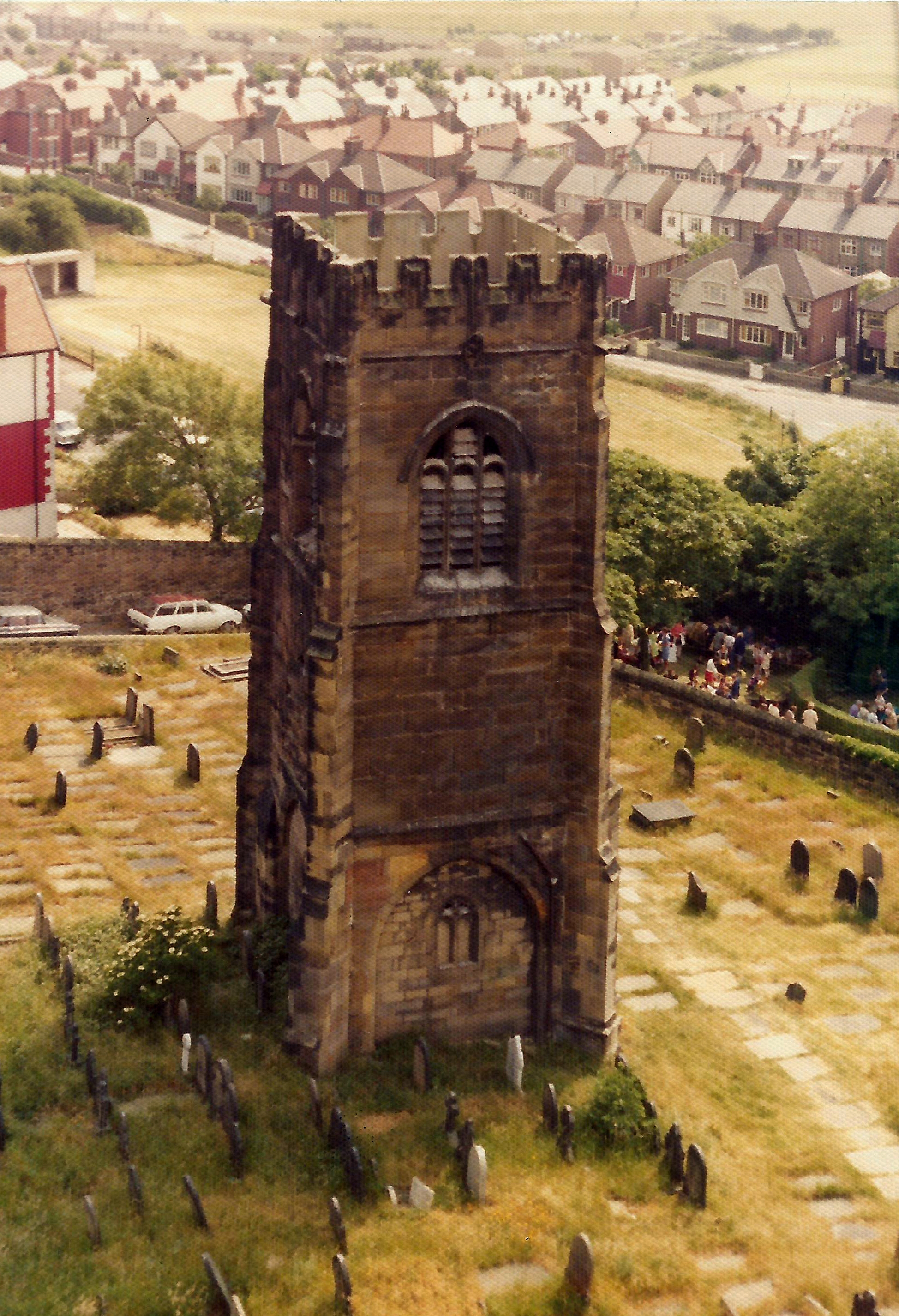
Wallasey Village is a district and suburb of Wallasey, in the Metropolitan Borough of Wirral, England. At the 2001 Census the population of the area was 8,550. Wallasey Village is the most westerly suburb of Wallasey and borders the other suburbs of New Brighton to the north east, Liscard to the east and Poulton to the south east. Further west is Leasowe, and to the north, beyond Harrison Park, is the King's Parade fronting Liverpool Bay. The Wirral Show used to be held on the extensive grassed areas - known as "the Dips" along this promenade, to the west of New Brighton. History St Hilary's Church may date back to the earliest days of Christianity in Britain. There are just eight churches in Britain named after the Bishop of Poitiers, St. Hilary, who contributed to the First Council of Nicaea in 325 AD, and it is thought that they were founded by St Germanus, who was invited from France as a missionary by the 5th-century English church. The tower is all that remains of ... [...More Info...] [...Related Items...] OR: [Wikipedia] [Google] [Baidu] |
Mersey Ferry
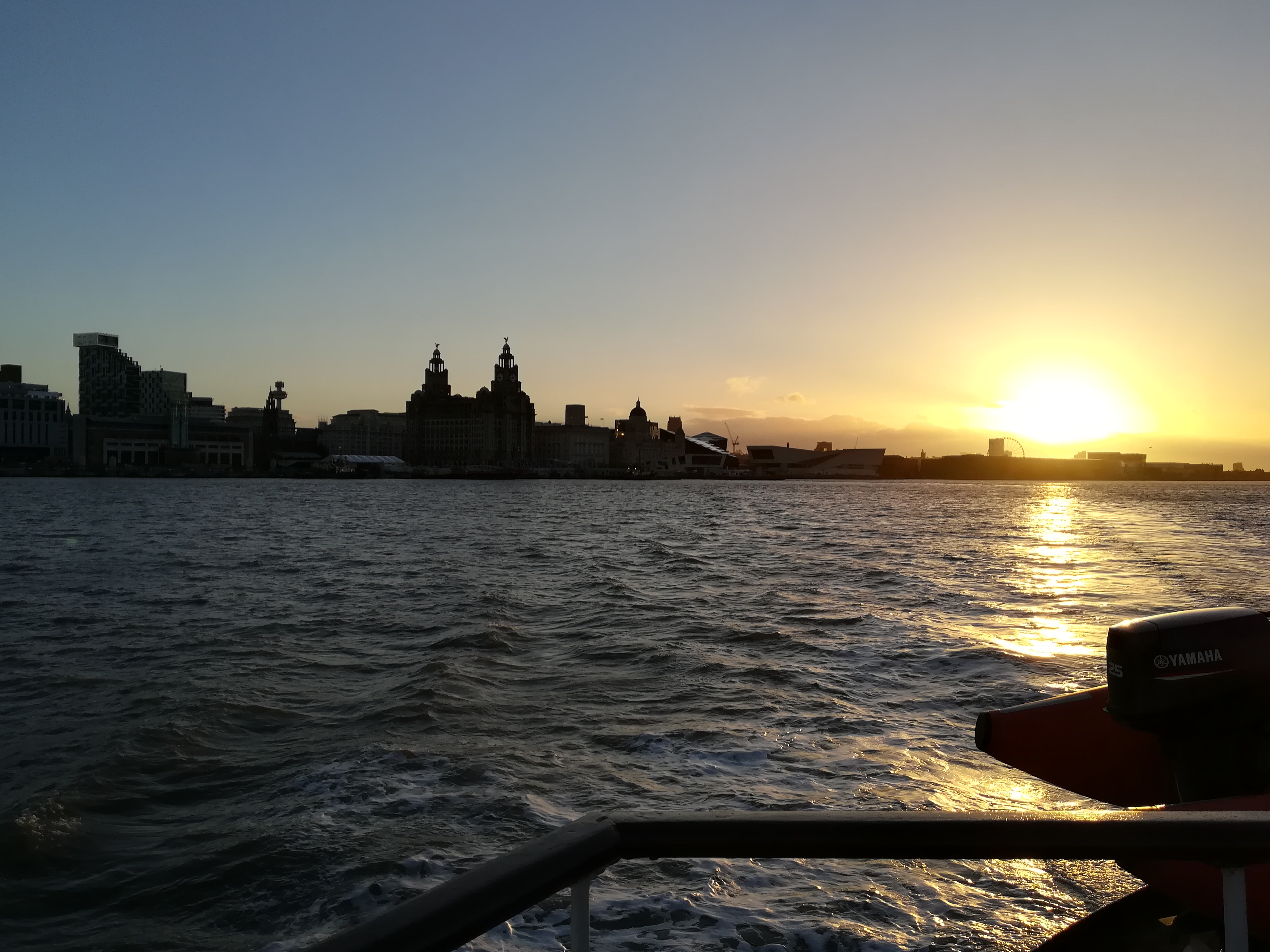
The Mersey Ferry is a ferry service operating on the River Mersey in northwest England, between Liverpool to the east and Birkenhead and Wallasey on the Wirral Peninsula to the west. Ferries have been used on this route since at least the 12th century and continue to be popular for both local people and visitors. The current fleet consists of two vessels. A third ferry, '' Royal Daffodil'' was in service until 2012. The current ferries originally came into service in the 1960s and were named ''Mountwood'' and ''Woodchurch''. Both ferries have been extensively refurbished and renamed '' Royal Iris of the Mersey'' and '' Snowdrop''. The ferries share the workload of cross-river ferrying, charter cruises and the Manchester Ship Canal cruise. The service is operated by Merseytravel, under the "Mersey Ferries" brand. History Medieval ferries In about 1150, the Benedictine Priory at Birkenhead was established. The monks used to charge a small fare to row passengers across the r ... [...More Info...] [...Related Items...] OR: [Wikipedia] [Google] [Baidu] |
St Hilary's Church, Wallasey
St Hilary's Church is in the town of Wallasey, Wirral, Merseyside, England. It consists of a church built in 1858–59 and the separate tower of a former medieval church. Both the church and the tower are recorded in the National Heritage List for England as designated Grade II listed buildings. The church is an active Anglican parish church in the diocese of Chester, the archdeaconry of Chester and the deanery of Wallasey. History The present building is believed to be the sixth church on the site. The first church is thought to have been built in Saxon times and was probably built of timber and of which there is no trace. Several stones have been found of a Norman structure on the site. It is thought that a new church was built between 1162 and 1182 by William de Waley. This was rebuilt and a tower added during the reigns of Edward I and Edward II. The next rebuilding was in the age of Henry VIII when the tower of 1530 was reconstructed. In 17 ... [...More Info...] [...Related Items...] OR: [Wikipedia] [Google] [Baidu] |
Liscard
Liscard is an area of the town of Wallasey, in the Metropolitan Borough of Wirral, Merseyside, England. The most centrally located of Wallasey's townships, it is the main shopping area of the town, with many shops located in the Cherry Tree Shopping Centre. At the 2001 United Kingdom census, 2001 census the population of Liscard (ward), Liscard local government ward was recorded at 15,510, increasing to 15,574 at the 2011 United Kingdom census, 2011 census. History The first mention of the settlement was circa 1260 as ''Lisnekarke''. The name is from Welsh ''Llys carreg'', with the name meaning "hall at the rock" or "...cliff". In the past the name has been spelt as ''Liscak'' (1260), ''Lisecair'' (c.1277), ''Lysenker'' (1295) and ''Lyscart'' (1417). Liscard was formerly a Township (England), township and chapelry in the parish of Wallasey, in the Wirral Hundred, in 1866 Liscard became a separate civil parish, on 1 April 1912 the parish was abolished and merged with Wallase ... [...More Info...] [...Related Items...] OR: [Wikipedia] [Google] [Baidu] |
Wallasey Town Hall
Wallasey Town Hall is a municipal building on Brighton Street in Wallasey, Merseyside, England. The town hall, which was the headquarters of Wirral Council until 2023, is a Grade II* listed building. History In the early 20th century, Wallasey urban district council, which had been created in 1894, was based in council offices in Church Street. After population growth, largely associated with the tourism, Wallasey became a municipal borough in 1910 and then a county borough in 1913. Civic leaders decided to procure a town hall: after a long debate, during which sites at Liscard and in Rake Lane were also considered, the site they selected was one which had been occupied by a mansion known as Northmead House. The foundation stone for the new building was laid by George V, King George V, who was accompanied by Mary of Teck, Queen Mary, on 25 March 1914. It was designed by Arnold Thornely, Briggs, Wolstenholme & Thornely in the Neoclassical architecture, Neoclassical style and bu ... [...More Info...] [...Related Items...] OR: [Wikipedia] [Google] [Baidu] |
Leasowe
Leasowe () is a village in the Metropolitan Borough of Wirral, Merseyside, England. Located on the north coast of the Wirral Peninsula, it is approximately to the west of Wallasey. Historically within Cheshire, Leasowe was part of the old County Borough of Wallasey. It is now within the Leasowe and Moreton East Ward of the Metropolitan Borough of Wirral. Leasowe is also part of the parliamentary constituency of Wallasey. At the 2001 census, Leasowe had a population of 6,180. By the time of the 2011 census, specific figures for Leasowe were no longer maintained; the total population of the Leasowe and Moreton East ward was 14,640. History The name ''Leasowex'' comes from the Anglo-Saxon ''Leasowes'' or ''Meadow Pastures''; its sand dunes are the largest such system on the Wirral. Much of the area is at or below sea level and is protected by the coastal embankment. Houses built in the early 20th century were often flooded and unsanitary but, after about 1926, new roads and ... [...More Info...] [...Related Items...] OR: [Wikipedia] [Google] [Baidu] |
Wallasey Pool
Wallasey Pool was a natural tidal inlet of water that separated the towns of Wallasey and Birkenhead on the Wirral Peninsula, England. Originally flowing directly into the River Mersey, it was converted into the sophisticated Birkenhead Dock system from the 1820s onwards by land reclamation, with the main portion of the pool becoming known as the Great Float. In 1933, with the exception of a small lake, the head of Wallasey Pool at Poulton was converted into Bidston Dock. By 2003, this dock had been filled in. Redevelopment A new development was approved for Birkenhead docks in 2010. The Wirral Waters development will transform the docklands area into business, leisure and retail facilities. Bridges Four road bridges cross the former Wallasey Pool, over what is now Birkenhead Docks: Egerton Bridge is situated between Egerton Dock and Morpeth Dock and is a bascule bridge. It was built between 1928 and 1931, replacing an earlier hydraulic swing bridge. The bridge and the mach ... [...More Info...] [...Related Items...] OR: [Wikipedia] [Google] [Baidu] |
Wirral Peninsula
The Wirral Peninsula (), known locally as the Wirral, is a peninsula in North West England. The roughly rectangular peninsula is about long and wide, and is bounded by the Dee Estuary to the west, the Mersey Estuary to the east, and Liverpool Bay to the north. Historically, the Wirral was wholly in Cheshire; in the Domesday Book, its border with the rest of the county was placed at "two arrow falls from Chester city walls". However, since the Local Government Act 1972, only the southern third has been in Cheshire, with almost all the rest lying in the Metropolitan Borough of Wirral, Merseyside. An area of saltmarsh and reclaimed land adjoining the south-west of the peninsula lies in the Welsh county of Flintshire. Toponymy The name Wirral literally means " myrtle corner", from the Old English , a myrtle tree, and , an angle, corner or slope. It is supposed that the land was once overgrown with bog myrtle, a plant no longer found in the area, but plentiful around Form ... [...More Info...] [...Related Items...] OR: [Wikipedia] [Google] [Baidu] |
Poulton, Merseyside
Poulton is an area of the town of Wallasey, in the Metropolitan Borough of Wirral, Merseyside, England. It is located on the Wirral Peninsula and bordered by Liscard to the north, Egremont to the north east and Seacombe to the east. The West Float (part of the former Wallasey Pool which gave the area its name), is to the south. History The name is Old English in origin and derives from ''pōl'', meaning "pool" and ''tún'', "a farm or settlement". Originally a small fishing and farming hamlet, Poulton developed in the 19th century through the expansion of the docks and associated industries, becoming part of Poulton cum Seacombe before the two areas split. The settlement was part of the Wallasey parish of the Wirral Hundred, becoming a civil parish in 1866 and then part of the County Borough of Wallasey in 1912. The population of Poulton-cum-Seacombe was 178 in 1801, 3,044 in 1851, and 20,749 in 1901. The area was served from 1895 by Liscard and Poulton railway station on th ... [...More Info...] [...Related Items...] OR: [Wikipedia] [Google] [Baidu] |
Metropolitan Borough Of Wirral
The Metropolitan Borough of Wirral is a metropolitan borough of Merseyside, in North West England. It has a population of (), and encompasses of the northern part of the Wirral Peninsula. Major settlements include Birkenhead, Wallasey, Bebington, Heswall, Hoylake and West Kirby. It is one of the six boroughs of the Liverpool City Region, a combined authority area with a population of more than 1.5 million. Wirral is England's westernmost metropolitan borough, faced by the Liverpool, City of Liverpool to the northeast over the River Mersey. Geography Bordering is the River Mersey to the east, the Irish Sea to the north and the River Dee, Wales, River Dee to the west; the borough of Cheshire West and Chester occupies the remainder of the Wirral Peninsula and borders the borough of Wirral to the south. History The borough was formed on 1 April 1974, under the Local Government Act 1972, as a merger of the county boroughs of Birkenhead and Wallasey, along with the municipal bo ... [...More Info...] [...Related Items...] OR: [Wikipedia] [Google] [Baidu] |
Seacombe
Seacombe () is a district of the town of Wallasey, on the Wirral Peninsula, England. Administratively, Seacombe is a ward of the Metropolitan Borough of Wirral in Merseyside. Before local government reorganisation on 1 April 1974, it was part of the County Borough of Wallasey, within the geographical county of Cheshire. At the 2001 Census, the population of Seacombe was 15,158, (7,081 males and 8,077 females), increasing to 15,387 (7,554 males, 7,833 females) at the Census 2011. History Seacombe is mentioned in the Domesday Book of 1086 as Seccum. In 1845 George Turnbull was the civil engineer who designed and built the Seacombe Wall sea defence that helped drain the marshes behind the town. Seacombe was originally a terminus for the Wirral Railway; however, passenger services ended on 4 January 1960 and all services on the line terminated on 16 June 1963. Much of the line to Seacombe station was used as the approach road to the Kingsway Tunnel. Geography Seacombe i ... [...More Info...] [...Related Items...] OR: [Wikipedia] [Google] [Baidu] |


