|
Vorderer Tajakopf
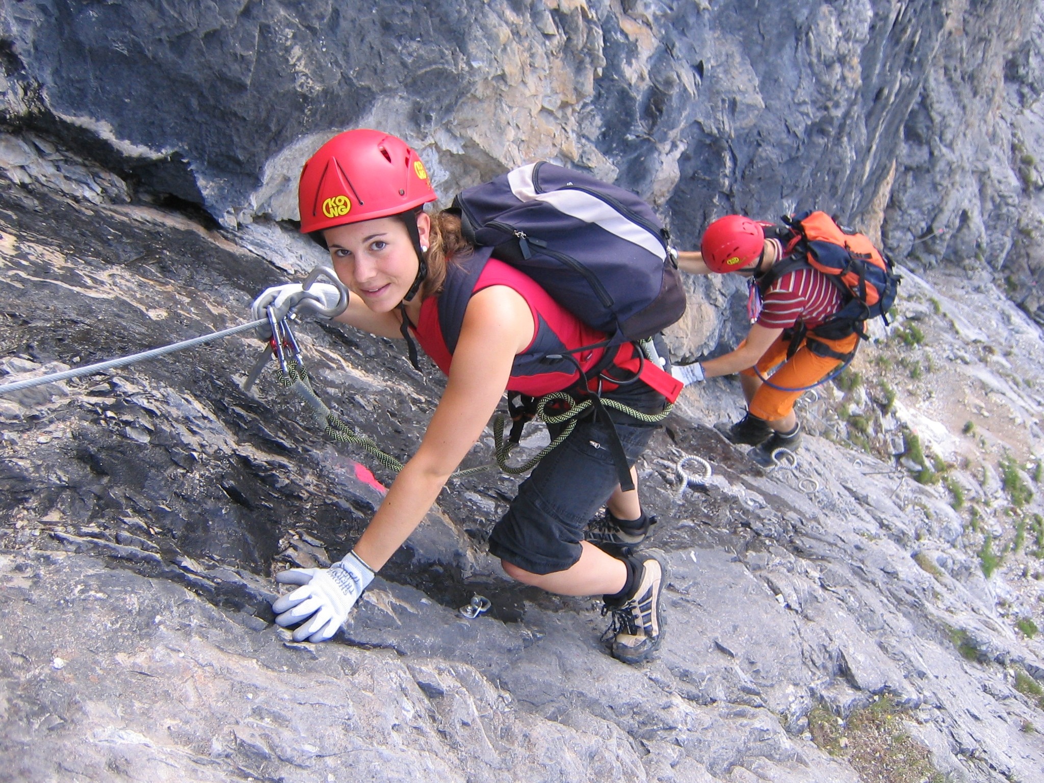
The Vorderer Tajakopf is a 2,450-metre-high mountain in the Mieming Chain in the Austrian state of Tyrol. The normal route to the summit runs from the Coburger Hut (1,917 m) over the ''Vorderes Tajatörl'' and the south arête. More recently the Vorderer Tajakopf has been climbed more frequently up a challenging klettersteig A via ferrata (Italian for "iron path", plural ''vie ferrate'' or in English ''via ferratas'') is a protected climbing route found in the Alps and certain other Alpine locations. The protection includes steel fixtures such as cables and railing ... laid out in 2000 along the west arête. The neighbouring Hinterer Tajakopf (2,408 m) is accessible via the Vorderer Tajatörl on the ''Coburger Klettersteig'' or from the Hinterer Tajatörl. Literature * Rudolf Wutscher: ''Mieminger Kette. Ein Führer für Täler, Hütten und Berge'' (= '' Alpine Club Guide. Ostalpen.''). Published iaw the guidelines of the UIAA. Bergverlag Rother, Munich, 1989, ... [...More Info...] [...Related Items...] OR: [Wikipedia] [Google] [Baidu] |
Seebensee
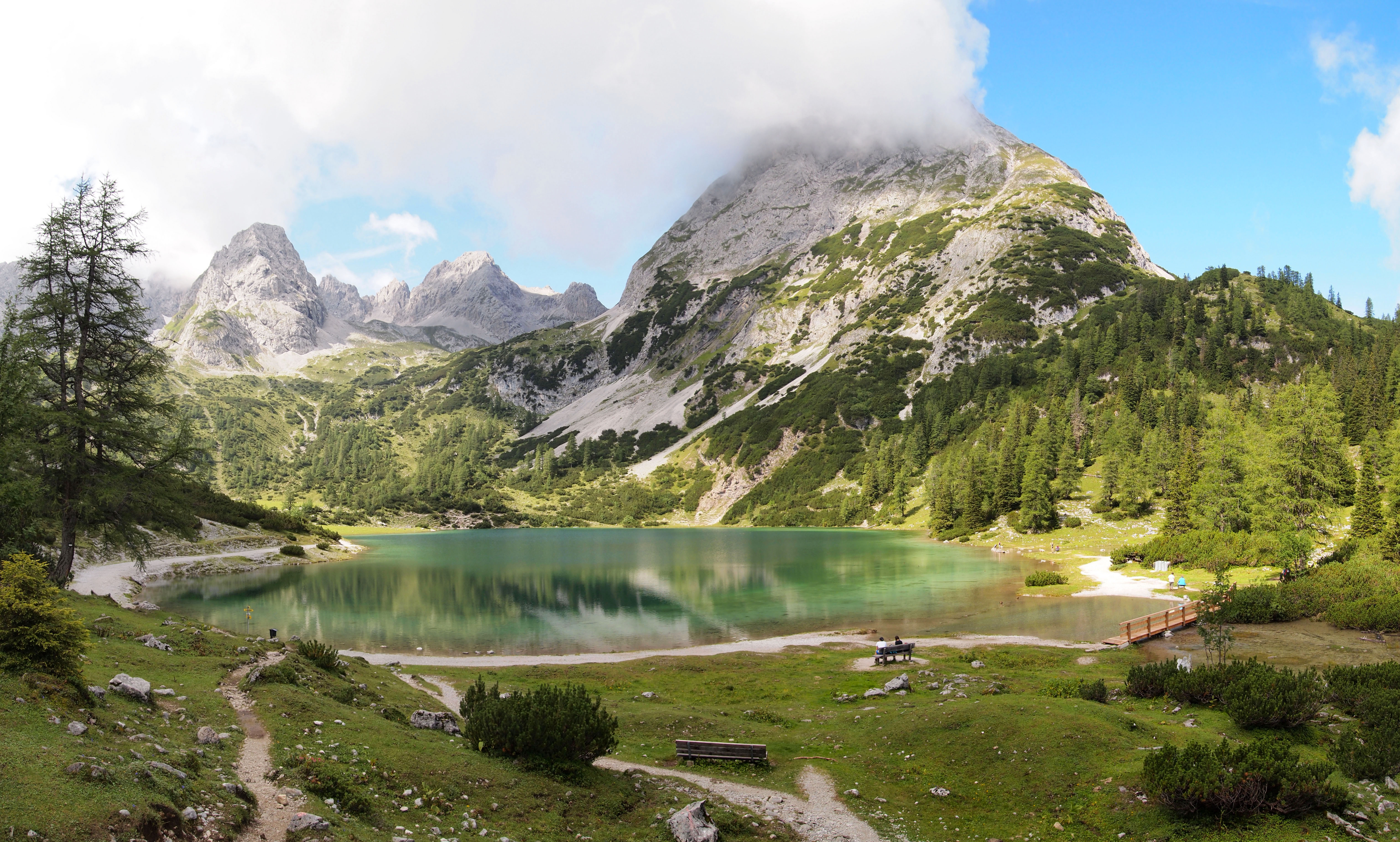
The Seebensee is a natural high mountain lake (an ice-age affected, rock basin lake) at a height of 1,657 metres, south of Ehrwald in the Mieming Range. It is surrounded by the Vorderer Tajakopf in the east, the Vorderer Drachenkopf in the south and the Ehrwalder Sonnenspitze in the west. The Seebensee has no significant above-ground inflows and one outflow via the Seebenbach Falls and the Geißbach into the Loisach river. The lake may be reached from Ehrwald on a forest track via the Ehrwalder Alm, via the Coburger Hut#Seeben Klettersteig, Seeben Klettersteig, a difficult klettersteig, or via one of the two protected mountain trails ''Coburger Hütte#Hoher Gang, Hoher Gang'' or ''Coburger Hütte#Immensteig, Immensteig''. From Biberwier, the lake may be reached via the arête of the Biberwierer Scharte, and from Leutasch through the Gaistal valley. Near the lake (to the northeast) lies the managed alpine pasture of Seebenalm. To the south on a rock terrace above the lake is the ... [...More Info...] [...Related Items...] OR: [Wikipedia] [Google] [Baidu] |
Mieming Chain
The Mieming(er) Range, Mieminger Chain () or Mieminger Mountains (''Mieminger Gebirge''), is a mountain range of the Northern Limestone Alps in the Eastern Alps. It is located entirely in Austria within the state of Tyrol (Bundesland), Tyrol. This sub-group is somewhat in the shadows of its more famous neighbour, the Wetterstein Mountains, Wetterstein to the north. Whilst the region around the Coburger Hut and the lakes of Seebensee and Drachensee in the west (Ehrwalder Sonnenspitze and Vorderer Tajakopf with its new ''klettersteig'' over the Tajakante) and the Hohe Munde in the extreme east receive large numbers of visitors, the less developed central area remains very quiet. The Hohe Munde is also a popular and challenging ski touring destination. Public transport links: The Außerfern Railway stops at Ehrwald on the western side of the range. Busses run from Leutasch on the southern side of the mountains to Mittenwald and Seefeld in Tirol. Geology The Mieminger Mountain ... [...More Info...] [...Related Items...] OR: [Wikipedia] [Google] [Baidu] |
Tyrol (state)
Tyrol ( ; ; ) is an Austrian Provinces of Austria, federal state. It comprises the Austrian part of the historical County of Tyrol, Princely County of Tyrol. It is a constituent part of the present-day Euroregion Tyrol–South Tyrol–Trentino (together with South Tyrol and Trentino in Italy). The capital of Tyrol is Innsbruck. Geography Tyrol is separated into two parts, divided by a strip of Salzburg (federal state), Salzburg State. The two constituent parts of Tyrol are the northern and larger North Tyrol () and the southeastern and smaller East Tyrol ('). Salzburg State lies to the east of North Tyrol, while on the south Tyrol has a border to the Italy, Italian province of South Tyrol, which was part of the Austro-Hungarian Empire before the First World War. With a land area of , Tyrol is the third-largest federal state in Austria. North Tyrol shares its borders with the federal states Salzburg in the east and Vorarlberg in the west. In the north, it adjoins the Germany ... [...More Info...] [...Related Items...] OR: [Wikipedia] [Google] [Baidu] |
Austria
Austria, formally the Republic of Austria, is a landlocked country in Central Europe, lying in the Eastern Alps. It is a federation of nine Federal states of Austria, states, of which the capital Vienna is the List of largest cities in Austria, most populous city and state. Austria is bordered by Germany to the northwest, the Czech Republic to the north, Slovakia to the northeast, Hungary to the east, Slovenia and Italy to the south, and Switzerland and Liechtenstein to the west. The country occupies an area of and has Austrians, a population of around 9 million. The area of today's Austria has been inhabited since at least the Paleolithic, Paleolithic period. Around 400 BC, it was inhabited by the Celts and then annexed by the Roman Empire, Romans in the late 1st century BC. Christianization in the region began in the 4th and 5th centuries, during the late Western Roman Empire, Roman period, followed by the arrival of numerous Germanic tribes during the Migration Period. A ... [...More Info...] [...Related Items...] OR: [Wikipedia] [Google] [Baidu] |
Wetterstein Limestone
The Wetterstein Formation is a regional geologic formation of the Northern Limestone Alps and Western Carpathians extending from southern Bavaria, Germany in the west, through northern Austria to northern Hungary and western Slovakia in the east. The formation dates back to the Ladinian to Carnian stages of the Late Triassic. The formation is named after the Wetterstein Mountains in southern Germany and northwestern Austria. The center of its distribution is in the Karwendel Mountains. It occurs in the Northern and Southern Limestone Alps and in the Western Carpathians. The formation is composed of mostly reefal limestones and dolomites, the latter the result of widespread diagenesis. In many areas there is a frequent alternation of limestone and dolomite facies. Local variants to indicate the Wetterstein Formation include (Wetterstein Limestone), Wettersteindolomit ("Wetterstein Dolomite") and combinations thereof. The Wetterstein Formation reaches a maximum thickness of wit ... [...More Info...] [...Related Items...] OR: [Wikipedia] [Google] [Baidu] |
Schwierigkeitsskala (Klettern)
Many climbing routes have grades for the technical difficulty, and in some cases for the risks, of the route. The first ascensionist can suggest a grade but it will be amended for the ''consensus view'' of subsequent ascents. While many countries with a tradition of climbing developed their own grading systems, a small number of grading systems have become internationally dominant for each type of climbing, and which has led to the standardization of grading worldwide. Over the years, grades have consistently risen in all forms of climbing, helped by improvements in climbing technique and equipment. In free climbing (i.e. climbing rock routes with no aid), the most popular grading systems are the French numerical or sport system (e.g. f7c+), the American YDS system (e.g. 5.13a), and latterly the UIAA scale (e.g. IX+). These systems grade technical difficulty being the main focus of the lower-risk activity of sport climbing. The American system adds an R/X suffix to tradi ... [...More Info...] [...Related Items...] OR: [Wikipedia] [Google] [Baidu] |
Normal Route
A normal route or normal way (; ) is the most frequently used climbing route for ascending and descending a given mountain peak; it is usually the easiest and often the most straightforward route. Other generic names include the ''Tourism, tourist route'' or ''trade route'', and some climbing routes have specific 'normal route' names such as the "Yak Route" on Mount Everest. References Hiking Climbing terminology {{Climbing-stub ... [...More Info...] [...Related Items...] OR: [Wikipedia] [Google] [Baidu] |
Coburger Hut
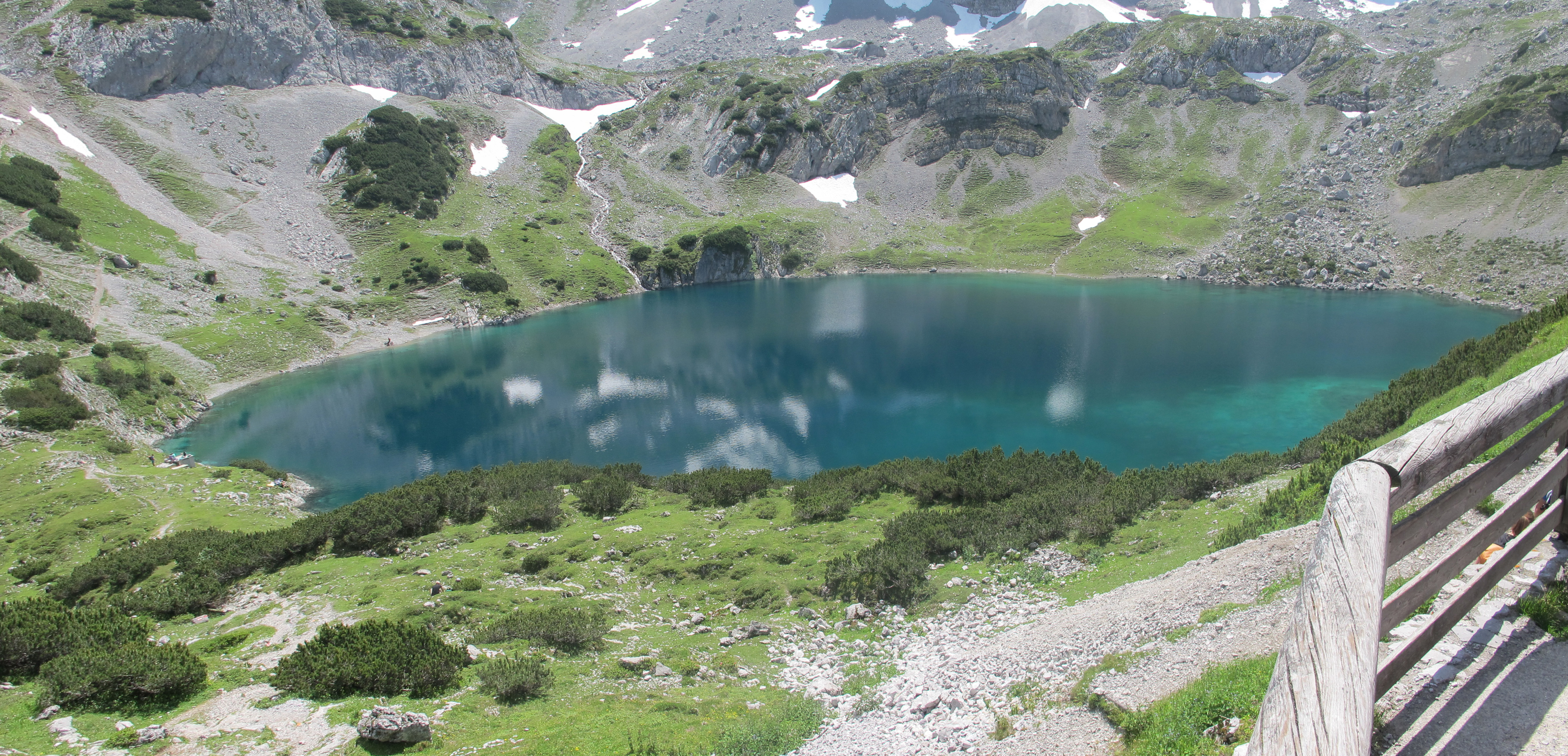
The Coburger Hut () is an Alpine hut owned by the Coburg Branch of the German Alpine Club. It is located in the Mieming Range in the Austrian state of Tyrol (state), Tyrol and lies only a few metres in height above the lake of Drachensee (Ehrwald), Drachensee. The accommodation is generally open from June to early October and there is a winter room. History The construction of the hut was originally proposed by the Munich alpinist, Ferdinand Kilger, in 1890. This was taken up in 1895 by the German Alpine Club's Coburg branch, established in 1879. In 1901 the first hut was completed and, in the years that followed, it was given a water connexion (the "drinking quality water" was drawn from the Grünsteinsee, a lake which has now dried out), an electrical generator and, in 1908, a telephone line. After the First World War the building was extended for the first time and, in 1962, the material ropeway was built. For the 75th anniversary of the hut a new toilet block was built. O ... [...More Info...] [...Related Items...] OR: [Wikipedia] [Google] [Baidu] |
Arête
An arête ( ; ) is a narrow ridge of rock that separates two valleys. It is typically formed when two glaciers erode parallel U-shaped valleys. Arêtes can also form when two glacial cirques erode headwards towards one another, although frequently this results in a saddle-shaped pass, called a col. The edge is then sharpened by freeze-thaw weathering, and the slope on either side of the arête steepened through mass wasting events and the erosion of exposed, unstable rock. The word ''arête'' is French for "edge" or "ridge"; similar features in the Alps are often described with the German equivalent term ''Grat''. Where three or more cirques meet, a pyramidal peak is created. Cleaver A cleaver is a type of arête that separates a unified flow of glacial ice from its uphill side into two glaciers flanking, and flowing parallel to, the ridge, analogous to an exposed mid-channel bar in a braided river. Cleaver gets its name from the way it resembles a meat cleaver slicin ... [...More Info...] [...Related Items...] OR: [Wikipedia] [Google] [Baidu] |
Klettersteig
A via ferrata (Italian for "iron path", plural ''vie ferrate'' or in English ''via ferratas'') is a protected climbing route found in the Alps and certain other Alpine locations. The protection includes steel fixtures such as cables and railings to arrest the effect of any fall, which the climber can either hold onto or clip into using climbing protection. Some via ferratas can also include steel fixtures that provide aid in overcoming the obstacles encountered, including steel ladders and steel steps. Description A via ferrata is a climbing route in the mountains that employs steel cables, rungs, or ladders, fixed to the rock to which the climbers affix a harness with two leashes, which allows the climbers to secure themselves to the metal fixture and limit any fall. The cable and other fixtures, such as iron rungs (stemples), pegs, carved steps, and ladders and bridges, provide both footings and handholds, as well. This allows climbing on otherwise dangerous routes without ... [...More Info...] [...Related Items...] OR: [Wikipedia] [Google] [Baidu] |
Hinterer Tajakopf
The Hinterer Tajakopf is a mountain, high, in the Mieming Range in the Austrian state of Tyrol. The Hintere Tajakopf may be ascended from the Coburger Hut () via the ''Hinteres Tajatörl'' () to the south and the south arête. Alternatively the Coburger Klettersteig runs to the top from the ''Vorderen Tajatörl'' to the north. This ascent is frequently combined with the klettersteig on the Vorderer Tajakopf () to the north of the Vorderes Tajatörl. West of the summit at just under are the remains of an abandoned mine. In the area around the Coburger Hut, lead and zinc ore was mined until the 20th century. On the actual summit is only a small wooden cross. A few meters away on a smooth rocky ridge, accessible via a short, protected passage, is a large summit cross with a summit register A summit book or summit register is a record of visitors to the summit of a mountain. It is usually enclosed in a weatherproof, animal-proof metal casing. Some books are maintained in an i ... [...More Info...] [...Related Items...] OR: [Wikipedia] [Google] [Baidu] |


