|
Coburger Hut
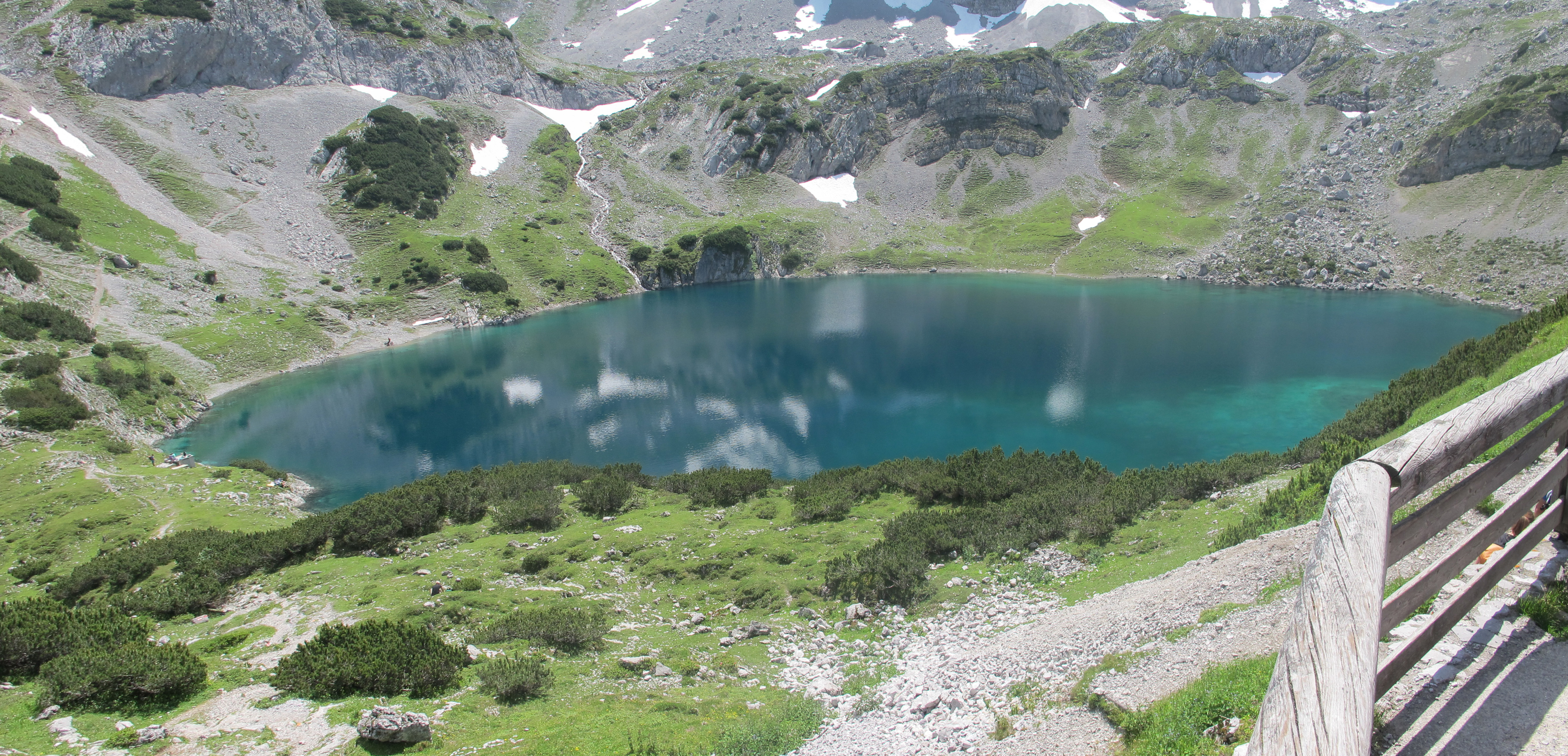
The Coburger Hut (german: Coburger Hütte) is an Alpine hut owned by the Coburg Branch of the German Alpine Club. It is located in the Mieming Range in the Austrian state of Tyrol and lies only a few metres in height above the lake of Drachensee. The accommodation is generally open from June to early October and there is a winter room. History The construction of the hut goes back to a proposal by the Munich alpinist, Ferdinand Kilger, in 1890. This was taken up in 1895 by the Coburg branch of the German Alpine Club, a branch which had been founded in 1879. In 1901 the first hut was finished and, in the years that followed, it was given a water connexion (the "drinking quality water" was drawn from the Grünsteinsee, a lake which has now dried out), an electrical generator and, in 1908, a telephone line. After the First World War the building was extended for the first time and, in 1962, the material ropeway was built. For the 75th anniversary of the hut a new toilet block ... [...More Info...] [...Related Items...] OR: [Wikipedia] [Google] [Baidu] |
Mieming Chain
The Mieming(er) Range, Mieminger Chain (german: Mieminger Kette) or Mieminger Mountains (''Mieminger Gebirge''), is a mountain range of the Northern Limestone Alps in the Eastern Alps. It is located entirely in Austria within the state of Tyrol. This sub-group is somewhat in the shadows of its more famous neighbour, the Wetterstein to the north. Whilst the region around the Coburger Hut and the lakes of Seebensee and Drachensee in the west ( Ehrwalder Sonnenspitze and Vorderer Tajakopf with its new ''klettersteig'' over the Tajakante) and the Hohe Munde in the extreme east receive large numbers of visitors, the less developed central area remains very quiet. The Hohe Munde is also a popular and challenging ski touring destination. Public transport links: The Außerfern Railway stops at Ehrwald on the western side of the range. Busses run from Leutasch on the southern side of the mountains to Mittenwald and Seefeld in Tirol. Geology The Mieminger Mountains lie in a par ... [...More Info...] [...Related Items...] OR: [Wikipedia] [Google] [Baidu] |
Seebensee
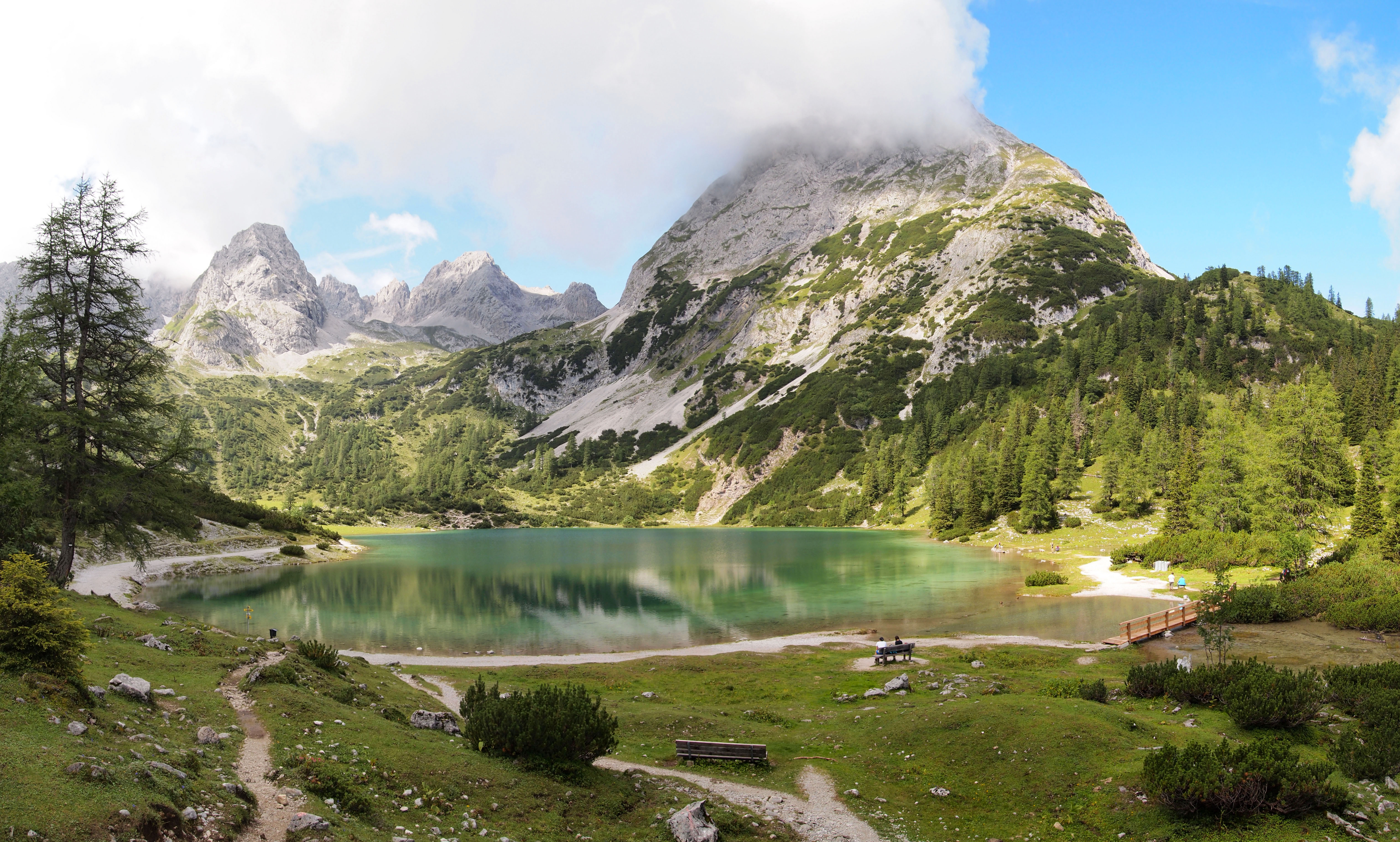
The Seebensee is a natural high mountain lake (an ice-age affected, rock basin lake) at a height of 1,657 metres, south of Ehrwald in the Mieming Range. It is surrounded by the Vorderer Tajakopf in the east, the Vorderer Drachenkopf in the south and the Ehrwalder Sonnenspitze in the west. The Seebensee has no significant above-ground inflows and one outflow via the Seebenbach Falls and the Geißbach into the Loisach river. The lake may be reached from Ehrwald on a forest track via the Ehrwalder Alm, via the Seeben Klettersteig, a difficult klettersteig, or via one of the two protected mountain trails '' Hoher Gang'' or '' Immensteig''. From Biberwier, the lake may be reached via the arête of the Biberwierer Scharte, and from Leutasch through the Gaistal valley. Near the lake (to the northeast) lies the managed alpine pasture of Seebenalm. To the south on a rock terrace above the lake is the Coburger Hut owned by the German Alpine Club. The surface of the lake covers around ... [...More Info...] [...Related Items...] OR: [Wikipedia] [Google] [Baidu] |
Knorr Hut
The Knorr Hut is a mountain hut belonging to the German Alpine Club and located in the Wetterstein Mountains at a height of 2,052 m. Its lies right on the edge of the ''Zugspitzplatt'' where it drops into the Reintalanger in a location with scenic views and is an important base for hikers who can climb up to it on the normal route from the town of Garmisch-Partenkirchen through the Reintal valley to Germany's highest mountain, the Zugspitze. The Knorr Hut is rated as category I, and belongs to the Munich Section of the German Alpine Club (DAV). History The Knorr Hut was built by 1855 as a small, rude refuge hut, the merchant, Angelo Knorr, contributing ''"a significant sum of money"'' towards it. By 1860 the hut had become run down, because ''"the maintenance of the same had been paid little attention"''. Finally the Munich Section of the newly founded German Alpine Club took over the hut. As well as the section itself, ''"the Royal District Office of Werdenfels, as well ... [...More Info...] [...Related Items...] OR: [Wikipedia] [Google] [Baidu] |
Wampeter Schrofen
Cat's cradle is a game involving the creation of various string figures between the fingers, either individually or by passing a loop of string back and forth between two or more players. The true origin of the name is debated, though the first known reference is in ''The light of nature pursued'' by Abraham Tucker in 1768. The type of string, the specific figures, their order, and the names of the figures vary. Independent versions of this game have been found in indigenous cultures throughout the world, including in Africa, Eastern Asia, the Pacific Islands, Australia, the Americas, and the Arctic. Play The simplest version of the game involves a player using a long string loop to make a complex figure using their fingers and hands. Another version of the game consists of two or more players making a sequence of string figures, each altering the figure made by the previous player. The game begins with one player making the eponymous figure ''Cat's Cradle'' (above). A ... [...More Info...] [...Related Items...] OR: [Wikipedia] [Google] [Baidu] |
Hinterer Tajakopf
The Hinterer Tajakopf is a mountain, 2,408 metres high, in the Mieming Range in the Austrian state of Tyrol. The Hintere Tajakopf may be ascended from the Coburger Hut (1,917 m) via the ''Hinteres Tajatörl'' (2,259 m) to the south and the south arête. Alternatively the Coburger Klettersteig runs to the top from the ''Vorderen Tajatörl'' to the north. This ascent is frequently combined with the klettersteig on the Vorderer Tajakopf (2,450 m) to the north of the Vorderes Tajatörl. West of the summit at just under 2,300 metres are the remains of an abandoned mine. In the area around the Coburger Hut lead and zinc ore was mined until the 20th century. On the actual summit is only a small wooden cross. A few metres away on a smooth rocky ridge, accessible via a short, protected passage, is a large summit cross with a summit register. Gipfelkreuz Hinterer Tajakopf.jpeg, Cross, west of the summit, with Wampeter Schrofen Gipfelkreuz Hinterer Tajakopf, 24 ... [...More Info...] [...Related Items...] OR: [Wikipedia] [Google] [Baidu] |
Ehrwalder Sonnenspitze
The Sonnenspitze, also Ehrwalder Sonnenspitze, is a mountain, high, in the Mieming Chain in the Austrian state of Tyrol with a subpeak, the ''Signalgipfel'' (2,412 m) to the south. An ascent of the Sonnenspitze is one of the most popular tours of the Mieming Chain. Location The Sonnenspitze lies south of the village of Ehrwald on the north-westernmost end of the Mieming Chain. To the west lies the village of Biberwier, to the east is the 1,657 m high lake of Seebensee. To the south over the col of ''Biberwierer Scharte'' (2,000 m) is the Wampeter Schrofen (2,520 m). Ascents The summit may be ascended from the Coburger Hut (1,917 m) on an easy, but in places exposed climb (in places UIAA II) up its south side. The way is marked and secured with anchors and several pitons as intermediate belay points. In places the waymarks are hard to spot, which is why a good sense of direction for the ascent is essential. At the top there is another very narrow a ... [...More Info...] [...Related Items...] OR: [Wikipedia] [Google] [Baidu] |
Vorderer Tajakopf
The Vorderer Tajakopf is a 2,450-metre-high mountain in the Mieming Chain in the Austrian state of Tyrol. The normal route to the summit runs from the Coburger Hut (1,917 m) over the ''Vorderes Tajatörl'' and the south arête. More recently the Vorderer Tajakopf has been climbed more frequently up a challenging klettersteig laid out in 2000 along the west arête. The neighbouring Hinterer Tajakopf (2,408 m) is accessible via the Vorderer Tajatörl on the ''Coburger Klettersteig'' or from the Hinterer Tajatörl. Literature * Rudolf Wutscher: ''Mieminger Kette. Ein Führer für Täler, Hütten und Berge'' (= ''Alpine Club Guide The ''Alpine Club Guides'' (german: Alpenvereinsführer, commonly shortened to ''AV Führer'' or ''AVF'') are the standard series of Alpine guides that cover all the important mountain groups in the Eastern Alps. They are produced jointly by the Ge .... Ostalpen.''). Published iaw the guidelines of the UIAA. Bergverlag Rother, Munich, 1989, , pp ... [...More Info...] [...Related Items...] OR: [Wikipedia] [Google] [Baidu] |
Obsteig
Obsteig is a municipality in the Imst district and is located 15 km northeast of Imst and 3 km above Mötz. The village has 14 parts and is a popular area for skiing Skiing is the use of skis to glide on snow. Variations of purpose include basic transport, a recreational activity, or a competitive winter sport. Many types of competitive skiing events are recognized by the International Olympic Committee .... Main sources of income is Winter tourism. Population References External links Cities and towns in Imst District {{Tyrol-geo-stub ... [...More Info...] [...Related Items...] OR: [Wikipedia] [Google] [Baidu] |
Biberwier
Biberwier is a municipality with 612 inhabitants (as of 1 January 2019) in the district of Reutte in the Austrian state of Tyrol. The municipality is located in the district court Reutte. Geography The village is located on the southern edge of the Lermooser Moos, between a mountain slope and the landslide landscape of the Fern Pass in the Tyrolean Alps. The municipality is crossed by the Loisach, which springs west of the village. The community is located near the border with Germany on the edge of the Wetterstein Mountains and is visible from the Zugspitze. History The name derives from beavers, who have demonstrably lived in the municipality until 1800 and arrived back in recent years. Corpus of finds from the Roman period bear witness to the early importance of the place on the Via Claudia Augusta. The track grooves at the northern entrance, though referred to as Roman, are from Medieval times. From the Middle Ages to the year 1921, at the ''Silberleithe'', there was ... [...More Info...] [...Related Items...] OR: [Wikipedia] [Google] [Baidu] |


