|
Urubamba, Peru
Urubamba (possibly from in the Quechua spelling ''Urupampa'', flat land of spiders) is a small town in Peru, located near the Urubamba River under the snow-capped mountain Chicón. It is the capital of the district of the same name. Located one hour from Cusco, Urubamba is the largest town in the Sacred Valley of the Incas. It is also located near a number of significant ruins of the Inca Empire, including Machu Picchu. The sparse remains of the Inca palace, Quispiguanca, are within the town. Tourists often come through the town on their way to visit these sites. Geography Urubamba is located in the Highlands of Peru. It is regarded as a good location to go to acclimate to the elevation to prevent altitude sickness prior to going more popular tourist destinations like Cusco. Economy There is a popular market selling fresh fruit and vegetables and also pots, pans, and other essential items. As social workers/volunteers visit the city often, the main market does cater to ... [...More Info...] [...Related Items...] OR: [Wikipedia] [Google] [Baidu] |
Urubamba River
The Urubamba River or Vilcamayo River (possibly from Quechua ''Willkamayu'', for "sacred river") is a river in Peru. Upstream it is called Vilcanota River (possibly from Aymara ''Willkanuta'', for "house of the sun"). Within the La Convención Province, the name changes to Urubamba. A partially navigable headwater of the Amazon River, the Urubamba rises in the Andes to the southeast of Cusco. It originates on the slopes of Cunurana in the Puno Region, Melgar Province, near the La Raya pass. It flows north-north-west for before coalescing with the Tambo River to form the Ucayali River. The Urubamba is divided into the Upper Urubamba and the Lower Urubamba, the dividing feature being the Pongo de Mainique, an infamous whitewater canyon, where the river narrows to a width of 45 metres (148 ft). Upper Urubamba The Upper Urubamba (''Alto Urubamba'') valley features a high population and extensive irrigation works. A number of ruins of the Inca Empire The Inca Empir ... [...More Info...] [...Related Items...] OR: [Wikipedia] [Google] [Baidu] |
Machu Picchu
Machu Picchu is a 15th-century Inca citadel located in the Eastern Cordillera of southern Peru on a mountain ridge at . Often referred to as the "Lost City of the Incas", it is the most familiar icon of the Inca Empire. It is located in the Machupicchu District within the Urubamba Province above the Sacred Valley, which is northwest of the city of Cusco. The Urubamba River flows past it, cutting through the Cordillera and creating a canyon with a subtropical mountain climate. The Inca civilization had no written language and following the first encounter by the Spanish soldier Baltasar Ocampo, no Europeans are recorded to have visited the site from the late 16th century until the 19th century. As far as historical knowledge extends, there are no existing written records detailing the site during its period of active use. The leading theory is that Machu Picchu was a private city for Incan royalty. The names of the buildings, their supposed uses, and their inhabitants, ... [...More Info...] [...Related Items...] OR: [Wikipedia] [Google] [Baidu] |
PeruRail
PeruRail is a railway operator providing tourist, freight, and charter services in southern Peru. It was founded in 1999 by two Peruvian entrepreneurs and the British company Sea Containers. The main line between the port of Matarani, Arequipa, Cusco and Puno on Lake Titicaca was formerly known as the Ferrocarril del Sur (Peru Southern Railway), and was for a time owned and operated by the Empresa Nacional de Ferrocarriles del Peru, ENAFER state company. It is the third highest railway in the world after the Qinghai–Tibet Railway to Tibet and the Ferrocarril Central Andino, FCCA line from Lima to Huancayo, and is the longest line in Peru. From Cusco, PeruRail provides passenger services on the Track gauge, gauge Ferrocarril Santa Ana to Aguas Calientes, Peru, Aguas Calientes, delivering tourists for Machu Picchu. It operates in a 50/50 joint venture between Belmond Limited and Peruvian Trains and Railways, owned by two Peruvian entrepreneurs; Lorenzo Sousa Debarbieri is the ... [...More Info...] [...Related Items...] OR: [Wikipedia] [Google] [Baidu] |
Urubamba Peru- Bus Station
Urubamba (possibly from Quechua for "spider's plain") may refer to: Places * Urubamba Province, Peru ** Urubamba District *** Urubamba, Peru * Urubamba River, in Peru * Urubamba Valley, Peru * Urubamba mountain range, Peru ** Veronica (mountain) Veronica, also called Huacrahuilki ("horn pass"), Huacay Huilcay, Wayna Willka, Waqaywillka, Urubamba ("spider's plain"), or Padre Eterno, is a mountain in the Urubamba mountain range in the Andes of Peru. It is located in the Cusco Region, La ..., in Urubamba mountain range Music * Urubamba (band), a South-American music group that recorded with Paul Simon {{disambiguation, geo ... [...More Info...] [...Related Items...] OR: [Wikipedia] [Google] [Baidu] |
Alpaca
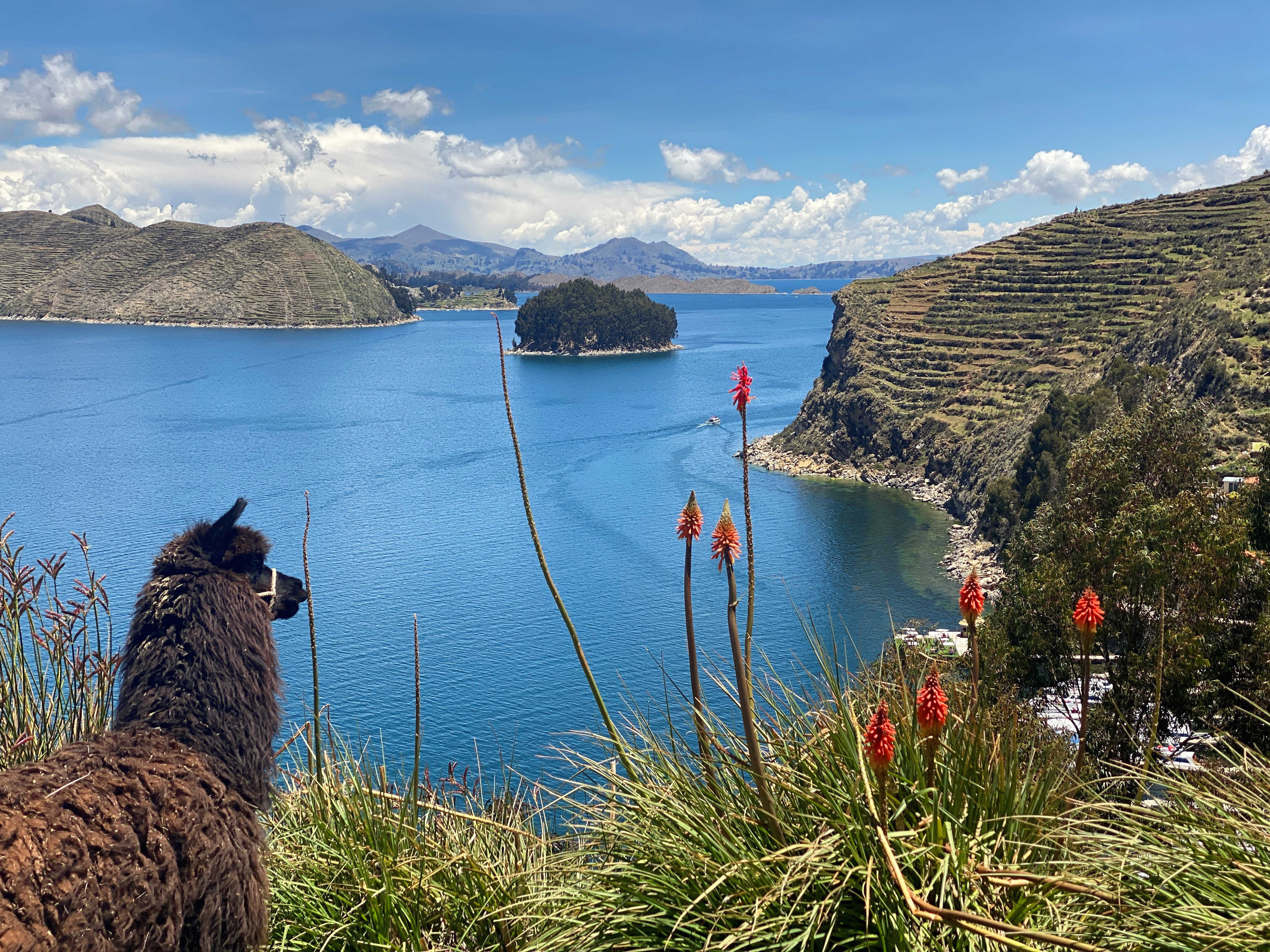
The alpaca (''Lama pacos'') is a species of South American camelid mammal. Traditionally, alpacas were kept in herds that grazed on the level heights of the Andes of Southern Peru, Western Bolivia, Ecuador, and Northern Chile. More recently, alpacas may be found on farms and ranches worldwide, with thousands of animals born and raised annually. Alpacas are especially popular in North America, Europe, and Australia. There are two modern breeds of alpaca, separated based on their respective region of endemism and fiber (wool) type: the Suri alpaca and the Huacaya alpaca. Both breeds produce a highly valued fiber, with Suri alpaca's fiber growing in straight "locks," while Huacaya fiber has a "crimped," wavy texture and grows in bundles. These breeds' fibers are used for making knitted and woven items, similar to sheep's wool. Alpacas are visually and genetically similar to, and often confused with a relative species, the llamas; however, alpacas are visibly shorter and pr ... [...More Info...] [...Related Items...] OR: [Wikipedia] [Google] [Baidu] |
Altitude Sickness
Altitude sickness, the mildest form being acute mountain sickness (AMS), is a harmful effect of high altitude, caused by rapid exposure to low amounts of oxygen at high elevation. People's bodies can respond to high altitude in different ways. Symptoms of altitude sickness may include headaches, vomiting, tiredness, confusion, trouble sleeping, and dizziness. Acute mountain sickness can progress to high-altitude pulmonary edema (HAPE) with associated shortness of breath or high-altitude cerebral edema (HACE) with associated confusion. Chronic mountain sickness may occur after long-term exposure to high altitude. Altitude sickness typically occurs only above , though some people are affected at lower altitudes. Risk factors include a prior episode of altitude sickness, a high degree of activity, and a rapid increase in elevation. Being physically fit does not decrease the risk. Diagnosis is based on symptoms and is supported for those who have more than a minor reduction ... [...More Info...] [...Related Items...] OR: [Wikipedia] [Google] [Baidu] |
Quispiguanca
Quispiguanca, also Q'espihuanca and Q'espiwanka, was a royal estate of the Inca emperor Huayna Capac (c. 1464–1525 CE). The ruins of the estate are located in the northern part of the present-day town of Urubamba, Peru at an elevation of . Background Inca emperors customarily acquired large royal estates to increase their power and wealth and that of their descendants who inherited the estates. Royal estates served as elegant country palaces and, at times, fortresses to fend off rivals for power. The ruins of other royal estates, notably Huchuy Qosqo and Machu Picchu are scattered up and down the Urubamba or Yucay Valley, commonly called the Sacred Valley. The Sacred Valley was a popular area for royal estates. It was within about of the Inca capital of Cuzco, but at lower elevations and with a warmer climate. Maize, the prestige crop of the Incas, could be grown in the Sacred Valley, whereas the climate nearer Cuzco was mostly too cold for maize cultivation. The Sacr ... [...More Info...] [...Related Items...] OR: [Wikipedia] [Google] [Baidu] |
Inca Empire
The Inca Empire, officially known as the Realm of the Four Parts (, ), was the largest empire in pre-Columbian America. The administrative, political, and military center of the empire was in the city of Cusco. The History of the Incas, Inca civilisation rose from the Peruvian highlands sometime in the early 13th century. The Portuguese explorer Aleixo Garcia was the first European to reach the Inca Empire in 1524. Later, in 1532, the Spanish Empire, Spanish began the conquest of the Inca Empire, and by 1572 Neo-Inca State, the last Inca state was fully conquered. From 1438 to 1533, the Incas incorporated a large portion of western South America, centered on the Andes, Andean Mountains, using conquest and peaceful assimilation, among other methods. At its largest, the empire joined modern-day Peru with what are now western Ecuador, western and south-central Bolivia, northwest Argentina, the southwesternmost tip of Colombia and Incas in Central Chile, a large portion of modern- ... [...More Info...] [...Related Items...] OR: [Wikipedia] [Google] [Baidu] |
Regions Of Peru
According to the ''Organic Law of Regional Governments'', the regions () are, with the departments, the first-level semi autonomous administrative subdivisions of Peru. Since its Peruvian War of Independence, 1821 independence, Peru had been divided into departments of Peru, departments (Regions) Peru’s 24 departments each have a regional government and legislature responsible for administration, economic planning, and public services. These governments operate with autonomy while still coordinating with national authorities. Each department is led by a regional governor, who is elected by popular vote for a four-year term. The governor is responsible for implementing regional policies, managing budgets, and overseeing infrastructure projects. Supporting the governor is the regional legislative council, composed of elected representatives from different provinces within the department. This council approves budgets, monitors public investments, and ensures government accountab ... [...More Info...] [...Related Items...] OR: [Wikipedia] [Google] [Baidu] |
Sacred Valley
The Sacred Valley of the Incas (; ), or the Urubamba Valley, is a valley in the Andes of Peru, north of the Inca capital of Cusco. It is located in the present-day Peruvian region of Cusco. In colonial documents it was referred to as the "Valley of Yucay". The Sacred Valley was incorporated slowly into the incipient Inca Empire during the period from 1000 to 1400. The Sacred Valley is a major tourist destination. In 2019, 1.6 million people, the majority non-Peruvians, visited Machu Picchu, its most famous archaeological site. Many of the same tourists also visited other archaeological sites and modern towns in the Sacred Valley. Stretching from Pisac to Ollantaytambo, this fertile valley is irrigated by the Urubamba River. The Chanapata civilisation first utilised this area starting at around 800 BCE because of its rich soil used for agriculture. The Qotacalla civilization lived in the Sacred Valley from 500 to 900 CE. The Killke civilization then flourished in the Sacred ... [...More Info...] [...Related Items...] OR: [Wikipedia] [Google] [Baidu] |


