|
USS Ariel (1862)
USS ''Ariel'' was a captured Confederate schooner acquired by the Union Navy from the prize court during the American Civil War. She was put into service by the Union Navy to patrol navigable waterways of the Confederate States of America, Confederacy to prevent the South from trading with other countries. Service history Early in the Civil War—a small, privately owned schooner—worked out of Mobile, Alabama, under Confederate papers as a blockade runner. Few details of these operations have been found; but we do know that, on the night of 11 October 1862, she succeeded in slipping through the Federal blockade off Mobile Bay and sailed to Cuba laden with cotton. After arriving at Havana, Cuba, six days later, she delivered her cargo and filled up with lead, tin, medicine, wine, coffee, and other items needed by the South. On the evening of 14 November, as she was attempting to return to Mobile, ''Ariel'' was detected and captured by the Union screw steamer USS Huntsville ( ... [...More Info...] [...Related Items...] OR: [Wikipedia] [Google] [Baidu] |
Flagship
A flagship is a vessel used by the commanding officer of a group of navy, naval ships, characteristically a flag officer entitled by custom to fly a distinguishing flag. Used more loosely, it is the lead ship in a fleet of vessels, typically the first, largest, fastest, most heavily armed, or best known. Over the years, the term "flagship" has become a metaphor used in industries such as broadcasting, automobiles, education, technology, airlines, and retail to refer to their highest quality, best known, or most expensive products and locations. Naval use In common naval use, the term ''flagship'' is fundamentally a temporary designation; the flagship is wherever the admiral's flag is being flown. However, admirals have always needed additional facilities, including a meeting room large enough to hold all the captains of the fleet and a place for the admiral's staff to make plans and draw up orders. Historically, only larger ships could accommodate such requirements. The ter ... [...More Info...] [...Related Items...] OR: [Wikipedia] [Google] [Baidu] |
Florida
Florida ( ; ) is a U.S. state, state in the Southeastern United States, Southeastern region of the United States. It borders the Gulf of Mexico to the west, Alabama to the northwest, Georgia (U.S. state), Georgia to the north, the Atlantic Ocean to the east, the Straits of Florida to the south, and The Bahamas to the southeast. About two-thirds of Florida occupies a peninsula between the Gulf of Mexico and the Atlantic Ocean. It has the List of U.S. states by coastline, longest coastline in the contiguous United States, spanning approximately , not including its many barrier islands. It is the only state that borders both the Gulf of Mexico and the Atlantic Ocean. With a population of over 23 million, it is the List of U.S. states and territories by population, third-most populous state in the United States and ranks List of states and territories of the United States by population density, seventh in population density as of 2020. Florida spans , ranking List of U.S. states ... [...More Info...] [...Related Items...] OR: [Wikipedia] [Google] [Baidu] |
Chassahowitzka River
The Chassahowitzka River is a spring-fed river located in southwestern Citrus County, Florida. The U.S. Geological Survey. National Hydrography Dataset high-resolution flowline dataThe National Map, accessed April 18, 2011 river is home to hundreds of bird species, including the bald eagle, and serves as a common refuge for the West Indian manatee. In 1941, approximately of its saltwater creeks, freshwater tributaries, and hardwood hammocks were designated as Chassahowitzka National Wildlife Refuge. The river is accessible by boat from a nearby public boat ramp located at a campground that also bears its Indian name which means "land of hanging pumpkins"—a reference to a wild variety that once grew along its banks. The headwater of the river is Chassahowitzka Spring, a first-magnitude spring visible from the campground dock.Chassahowitzka River' Southwest Florida Water Management District. Retrieved on 2010-10-08. A group of smaller sister springs are located in a creek ... [...More Info...] [...Related Items...] OR: [Wikipedia] [Google] [Baidu] |
Charlotte Harbor, Florida
Charlotte Harbor is a census-designated place (CDP) in Charlotte County, Florida, United States. The name Charlotte Harbor also refers to Charlotte Harbor (estuary) and Charlotte Harbor Preserve State Park, a preserve with of shoreline along Charlotte Harbor in Charlotte County. The population of Charlotte Harbor was 3,784 in 2020, up from 3,710 at the 2010 census. It is part of the Punta Gorda, Florida Metropolitan Statistical Area and included in the North Port-Bradenton, Florida Combined Statistical Area. Geography Charlotte Harbor is located at (26.963897, -82.062267) on the north bank of the Peace River, the main tidal inlet to the Charlotte Harbor estuary, itself an arm of the Gulf of Mexico. U.S. Route 41, the Tamiami Trail, crosses the Peace River between Charlotte Harbor and Punta Gorda via the Barron Collier Bridge (northbound) and the Gilchrist Bridge (southbound). According to the United States Census Bureau The United States Census Bureau, offici ... [...More Info...] [...Related Items...] OR: [Wikipedia] [Google] [Baidu] |
Gulf Of Mexico
The Gulf of Mexico () is an oceanic basin and a marginal sea of the Atlantic Ocean, mostly surrounded by the North American continent. It is bounded on the northeast, north, and northwest by the Gulf Coast of the United States; on the southwest and south by the Mexican states of Tamaulipas, Veracruz, Tabasco, Campeche, Yucatán, and Quintana Roo; and on the southeast by Cuba. The coastal areas along the Southern U.S. states of Texas, Louisiana, Mississippi, Alabama, and Florida, which border the Gulf on the north, are occasionally referred to as the "Third Coast" of the United States (in addition to its Atlantic and Pacific coasts), but more often as "the Gulf Coast". The Gulf of Mexico took shape about 300 million years ago (mya) as a result of plate tectonics. The Gulf of Mexico basin is roughly oval and is about wide. Its floor consists of sedimentary rocks and recent sediments. It is connected to part of the Atlantic Ocean through the Straits of Florida between the ... [...More Info...] [...Related Items...] OR: [Wikipedia] [Google] [Baidu] |
Bahamas
The Bahamas, officially the Commonwealth of The Bahamas, is an archipelagic and island country within the Lucayan Archipelago of the Atlantic Ocean. It contains 97 per cent of the archipelago's land area and 88 per cent of its population. It comprises more than 3,000 islands, cays and islets in the Atlantic Ocean, and is located north of Cuba and north-west of the island of Hispaniola (split between the Dominican Republic and Haiti) and the Turks and Caicos Islands, southeast of the U.S. state of Florida and east of the Florida Keys. The capital and largest city is Nassau on the island of New Providence. The Royal Bahamas Defence Force describes the Bahamas' territory as encompassing of ocean space. The Bahama islands were inhabited by the Arawak and Lucayans, a branch of the Arawakan- speaking Taíno, for many centuries. Christopher Columbus was the first European to see the islands, making his first landfall in the "New World" in 1492 when he landed on the ... [...More Info...] [...Related Items...] OR: [Wikipedia] [Google] [Baidu] |
New Providence Island
New Providence is the most populous island in The Bahamas, containing more than 70% of the total population. On the eastern side of the island is the national capital city of Nassau; it had a population of 246,329 at the 2010 Census, and a population of 292,522 at the 2022 census. Nearly three quarters of The Bahamas's population lives in New Providence. The island was originally under Spanish control following Christopher Columbus's purported discovery of the New World, but the Spanish government showed little interest in developing the island (and The Bahamas as a whole). Nassau, the island's largest city, was formerly known as Charles-town, but it was burned to the ground by the Spanish in 1684. It was laid out and renamed Nassau in 1695 by Nicholas Trott, the most successful Lord Proprietor, in honour of the Prince of Orange-Nassau who became William III of England. The three branches of Bahamian Government: the executive, the legislative, and the judiciary, are all h ... [...More Info...] [...Related Items...] OR: [Wikipedia] [Google] [Baidu] |
Nassau, Bahamas
Nassau ( ) is the capital and largest city of The Bahamas. It is on the island of New Providence, which had a population of 246,329 in 2010, or just over 70% of the entire population of The Bahamas. As of April 2023, the preliminary results of the 2022 census of The Bahamas reported a population of 296,522 for New Providence, 74.26% of the country's population. Nassau is commonly defined as a primate city, dwarfing all other towns in the country. It is the centre of commerce, education, law, administration, and media of the country. Lynden Pindling International Airport, the major airport for The Bahamas, is located about west of the city centre of Nassau, and has daily flights to and from major cities in Canada, the Caribbean, the United Kingdom and the United States. Nassau is the site of the House of Assembly and various judicial departments and was considered historically to be a stronghold of pirates. The city was named in honour of William III of England, Prince of Or ... [...More Info...] [...Related Items...] OR: [Wikipedia] [Google] [Baidu] |
Turpentine
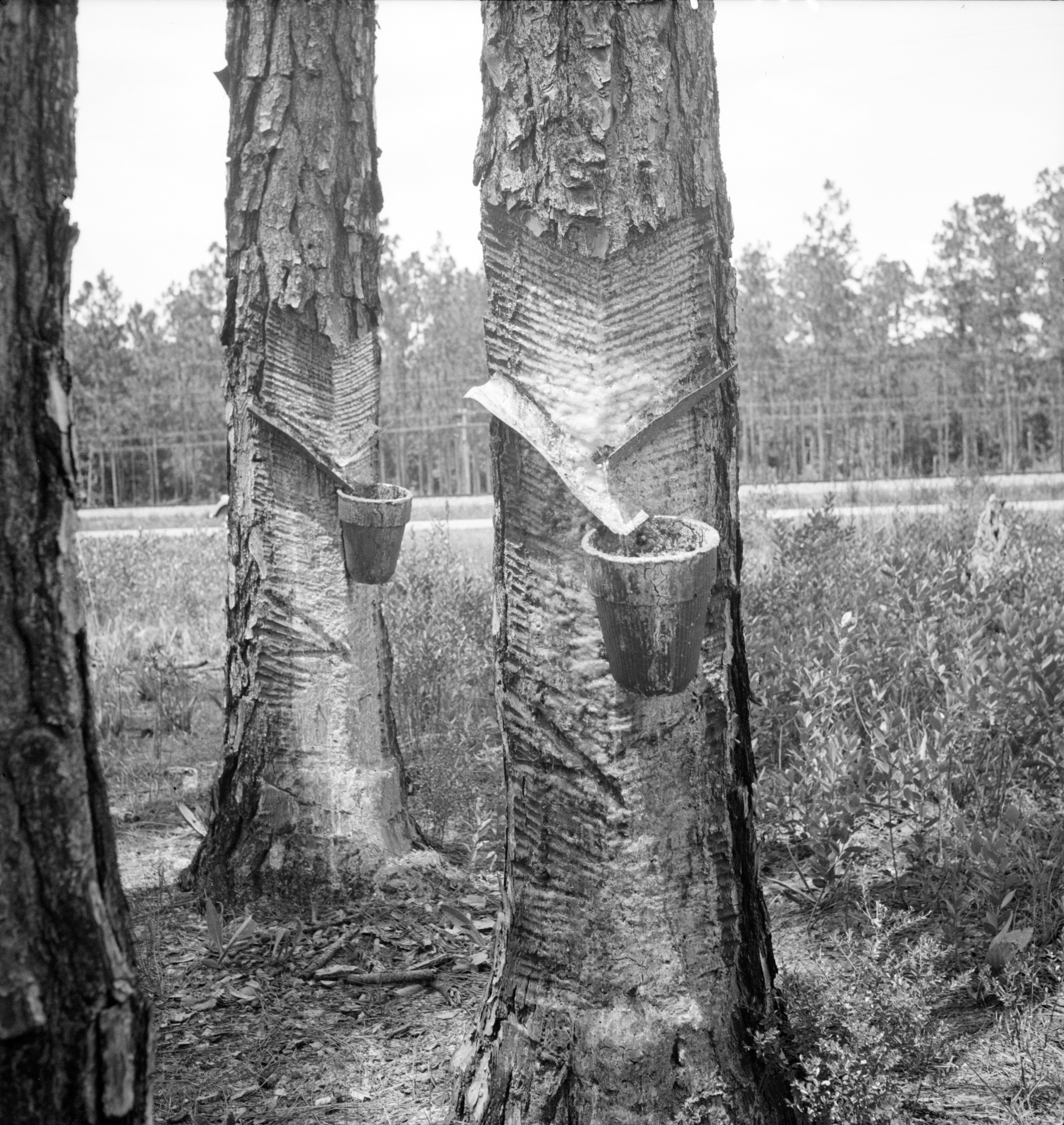
Turpentine (which is also called spirit of turpentine, oil of turpentine, terebenthine, terebenthene, terebinthine and, colloquially, turps) is a fluid obtainable by the distillation of resin harvested from living trees, mainly pines. Principally used as a specialized solvent, it is also a source of material for Organic synthesis, organic syntheses. Turpentine is composed of terpenes, primarily the monoterpenes alpha-Pinene, alpha- and beta-Pinene, beta-pinene, with lesser amounts of carene, camphene, limonene, and terpinolene.Kent, James A. ''Riegel's Handbook of Industrial Chemistry'' (Eighth Edition) Van Nostrand Reinhold Company (1983) p.569 Nowadays, turpentine is rarely the product of distillation of pine resin, but is a byproduct of pulping. Pulping is achieved by two processes, the Kraft process and the sulfite process. The turpentines obtained from these two processes differ in their chemical compositions. The sulfite process gives a product that is rich in cymene, w ... [...More Info...] [...Related Items...] OR: [Wikipedia] [Google] [Baidu] |
New Smyrna, Florida
New Smyrna Beach is a city in Volusia County, Florida, United States, located on the central east coast of the state, with the Atlantic Ocean to the east. The downtown section of the city is located on the west side of the Indian River and the Indian River Lagoon system. The Coronado Beach Bridge crosses the Intracoastal Waterway just south of Ponce de Leon Inlet, connecting the mainland with the beach on the coastal barrier island. The population was 30,142 at the 2020 census; according to 2023 census estimates, the city is estimated to have a population of 32,655. The surrounding area offers many opportunities for outdoor recreation; these include fishing, sailing, motorboating, golfing, and hiking. Visitors participate in water sports of all kinds, including swimming, scuba diving, kitesurfing, and surfing. In July 2009, New Smyrna Beach was ranked number nine on the list of "best surf towns" in '' Surfer.'' It was recognized as one of the "world's top 20 surf towns" by '' ... [...More Info...] [...Related Items...] OR: [Wikipedia] [Google] [Baidu] |


