|
Turkish Dance
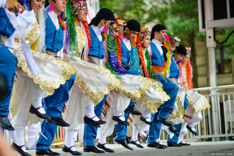
Turkish folk dances are the folk dances of Turkey. Facing three seas, straddling important trade routes, Turkey has a complex, sophisticated culture, reflected in the variety of its dances. The dominant dance forms are types of line dance. There are many different types of folk dances performed in various ways in Turkey. Zeybek, Teke Zortlatması in Aegean region, Bar in Erzurum province, Halay in the central, southern, eastern, and southeastern parts of the country, Hora in Thrace, Horon in the eastern Black Sea region, Spoon dances in and around Konya, and Lezginka in Kars and Ardahan are some of the best known examples of these. Types of dance Bar With their structure and formation, they are the dances performed by groups in the open. They are spread, in general, over the eastern part of Anatolia (Erzurum, Bayburt, Ağrı, Kars, Artvin and Erzincan provinces). The characteristic of their formation is that they are performed side-by-side, hand, shoulder and arm ... [...More Info...] [...Related Items...] OR: [Wikipedia] [Google] [Baidu] |
Kars
Kars ( or ; ; ) is a city in northeast Turkey. It is the seat of Kars Province and Kars District.İl Belediyesi , Turkey Civil Administration Departments Inventory. Retrieved 1 March 2023. As of 2022, its population was 91,450. Kars, in classical historiography (Strabo), was in the ancient region known as ''Chorzene'' (), part of the province of Ayrarat in the Kingdom of Armenia (antiquity), Kingdom of Armenia, and later the historic capitals of Armenia, capital of the Bagratid Kingdom of Armenia from 929 to 961. Currently, the mayor of Kars is Ötüken Senger. The city had an Armenians, Armenian ethnic majority until it was re-captured by Turkish National Movement, Turkish nationalist forces in late 1920. Etymology The city's name may derive from the Armenian language, Armenian w ...[...More Info...] [...Related Items...] OR: [Wikipedia] [Google] [Baidu] |
Aksak
In Ottoman musical theory, ''aksak'' () is a rhythmic system in which pieces or sequences, executed in a fast tempo, are based on the uninterrupted reiteration of a matrix, which results from the juxtaposition of rhythmic cells based on the alternation of binary and ternary quantities, as in , , , etc. The name literally means "limping", "stumbling", or "slumping", and has been borrowed by Western ethnomusicologists to refer generally to irregular, or additive meters. In Turkish folk music, these metres occur mainly in vocal and instrumental dance music, though they are found also in some folksongs. Strictly speaking, in Turkish music theory the term refers only to the grouping of nine pulses into a pattern of . Some examples are shown below. In jazz The ''aksak'' rhythm is prominently featured in the jazz standard "Blue Rondo à la Turk" by Dave Brubeck. In rock The Belgian experimental rock group Aksak Maboul take their name from this rhythm. See also *Additive rhythm an ... [...More Info...] [...Related Items...] OR: [Wikipedia] [Google] [Baidu] |
Zurna
The zurna is a double reed wind instrument played in Central Asia, West Asia, the Caucasus, Southeast Europe and parts of North Africa. It is also used in Sri Lanka. It is usually accompanied by a davul (bass drum) in Armenian, Anatolian and Assyrian folk music. The zurna is largely played in Turkey. Etymology and terminology A folk etymology explains that the name is derived from Persian "" (''surnāy''), composed of "" (''sūr'') meaning "banquet, feast", and (''nāy'') meaning "reed, pipe". The term is attested in the oldest Turkic records, as "''suruna''" in the 12th and 13th century Codex Cumanicus (CCM fol. 45a). Zurna has also been suggested as a possible borrowing from Hittite or Luwian into the Armenian language, where Arm. զուռնա ''zuṙna'' is compared to Luwian ''zurni'' "horn". Origins The zurna was said to originate from Central Asia and ancient Asia Minor (Anatolia). Images of the zurna are visible in stone reliefs and artwork by the Hittites, who wer ... [...More Info...] [...Related Items...] OR: [Wikipedia] [Google] [Baidu] |
Davul
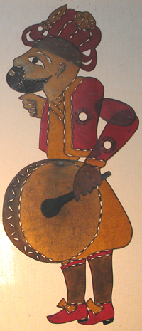
The davul, dhol, tapan, atabal or tabl is a large double-headed drum that is played with mallets. It has many names depending on the country and region. These drums are commonly used in the music of the Middle East and the Balkans. These drums have both a deep bass drum, bass sound and a thin treble (sound), treble sound due to their construction and playing style, where different heads and sticks are used to produce different sounds on the same drum. Names Some names of davuls include: *''dhol'' () *''dawola/tabla'' () *''dohol'' () *''doli'' ( ka, დოლი doli) *''davul'' () *''dahol'' (, ) *''davil'' () *''davula'' (Sinhala language, Sinhala: දවුල) *''tupan'' (Gora dialect, Goranian: tupan) *''daul'', ''tǎpan'', ''tupan'' () *''goč'', ''tapan'', ''tupan'' () *''tapan, tupan'' () *''tobă/dobă'' () *''tabl'' ( or ''tabl baladi'') *''tof'' () *''taoul(in)'' () *''lodra'', ''tupana'', ''daulle'', ''taborre'' () *''moldvai dob'' () Other Greek language, Greek ... [...More Info...] [...Related Items...] OR: [Wikipedia] [Google] [Baidu] |
Erzincan Province
Erzincan Province (; ; ) is a Provinces of Turkey, province in the Eastern Anatolia Region of Turkey. In Turkey, its capital is also called Erzincan. Its area is 11,815 km2, and its population is 239,223 (2022). Geography Erzincan is traversed by the northeasterly line of equal latitude and longitude. It lies on the North Anatolian Fault, Northern Anatolian Fault, where it is often the location for earthquakes such as 1939 Erzincan earthquake, on 27 December 1939 and 1992 Erzincan earthquake, 13 March 1992. History In September 1935 the third Inspectorates-General (Turkey), Inspectorate General (''Umumi Müfettişlik,'' UM) was created, into which the Erzincan province was included. Its creation was based on the Law 1164 from June 1927, which was passed in order to Turkification, Turkefy the population. The Erzincan province was included in this area. The third UM span over the provinces of Erzurum Province, Erzurum, Artvin Province, Artvin, Rize Province, Rize, Trabzon ... [...More Info...] [...Related Items...] OR: [Wikipedia] [Google] [Baidu] |
Artvin Province
Artvin Province (; Armenian language, Armenian: Արտվինի նահանգ ''Artvini nahang''; ka, , ''Artvinis p'rovintsia''; Laz language, Laz: ართვინიშ დობადონა ''Artvinish dobadona;'') is a Provinces of Turkey, province in Turkey, on the Black Sea coast in the northeastern corner of the country, on the border with Georgia (country), Georgia. Artvin also borders the Turkish provinces of Erzurum Province, Erzurum, Ardahan Province, Ardahan and Rize Province, Rize. Its area is 7,393 km2, and its population is 169,403 (2022). The provincial capital is the city of Artvin. Geography Artvin is an attractive area of steep valleys carved by the Çoruh River system, surrounded by high mountains of Kaçkar, Karçal and Yalnızçam Mountains, Yalnızçam (up to 3900 m) and forest with much national parkland including the Karagöl-Sahara, which contains the Şavşat and Borçka lakes. The weather in Artvin is very wet and mild at the coast, and ... [...More Info...] [...Related Items...] OR: [Wikipedia] [Google] [Baidu] |
Kars Province
Kars Province (; Azerbaijani: Qars Rayonu; ; ) is a province of Turkey, located in the northeastern part of the country. It shares part of its closed border with Armenia. Its area is 10,193 km2, and its population is 274,829 (2022). The provincial capital is the city of Kars. The provinces of Ardahan and Iğdır were part of Kars Province until 1992.Kanun No. 3806 Resmî Gazete, 3 June 1992. History In ancient times, Kars () was part of the province of Ararat in the Kingdom of Armenia. The first known people were the followers of Vanand (Վանանդ), for whom Kars was their main settlement and fortress. In 928, Kars became the capital of[...More Info...] [...Related Items...] OR: [Wikipedia] [Google] [Baidu] |
Ağrı Province
Ağrı Province () is located in eastern Turkey, bordering Iran to the east and the Provinces of Turkey, provinces of Kars Province, Kars to the north, Erzurum Province, Erzurum to the northwest, Muş Province, Muş and Bitlis Province, Bitlis to the southwest, Van Province, Van to the south, and Iğdır Province, Iğdır to the northeast. Its area is 11,099 km2, and its population is 511,238 (2023). The provincial capital is Ağrı, situated on a high plateau. Doğubayazıt was the capital of the province until 1946. The current Wāli#Turkish term, governor is Mustafa Koç. The province is considered part of Western Armenia and was part of the ancient province of Ayrarat of Kingdom of Armenia (antiquity), Kingdom of Armenia. Before the Armenian genocide, modern Ağri Province was part of the Six vilayets, six Armenian vilayets. The majority of the province's population are ethnic Kurds. Districts Ağrı province is divided into eight Districts of Turkey, districts (capit ... [...More Info...] [...Related Items...] OR: [Wikipedia] [Google] [Baidu] |
Bayburt Province
Bayburt Province () is a Provinces of Turkey, province of Turkey. Located in the Northeast Anatolia Region (statistical), Northeast Anatolia region of the country, the capital city is Bayburt. Its area is 3,746 km2, and its population is 84,241 (2022), making it the least-populous province in Turkey. The province was created in 1989 from part of Gümüşhane Province. Geography Bayburt is traversed by the northeasterly line of equal latitude and longitude. Districts Bayburt province is divided into 3 Districts of Turkey, districts (capital district in bold): * Aydıntepe District, Aydıntepe * Bayburt District, Bayburt * Demirözü District, Demirözü Historical sites, places and museums The most important places in Bayburt Province are: * Bayburt Tower * Saruhan Tower * Aydıntepe underground city * Mausoleum of Dede Korkut * Mausoleum of Şehit Osman * Traditional Bayburt houses * Ulu Mosque * Pulur (Gökçedere) Ferahşat Bey Mosque * Sünür (Çayıryolu) Kutlu Bey ... [...More Info...] [...Related Items...] OR: [Wikipedia] [Google] [Baidu] |
Erzurum Province
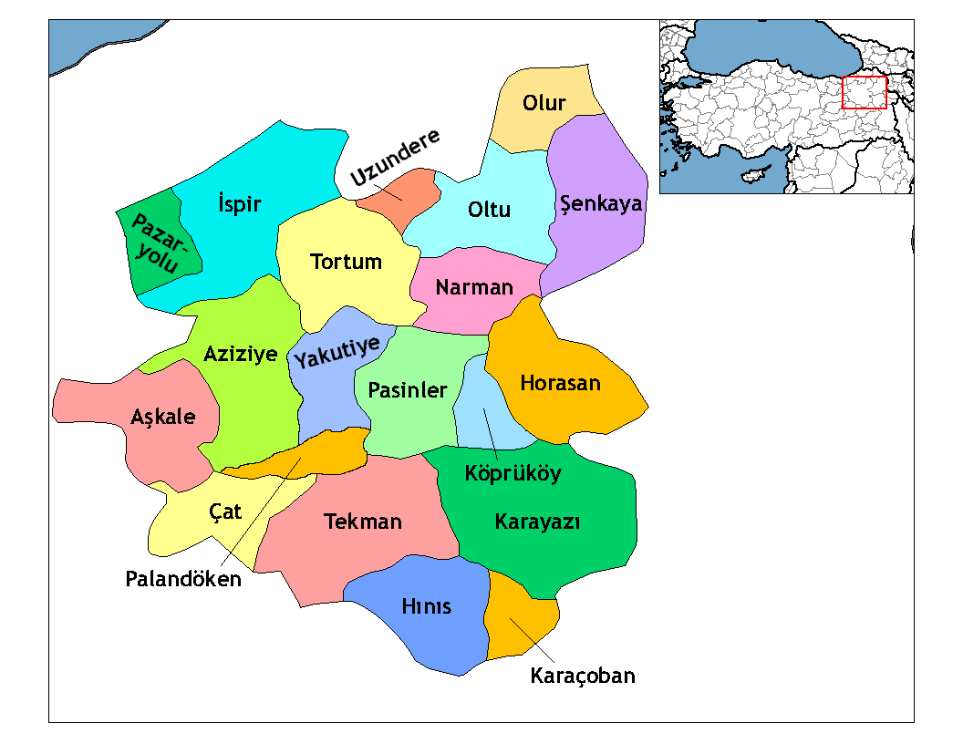
Erzurum Province () is a province and metropolitan municipality in the Eastern Anatolia Region of Turkey. Its area is 25,006 km2, and its population is 749,754 (2022). The capital of the province is the city of Erzurum. It is the fourth largest province in all of Turkey. It is bordered by the provinces of Kars and Ağrı to the east, Muş and Bingöl to the south, Erzincan and Bayburt to the west, Rize and Artvin to the north and Ardahan to the northeast. The governor of the province is Mustafa Çiftçi, appointed in August 2023. The province has a Turkish majority. Geography The surface area of the province of Erzurum is the fourth biggest in Turkey. The majority of the province is elevated. Most plateaus are about above sea level, and the mountainous regions beyond the plateaus are and higher. Depression plains are located between the mountains and plateaus. The southern mountain ranges include the Palandöken Mountains (highest peak Büyük Ejder high) and t ... [...More Info...] [...Related Items...] OR: [Wikipedia] [Google] [Baidu] |


