|
Tufsingdalen
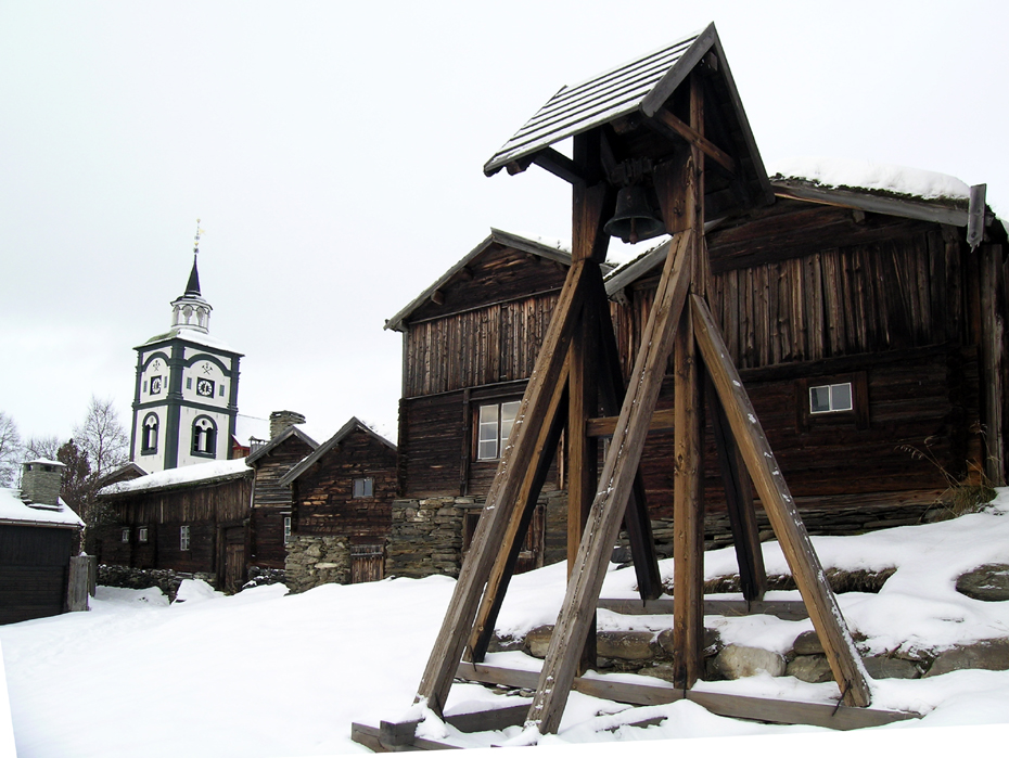
Tufsingdalen or Tufsingdal is a village area and valley in Os Municipality in Innlandet county, Norway. The village area is located along the river Tufsinga which flows through the Tufsingdalen valley. It lies in the southeastern part of the municipality, about southeast of the village of Os i Østerdalen and about north of the large lake Femunden. There are about 170 residents in the valley. Tufsingdalen Church is located in the valley. History Before 1713, there were no permanent residents in Tufsingdalen. However, it was known for the rich population of Whitefish (fisheries term), whitefish in the river, and there were certainly fishing and haying along the river before this time. In 1712, ore explorers from Røros Copper Works, Røros Kobberverk found silver in the rock on the west side of Tufsingdalen, and a trial operation was started the following year. The mine was operated until 1716, because the deposit turned out to be smaller than expected. Of the 28 people who wo ... [...More Info...] [...Related Items...] OR: [Wikipedia] [Google] [Baidu] |
Tufsingdalen Church
Tufsingdalen Church () is a parish church of the Church of Norway in Os Municipality in Innlandet county, Norway. It is located in the village of Tufsingdal. It is one of the churches for the Narbuvoll parish which is part of the Nord-Østerdal prosti (deanery) in the Diocese of Hamar. The white, wooden church was built in a long church design in 1920 using plans drawn up by the architect Peder Sæther. The church seats about 120 people. History A burial ground was consecrated on this site in October 1914. Then a burial chapel was constructed on the site in 1918. In 1920, the small chapel was enlarged by adding a Choir (architecture), choir and sacristy. The architect Peder Sæther designed the building. The newly enlarged building was consecrated in 1920. In 1923, a second floor seating gallery was added. Originally, the church was considered an annex chapel, but in the 1970s, the chapel was renovated and upgraded to the status of parish church. Historically, the church was paint ... [...More Info...] [...Related Items...] OR: [Wikipedia] [Google] [Baidu] |
Os Municipality
Os is a List of municipalities of Norway, municipality in Innlandet county, Norway. It is located in the Traditional districts of Norway, traditional district of Østerdalen. The administrative centre of the municipality is the village of Os i Østerdalen. Other villages in the municipality include Dalsbygda, Narbuvoll, and Tufsingdalen. The municipality is the 110th largest by area out of the 357 municipalities in Norway. Os Municipality is the 289th most populous municipality in Norway with a population of 1,895. The municipality's population density is and its population has decreased by 6.1% over the previous 10-year period. General information The parish of Os was historically part of Tolga Municipality. On 1 July 1926, the parish of Os (population: 1,936) was separated from Tolga Municipality to become a separate municipality. In 1927, a small area of Tolga Municipality (population: 18) was transferred to Os Municipality. During the 1960s, there were many municipal me ... [...More Info...] [...Related Items...] OR: [Wikipedia] [Google] [Baidu] |
Norway
Norway, officially the Kingdom of Norway, is a Nordic countries, Nordic country located on the Scandinavian Peninsula in Northern Europe. The remote Arctic island of Jan Mayen and the archipelago of Svalbard also form part of the Kingdom of Norway. Bouvet Island, located in the Subantarctic, is a Dependencies of Norway, dependency, and not a part of the Kingdom; Norway also Territorial claims in Antarctica, claims the Antarctic territories of Peter I Island and Queen Maud Land. Norway has a population of 5.6 million. Its capital and largest city is Oslo. The country has a total area of . The country shares a long eastern border with Sweden, and is bordered by Finland and Russia to the northeast. Norway has an extensive coastline facing the Skagerrak strait, the North Atlantic Ocean, and the Barents Sea. The unified kingdom of Norway was established in 872 as a merger of Petty kingdoms of Norway, petty kingdoms and has existed continuously for years. From 1537 to 1814, Norway ... [...More Info...] [...Related Items...] OR: [Wikipedia] [Google] [Baidu] |
Femunden
Femunden is Norway's third largest lake and the second largest natural lake in Norway. It is located in Innlandet and Trøndelag counties in Norway, just west of the border with Sweden. The lake lies primarily in Engerdal Municipality (in Innlandet) and also smaller parts are located in Os Municipality (Innlandet) and Røros Municipality (Trøndelag). Femundsmarka National Park borders the northeastern part of the lake. The lake holds about of water and reaches a maximum depth of . The surface of the lake sits about above sea level. Name The first element (''Fe-'' or ''Fem-'') has no known meaning, and the last element is the suffix ''-mund'' or ''-und'' (both are common in Norwegian place names). The final part ''-en'' is the definite article in the Norwegian language. History After Sweden had conquered the parishes of Idre and Särna in 1644, the lake Femunden was considered to be part of the border between Norway and Sweden. But this was never officially recognised by ... [...More Info...] [...Related Items...] OR: [Wikipedia] [Google] [Baidu] |
Røros Mining Town And The Circumference
Røros may refer to: Places *Røros Municipality, a municipality in Trøndelag county, Norway *Røros (town), a town within Røros Municipality in Trøndelag county, Norway *Røros Church, a church in Røros Municipality in Trøndelag county, Norway * Røros Chapel, a chapel in Røros Municipality in Trøndelag county, Norway *Røros landsogn, a former municipality in the old Sør-Trøndelag county, Norway * Røros Mining Town and the Circumference, a UNESCO world heritage site in Røros Municipality in Trøndelag county, Norway Transportation *Røros Airport, an airport in Røros Municipality in Trøndelag county, Norway *Røros Station, a railway station in Røros Municipality in Trøndelag county, Norway *Røros Line, a railway line in Trøndelag county, Norway * Røros Flyservice, a Norwegian aircraft ground handling company operating at nine airports Other * Røros IL, a sports club based in Røros Municipality ( Norwegian) or is a municipality in Trøndelag county, Norw ... [...More Info...] [...Related Items...] OR: [Wikipedia] [Google] [Baidu] |
UNESCO World Heritage List
World Heritage Sites are landmarks and areas with legal protection under an international treaty administered by UNESCO for having cultural, historical, or scientific significance. The sites are judged to contain "cultural and natural heritage around the world considered to be of outstanding value to humanity". To be selected, a World Heritage Site is nominated by its host country and determined by the UNESCO's World Heritage Committee to be a unique landmark which is geographically and historically identifiable, having a special cultural or physical significance, and to be under a sufficient system of legal protection. World Heritage Sites might be ancient ruins or historical structures, buildings, cities, deserts, forests, islands, lakes, monuments, mountains or wilderness areas, and others. A World Heritage Site may signify a remarkable accomplishment of humankind and serve as evidence of humanity's intellectual history on the planet, or it might be a place of great natur ... [...More Info...] [...Related Items...] OR: [Wikipedia] [Google] [Baidu] |
Røros (town)
or is the administrative centre of Røros Municipality in Trøndelag county, Norway. The town is located along the river Hyttelva and along the Rørosbanen railway line, about south of the village of Glåmos and about the same distance north of the village of Os i Østerdalen in neighboring Innlandet county. The town has a population (2024) of 3,909 and a population density of . The mining town of Røros is sometimes called ''Bergstaden'', which means "the rock town", due to its historical copper mining. It is one of two towns in Norway that were historically designated as a '' bergstad'' or "mining town", along with the "silver-town" of Kongsberg in Buskerud county. The ''bergstad'' formerly had special rights as a mining town, slightly different from those of other towns/cities in Norway. Because of this, it is sometimes referred to as a town, despite the actual classification being a bergstad. Many modern-day inhabitants of Røros still work and live in the characte ... [...More Info...] [...Related Items...] OR: [Wikipedia] [Google] [Baidu] |
Smelter
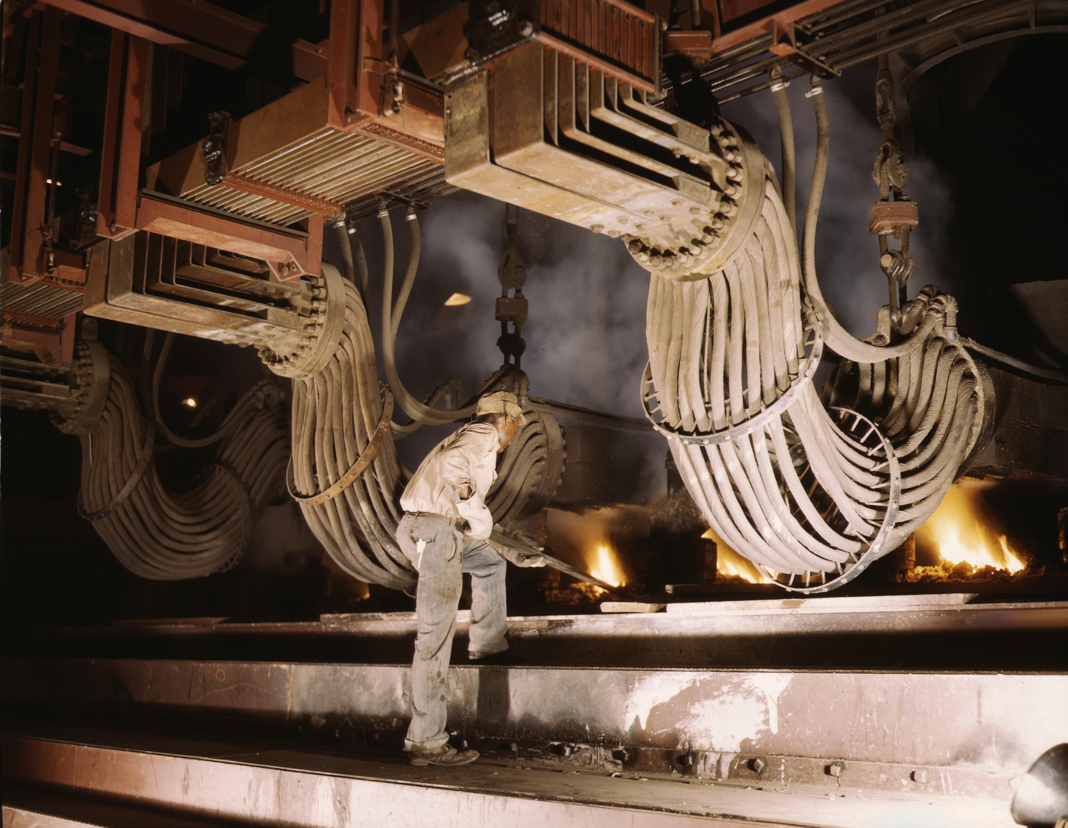
Smelting is a process of applying heat and a chemical reducing agent to an ore to extract a desired base metal product. It is a form of extractive metallurgy that is used to obtain many metals such as iron, copper, silver, tin, lead and zinc. Smelting uses heat and a chemical reducing agent to decompose the ore, driving off other elements as gases or slag and leaving the metal behind. The reducing agent is commonly a fossil-fuel source of carbon, such as carbon monoxide from incomplete combustion of coke—or, in earlier times, of charcoal. The oxygen in the ore binds to carbon at high temperatures, as the chemical potential energy of the bonds in carbon dioxide () is lower than that of the bonds in the ore. Sulfide ores such as those commonly used to obtain copper, zinc or lead, are roasted before smelting in order to convert the sulfides to oxides, which are more readily reduced to the metal. Roasting heats the ore in the presence of oxygen from air, oxidizing the or ... [...More Info...] [...Related Items...] OR: [Wikipedia] [Google] [Baidu] |
Røros Copper Works
The Røros Copper Works () was a copper mining company based in the town (bergstad) of Røros in what is now Røros Municipality in Trøndelag county, Norway. The mines operated from 1644 until 1977. The Crown designated the area as a bergstad in 1647 and put Joachim Irgens von Westervick in charge, including rights to forests and water resources within a circular diameter of around the town. The local farmers were given working obligations, such as transport and charcoal production for the copper works. Among the mines were the ''Storwartz'' mines, ''Hestkletten'', ''Christianus Qvintus'', ''Olavsgruven'', ''Kongens Gruve'', and ''Christianus Sextus''. During its operation a total of of copper and of pyrites was produced. History In 1644, the general manager of the mine at Kongsberg gave permission to exploit one lode of copper in the mountains near Rauhaammaaren. Storvola and Gamle Storwartz became some of the company's most important mines. Nordgruve, another important minin ... [...More Info...] [...Related Items...] OR: [Wikipedia] [Google] [Baidu] |
Whitefish (fisheries Term)
Whitefish or white fish is a fisheries term for several species of demersal fish with fins, particularly Atlantic cod (''Gadus morhua''), whiting (fish), whiting (''Merluccius bilinearis''), haddock (''Melanogrammus aeglefinus''), Phycidae, hake (''Urophycis''), and pollock (''Pollachius''), among others. Whitefish live on or near the seafloor, and can be contrasted with the Oily fish, oily or pelagic fish, which live away from the seafloor. Whitefish do not have much fish oil, oil in their tissue, and have flakier white or light-coloured flesh. Most of the oil found in their bodies is concentrated in the organs, e.g. cod liver oil. Whitefish can be divided into benthopelagic fish (round fish that live ''near'' the sea bed, such as cod and Coley (fish), coley) and benthic fish (which live ''on'' the sea bed, such as flatfish like plaice). Whitefish is sometimes eaten straight but is often used reconstituted for fishsticks, gefilte fish, lutefisk, surimi (imitation crab meat), e ... [...More Info...] [...Related Items...] OR: [Wikipedia] [Google] [Baidu] |


