|
Tropical Storm Alberto (2024)
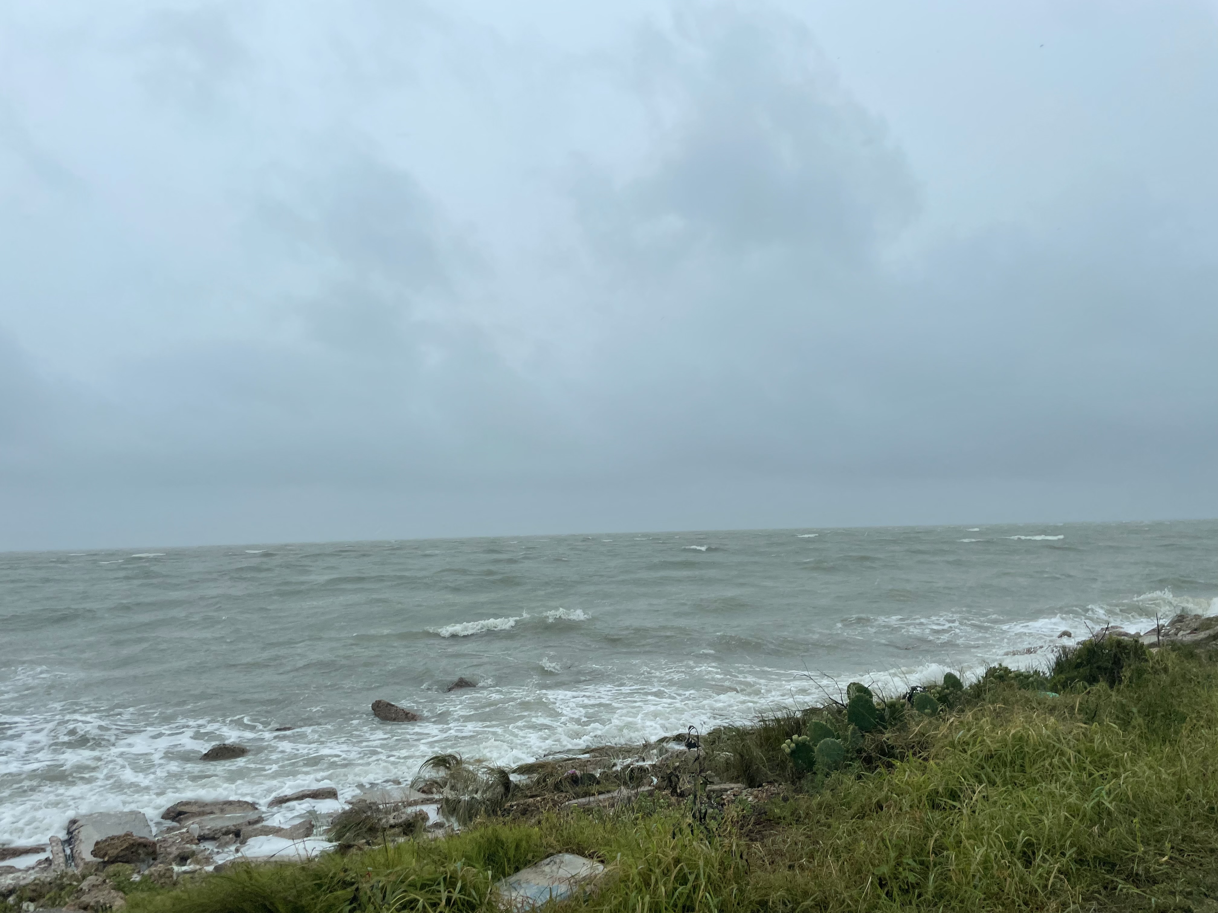
Tropical Storm Alberto was a broad but short-lived tropical cyclone that affected portions of Mexico, Texas, and Louisiana during June 2024. The first named storm of the 2024 Atlantic hurricane season, Alberto originated on June 12 from a broad area of disturbed weather in the Gulf of Mexico. A few days later, a low-pressure area formed from the disturbance, over the Bay of Campeche. It would steadily coalesce, and despite not being a tropical cyclone yet, would be designated as ''Glossary of tropical cyclone terms#P, Potential Tropical Cyclone One'' by the National Hurricane Center on June 17 due to its proximity to the coast. It eventually intensified into a tropical storm two days later, being named ''Alberto''. Its formation marked the latest start to an Atlantic hurricane season since Hurricane Arthur, 2014. The next day, Alberto peaked with sustained winds of before making landfall near Tampico, Tamaulipas. Despite being weak, Alberto was unusually broad, affecting Texas, L ... [...More Info...] [...Related Items...] OR: [Wikipedia] [Google] [Baidu] |
Gulf Of Mexico
The Gulf of Mexico ( es, Golfo de México) is an ocean basin and a marginal sea of the Atlantic Ocean, largely surrounded by the North American continent. It is bounded on the northeast, north and northwest by the Gulf Coast of the United States; on the southwest and south by the Mexican states of Tamaulipas, Veracruz, Tabasco, Campeche, Yucatan, and Quintana Roo; and on the southeast by Cuba. The Southern U.S. states of Texas, Louisiana, Mississippi, Alabama, and Florida, which border the Gulf on the north, are often referred to as the " Third Coast" of the United States (in addition to its Atlantic and Pacific coasts). The Gulf of Mexico took shape approximately 300 million years ago as a result of plate tectonics.Huerta, A.D., and D.L. Harry (2012) ''Wilson cycles, tectonic inheritance, and rifting of the North American Gulf of Mexico continental margin.'' Geosphere. 8(1):GES00725.1, first published on March 6, 2012, The Gulf of Mexico basin is roughly ov ... [...More Info...] [...Related Items...] OR: [Wikipedia] [Google] [Baidu] |
Invest (meteorology)
An invest in meteorology (short for ''investigative area'', alternatively written INVEST) is a designated area of disturbed weather that is being monitored for potential tropical cyclone development. Invests are designated by three separate United States forecast centers: the National Hurricane Center, the Central Pacific Hurricane Center, and the Joint Typhoon Warning Center. Invests (also called ''areas of interest'') are designated by three separate forecast centers located in the United States: the National Hurricane Center in Miami, Florida, overseeing the North Atlantic and North Eastern Pacific basins (east of the 140°W meridian); the Central Pacific Hurricane Center in Honolulu, Hawaii, monitoring the North Central Pacific basin (between the International Date Line and the 140°W meridian); and the military Joint Typhoon Warning Center in Pearl Harbor, Hawaii (formerly located in the island of Guam), serving U.S. government interests elsewhere (i.e. the North Western Pa ... [...More Info...] [...Related Items...] OR: [Wikipedia] [Google] [Baidu] |
Boeing CH-47 Chinook
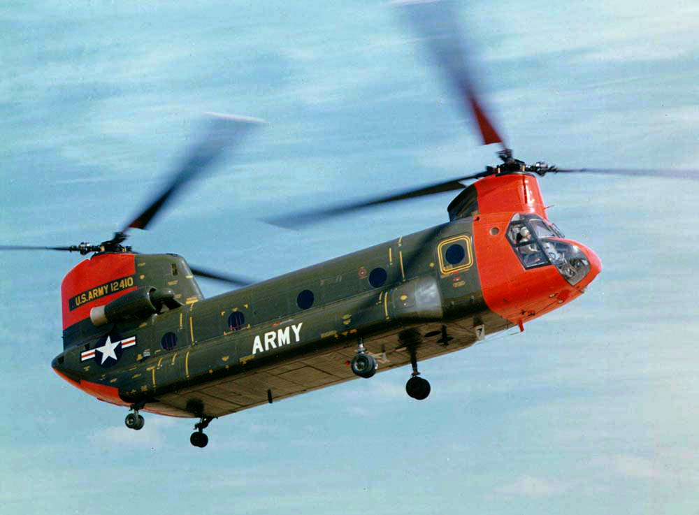
The Boeing CH-47 Chinook is a tandem rotor helicopter developed by American rotorcraft company Vertol and manufactured by Boeing Vertol. The Chinook is a heavy-lift helicopter that is among the heaviest lifting Western helicopters. Its name, Chinook, is from the Native American Chinook people of Oregon and Washington state. The Chinook was originally designed by Vertol, which had begun work in 1957 on a new tandem-rotor helicopter, designated as the Vertol Model 107 or V-107. Around the same time, the United States Department of the Army announced its intention to replace the piston engine–powered Sikorsky CH-37 Mojave with a new, gas turbine–powered helicopter. During June 1958, the U.S. Army ordered a small number of V-107s from Vertol under the ''YHC-1A'' designation; following testing, it came to be considered by some Army officials to be too heavy for the assault missions and too light for transport purposes. While the YHC-1A would be improved and adopted by t ... [...More Info...] [...Related Items...] OR: [Wikipedia] [Google] [Baidu] |
Texas National Guard
The Texas Military Forces (TXMF) are the principal instrument through which the Texas Military Department (TMD) executes security policy for Texas, which has the second-largest List of states and territories of the United States by population, population and International border states of the United States, border in the United States, and the List of U.S. states and territories by GDP, 9th-largest economy in the List of countries by GDP (nominal), world. The Texas Military Forces have a budget of $101.1 million as of 2017. Current forces include the Texas Army National Guard, Texas Air National Guard, and Texas State Guard of the Texas Militia. Former forces include the Texian Militia, Texian Army, Texian Navy, Army of the Republic of Texas, Texas Army, Texas Navy, and Texas Marines. It also included the Texas Ranger Division, Texas Rangers from their inception until 1935. The Texas Military Forces are administered by the Texas Military Department under command of the adjutant g ... [...More Info...] [...Related Items...] OR: [Wikipedia] [Google] [Baidu] |
Greg Abbott
Gregory Wayne Abbott (born November 13, 1957) is an American politician, attorney, and former jurist serving as the 48th governor of Texas since 2015. A member of the Republican Party, he served as the 50th attorney general of Texas from 2002 to 2015 and as a member of the Texas Supreme Court from 1996 to 2001. Abbott was the third Republican to serve as attorney general of Texas since the Reconstruction era. He was elected to that office with 57% of the vote in 2002 and reelected with 60% in 2006 and 64% in 2010, becoming the longest-serving Texas attorney general in state history, with 12 years of service. Before becoming attorney general, Abbott was a justice of the Texas Supreme Court, a position to which he was appointed in 1995 by then-governor George W. Bush. Abbott won a full term in 1998 with 60% of the vote. As attorney general, he successfully advocated for the Texas State Capitol to display the Ten Commandments in the 2005 U.S. Supreme Court case '' Van Orden ... [...More Info...] [...Related Items...] OR: [Wikipedia] [Google] [Baidu] |
Associated Press
The Associated Press (AP) is an American non-profit news agency headquartered in New York City. Founded in 1846, it operates as a cooperative, unincorporated association. It produces news reports that are distributed to its members, U.S. newspapers and broadcasters. The AP has earned 56 Pulitzer Prizes, including 34 for photography, since the award was established in 1917. It is also known for publishing the widely used ''AP Stylebook''. By 2016, news collected by the AP was published and republished by more than 1,300 newspapers and broadcasters, English, Spanish, and Arabic. The AP operates 248 news bureaus in 99 countries. It also operates the AP Radio Network, which provides newscasts twice hourly for broadcast and satellite radio and television stations. Many newspapers and broadcasters outside the United States are AP subscribers, paying a fee to use AP material without being contributing members of the cooperative. As part of their cooperative agreement with the AP ... [...More Info...] [...Related Items...] OR: [Wikipedia] [Google] [Baidu] |
Campeche
Campeche (; yua, Kaampech ), officially the Free and Sovereign State of Campeche ( es, Estado Libre y Soberano de Campeche), is one of the 31 states which make up the 32 Federal Entities of Mexico. Located in southeast Mexico, it is bordered by the states of Tabasco to the southwest, Yucatán to the northeast, and Quintana Roo to the east; to the southeast by the Orange Walk district of Belize, and by the Petén department of Guatemala to the south. It has a coastline to the west with the Gulf of Mexico. The state capital, also called Campeche, was declared a World Heritage Site in 1997. The formation of the state began with the city, which was founded in 1540 as the Spanish began the conquest of the Yucatán Peninsula. The city was a rich and important port during the colonial period, but it declined after Mexico's independence. Campeche was part of the province of Yucatán but split off in the mid-19th century, mostly due to political friction with the city of Mérida. Much ... [...More Info...] [...Related Items...] OR: [Wikipedia] [Google] [Baidu] |
Tabasco
Tabasco (), officially the Free and Sovereign State of Tabasco ( es, Estado Libre y Soberano de Tabasco), is one of the 32 Federal Entities of Mexico. It is divided into 17 municipalities and its capital city is Villahermosa. It is located in the southeast of the country, bordering the states of Campeche to the northeast, Veracruz to the west, and Chiapas to the south and the Petén department of Guatemala to the southeast. It has a coastline to the north with the Gulf of Mexico. Most of the state is covered in rainforest as, unlike most other areas of Mexico, it has plentiful rainfall year-round. The state is also home to La Venta, the major site of the Olmec civilization, considered to be the origin of later Mesoamerican cultures. It produces significant quantities of petroleum and natural gas. Geography The state is located in the southeast of Mexico, bordering the states of Campeche, Chiapas, and Veracruz, with the Gulf of Mexico to the north and the country of Guatemal ... [...More Info...] [...Related Items...] OR: [Wikipedia] [Google] [Baidu] |
Quintana Roo
Quintana Roo ( , ), officially the Free and Sovereign State of Quintana Roo ( es, Estado Libre y Soberano de Quintana Roo), is one of the 31 states which, with Mexico City, constitute the 32 federal entities of Mexico. It is divided into 11 municipalities and its capital city is Chetumal. Quintana Roo is located on the eastern part of the Yucatán Peninsula and is bordered by the states of Campeche to the west and Yucatán to the northwest, and by the Orange Walk and Corozal districts of Belize, along with an offshore borderline with Belize District to the south. As Mexico's easternmost state, Quintana Roo has a coastline to the east with the Caribbean Sea and to the north with the Gulf of Mexico. The state previously covered and shared a small border with Guatemala in the southwest of the state. However, in 2013, Mexico's Supreme Court of Justice of the Nation resolved the boundary dispute between Quintana Roo, Campeche, and Yucatán stemming from the creation of t ... [...More Info...] [...Related Items...] OR: [Wikipedia] [Google] [Baidu] |
Tecolutla
Tecolutla is a town and municipality located on the Tecolutla River on the eastern coast of the state of Veracruz in Mexico. It has the closest beaches to Mexico City, and much of its economy is based on tourism, as it is only a four- or five-hour drive from the capital. It is the northern end of a tourist corridor along the Gulf of Mexico called the "Emerald Coast," which extends down to the city of Veracruz. Tecolutla's biggest attraction is its natural settings of wetlands with estuaries, canals and mangroves associated with the river. The town is known for the "Tecolutla Monster,"—probably a dead whale—that was washed ashore in 1969. Its remains are kept at the Marine Museum. The name Tecolutla means "place of the tecolotes or owls." Tourism The most important and growing economic activity in the zone is tourism. Tecolutla has the closest beaches to Mexico City. The town has about 15 km of beaches which face directly onto the Gulf of Mexico. (The municipality has a t ... [...More Info...] [...Related Items...] OR: [Wikipedia] [Google] [Baidu] |
San Luis Pass (Galveston Island)
San Luis Pass is a strait of water at the south-western end of Galveston Island off the Texas Gulf Coast of the U.S. state of Texas. It connects the sheltered waters of West Bay to the open Gulf of Mexico. Fishermen and swimmers have been killed in the Pass' treacherous waters, largely due to the aggressive oceanic currents of Gulf Stream, fluctuating tides in marginal sea, marine sediment, and uncertainties of continental margin. The San Luis Pass-Vacek Toll Bridge spans San Luis Pass from Galveston County to Brazoria County. Characteristics Tide levels can vary by almost 2 feet in height, although the tidal effects seem more pronounced along straits than other barrier island zones. Water current dangers are prominent up to about one mile away from the pass along either island. A high amount of drownings occur in the vicinity of the San Luis Pass compared to other areas off of nearby beaches. Until June 2013, about 10 people drowned near San Luis pass on the Galveston side s ... [...More Info...] [...Related Items...] OR: [Wikipedia] [Google] [Baidu] |
Altamira, Tamaulipas
Altamira is a port city on the Gulf of Mexico and is located near the southeastern tip of the state of Tamaulipas in Mexico. It is the second-largest city in the municipality of Altamira. To the south is Tampico, also in this state. The city is part of the Tampico Metropolitan Area. Its port business is mostly containerized cargo for ocean-going ships. According to the INEGI 2010 census, the city has a population of 59,536, the tenth-largest in the state. : Instituto Nacional de Estadística, Geografía e Informática References Populated places in Tamaulipas[...More Info...] [...Related Items...] OR: [Wikipedia] [Google] [Baidu] |


