|
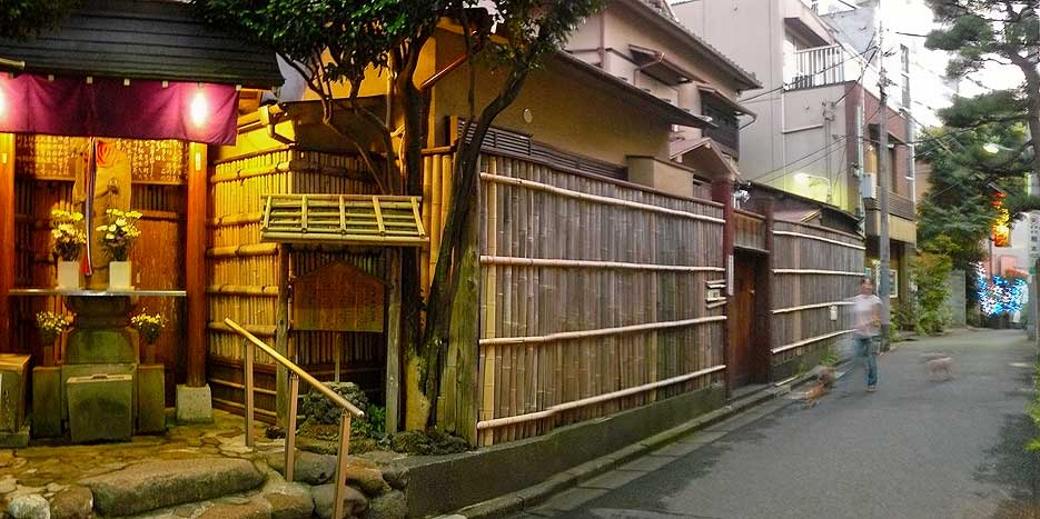
Tomigaya
is a district of Shibuya, Tokyo, Japan. As of October 2020, the population of this district is 9,499. The postal code for Tomigaya is . Education operates public elementary and junior high schools. Tomigaya 1-chome, and Tomigaya 2-chome 1–9, 12–21, and 44-45-ban are zoned to Tomigaya Elementary School ( 富谷小学校). Tomigaya 2-chome 10-11 and 22-43-ban are zoned to Uehara Elementary School ( 上原小学校). All of Tomigaya (1 and 2-chome) is zoned to Uehara Junior High School ( 上原中学校). - Has junior high school zoning The Yoyogi campus of Tokai University is a private non-sectarian higher education institution located in Tokyo, Japan. It was founded by Dr. Shigeyoshi Matsumae. It was accredited under Japan's old educational system in 1946 and under the new system in 1950. In 2008, Tokai Uni ... is located here. References Neighborhoods of Tokyo Shibuya {{tokyo-geo-stub ... [...More Info...] [...Related Items...] OR: [Wikipedia] [Google] [Baidu] |
Shibuya
is a Special wards of Tokyo, special ward in Tokyo, Japan. A major commercial center, Shibuya houses one of the busiest railway stations in the world, Shibuya Station. As of January 1, 2024, Shibuya Ward has an estimated population of 230,609 in 142,443 households and a population density of . The total area is . Notable neighborhoods and districts of Shibuya include Harajuku, Ebisu, Shibuya, Ebisu, Omotesandō, Yoyogi and Sendagaya. Shibuya came into the possession of the Shibuya clan in the early 1160s, after which the area was named. The branch of the clan that ruled this area was defeated by the Later Hōjō clan on January 13, 1524, during the Sengoku period, and the area then came under their control. During the Edo period, Shibuya, particularly Maruyamachō, Shibuya, Maruyamachō on Dōgenzaka, prospered as a town on Oyama Road (present-day Japan National Route 246, Route 246), and in the Meiji era, as a Hanamachi. Shibuya emerged as a railway terminus during the expan ... [...More Info...] [...Related Items...] OR: [Wikipedia] [Google] [Baidu] |
Yoyogi
is a neighbourhood in the northern part of Shibuya, Tokyo, Japan. Geography The area encompassed by Yoyogi is typically defined two ways: * Only the five Yoyogi . * The former , corresponding roughly to the area south of Japan National Route 20, National Route 20 (Kōshū-kaidō), east of Tokyo Route 420, north of the districts of Uehara and Tomigaya, and west of Meiji Shrine. This larger definition of Yoyogi is generally used by residents and government to deliver services such as police, fire, and postal delivery. Characteristics Yoyogi is composed of ten districts. * : Home of the ''juku'' chain Yoyogi Seminar as well as other college preparatory schools and technical institutions. There are also several businesses catering to those who use Yoyogi Station. * : The Nishi-Shinjuku skyscraper district is directly north of this area. There are numerous offices and shops due to the proximity to the south exit of Shinjuku Station. * : This area was once called Yamaya-chō (山� ... [...More Info...] [...Related Items...] OR: [Wikipedia] [Google] [Baidu] |
Prefectures Of Japan
Japan is divided into 47 prefectures (, , ), which rank immediately below the national government and form the country's first level of jurisdiction and Administrative divisions of Japan, administrative division. They include 43 prefectures proper (, ''Prefectures of Japan#Ken, ken''), two Fu (administrative division), urban prefectures (, ''Prefectures of Japan#Fu, fu'': Osaka Prefecture, Osaka and Kyoto Prefecture, Kyoto), one regional prefecture (, ''Prefectures of Japan#Dō, dō'': Hokkaido, Hokkaidō) and one metropolis (, ''Prefectures of Japan#To, to'': Tokyo). In 1868, the Meiji Restoration, Meiji ''Fuhanken sanchisei'' administration created the first prefectures (urban ''fu'' and rural ''ken'') to replace the urban and rural administrators (''bugyō'', ''daikan'', etc.) in the Tenryō, parts of the country previously controlled directly by the shogunate and a few territories of rebels/shogunate loyalists who had not submitted to the new government such as Aizu domain, ... [...More Info...] [...Related Items...] OR: [Wikipedia] [Google] [Baidu] |
Special Wards Of Tokyo
The of Tokyo are a special form of Municipalities of Japan, municipalities in Japan under the 1947 Local Autonomy Act, Local Autonomy Law. They are city-level wards: primary subdivisions of a prefecture with municipal autonomy largely comparable to other forms of municipalities. With a land area of , it is about three-quarters the size of Singapore. As of 2024, it has a population of almost 10 million, with a density of about . Although the autonomy law today allows for special wards to be established in other prefectures, to date they exist only in Tokyo, which consists of 23 special wards and 39 other, ordinary municipalities (cities of Japan, cities, list of towns in Japan, towns, and list of villages in Japan, villages). The special wards of Tokyo occupy the land that was once the core Tokyo City in its 1936 borders before it was abolished under the Tōjō Cabinet in 1943 to become directly ruled by the Tokyo Metropolitan Government, prefectural government, then renamed to " ... [...More Info...] [...Related Items...] OR: [Wikipedia] [Google] [Baidu] |
Area Code
A telephone numbering plan is a type of numbering scheme used in telecommunication to assign telephone numbers to subscriber telephones or other telephony endpoints. Telephone numbers are the addresses of participants in a telephone network, reachable by a system of destination code routing. Telephone numbering plans are defined world-wide, as well as within each of the administrative regions of the public switched telephone network (PSTN), and in private telephone networks. In public numbering systems, geographic location typically plays a role in the sequence of numbers assigned to each telephone subscriber. Many numbering plan administrators subdivide their territory of service into geographic regions designated by a prefix, often called an area code or city code, which is a set of digits forming the most-significant part of the dialing sequence to reach a telephone subscriber. Within such regions designated by area codes, locally unique telephone number are assigned based on ... [...More Info...] [...Related Items...] OR: [Wikipedia] [Google] [Baidu] |
Tokyo
Tokyo, officially the Tokyo Metropolis, is the capital of Japan, capital and List of cities in Japan, most populous city in Japan. With a population of over 14 million in the city proper in 2023, it is List of largest cities, one of the most populous urban areas in the world. The Greater Tokyo Area, which includes Tokyo and parts of six neighboring Prefectures of Japan, prefectures, is the most populous metropolitan area in the world, with 41 million residents . Lying at the head of Tokyo Bay, Tokyo is part of the Kantō region, on the central coast of Honshu, Japan's largest island. It is Japan's economic center and the seat of the Government of Japan, Japanese government and the Emperor of Japan. The Tokyo Metropolitan Government administers Tokyo's central Special wards of Tokyo, 23 special wards, which formerly made up Tokyo City; various commuter towns and suburbs in Western Tokyo, its western area; and two outlying island chains, the Tokyo Islands. Although most of the w ... [...More Info...] [...Related Items...] OR: [Wikipedia] [Google] [Baidu] |
Japan
Japan is an island country in East Asia. Located in the Pacific Ocean off the northeast coast of the Asia, Asian mainland, it is bordered on the west by the Sea of Japan and extends from the Sea of Okhotsk in the north to the East China Sea in the south. The Japanese archipelago consists of four major islands—Hokkaido, Honshu, Shikoku, and Kyushu—and List of islands of Japan, thousands of smaller islands, covering . Japan has a population of over 123 million as of 2025, making it the List of countries and dependencies by population, eleventh-most populous country. The capital of Japan and List of cities in Japan, its largest city is Tokyo; the Greater Tokyo Area is the List of largest cities, largest metropolitan area in the world, with more than 37 million inhabitants as of 2024. Japan is divided into 47 Prefectures of Japan, administrative prefectures and List of regions of Japan, eight traditional regions. About three-quarters of Geography of Japan, the countr ... [...More Info...] [...Related Items...] OR: [Wikipedia] [Google] [Baidu] |
Chome
The Japanese addressing system is used to identify a specific location in Japan. When written in Japanese characters, addresses start with the largest geographical entity and proceed to the most specific one. The Japanese system is complex, the product of the natural growth of urban areas, as opposed to the systems used in cities that are laid out as grids and divided into quadrants or districts. When written in Latin characters, addresses follow the convention used by most Western addresses and start with the smallest geographic entity (typically a house number) and proceed to the largest. However, even when translated using Latin characters, Japan Post requires that the address also is written in Japanese to ensure correct delivery. Address parts Japanese addresses begin with the largest division of the country, the prefecture. Most of these are called , but there are also three other special prefecture designations: for Tokyo, for Hokkaido and for the two urban prefe ... [...More Info...] [...Related Items...] OR: [Wikipedia] [Google] [Baidu] |


