|
Tokugawa Ieharu
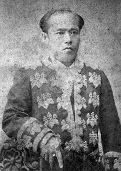
Tokugawa Ieharu 徳川 家治 (20 June 1737 – 17 September 1786) was the tenth ''shōgun'' of the Tokugawa shogunate of Japan, who held office from 1760 to 1786. His childhood name was Takechiyo (竹千代). Ieharu died in 1786 and given the Buddhist name Shunmyoin and buried at Kan'ei-ji. Family * Father: Tokugawa Ieshige * Mother: Oko no Kata (d. 1728) later Shinshin'in * Wife: Iso no Miya Tomoko (1738–1771) * Concubines: ** Omiyo no Kata ** Ochiho no Kata (1737–1791) later Renkoin ** Oshina no Kata (d. 1778) later Yoren-in * Child: ** Chiyohime (1756–1757) by Tomoko ** Manjuhime (1761–1773) (born by Tomoko but after she died adopted by Ieharu's concubine, Omaki no Kata) ** Tokugawa Takechiyo later Tokugawa Iemoto (1762–1779) born by Ochiho no Kata ** Tokugawa Teijiro (1762–1763) born by Oshina no Kata * Adopted: ** Tokugawa Ienari ** Tanehime (1765–1794), daughter of Tokugawa Munetake and married Tokugawa Harutomi of Kishū Domain Events of the Ieharu's '' ... [...More Info...] [...Related Items...] OR: [Wikipedia] [Google] [Baidu] |
Tokugawa (surname)
Tokugawa (Shinjitai spelling: ; Kyūjitai spelling: ) is a Japanese name, surname in Japan literally meaning "virtuous river". It originated with Tokugawa Ieyasu, who took the surname in 1567, reviving an Tokugawa clan#History, ancestral placename. He and his fourteen successors were ''shōguns'' during the Edo period of History of Japan, Japanese history. Some of his sons also bore the Tokugawa surname, and three cadet branches of his line, the Owari Province, Owari, Kii Province, Kii, and Mito, Ibaraki, Mito Tokugawa, continued as ''daimyōs'' through the Edo period. Descendants of Ieyasu who were not permitted to take the Tokugawa name normally bore the Matsudaira surname. See also *Tokugawa clan *:Tokugawa clan Japanese-language surnames {{surname-stub ... [...More Info...] [...Related Items...] OR: [Wikipedia] [Google] [Baidu] |
Kishū Domain
The Kishū Domain (紀州藩, Kishū-han), also referred to as Kii Domain or Wakayama Domain, was a feudal domain in Kii Province, Japan. This domain encompassed regions in present-day Wakayama and southern Mie Prefecture, Mie prefectures and had a substantial income of 555,000 koku. The administrative center of the domain was located at Wakayama Castle, which is situated in present-day Wakayama (city), Wakayama, Wakayama Prefecture. History After the Battle of Sekigahara in 1600, Asano Yukinaga, the lord of Kai Province, was granted Kii Province. This led to the establishment of the Kishu Domain, which governed the Asano clan of Tozama. However, in 1619, the Asano clan was relocated to the Hiroshima Domain in Aki Province under the leadership of Fukushima Masanori. At the same time, Tokugawa Yorinobu, the tenth son of Tokugawa Ieyasu and the former lord of the Sunpu Domain, merged the former territory of Asano with 555,000 koku. This expansion included Minami Ise and Kishu, wh ... [...More Info...] [...Related Items...] OR: [Wikipedia] [Google] [Baidu] |
Shingon
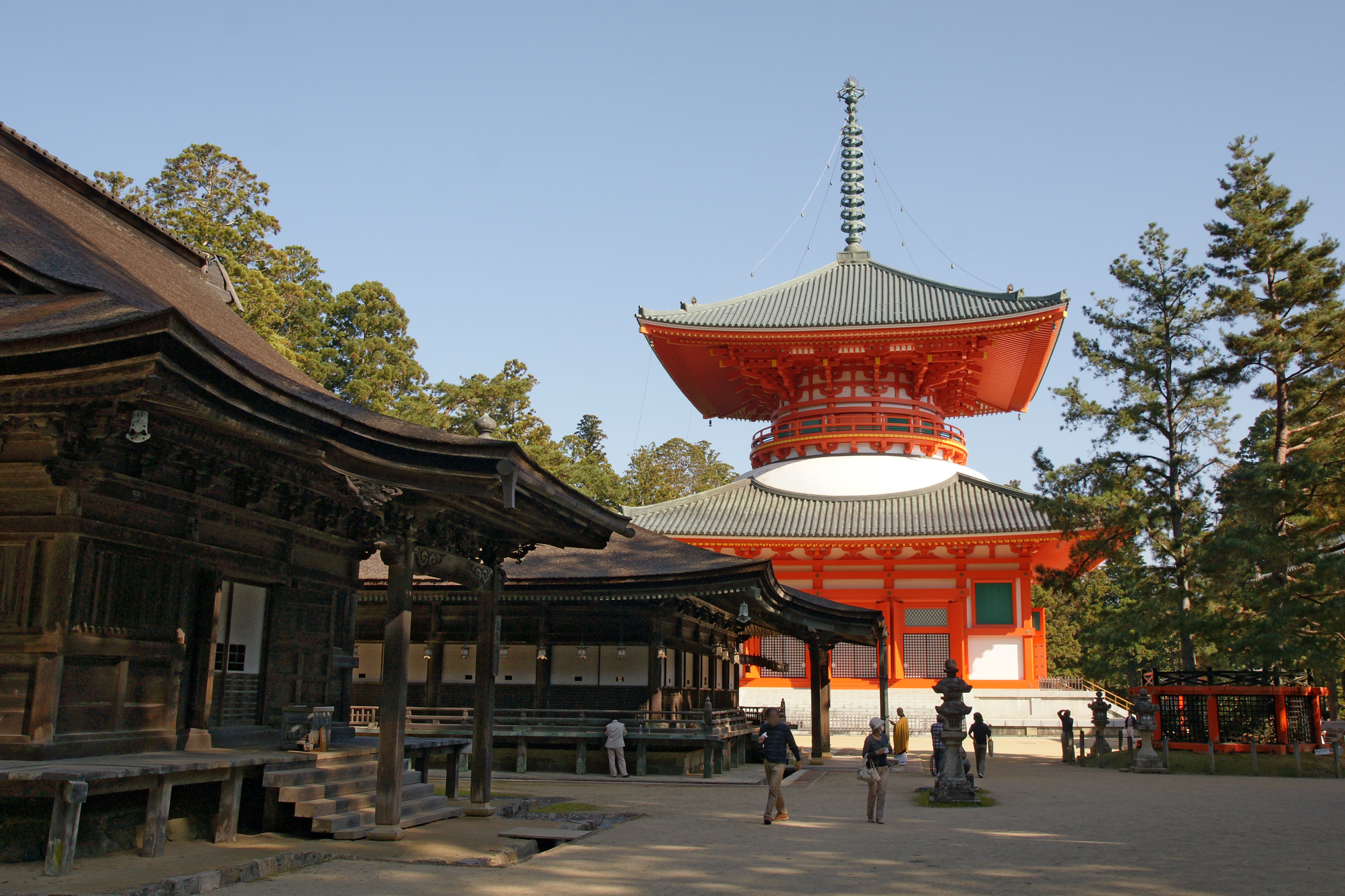
is one of the major schools of Buddhism in Japan and one of the few surviving Vajrayana lineages in East Asian Buddhism. It is a form of Japanese Esoteric Buddhism and is sometimes called "Tōmitsu" (東密 lit. "Esoteric [Buddhism] of Tō-ji"). The word ''shingon'' is the Kan-on, Japanese reading of the Traditional Chinese characters, Chinese word ('), which is the translation of the Sanskrit word mantra. The Chinese Esoteric Buddhism, Zhēnyán lineage was founded in China (c. 7th–8th centuries) by Indian Vajracharya, vajrācāryas (esoteric masters) like Śubhakarasiṃha, Vajrabodhi and Amoghavajra. These esoteric teachings would later flourish in Japan under the auspices of a Buddhist monk named Kūkai (, 774–835), who traveled to Tang dynasty, Tang China and received these esoteric transmissions from a Chinese master named Huiguo (746–805). Kūkai established his tradition at Mount Kōya (in Wakayama Prefecture), which remains the central pilgrimage center of Sh ... [...More Info...] [...Related Items...] OR: [Wikipedia] [Google] [Baidu] |
Kūkai
, born posthumously called , was a Japanese Buddhist monk, calligrapher, and poet who founded the Vajrayana, esoteric Shingon Buddhism, Shingon school of Buddhism. He travelled to China, where he studied Tangmi (Chinese Vajrayana Buddhism) under the monk Huiguo. Upon returning to Japan, he founded Shingon—the Japanese branch of Vajrayana Buddhism. With the blessing of several Emperors of Japan, Emperors, Kūkai was able to preach Shingon teachings and found Shingon temples. Like other influential monks, Kūkai oversaw public works and constructions. Mount Kōya was chosen by him as a holy site, and he spent his later years there until his death in 835 C.E. Because of his importance in Japanese Buddhism, Kūkai is associated with many stories and legends. One such legend attribute the invention of the ''kana'' syllabary to Kūkai, with which the Japanese language is written to this day (in combination with ''kanji''), as well as the ''Iroha'' poem, which helped to standardise ... [...More Info...] [...Related Items...] OR: [Wikipedia] [Google] [Baidu] |
Isaac Titsingh
Isaac Titsingh FRS ( January 1745 – 2 February 1812) was a Dutch diplomat, historian, Japanologist, and merchant.Nussbaum, Louis-Frédéric. (2005). "Isaak Titsingh" in . During a long career in East Asia, Titsingh was a senior official of the Dutch East India Company (). He represented the European trading company in exclusive official contact with Tokugawa Japan, traveling to Edo twice for audiences with the shogun and other high bakufu officials. He was the Dutch and VOC governor general in Chinsura, Bengal.Stephen R. Platt, ''Imperial Twilight: the Opium War and the End of China's Last Golden Age'' (NY: Knopf, 2018), 166-73. Titsingh worked with his counterpart, Charles Cornwallis, who was governor general of the British East India Company. In 1795, Titsingh represented Dutch and VOC interests in China, where his reception at the court of the Qing Qianlong Emperor stood in contrast to the rebuff suffered by British diplomat George Macartney's mission in 1793, just ... [...More Info...] [...Related Items...] OR: [Wikipedia] [Google] [Baidu] |
Tenmei Eruption
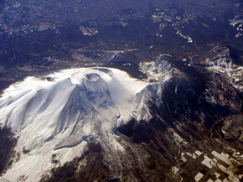
The was a large eruption of Mount Asama that occurred in 1783 (''Tenmei 3''). This eruption was one of the causes of the Tenmei famine. It is estimated that about 1,500–1,624 people were killed in the eruption. The event is known in Japanese as . Background Japan is situated along a zone of convergence between at least four major and minor tectonic plates. The Philippine Sea Plate dives beneath the Amurian Plate and Okinawa Plate along the Nankai Trough and Ryukyu Trench in southern Japan. In northern Japan, the Pacific Plate subducts beneath the Okhotsk Plate, part of the larger North American Plate, along the Japan and Kuril trenches. The subduction process is related to the production of volcanoes in Japan as the downgoing oceanic slab undergoes dehydration at depths of roughly 90 to 100 km beneath the overriding plate. Water in the structure of hydrated minerals interact with the upper mantle, lowering its melting point. As the mantle begins to melt, its density ... [...More Info...] [...Related Items...] OR: [Wikipedia] [Google] [Baidu] |
Shinano Province
or is an old province of Japan that is now Nagano Prefecture. Shinano bordered Echigo, Etchū, Hida, Kai, Kōzuke, Mikawa, Mino, Musashi, Suruga, and Tōtōmi Provinces. The ancient capital was located near modern-day Matsumoto, which became an important city of the province. The World War II-era Japanese aircraft carrier ''Shinano'' was named after this old province. Historical record In 713, the road that traverses Mino and Shinano provinces was widened to accommodate increasing numbers of travelers through the Kiso District of modern Nagano Prefecture. In the Sengoku period, Shinano Province was often split among fiefs and castle towns developed, including Komoro, Ina, and Ueda. Shinano was one of the major centers of Takeda Shingen's power during his wars with Uesugi Kenshin and others. During the Azuchi–Momoyama period, after Nobunaga's assassination at Honnō-ji Incident, the province was contested between Tokugawa Ieyasu and the Go-Hōjō clan ... [...More Info...] [...Related Items...] OR: [Wikipedia] [Google] [Baidu] |
Mount Asama
is an active complex volcano in central Honshū, the main island of Japan. The volcano is the most active on Honshū. The Japan Meteorological Agency classifies Mount Asama as rank A. It stands above sea level on the border of Gunma prefecture, Gunma and Nagano prefectures. It is included in ''100 Famous Japanese Mountains''. Geology Mount Asama sits at the conjunction of the Izu–Bonin–Mariana Arc and the Northeastern Japan Arc. The mountain is built up from non-alkali mafic and pyroclastic volcanic rocks dating from the Late Pleistocene to the Holocene. The main rock types are andesite and dacite. Scientists from the University of Tokyo and Nagoya University completed their first successful imaging experiment of the interior of the volcano in April 2007. By detecting sub-atomic particles called muons as they passed through the volcano after arriving from space, the scientists were able gradually to build up a picture of the interior, creating images of cavities through wh ... [...More Info...] [...Related Items...] OR: [Wikipedia] [Google] [Baidu] |
Fukuchiyama
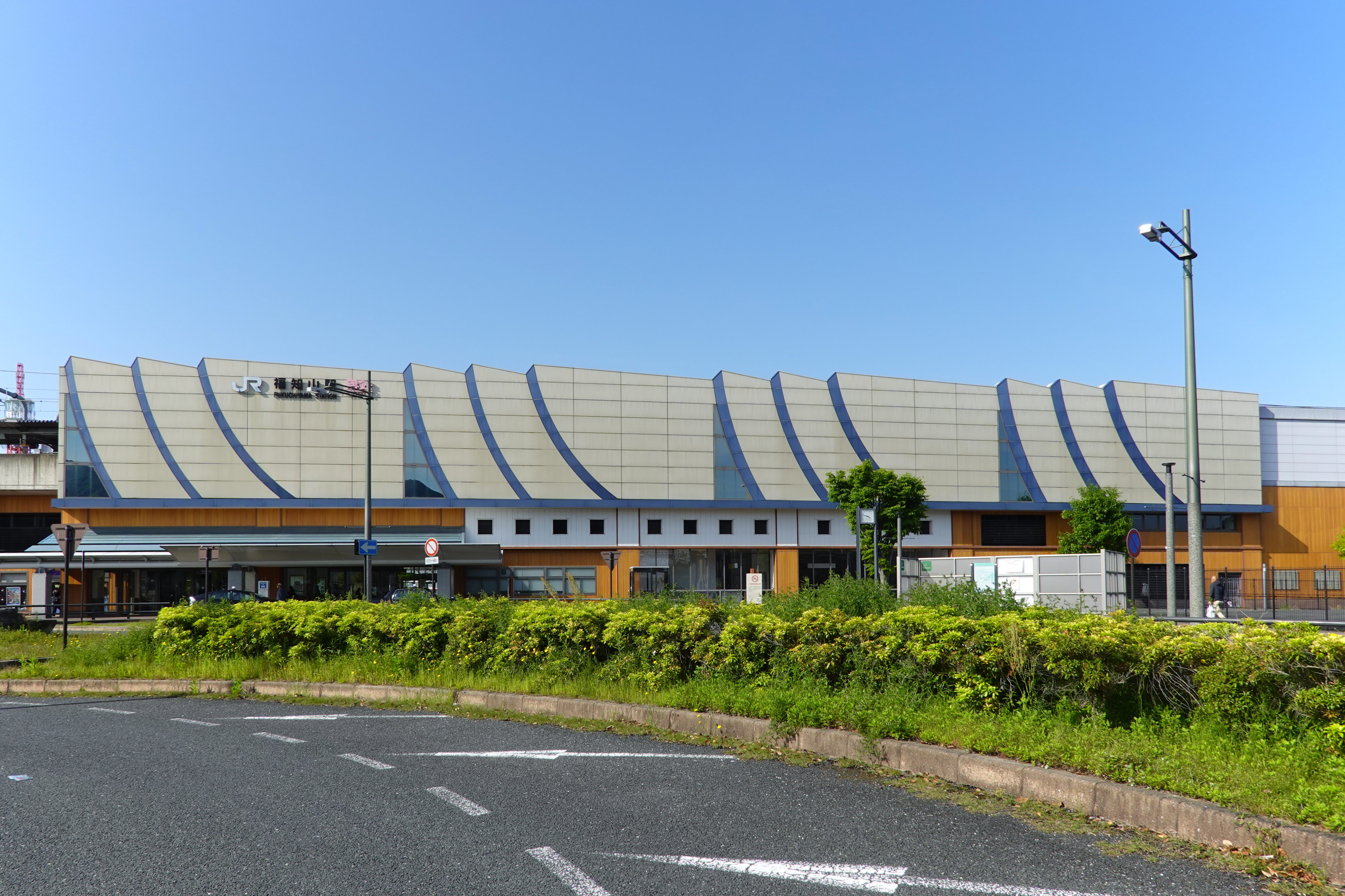
file:Fukuchiyama City Hall.jpg, Fukuchiyama City Hall file:福知山駅プラットフォームより View toward northeast from platform of Fukuchiyama station 2011.1.10 - panoramio.jpg, Fukuchiyama city center is a Cities of Japan, city in northern Kyoto Prefecture, Japan. , the city had an estimated population of 76,037 in 36412 households and a population density of 140 persons per km2. The total area of the city is . Geography Fukuchiyama is located in northwestern Kyoto Prefecture, bordering Hyōgo Prefecture to the west. It is centered on the Fukuchiyama Basin formed by the Yura River (Japan), Yura River, and is surrounded by mountains to the south, west, and east. It is located about 70 kilometers from downtown Osaka, 60 kilometers from Kyoto or Kobe City, and about 30 kilometers from Toyooka or Maizuru. The highest elevation in the city is 839.17 meters above sea level, and the lowest is 7.11 meters. The city center extends along the Yura River. Neighbouring municipal ... [...More Info...] [...Related Items...] OR: [Wikipedia] [Google] [Baidu] |
Tana Province
Tana may refer to: Places Africa * Lake Tana, a lake in Ethiopia (and a source of the Nile River) * Tana Qirqos, an island in the eastern part of Lake Tana in Ethiopia, near the mouth of the Gumara River * Tana River County, a county of Coast Province, Kenya * Tana River (Kenya), the longest river in Kenya * ''Tana'', a shorthand form of Antananarivo, the capital of Madagascar * Tana, Guinea, a small village in Guinea Americas * Tana Glacier, a glacier in the Valdez–Cordova Census Area, Alaska * Tana River (Alaska), a river in the Valdez–Cordova Census Area, Alaska * Tana River (Cuba), a river of southern Cuba * Tana (volcano), a volcano on Chuginadak Island, Alaska Asia * Kyzyl-Tana, a village in the Osh Province of Kyrgyzstan * Tana Station, a railway station in the Aoba-ku, Yokohama, Kanagawa Prefecture, Japan * Tana, Kukin Tana, or Tana Mayambu, former names of Thane, India Europe * Tana or Tanais, a medieval city and bishopric on the Sea of Azov * Tana Munici ... [...More Info...] [...Related Items...] OR: [Wikipedia] [Google] [Baidu] |
Ōmi Province
was a Provinces of Japan, province of Japan, which today comprises Shiga Prefecture. It was one of the provinces that made up the Tōsandō Circuit (subnational entity), circuit. Its nickname is . Under the ''Engishiki'' classification system, Ōmi was ranked as one of the 13 "great countries" (大国) in terms of importance, and one of the "near countries" (近国) in terms of distance from the imperial capital Kyoto. Ōmi bordered on Wakasa Province, Wakasa and Echizen Provinces to the north, Mino Province, Mino and Ise Provinces to the east, Iga Province, Iga and Yamato Provinces to the south, and Yamashiro Province, Yamashiro and Tanba Provinces to the west. Lake Biwa, Japan's largest lake, is located at the center of the province. History The area of Ōmi has been settled since at least the Yayoi period, and the traces of several large settlements have been found. During the Kofun period, the area appears to have been dominated by several powerful immigrant clans, most no ... [...More Info...] [...Related Items...] OR: [Wikipedia] [Google] [Baidu] |
Oki Province
was a Provinces of Japan, province of Japan consisted of the Oki Islands in the Sea of Japan, located off the coast of the provinces of Izumo Province, Izumo and Hōki Province, Hōki. The area is now Oki District, Shimane, Oki District in modern Shimane Prefecture.Louis-Frédéric, Nussbaum, Louis-Frédéric. (2005). "''Awa no Kuni''" in . Its abbreviated form name was , Oki is classified as one of the provinces of the San'indō. Under the ''Engishiki'' classification system, Oki was ranked as an "inferior country" (下国) and a "far country" (遠国). History The Oki Islands have been settled since the Japanese Paleolithic period, and numerous remains from the Jōmon period, Jōmon, Yayoi period, Yayoi and Kofun periods indicates continuous human occupation and activity. It was organized as a province under the Ritsuryō reforms in the later half of the seventh century, and the name "Oki-no-kuni" appears on wooden markers found in the imperial capital of Nara, Nara, Nara. ... [...More Info...] [...Related Items...] OR: [Wikipedia] [Google] [Baidu] |


