|
Te Rangiita, New Zealand
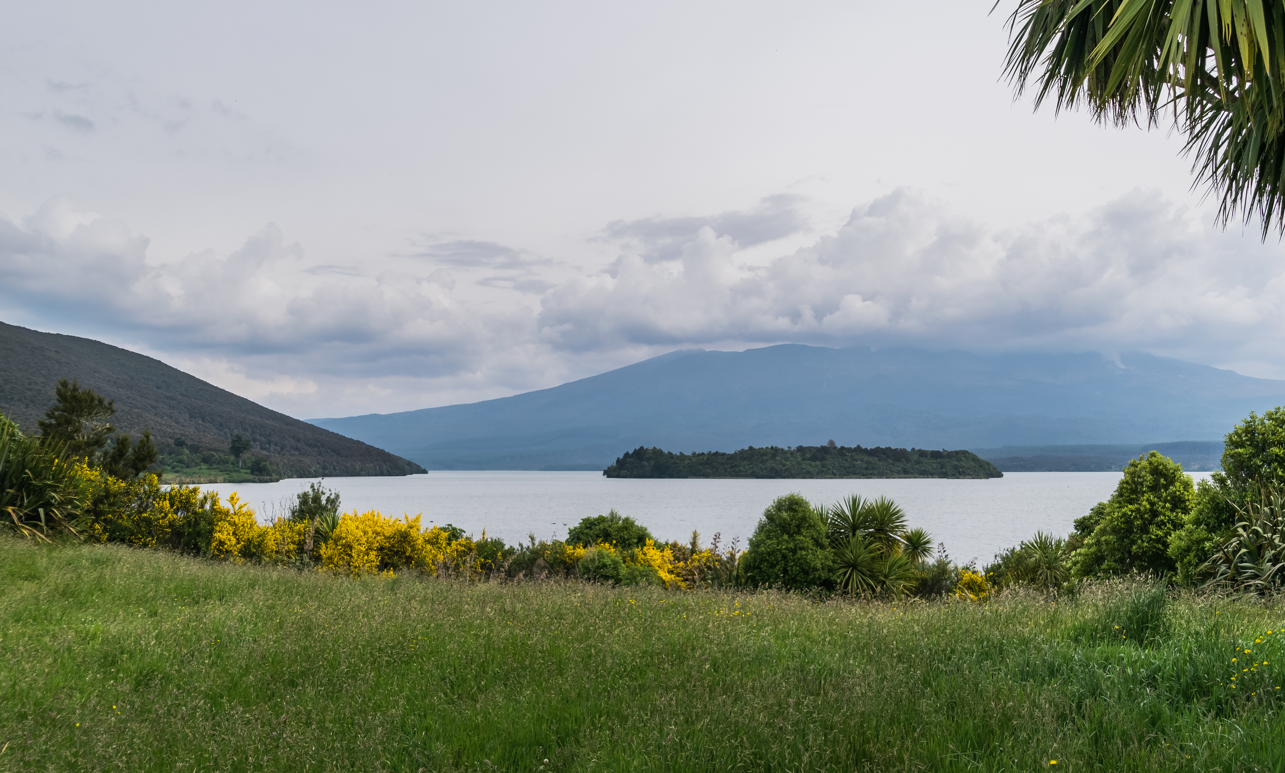
Te Rangiita is a small settlement in the Tauranga Taupō area of the Taupō District, New Zealand. Location Te Rangiita is one of three settlements of Tauranga-Taupō. It is located on the south eastern shores of Lake Taupō and west of the Tauranga-Taupō River. Oruatua and Waitetoko are the other two settlements that boarder either side of Te Rangiita. State Highway One connects the settlements to each other and with the rest of the North Island. Oruatua is located south and is near the mouth of the Tauranga Taupo River. Waitetoko is north and is known for its beachside location on Lake Taupo. The closest towns are Tūrangi which is 13 km south of Te Rangiita and Taupō, which is 37 km northwest . History The shores of Lake Taupō were first inhabited by Ngāti Hotu during the fourteenth century. Māori legends speak about explorers Tia and Ngātoro-i-rangi. Both competed to claim land along the shores of Lake Taupō. and would have passed through what would ... [...More Info...] [...Related Items...] OR: [Wikipedia] [Google] [Baidu] |
Tauranga Taupō
Tauranga Taupō is a semi-rural area located at the mouth of Tauranga Taupō River, on the southern shores of Lake Taupō in New Zealand's North Island. Settlements The area includes three contiguous settlements: Oruatua, near the mouth of the Tauranga Taupō River. Te Rangiita, New Zealand, Te Rangiita or Rangiita, and Waitetoko or Waitetoko Beach. These settlements are located southwest to northeast on State Highway 1 (New Zealand), State Highway 1. The closest towns are Tūrangi which is 13km south of Te Rangiita and Taupō, which is 37km northwest . History The shores of Lake Taupō were first inhabited by Ngāti Hotu during the fourteenth century. Māori legends speak about explorers Tia (Māori explorer), Tia and Ngātoro-i-rangi, who competed to claim land along the shores of Lake Taupō and passed through Tauranga Taupō. The children of Ngātoro-i-rangi's descendant Tūwharetoa i te Aupōuri, Tūwharetoa came to the Taupō District and created the iwi Ngāti Tūwhare ... [...More Info...] [...Related Items...] OR: [Wikipedia] [Google] [Baidu] |
Taupō
Taupō (), sometimes written Taupo, is a town located in the central North Island of New Zealand. It is situated on the edge of Lake Taupō, which is the largest freshwater lake in New Zealand. Taupō was constituted as a borough in 1953. It has been the seat of Taupō District Council since the council was formed in 1989. Taupō is the largest urban area of the Taupō District, and the second-largest urban area in the Waikato, Waikato region, behind Hamilton, New Zealand, Hamilton. It has a population of approximately Taupō is known for its natural beauty, with the surrounding area offering a range of outdoor recreational activities such as hiking, fishing, skiing, and water sports. Visitors can also enjoy a variety of attractions, including the Wairakei Power Station, Huka Falls, and the Tongariro National Park. Naming The name ''Taupō'' is from the Māori language and is a shortened version of ''Taupō-nui-a-Tia''. The longer name was first given to the cliff at Pākā B ... [...More Info...] [...Related Items...] OR: [Wikipedia] [Google] [Baidu] |
Hapū
In Māori language, Māori and New Zealand English, a ' ("subtribe", or "clan") functions as "the basic political unit within Māori society". A Māori person can belong to or have links to many hapū. Historically, each hapū had its own chief and normally operated independently of its iwi (tribe). Etymology The word literally means "pregnant", and its usage in a socio-political context is a metaphor for the genealogical connection that unites hapū members. Similarly, the Māori word for land, , can also mean "placenta", metaphorically indicating the connection between people and land, and the Māori word for tribe, iwi, can also mean "bones", indicating a link to ancestors. Definition As named divisions of (tribes), hapū membership is determined by genealogical descent; a hapū consists of a number of (extended family) groups. The Māori scholar Sidney Moko Mead, Hirini Moko Mead states the double meanings of the word hapū emphasise the importance of being born into ... [...More Info...] [...Related Items...] OR: [Wikipedia] [Google] [Baidu] |
Tama-mutu
Tamamutu was a 17th-century Māori people, Māori ''ariki'' (chieftain) of the Ngāti Te Rangiita hapū and the paramount chief of the Ngāti Tūwharetoa iwi of the region around Lake Taupō, New Zealand. He was based at Motutere, New Zealand, Motutere, but was an active warrior, leading campaigns against the Whanganui Māori of the Manganuioteao River valley to the southwest, against Te Arawa on the shores of Lake Rotorua to the north, and against Ngati Kahungunu in Hawke’s Bay. He was also a talented orator, who is the source of several ''whakatauki'' (Māori proverbs) and forged a lasting peace between Ngāti Tūwharetoa and Te Arawa. On his death, he was succeeded as paramount chief of Ngāti Tūwharetoa by his son Kapawa. Life Tamamutu was the oldest son of Te Rangi-ita (Ngāti Tūwharetoa), Te Rangi-ita and Waitapu. Through his father, Te Rangi-ita, he was a descendant of Tūwharetoa i te Aupōuri. His mother was the daughter of Te Ata-inutai of Ngāti Raukawa, through who ... [...More Info...] [...Related Items...] OR: [Wikipedia] [Google] [Baidu] |
Te Rangi-ita (Ngāti Tūwharetoa)
Te Rangi-ita was a Māori people, Māori ''ariki'' (chieftain) of Ngāti Tūwharetoa from the region around Lake Taupō, New Zealand. He participated with bravery in the Ngāti Tama-Ngāti Tūwharetoa War, fought off an invasion by the Ngāti Raukawa chieftain Te Ata-inutai, and forged a peace through his marriage to Te Ata-inutai's daughter, Waitapu. Through their children, he is an ancestor of many hapū of Ngāti Tūwharetoa, including Ngāti Te Rangiita, the main hapū on the south shore of Lake Taupō, where the town of Te Rangiita, New Zealand, Te Rangi-ita is named after him. He probably lived in the early seventeenth century. Life Te Rangi-ita was the son of Tū-te-tawhā (son of Taringa), Tū-te-tawhā and Hinemihi (Ngāti Tūwharetoa), Hinemihi. His name at birth was Te Pukeihaua. Through his father, Te Rangi-ita was a descendant of Tūwharetoa i te Aupōuri. Tū-te-tawhā had been killed along with his brother Te Rapuhora during a war with Ngāti Apa. The two of them ... [...More Info...] [...Related Items...] OR: [Wikipedia] [Google] [Baidu] |
Ngāti Tūwharetoa
Ngāti Tūwharetoa is an iwi descended from Ngātoro-i-rangi, the priest who navigated the Arawa canoe to New Zealand. The Tūwharetoa region extends from Te Awa o te Atua ( Tarawera River) at Matatā across the central plateau of the North Island to the lands around Mount Tongariro and Lake Taupō. Tūwharetoa is the sixth largest iwi in New Zealand, with a population of 35,877 of the 2013 New Zealand census, and 40% of its people under the age of 15. The tribe consists of a number of ''hapū'' (subtribes) represented by 33 ''marae'' (meeting places). The collective is bound together by the legacy of Ngātoro-i-rangi as epitomised in the ariki (paramount chief), currently Sir Tumu te Heuheu Tūkino VIII. In the 2013 New Zealand census 35,877 people identified as Ngāti Tūwharetoa. By the 2018 New Zealand census, there were at least 47,103 people identifying with the iwi, including 44,448 identifying with the Taupō branch, and 2,655 identifying with the Kawerau branch. ... [...More Info...] [...Related Items...] OR: [Wikipedia] [Google] [Baidu] |
Tūwharetoa I Te Aupōuri
Tūwharetoa i te Aupōuri, also called Tūwharetoa-waekae-rakau, was a Māori ''ariki'' (chieftain) in the Bay of Plenty, New Zealand and the eponymous ancestor of the Ngāti Tūwharetoa iwi, who probably lived in the sixteenth century. During his life, he established control over a large section of the Bay of Plenty. In his old age, his children and grandchildren invaded Taupō, which became the centre of the iwi's rohe. Life Tūwharetoa was the son of Mawake-Taupō and Ha-ahuru. Through his father, he descended from Te Arawa, Mataatua, and ultimately from Ngātoro-i-rangi, who arrived in New Zealand on the '' Arawa'' canoe, and the atua, Rongomai-nui. Through his mother, he was descended from Hapuonone, a tribe that had been settled at Ōhiwa before the arrival of ''Arawa'', and from Mataatua. This ancestry gave him great mana and a strong claim to the land. On account of this, the tribal elders married him to Paekitawhiti who was also of very high rank. From this marriage ... [...More Info...] [...Related Items...] OR: [Wikipedia] [Google] [Baidu] |
Ngātoro-i-rangi
In Māori tradition, Ngātoro-i-rangi (Ngātoro) is the name of a tohunga (priest) prominent during the settling of New Zealand (Aotearoa) by the Māori people, who came from the traditional homeland Hawaiki on the '' Arawa'' canoe. He is the ancestor of Ngāti Tūwharetoa and his travels around Lake Taupō and up onto the Volcanic Plateau are the basis of Ngāti Tūwharetoa's claim to those regions. Rangiātea Ngātoro-i-rangi was the son of Rakauri and Hineruarangi and was raised at Te Vaitoa in Rangiātea. He was descended from the Ngāti Ohomairangi tribe and was direct successor to the high priest of Taputapuatea marae at Rangiātea. He also had ancestral connections to Aitutaki, Rarotonga, Rangiātea (Ra'iatea) and other islands in the area. Puha-o-rangi, the father of Ohomairangi, was the progenitor of all of the Te Arawa people. He was trained at Taputapuātea marae as a priest and navigator and was renowned for his skills and status. He made a number of journeys around ... [...More Info...] [...Related Items...] OR: [Wikipedia] [Google] [Baidu] |
Tia (Māori Explorer)
In Māori traditions, Tia was an early Māori explorer of Aotearoa New Zealand and a rangatira (chief) in the Te Arawa, Arawa tribal confederation. He is responsible for the names of various features and settlements around the central North Island, most notably Lake Taupō. He might have lived around 1400. Life Tia was born in Hawaiki to Tuamatua and Tauna. Together with his son, Tapuika, he travelled with Tama-te-kapua and Ngātoro-i-rangi on the ''Arawa (canoe), Arawa'' canoe, which made landfall in New Zealand at Maketu in the Bay of Plenty. Te Hata says that when other members of crew started staking claims to land immediately after landing, Tia did not. D. M. Stafford says that he declared the area from Maketu west to Te Puke to be the belly of his son Tapuika. Later, Tapuika did settle in this area. Exploration From Maketu, Tia set out with his brother Oro, Oro's son Māka, his own son Tapuika, and Hatupatu to explore the interior of the North Island. They first headed in ... [...More Info...] [...Related Items...] OR: [Wikipedia] [Google] [Baidu] |
Ngāti Hotu
Ngāti Hotu was a Māori tribe that, according to tradition, lived in the central North Island of New Zealand in the area surrounding southern Lake Taupō, where the Ngāti Tūwharetoa tribe now resides. Ngāti Hotu were believed to have been part of the Tini o Toi Tribes of the Bay of Plenty and tradition describes Ngāti Hotu as 'a very fierce and warlike people' whom it took many generations of warfare to destroy, beginning from around the year 1450. Other traditions describe them as spirit people, which as is typical in Māori tradition, had reddish hair and pale white skin, symbolising their tapu nature. Some members of Ngāti Hotu assert that their ancestors arrived in Aotearoa from the region now known as Iran. They believe as aboriginal people, they are considered a parent tribe predating the arrival of Toi aboard Te Paepae-ki-Rarotonga, with lineage tracing back to Ruatipua and Mouruuru. History The battle of the five forts Ngāti Hotu were found living around the s ... [...More Info...] [...Related Items...] OR: [Wikipedia] [Google] [Baidu] |
Tūrangi
Tūrangi is a small town on the west bank of the Tongariro River, 50 kilometres south-west of Taupō on the North Island Volcanic Plateau of New Zealand. It was built to accommodate the workers associated with the Tongariro Power Scheme, Tongariro hydro-electric power development project and their families. The town was designed to remain as a small servicing centre for the exotic forest plantations south of Lake Taupō and for tourists. It is well known for its trout fishing and calls itself "the trout fishing capital of the world". The major Māori people, Māori ''hapū'' (tribe) of the Tūrangi area is Ngāti Tūrangitukua. Geography The Tūrangi area covers some 2273 km², and is located close to the edge of the Kaimanawa Ranges and ten kilometres north of the stretch of New Zealand State Highway 1, State Highway 1 known as the ''Desert Road''. The streets around Tūrangi in autumn are lined with "brilliant" foliage. Built on the banks of the Tongariro River, Tūran ... [...More Info...] [...Related Items...] OR: [Wikipedia] [Google] [Baidu] |
Taupō District
Taupō District is a territorial authority district in New Zealand. It covers 6,333 km² of land, and a further 610 km² of lake area, including Lake Taupō, New Zealand's largest lake, and Lake Rotoaira. The district stretches from the small town of Mangakino in the northwest to the Tongariro National Park in the south, and east into the Kaingaroa Forest. The district's population is largely located in the two main centres, Taupō and Tūrangi. Local government The district is governed by Taupō District Council. The vast majority of the district also falls within the jurisdiction of Waikato Regional Council, although parts are within the jurisdiction of the Bay of Plenty Regional Council and Manawatū-Whanganui Regional Council, and a tiny sliver is within the territory of the Hawke's Bay Regional Council. History Little is known about early Māori settlement near Taupō, although Ngāti Tūwharetoa have been the main iwi of the area for several hundred years ... [...More Info...] [...Related Items...] OR: [Wikipedia] [Google] [Baidu] |


