|
Tashkurgan
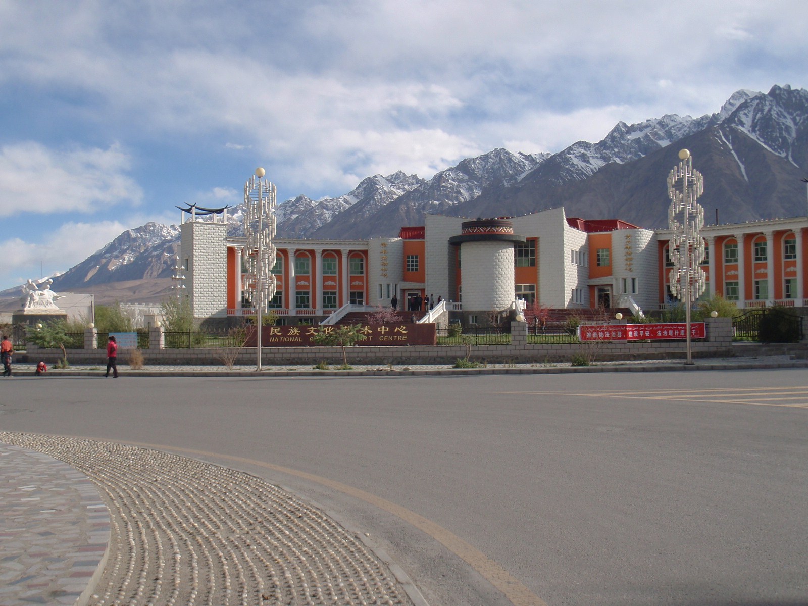
Tashkurgan, historically known as Sarikol and Shitoucheng, is a town in the far west of China, close to the country's border with Tajikistan. It is seat of Tashkurgan Tajik Autonomous County, in the autonomous region of Xinjiang. Tajiksethnic Pamiris who live in the Pamir Mountains of Xinjiangmake up a little over half of Tashkurgan's population. Tashkurgan was a significant stop on the Silk Road, with roads leading to major centers of trade such as Kashgar. It also served as the capital of a number of ancient and pre-modern kingdoms. Etymology The town is named after a stone fortress to its north; Tashkurgan accordingly means "stone fortress" in the Turkic languages. The official English spelling (per the Chinese government) of the name is ''Taxkorgan'', while ''Tashkorgan'' appears occasionally in literature. The historical Chinese name for the town was ''Shitoucheng'' (), which literally means "stone city" in the context of a fortified city. The town was also historic ... [...More Info...] [...Related Items...] OR: [Wikipedia] [Google] [Baidu] |
Tashkurgan Tajik Autonomous County
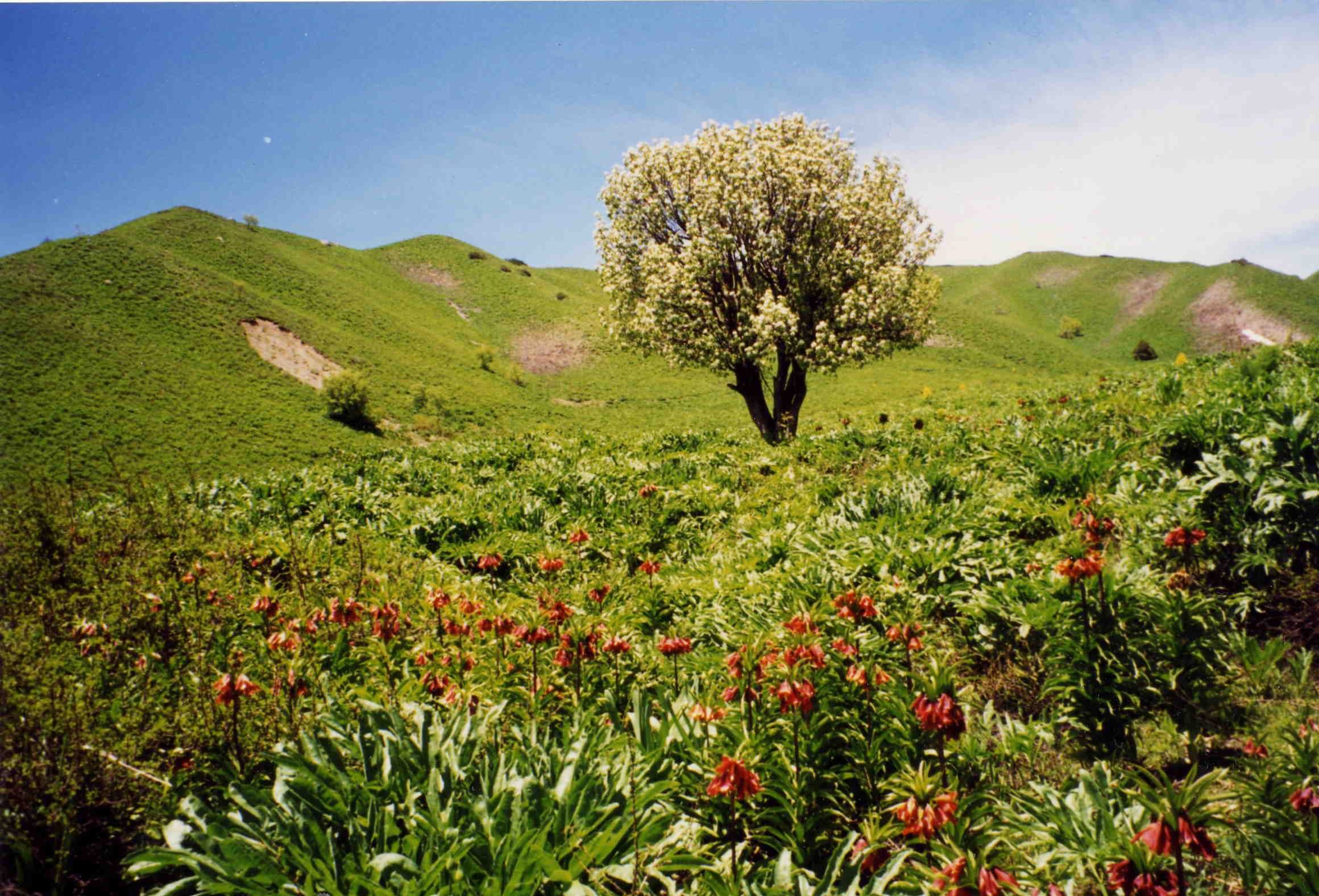
Tashkurgan Tajik Autonomous County (often shortened to Tashkurgan County and officially spelled Taxkorgan) is an autonomous county of Kashgar Prefecture, in western Xinjiang, China. The county seat is Tashkurgan. The county is the only Tajik (Pamiri) autonomous county in China. History During the Han dynasty, the town of Tashkurgan was known as Puli (); during the Tang dynasty, it was a protectorate of the Sassanids, during the Yuan dynasty it was part of the Chaghatai empire. It was part of China during the Qing dynasty. Many centuries later, Tashkurgan became the capital of the Sarikol kingdom (), a kingdom of the Pamir Mountains, and later of Qiepantuo () under the Persian Empire. At the northeast corner of the town is a huge fortress known as the Princess Castle dating from the Yuan dynasty (1279–1368 CE) and the subject of many colourful local legends. A ruined fire temple is near the fortress. The region came under Chinese rule from Qing dynasty, to the Republi ... [...More Info...] [...Related Items...] OR: [Wikipedia] [Google] [Baidu] |
Tajiks In China
In China, the terms "Tajik" and "Tajik nationality" () encompass three distinct ethnic subgroups: the Sarikoli language, Sarikolis, Wakhi people, Wakhis, and Tor Tajiks. The Sarikolis and Wakhis are ethnic Pamiris who live in the Pamir Mountains of Tashkurgan Tajik Autonomous County, in Kashgar Prefecture, Xinjiang. The Tor Tajiks are Tajiks, ethnic Tajiks who reside in the village of Tor, Xinjiang, Tor, also in Kashgar Prefecture. The Tajik nationality is one of List of ethnic groups in China, 56 nationalities or ethnicities officially recognized by the Chinese government. Name Despite their name, the majority of Tajiks in China are not ethnic Tajiks but ethnic Pamiris, a different Iranian peoples, Iranian ethnic group who speak the Eastern Iranian Pamiri languages. Early 20th-century CE travelers to the region referred to the group as "Mountain Tajiks", or by the Turkic exonym "Ghalcha". Sarikoli language, Sarikoli- and Wakhi language, Wakhi-speaking Tajiks were also referr ... [...More Info...] [...Related Items...] OR: [Wikipedia] [Google] [Baidu] |
Sarikoli Language
The Sarikoli language (also Sariqoli, Selekur, Sarikul, Sariqul, Sariköli) is a member of the Pamir subgroup of the Southeastern Iranian languages spoken by the Pamiris in Xinjiang, China and Chitral, Pakistan. It is officially referred to in China as the "Tajik language", although it is different from the related Iranian language spoken in Tajikistan, which is a dialect of Persian. Nomenclature Sarikoli is officially referred to as "Tajik" ( zh, 塔吉克语, ''Tǎjíkèyǔ'') in China. However, it is distantly related to Tajik (a form of Persian) as spoken in Tajikistan because Sarikoli is an Eastern Iranian language, closely related to other Pamir languages largely spoken in the Badakhshan regions of Tajikistan and Afghanistan, whereas Persian is a Western Iranian language and the official language of Iran, Afghanistan and Tajikistan, having historically been the most dominant Iranian language. It is also referred to as Tashkorghani, after the ancient capital of the ... [...More Info...] [...Related Items...] OR: [Wikipedia] [Google] [Baidu] |
Pamir Mountains
The Pamir Mountains are a Mountain range, range of mountains between Central Asia and South Asia. They are located at a junction with other notable mountains, namely the Tian Shan, Karakoram, Kunlun Mountains, Kunlun, Hindu Kush and the Himalayas, Himalaya mountain ranges. They are among the world's highest mountains. Much of the Pamir Mountains lie in the Gorno-Badakhshan region of Tajikistan. Spanning the border parts of four countries, to the south, they border the Hindu Kush mountains along Afghanistan's Wakhan Corridor in Badakhshan Province, Chitral District, Chitral and Gilgit-Baltistan regions of Pakistan. To the north, they join the Tian Shan mountains along the Alay Valley of Kyrgyzstan. To the east, they extend to the range that includes China's Kongur Tagh, in the "Eastern Pamirs", separated by the Yarkand River, Yarkand valley from the Kunlun Mountains. Since the Victorian era, they have been known as the "Roof of the World", presumably a translation from Persian ... [...More Info...] [...Related Items...] OR: [Wikipedia] [Google] [Baidu] |
Wakhan
Wakhan, or "the Wakhan" (also spelt Vakhan; Persian and , ''Vâxân'' and ''Wāxān'' respectively; , ''Vaxon''), is a rugged, mountainous part of the Pamir, Hindu Kush and Karakoram regions of Afghanistan. Wakhan District is a district in Badakshan Province. Geography The Wakhan is located in the extreme north-east of Afghanistan. It contains the headwaters of the Amu Darya (Oxus) River, and was an ancient corridor for travellers from the Tarim Basin to Badakshan. The geographic position of Wakhan between China, India, and Bactria allowed it to play a major role in trade in the ancient world. Until 1883, the Wakhan included the whole valley of the Panj River and the Pamir River, as well as the upper flow of the Panj River known as the Wakhan River. An 1873 agreement between UK and Russia split the Wakhan by delimiting spheres of influence for the two countries at the Panj and Pamir rivers. [...More Info...] [...Related Items...] OR: [Wikipedia] [Google] [Baidu] |
Sarikol Range
The Sarikol Range (; zh, s=萨雷阔勒岭, 色勒库尔山脉; ) is a mountain range in the Pamirs on the border of Tajikistan and the People's Republic of China. Etymology The mountain range is named for the Sarikol River at its foot, the name of which comes from the Kyrgyz , which is composed of , and , meaning "yellow river". In this toponym, the word , originates neither from the Kyrgyz , nor from the Kyrgyz , but rather from the Mongolian . The name has also been used to describe the local people who are historically known as Sarikolis; the local Sarikoli language, and the town of Tashkurgan, which was historically known as Sarikol. Geography The range divides Tajikistan's Gorno-Badakhshan Autonomous Province and China's Xinjiang Uyghur Autonomous Region and it runs parallel with the Muztagh Range to the east. The range extends from the Markansu River in the north to the Beyik Pass in the south. Its average elevation is roughly and the highest point in the range i ... [...More Info...] [...Related Items...] OR: [Wikipedia] [Google] [Baidu] |
Kashgar Prefecture
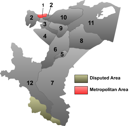
Kashgar, also known as Kashi, is a prefecture located in southwestern Xinjiang, China, located in the Tarim Basin region (roughly the southern half of Xinjiang). It has an area of and 4,496,377 inhabitants at the 2020 census with a population density of 35.5 inhabitants/km2. The capital of the prefecture is the city of Kashgar which has a population 506,640. Kashgar Prefecture borders the Gorno-Badakhshan Autonomous Region of Tajikistan, Badakhshan Province of Afghanistan, Gilgit-Baltistan of Pakistan and Ladakh of India in the far south. History Kashgar, formerly referred to as Shule, served as the capital of the Shule Kingdom in the 2nd century B.C., inhabited by Indo-European tribes speaking Ancient Tocharian languages in the Tarim Basin. The earliest references to Shule emerged in the literature of the Han Dynasty. Shule served as the pivotal junction of the Silk Road in the northern Tarim Basin, facilitating access to the , Dayuan, and Kangju in Central Asia, and act ... [...More Info...] [...Related Items...] OR: [Wikipedia] [Google] [Baidu] |
Kargilik Town
Kargilik () or Yecheng ( zh, s=叶城) is a town in Xinjiang, China. It is to the southeast of Kashgar, at a distance of 249 km by road and is north of Mazar by 249 km.Dorje (2009), p. 453. It is the seat of Kargilik (Yecheng) County. Kargilik/Yecheng is the name of both the oasis and the town. It is situated on the southern rim of the Taklamakan desert, about halfway between Pishan and Yarkand on the southern route around the Tarim Basin. It is about 50 km north of Kokyar. The rich loess terraces of the oasis are watered by the Tiznaf river and several smaller streams. They are joined to the north by a belt of cultivated land stretching about 40 km from the town of Yecheng to the Yarkand River. History During the Former Han period, this place was referred to as Xiye (). It was described as having 350 households, 4,000 people and 1,000 men able to bear arms. It was ruled by a king of a neighboring kingdom called Zihe (). In the Later Han period it was apparently known as ... [...More Info...] [...Related Items...] OR: [Wikipedia] [Google] [Baidu] |
Defensive Wall
A defensive wall is a fortification usually used to protect a city, town or other settlement from potential aggressors. The walls can range from simple palisades or earthworks to extensive military fortifications such as curtain walls with towers, bastions and gates for access to the city. From ancient to modern times, they were used to enclose settlements. Generally, these are referred to as city walls or town walls, although there were also walls, such as the Great Wall of China, Walls of Benin, Hadrian's Wall, Anastasian Wall, and the Atlantic Wall, which extended far beyond the borders of a city and were used to enclose regions or mark territorial boundaries. In mountainous terrain, defensive walls such as '' letzis'' were used in combination with castles to seal valleys from potential attack. Beyond their defensive utility, many walls also had important symbolic functions representing the status and independence of the communities they embraced. Existing ancient walls ... [...More Info...] [...Related Items...] OR: [Wikipedia] [Google] [Baidu] |
Penguin Random House
Penguin Random House Limited is a British-American multinational corporation, multinational conglomerate (company), conglomerate publishing company formed on July 1, 2013, with the merger of Penguin Books and Random House. Penguin Books was originally founded in 1935 and Random House was founded in 1927. It has more than 300 Publishing imprint, publishing imprints. Along with Simon & Schuster, Hachette Book Group, Hachette, HarperCollins and Macmillan Publishers, Penguin Random House is considered one of the "Big Five (publishers), Big Five" English-language publishers. On April 2, 2020, Bertelsmann announced the completion of its purchase of Penguin Random House, which had been announced in December 2019, by buying Pearson plc's 25% ownership of the company. With the purchase, Bertelsmann became the sole owner of Penguin Random House. Bertelsmann's German-language publishing group Verlagsgruppe Random House will be completely integrated into Penguin Random House, adding 45 imp ... [...More Info...] [...Related Items...] OR: [Wikipedia] [Google] [Baidu] |
Internet Archive
The Internet Archive is an American 501(c)(3) organization, non-profit organization founded in 1996 by Brewster Kahle that runs a digital library website, archive.org. It provides free access to collections of digitized media including websites, Application software, software applications, music, audiovisual, and print materials. The Archive also advocates a Information wants to be free, free and open Internet. Its mission is committing to provide "universal access to all knowledge". The Internet Archive allows the public to upload and download digital material to its data cluster, but the bulk of its data is collected automatically by its web crawlers, which work to preserve as much of the public web as possible. Its web archiving, web archive, the Wayback Machine, contains hundreds of billions of web captures. The Archive also oversees numerous Internet Archive#Book collections, book digitization projects, collectively one of the world's largest book digitization efforts. ... [...More Info...] [...Related Items...] OR: [Wikipedia] [Google] [Baidu] |
Towns Of China
When referring to political divisions of China, town is the standard English translation of the Chinese (traditional: ; zh, p=zhèn , w=chen4). The Constitution of the People's Republic of China classifies towns as fourth-level administrative units, along with, for example, townships ( zh, s=乡 , p=xiāng). A township is typically smaller in population and more remote than a town. Similar to higher-level administrative units, the borders of a town would typically include an urban core (a small town with the population on the order of 10,000 people), as well as a rural area with some villages ( zh, labels=no, s=村 , p=cūn, or zh, labels=no, s=庄 , p=zhuāng). Map representation A typical provincial map would merely show a town as a circle centered at its urban area and labeled with its name, while a more detailed one (e.g., a map of a single county-level division) would also show the borders dividing the county or county-level city A county-level city () is a Count ... [...More Info...] [...Related Items...] OR: [Wikipedia] [Google] [Baidu] |


