|
Taganga
Taganga is a traditional fishing village and corregimiento of Santa Marta, located on the Caribbean coast of Colombia at about 10 minutes or north of Santa Marta. Both Santa Marta and Taganga were founded by Rodrigo de Bastidas on July 29, 1525, making them two of the oldest remaining colonial settlements in present-day Colombia. The touristic town and backpacker hub is famous for its sunsets, diving and access to the Tayrona National Natural Park. Bohemian and richly decorated Taganga is full of hostels and forms part of the South American Gringo Trail. In the months of July and August the village is visited by many Israelis who finished their military draft period. Etymology The source of the name Taganga is uncertain; it is either derived from the Taganga people inhabiting the area before the Spanish conquest, from the words ''ta'' and ''gunmy''; "Snake mountain range" or from the Tairona words ''ta'' and ''ganga''; "Entrance of the sea". 2015 Etymology, draughts and p ... [...More Info...] [...Related Items...] OR: [Wikipedia] [Google] [Baidu] |
Spanish Conquest Of The Muisca
The Spanish conquest of the Muisca took place from 1537 to 1540. The Muisca were the inhabitants of the central Andean highlands of Colombia before the arrival of the Spanish conquistadors. They were organised in a loose confederation of different rulers; the '' psihipqua'' of Muyquytá, with his headquarters in Funza, the ''hoa'' of Hunza, the '' iraca'' of the sacred City of the Sun Sugamuxi, the Tundama of Tundama, and several other independent ''caciques''. The most important rulers at the time of the conquest were ''psihipqua'' Tisquesusa, ''hoa'' Eucaneme, ''iraca'' Sugamuxi and Tundama in the northernmost portion of their territories. The Muisca were organised in small communities of circular enclosures (''ca'' in their language Muysccubbun; literally "language of the people"), with a central square where the '' bohío'' of the ''cacique'' was located. They were called "Salt People" because of their extraction of salt in various locations throughout their ter ... [...More Info...] [...Related Items...] OR: [Wikipedia] [Google] [Baidu] |
Rodrigo De Bastidas
Rodrigo de Bastidas (; Triana, Seville, Andalusia, c. 1465 – Santiago de Cuba, Cuba, 28 July 1527) was a Spanish conquistador and explorer who mapped the northern coast of South America, discovered Panama, and founded the city of Santa Marta. Personal life Rodrigo de Bastidas was a well-to-do merchant and mariner from the town of Triana near Seville. Because of a mistake by historian Martín Fernández de Navarrete, Bastidas is still sometimes misrepresented as a notary. He was born around 1465 and married Isabel Rodríguez de Romera sometime before 1500. Exploration After sailing with Christopher Columbus during his second voyage to the New World in 1493, De Bastidas petitioned the Spanish Crown to start his own quest to be financed totally with his own money. In exchange for granting De Bastidas the right to explore various territories in the New World, the Crown required him to give them one fourth of the net profits he would acquire. The King and Queen issued a ch ... [...More Info...] [...Related Items...] OR: [Wikipedia] [Google] [Baidu] |
Tayrona National Natural Park
The Tayrona National Natural Park ( es, Parque Nacional Natural Tayrona) is a protected area in the Colombian northern Caribbean region and within the jurisdiction of the city of Santa Marta, from the city centre. The park presents a biodiversity endemic to the area of the Sierra Nevada de Santa Marta mountain range, featuring a variety of climates (mountain climate) and geography that ranges from arid sea level to 900 meters above sea level. The park covers approximately of maritime area in the Caribbean sea and approximately of land. It was the second most visited national park in Colombia in 2019, with 458,755 visitors. History The Tayrona National Park was created by the 191st Law of the Colombian. Institute for Agrarian Reform (INCORA), in order to guarantee the protection of the region and the preservation of the ecological environment. Geography The park has an area of . It is located in the jurisdiction of the Santa Marta municipality, in the Department of ... [...More Info...] [...Related Items...] OR: [Wikipedia] [Google] [Baidu] |
Santa Marta, Colombia
Santa Marta (), officially Distrito Turístico, Cultural e Histórico de Santa Marta ("Touristic, Cultural and Historic District of Santa Marta"), is a city on the coast of the Caribbean Sea in northern Colombia. It is the capital of Magdalena Department and the fourth-largest urban city of the Caribbean Region of Colombia, after Barranquilla, Cartagena, and Soledad. Founded on July 29, 1525, by the Spanish conqueror Rodrigo de Bastidas, it was the first Spanish settlement in Colombia, its oldest surviving city, and second oldest in South America. This city is situated on a bay by the same name and as such, it is a prime tourist destination in the Caribbean region. History Pre-Colombian times Before the arrival of Europeans, the South American continent was inhabited by a number of indigenous groups. Due to a combination of tropical weather, significant rainfall, and the destruction and misrepresentation of many records by Spanish conquistadors, our understanding of the ... [...More Info...] [...Related Items...] OR: [Wikipedia] [Google] [Baidu] |
Gringo Trail
The Gringo Trail refers to a string of the places most often visited''The Gringo Trail'', Mark Manat Amazon/ref> by "gringos", Canadians, Americans, other budget travelers, vice tourists, backpackers, Anglo-European, Dutch, German heritage foreigners in Latin America. Geographical reach The Gringo Trail encompasses almost all of Latin America, except Brazil, but there is no overland route on the Pan-American Highway between Central America and South America across the Darién Gap. Travelers generally charter sailboats in Panama or take the ferry. North America * Mexico: ** Chichen Itza ** Guanajuato ** Isla Mujeres ** Oaxaca ** Puerto Escondido ** Querétaro ** Tulum Central America * Belize: ** Caye Caulker ** San Ignacio * Costa Rica: ** Arenal ** La Fortuna ** Jacó ** Manuel Antonio National Park ** Montezuma ** Nosara ** Puerto Viejo de Talamanca * Guatemala: ** Antigua ** Lake Atitlán ** Semuc Champey ** Tikal * Honduras: ** Bay Islands ** Copán * Nicaragua: ** C ... [...More Info...] [...Related Items...] OR: [Wikipedia] [Google] [Baidu] |
Santa Marta
Santa Marta (), officially Distrito Turístico, Cultural e Histórico de Santa Marta ("Touristic, Cultural and Historic District of Santa Marta"), is a List of cities in Colombia, city on the coast of the Caribbean Sea in northern Colombia. It is the capital of Magdalena Department and the fourth-largest urban city of the Caribbean Region of Colombia, after Barranquilla, Cartagena, Colombia, Cartagena, and Soledad, Atlantico, Soledad. Founded on July 29, 1525, by the Spanish conqueror Rodrigo de Bastidas, it was the first Spanish settlement in Colombia, its oldest surviving city, and second oldest in South America. This city is situated on a bay by the same name and as such, it is a prime tourist destination in the Caribbean region. History Pre-Colombian times Before the arrival of Europeans, the South American continent was inhabited by a number of Indigenous peoples of the Americas, indigenous groups. Due to a combination of tropical weather, significant rainfall, and the ... [...More Info...] [...Related Items...] OR: [Wikipedia] [Google] [Baidu] |
Pico Cristóbal Colón
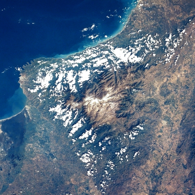
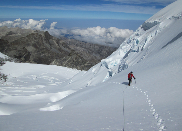
Pico Cristóbal Colón is the highest mountain in Colombia, with an estimated height of . Pico Cristóbal Colón and Pico Simón Bolívar are the two highest peaks in Colombia and are equal in elevation. One or the other of these peaks is therefore the fifth most prominent in the world (see list of peaks by prominence). The nearest peak that is higher is Cayambe, some away. There is a permanent snowcap on this peak and on the nearby mountains. It is part of the Sierra Nevada de Santa Marta range, along with Pico Simón Bolívar. The peak is named after Christopher Columbus. Climbing history Colón was first climbed in 1939 by Walter Wood, Anderson Bakerwell and E. Praolini. Access to these mountains became very difficult after the early 1990s due to hostile locals, drug traffickers, and FARC guerillas. An expedition in 2015 led by John Biggar was one of the first to climb in the range for many years, and reached the summit of Pico Colón on 13 December. See also * List o ... [...More Info...] [...Related Items...] OR: [Wikipedia] [Google] [Baidu] |
Pico Simón Bolívar
Pico Simón Bolívar is the second highest mountain in Colombia, with an estimated height of . Pico Bolívar and the neighbouring summit of Pico Cristóbal Colón are the two highest peaks in Colombia and are very nearly equal in elevation. The difference in elevation is estimated to be only one or two metres. One or other of these peaks is therefore the fifth most prominent in the world (see list of peaks by prominence). The nearest peak that is higher is Cayambe, some away. There is a permanent snowcap on this peak and on the nearby mountains. It is part of the Sierra Nevada de Santa Marta range, along with Pico Cristóbal Colón. The peak is named after Simón Bolívar. Climbing history Pico Simón Bolívar was first climbed in 1939 by W. Wood, A. Bakerwell and E. Praolini. Access to these mountains became very difficult after the early 1990s due to hostile locals, drug traffickers, and FARC guerillas. An expedition in 2015 was one of the first to climb in the range for ... [...More Info...] [...Related Items...] OR: [Wikipedia] [Google] [Baidu] |
Tairona
Tairona (or Tayrona) was a Pre-Columbian culture of Colombia, which consisted in a group of chiefdoms in the region of Sierra Nevada de Santa Marta in present-day Cesar, Magdalena and La Guajira Departments of Colombia, South America, which goes back at least to the 1st century AD and had significant demographic growth around the 11th century. The Tairona people formed one of the two principal linguistic groups of the Chibchan family, the other being the Muisca. Genetic and archaeological evidence shows a relatively dense occupation of the region by at least 200 BC. Pollen data compiled by Luisa Fernanda Herrera in 1980 shows considerable deforestation and the use of cultigens such as yuca and maize since possibly 1200 BC. However, occupation of the Colombian Caribbean coast by sedentary or semi-sedentary populations has been documented to have occurred by c. 4000 BC. Ethnohistorical data shows that initial contact with the Spanish was tolerated by the Tairona; but by ... [...More Info...] [...Related Items...] OR: [Wikipedia] [Google] [Baidu] |
Caribbean Plate
The Caribbean Plate is a mostly oceanic tectonic plate underlying Central America and the Caribbean Sea off the north coast of South America. Roughly 3.2 million square kilometers (1.2 million square miles) in area, the Caribbean Plate borders the North American Plate, the South American Plate, the Nazca Plate and the Cocos Plate. These borders are regions of intense seismic activity, including frequent earthquakes, occasional tsunamis, and volcanic eruptions. Boundary types The northern boundary with the North American Plate is a transform or strike-slip boundary which runs from the border area of Belize, Guatemala ( Motagua Fault), and Honduras in Central America, eastward through the Cayman trough along the Swan Islands Transform Fault before joining the southern boundary of the Gonâve Microplate. East of the Mid-Cayman Rise this continues as the Walton fault zone and the Enriquillo–Plantain Garden fault zone into eastern Hispaniola. From there it continue ... [...More Info...] [...Related Items...] OR: [Wikipedia] [Google] [Baidu] |


.gif)