|
South Kessock
South Kessock (Scottish Gaelic: ''Ceasag a Deas'', meaning "Ceasag's Place") is an area of the city of Inverness in the Highland council area of Scotland. It is situated to the city's north at the mouth of the River Ness. It is a traditionally working-class area. The neighbourhood borders on Merkinch and is also known, somewhat disparagingly, as the Ferry. This refers to the now-defunct ferry service running from South to North Kessock, across the Beauly Firth. The ferry operated for over 500 years, prior to the opening of the Kessock Bridge in 1982. Early in the evening of 23 February 1894, the Kessock Ferry was caught in a storm leading to the deaths of three ferrymen and three coastguards attempting to rescue them. The tragedy was immortalised by the poet William McGonagall in ''The Kessack Ferry-Boat Fatality'.'' The name Kessock derives from the Gaelic ''Ceasag'', the name of an ancient Christian saint once living in the area. South Kessock features in two novels by l ... [...More Info...] [...Related Items...] OR: [Wikipedia] [Google] [Baidu] |
Inverness And Nairn (Scottish Parliament Constituency)
Inverness and Nairn is a constituency of the Scottish Parliament ( Holyrood) covering part of the Highland council area. It elects one Member of the Scottish Parliament (MSP) by the first past the post method of election. It is also one of eight constituencies in the Highlands and Islands electoral region, which elects seven additional members, to produce a form of proportional representation for the region as a whole. The seat was first created for the 2011 Scottish Parliament election, and covers parts of the former seats of Inverness East, Nairn & Lochaber and Ross, Skye & Inverness West. Since being formed it has been held by Fergus Ewing of the Scottish National Party, who was previously the member for Inverness East, Nairn and Lochaber. Electoral region The Inverness and Nairn constituency is part of the Highlands and Islands electoral region; the other seven constituencies are Argyll and Bute, Caithness, Sutherland and Ross, Moray, Na h-Eileanan an Iar, Orkne ... [...More Info...] [...Related Items...] OR: [Wikipedia] [Google] [Baidu] |
Kessock Bridge
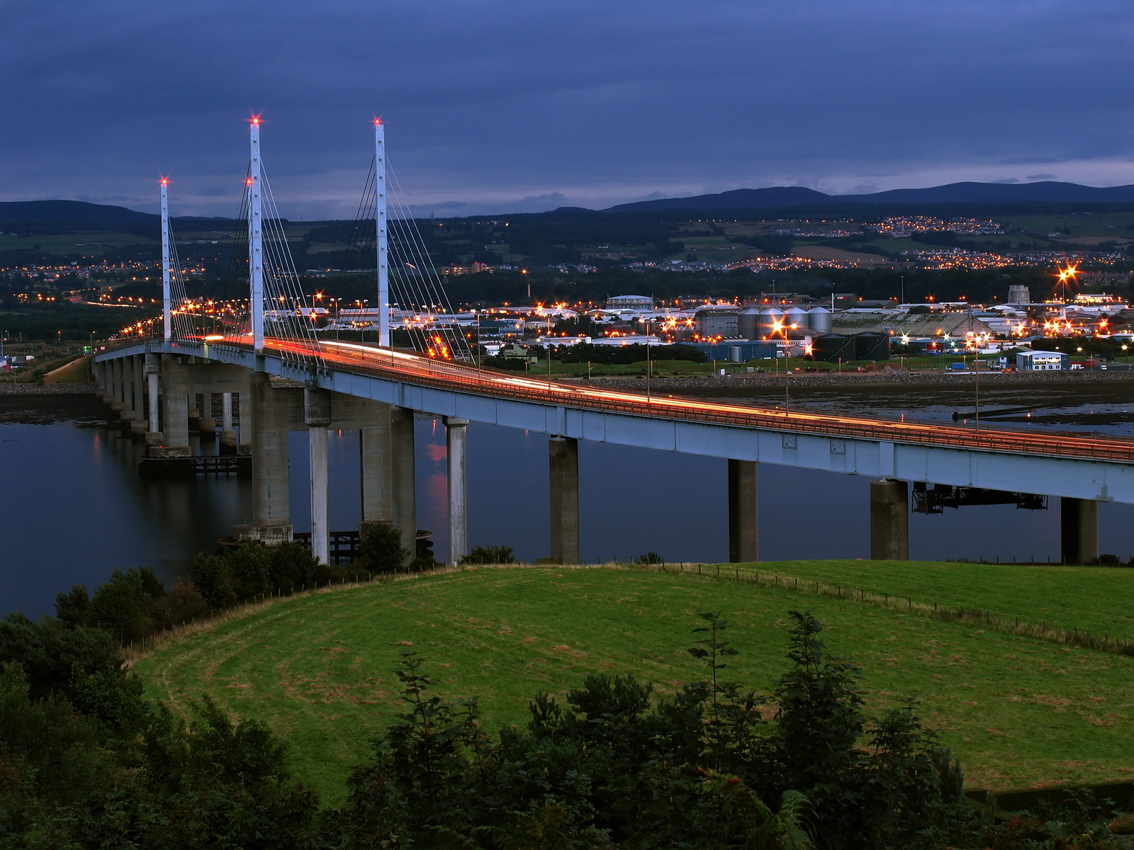
The Kessock Bridge ( gd, Drochaid Cheasaig) carries the A9 trunk road across the Beauly Firth at Inverness, Scotland. Description The Kessock Bridge is a cable-stayed bridge across the Beauly Firth, an inlet of the Moray Firth, between the village of North Kessock and the city of Inverness in the Scottish Highlands. The bridge has a total length of with a main span of . Designed by German engineer and built by Cleveland Bridge, it is similar to a bridge across the Rhine in Düsseldorf. The Beauly Firth is a navigable waterway and hence the bridge is raised high over sea level. The four bridge towers dominate the Inverness skyline, especially at night when they are lit. The bridge carries the A9 trunk road north from Inverness to the Black Isle. It is the southernmost of the "Three Firths" crossings (Beauly, Cromarty and Dornoch) which has transformed road transport in the Highlands. It has proved a key factor in the growth of the city of Inverness. To protect agains ... [...More Info...] [...Related Items...] OR: [Wikipedia] [Google] [Baidu] |
Roe Deer
The roe deer (''Capreolus capreolus''), also known as the roe, western roe deer, or European roe, is a species of deer. The male of the species is sometimes referred to as a roebuck. The roe is a small deer, reddish and grey-brown, and well-adapted to cold environments. The species is widespread in Europe, from the Mediterranean to Scandinavia, from Scotland to the Caucasus, and east to northern Iran and Iraq. Etymology English ''roe'' is from Old English ''rā'' or ''rāha'', from Proto-Germanic ''*raihô'', cognate with Old Norse ''rá'', Old Saxon ''rēho'', Middle Dutch and Dutch ''ree'', Old High German ''rēh'', ''rēho'', ''rēia'', German ''Reh''. It is perhaps ultimately derived from a PIE root ''*rei-'', meaning "streaked, spotted or striped". The word is attested on the 5th-century Caistor-by-Norwich astragalus -a roe deer talus bone, written in Elder Futhark as , transliterated as ''raïhan''. In the English language, this deer was originally simply called a 'r ... [...More Info...] [...Related Items...] OR: [Wikipedia] [Google] [Baidu] |
Shrubland
Shrubland, scrubland, scrub, brush, or bush is a plant community characterized by vegetation dominated by shrubs, often also including grasses, herbs, and geophytes. Shrubland may either occur naturally or be the result of human activity. It may be the mature vegetation type in a particular region and remain stable over time, or a transitional community that occurs temporarily as the result of a disturbance, such as fire. A stable state may be maintained by regular natural disturbance such as fire or browsing. Shrubland may be unsuitable for human habitation because of the danger of fire. The term was coined in 1903. Shrubland species generally show a wide range of adaptations to fire, such as heavy seed production, lignotubers, and fire-induced germination. Botanical structural form In botany and ecology a shrub is defined as a much-branched woody plant less than 8 m high and usually with many stems. Tall shrubs are mostly 2–8 m high, small shrubs 1–2 m high an ... [...More Info...] [...Related Items...] OR: [Wikipedia] [Google] [Baidu] |
Reed Beds
A reedbed or reed bed is a natural habitat found in floodplains, waterlogged depressions and estuaries. Reedbeds are part of a succession from young reeds colonising open water or wet ground through a gradation of increasingly dry ground. As reedbeds age, they build up a considerable litter layer that eventually rises above the water level and that ultimately provides opportunities in the form of new areas for larger terrestrial plants such as shrubs and trees to colonise. Artificial reedbeds are used to remove pollutants from greywater, and are also called constructed wetlands. Types Reedbeds vary in the species that they can support, depending upon water levels within the wetland system, climate, seasonal variations, and the nutrient status and salinity of the water. ''Reed swamps'' have 20 cm or more of surface water during the summer and often have high invertebrate and bird species use. ''Reed fens'' have water levels at or below the surface during the summer an ... [...More Info...] [...Related Items...] OR: [Wikipedia] [Google] [Baidu] |
Salt Marsh
A salt marsh or saltmarsh, also known as a coastal salt marsh or a tidal marsh, is a coastal ecosystem in the upper coastal intertidal zone between land and open saltwater or brackish water that is regularly flooded by the tides. It is dominated by dense stands of salt-tolerant plants such as herbs, grasses, or low shrubs. These plants are terrestrial in origin and are essential to the stability of the salt marsh in trapping and binding sediments. Salt marshes play a large role in the aquatic food web and the delivery of nutrients to coastal waters. They also support terrestrial animals and provide coastal protection. Salt marshes have historically been endangered by poorly implemented coastal management practices, with land reclaimed for human uses or polluted by upstream agriculture or other industrial coastal uses. Additionally, sea level rise caused by climate change is endangering other marshes, through erosion and submersion of otherwise tidal marshes. However, r ... [...More Info...] [...Related Items...] OR: [Wikipedia] [Google] [Baidu] |
Scottish Highlands
The Highlands ( sco, the Hielands; gd, a’ Ghàidhealtachd , 'the place of the Gaels') is a historical region of Scotland. Culturally, the Highlands and the Lowlands diverged from the Late Middle Ages into the modern period, when Lowland Scots replaced Scottish Gaelic throughout most of the Lowlands. The term is also used for the area north and west of the Highland Boundary Fault, although the exact boundaries are not clearly defined, particularly to the east. The Great Glen divides the Grampian Mountains to the southeast from the Northwest Highlands. The Scottish Gaelic name of ' literally means "the place of the Gaels" and traditionally, from a Gaelic-speaking point of view, includes both the Western Isles and the Highlands. The area is very sparsely populated, with many mountain range A mountain range or hill range is a series of mountains or hills arranged in a line and connected by high ground. A mountain system or mountain belt is a group of mountain ran ... [...More Info...] [...Related Items...] OR: [Wikipedia] [Google] [Baidu] |
South Kessock Spit
South is one of the cardinal directions or compass points. The direction is the opposite of north and is perpendicular to both east and west. Etymology The word ''south'' comes from Old English ''sūþ'', from earlier Proto-Germanic ''*sunþaz'' ("south"), possibly related to the same Proto-Indo-European root that the word ''sun'' derived from. Some languages describe south in the same way, from the fact that it is the direction of the sun at noon (in the Northern Hemisphere), like Latin meridies 'noon, south' (from medius 'middle' + dies 'day', cf English meridional), while others describe south as the right-hand side of the rising sun, like Biblical Hebrew תֵּימָן teiman 'south' from יָמִין yamin 'right', Aramaic תַּימנַא taymna from יָמִין yamin 'right' and Syriac ܬܰܝܡܢܳܐ taymna from ܝܰܡܝܺܢܳܐ yamina (hence the name of Yemen, the land to the south/right of the Levant). Navigation By convention, the ''bottom or down-facing side'' of a ... [...More Info...] [...Related Items...] OR: [Wikipedia] [Google] [Baidu] |
Celtic Christianity
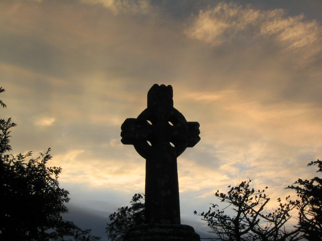
Celtic Christianity ( kw, Kristoneth; cy, Cristnogaeth; gd, Crìosdaidheachd; gv, Credjue Creestee/Creestiaght; ga, Críostaíocht/Críostúlacht; br, Kristeniezh; gl, Cristianismo celta) is a form of Christianity that was common, or held to be common, across the Celtic-speaking world during the Early Middle Ages. Some writers have described a distinct Celtic Church uniting the Celtic peoples and distinguishing them from adherents of the Roman Church, while others classify Celtic Christianity as a set of distinctive practices occurring in those areas. Varying scholars reject the former notion, but note that there were certain traditions and practices present in both the Irish and British churches that were not seen in the wider Christian world. Such practices include: a distinctive system for determining the dating of Easter, a style of monastic tonsure, a unique system of penance, and the popularity of going into "exile for Christ". Additionally, there were other pr ... [...More Info...] [...Related Items...] OR: [Wikipedia] [Google] [Baidu] |
William McGonagall
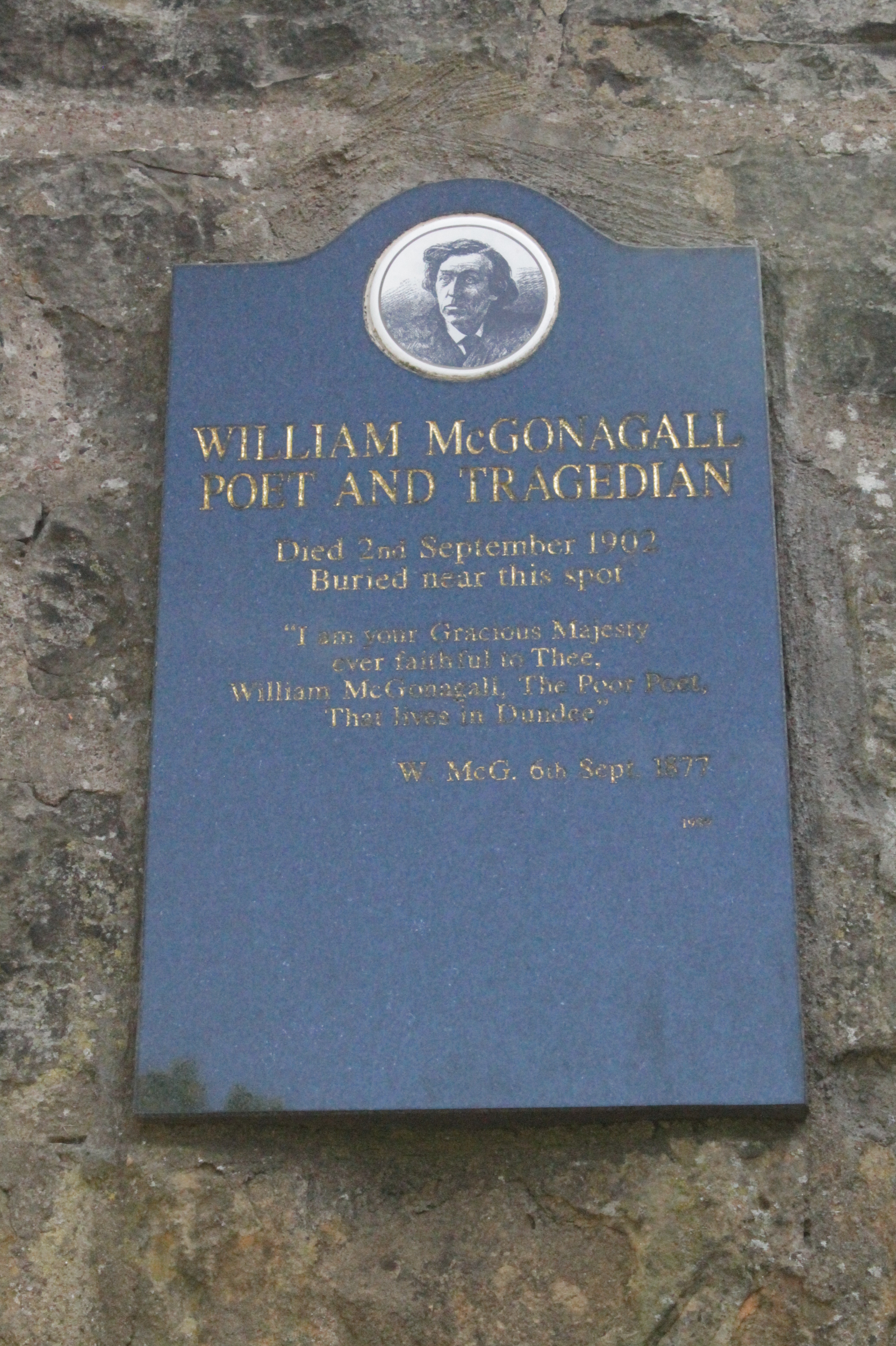
William Topaz McGonagall (March 1825 – 29 September 1902) was a Scottish poet of Irish descent. He gained notoriety as an extremely bad poet who exhibited no recognition of, or concern for, his peers' opinions of his work. He wrote about 200 poems, including " The Tay Bridge Disaster" and " The Famous Tay Whale", which are widely regarded as some of the worst in English literature. Groups throughout Scotland engaged him to make recitations from his work, and contemporary descriptions of these performances indicate that many listeners were appreciating McGonagall's skill as a comic music hall character. Collections of his verse remain popular, with several volumes available today. McGonagall has been lampooned as the worst poet in British history. The chief criticisms are that he was deaf to poetic metaphor and unable to scan correctly. His only apparent understanding of poetry was his belief that it needed to rhyme. McGonagall's fame stems from the humorous effects these s ... [...More Info...] [...Related Items...] OR: [Wikipedia] [Google] [Baidu] |


.jpg)


