|
Sokol Fort (Konavle)
Sokol () is the name of a medieval fortress located in the village of Dunave in Konavle, Croatia, underneath the eastern slopes of Sniježnica, near the border with Sutorina in Montenegro. It's also referred to as or . Arthur J. Evans is known to have done excavations on the site, but never published complete results. Archaeologists have been conducting surveys of the site since the 1970s, and it is known that the site was inhabited in the Eneolithic, Bronze and Iron Ages, most notably by the Cetina culture. The site was also inhabited during Roman times, growing in importance as part of a Byzantine ''limes''. It is not known exactly when the medieval Fort Sokol was built, the first historical records about it date to a mention in 1373 and also a mention in the 1391 donation of Konavle by the Sanković family to the Republic of Ragusa. It was garrisoned by Dubrovnik and commanded by a member of the gentry until it was abandoned in 1672. The site also contains a medieval stećak ... [...More Info...] [...Related Items...] OR: [Wikipedia] [Google] [Baidu] |
Zahumlje
Zachlumia or Zachumlia ( sh-Latn-Cyrl, separator=" / ", Zahumlje, Захумље, ), also Hum, was a medieval principality located in the modern-day regions of Herzegovina and southern Dalmatia (today parts of Bosnia and Herzegovina and Croatia, respectively). In some periods it was a fully independent or semi-independent South Slavic principality. It maintained relations with various foreign and neighbouring powers (Byzantine Empire, First Bulgarian Empire, Kingdom of Croatia, Principality of Serbia) and later was subjected (temporarily or for a longer period) to Kingdom of Hungary, Kingdom of Serbia, Kingdom of Bosnia, and at the end to the Ottoman Empire. Etymology Zachlumia is a derivative of ''Hum'', from Proto-Slavic '' *xŭlmŭ'', borrowed from a Germanic language (cf. Proto-Germanic '' *hulma-''), meaning ''"Hill"''. South Slavic ''Zahumlje'' is named after the mountain of Hum (za + Hum "behind the Hum"), above Bona, at the mouth of the Buna. The principality is named ... [...More Info...] [...Related Items...] OR: [Wikipedia] [Google] [Baidu] |
Republic Of Ragusa
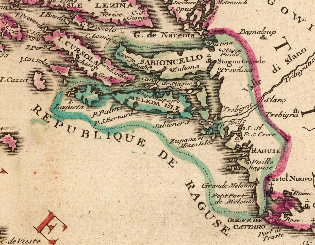
The Republic of Ragusa, or the Republic of Dubrovnik, was an maritime republics, aristocratic maritime republic centered on the city of Dubrovnik (''Ragusa'' in Italian and Latin; ''Raguxa'' in Venetian) in South Dalmatia (today in southernmost Croatia) that carried that name from 1358 until 1808. It reached its commercial peak in the 15th and the 16th centuries, before being conquered by Napoleon's First French Empire, French Empire and formally annexed by the Kingdom of Italy (Napoleonic), Napoleonic Kingdom of Italy in 1808. It had a population of about 30,000 people, of whom 5,000 lived within the city walls. Its motto was "'", a Latin phrase which can be translated as "Liberty is not well sold for all the gold". Names Originally named ' (Latin for "Ragusan municipality" or "community"), in the 14th century it was renamed ' (Latin for ''Ragusan Republic''), first mentioned in 1385. It was nevertheless a Republic under its previous name, although its Rector was appointed b ... [...More Info...] [...Related Items...] OR: [Wikipedia] [Google] [Baidu] |
Limestone
Limestone is a type of carbonate rock, carbonate sedimentary rock which is the main source of the material Lime (material), lime. It is composed mostly of the minerals calcite and aragonite, which are different Polymorphism (materials science), crystal forms of calcium carbonate . Limestone forms when these minerals Precipitation (chemistry), precipitate out of water containing dissolved calcium. This can take place through both biological and nonbiological processes, though biological processes, such as the accumulation of corals and shells in the sea, have likely been more important for the last 540 million years. Limestone often contains fossils which provide scientists with information on ancient environments and on the evolution of life. About 20% to 25% of sedimentary rock is carbonate rock, and most of this is limestone. The remaining carbonate rock is mostly Dolomite (rock), dolomite, a closely related rock, which contains a high percentage of the mineral Dolomite (mine ... [...More Info...] [...Related Items...] OR: [Wikipedia] [Google] [Baidu] |
Dunave
Dunave is a village in Croatia, in Konavle Konavle () is a municipality and a small Dalmatian subregion located southeast of Dubrovnik, Croatia. The region is administratively part of the Dubrovnik-Neretva County and the center of the municipality is Cavtat. Demographics The total muni ... municipality. It is the location of the Sokol Fort. Demographics According to the 2021 census, its population was 147. References Populated places in Dubrovnik-Neretva County {{DubrovnikNeretva-geo-stub ... [...More Info...] [...Related Items...] OR: [Wikipedia] [Google] [Baidu] |
Konavle
Konavle () is a municipality and a small Dalmatian subregion located southeast of Dubrovnik, Croatia. The region is administratively part of the Dubrovnik-Neretva County and the center of the municipality is Cavtat. Demographics The total municipality population was 8,577 people in 2011, split in the following 32 settlements: * Brotnice, population 31 * Cavtat, population 2,153 * Čilipi, population 933 * Drvenik, population 52 * Duba Konavoska, population 63 * Dubravka, population 295 * Dunave, population 155 * Đurinići, population 96 * Gabrili, population 210 * Gruda, population 741 * Jasenice, population 14 * Komaji, population 275 * Kuna Konavoska, population 17 * Lovorno, population 183 * Ljuta, population 194 * Mihanići, population 96 * Mikulići, population 88 * Močići, population 447 * Molunat, population 212 * Palje Brdo, population 130 * Pločice, population 83 * Poljice, population 70 * Popovići, population 236 * Pridvorje, population 23 ... [...More Info...] [...Related Items...] OR: [Wikipedia] [Google] [Baidu] |
Croatia
Croatia, officially the Republic of Croatia, is a country in Central Europe, Central and Southeast Europe, on the coast of the Adriatic Sea. It borders Slovenia to the northwest, Hungary to the northeast, Serbia to the east, Bosnia and Herzegovina and Montenegro to the southeast, and shares a maritime border with Italy to the west. Its capital and largest city, Zagreb, forms one of the country's Administrative divisions of Croatia, primary subdivisions, with Counties of Croatia, twenty counties. Other major urban centers include Split, Croatia, Split, Rijeka and Osijek. The country spans , and has a population of nearly 3.9 million. The Croats arrived in modern-day Croatia, then part of Illyria, Roman Illyria, in the late 6th century. By the 7th century, they had organized the territory into Duchy of Croatia, two duchies. Croatia was first internationally recognized as independent on 7 June 879 during the reign of Duke Branimir of Croatia, Branimir. Tomislav of Croatia, Tomis ... [...More Info...] [...Related Items...] OR: [Wikipedia] [Google] [Baidu] |
Sniježnica (mountain In Croatia)
Sniježnica is a mountain located in the southernmost part of Croatia, north of the Konavle Konavle () is a municipality and a small Dalmatian subregion located southeast of Dubrovnik, Croatia. The region is administratively part of the Dubrovnik-Neretva County and the center of the municipality is Cavtat. Demographics The total muni ... region. The eponymous highest peak is . References Bibliography Biology * Landforms of Dubrovnik-Neretva County Mountains of Croatia {{DubrovnikNeretva-geo-stub ... [...More Info...] [...Related Items...] OR: [Wikipedia] [Google] [Baidu] |
Sutorina
Sutorina (, , ) is a village and a river located in Herceg Novi Municipality in southwestern Montenegro. The village is located near the border with Croatia, some three kilometers northwest of the Adriatic Sea in Igalo. The surrounding region, including a short stretch of the Adriatic coast, was named after the little vale of the river Sutorina west of Herceg Novi. The long coast on the west side of the entrance to the Boka Kotorska, from Cape Kobila to Igalo, known generally as Sutorina, includes the Sutorina valley including 6 villages: Igalo, Sutorina, Sušćepan, Prijevor, Herceg Novi, Prijevor, Ratiševina and Kruševice, an area of 75 km². History Sutorina was part of Bosnia and Herzegovina within Austria-Hungary and Yugoslavia between 1878 and 1947 when it became part of SR Montenegro. Circumstances of this transfer are under long dispute, see Sutorina dispute. On 26 August 2015, governments of Bosnia and Herzegovina and Montenegro signed in Vienna a border agreement wh ... [...More Info...] [...Related Items...] OR: [Wikipedia] [Google] [Baidu] |
Montenegro
, image_flag = Flag of Montenegro.svg , image_coat = Coat of arms of Montenegro.svg , coa_size = 80 , national_motto = , national_anthem = () , image_map = Europe-Montenegro.svg , map_caption = , image_map2 = , capital = Podgorica , coordinates = , largest_city = capital , official_languages = Montenegrin language, Montenegrin , languages2_type = Languages in official use , languages2 = , ethnic_groups = , ethnic_groups_ref = , ethnic_groups_year = 2023 census , religion = , religion_ref = , religion_year = 2023 census , demonym = Montenegrins, Montenegrin , government_type = Unitary parliamentary republic , leader_title1 = President of Montenegro, President , leader_name1 = Jakov Milatović , leader_title2 ... [...More Info...] [...Related Items...] OR: [Wikipedia] [Google] [Baidu] |
Arthur J
Arthur is a masculine given name of uncertain etymology. Its popularity derives from it being the name of the legendary hero King Arthur. A common spelling variant used in many Slavic, Romance, and Germanic languages is Artur. In Spanish and Italian it is Arturo. Etymology The earliest attestation of the name Arthur is in the early 9th century Welsh-Latin text ''Historia Brittonum'', where it refers to a circa 5th century Romano-British general who fought against the invading Saxons, and who later gave rise to the famous King Arthur of medieval legend and literature. A possible earlier mention of the same man is to be found in the epic Welsh poem '' Y Gododdin'' by Aneirin, which some scholars assign to the late 6th century, though this is still a matter of debate and the poem only survives in a late 13th century manuscript entitled the Book of Aneirin. A 9th-century Breton landowner named Arthur witnessed several charters collected in the '' Cartulary of Redon''. The Irish bo ... [...More Info...] [...Related Items...] OR: [Wikipedia] [Google] [Baidu] |
Cetina Culture
The Cetina culture is the name for the culture of the inhabitants of the Middle Dalmatian coast, and especially its hinterland, during the early Bronze Age (c. 1900-1600 BC), or, according to Paul Reineck's chronology (c. 2200–1500 BC). It is named after the numerous sites along the Cetina river in Central Dalmatia and Herzegovina. People of this culture were present in caves ( Škarin Samograd near Drniš, Gudnja near Ston, Ravlić cave in Drinovci) or in open settlements (Gradac in Kotorac and Krstina near Posušje). The graves are in rocky colonies. In the case of inhumation, they have the shape of a stone chest, while incinerated remains of the deceased are laid in clay pots. Heyd (2013) describes the early Cetina culture as a "syncretistic Bell Beaker culture", splitting off from the dissolving variant of the Vučedol complex, and at the same time incorporating elements of the Bell Beaker phenomenon. Area of diffusion The largest number of well-known sites of Cetin ... [...More Info...] [...Related Items...] OR: [Wikipedia] [Google] [Baidu] |
Limes (Roman Empire)
(Latin; , : ) is a term used primarily for the Germanic border defence or delimiting system of ancient Rome marking the borders of the Roman Empire. The term has been extended in modern times to refer to the Roman military frontiers and fortifications, frontier defences in other parts of the empire, such as in the east and in Africa. Overview The Roman frontier stretched for more than from the Atlantic coast of northern Roman Britain, Britain, through Europe to the Black Sea, and from there to the Red Sea and across North Africa to the Atlantic coast. The positions of the borders changed especially during the main periods of Roman expansion and contraction, and first became more stable during the early Roman Empire, Empire period under Augustus, but the borders continued to change with time in different provinces. The borders had different constituents depending on local needs; often they consisted of natural boundaries (e.g. rivers) with roads behind for easier movement o ... [...More Info...] [...Related Items...] OR: [Wikipedia] [Google] [Baidu] |


