|
Skagerrak-Centered Large Igneous Province
The Skagerrak-Centered Large Igneous Province (SCLIP), also known as the European-Northwest African Large Igneous Province (EUNWA), and Jutland LIP, is a (Ma) large igneous province (LIP) centered on what is today the Skagerrak strait in north-western Europe (, paleocoordinates (south of Lake Chad)). It was named by . The SCLIP covered an area of at least and includes the Oslo and Skagerrak grabens, areas in south-western Sweden, Scotland, northern England, and the central North Sea. The SCLIP erupted at 297±4 Ma. It produced 228,000 km2 of currently exposed volcanic material that can be found in Skagerrak, the Oslo Fjord, central North Sea, North-east Germany; 14,000 km2 of sills in Scotland, England, Germany, The Netherlands, and Sweden; and 3,353 km total length of dykes in Scotland, Norway, and Sweden. The period of eruptions comprised a relatively short time span, perhaps less than 4 Ma, but magma propagated more than from the plume centre. ... [...More Info...] [...Related Items...] OR: [Wikipedia] [Google] [Baidu] |
Large Igneous Province
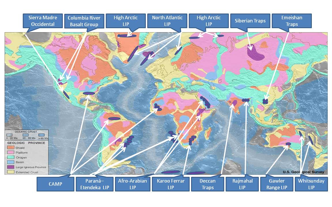
A large igneous province (LIP) is an extremely large accumulation of igneous rocks, including intrusive (sills, dikes) and extrusive (lava flows, tephra deposits), arising when magma travels through the crust towards the surface. The formation of LIPs is variously attributed to mantle plumes or to processes associated with divergent plate tectonics. The formation of some of the LIPs in the past 500 million years coincide in time with mass extinctions and rapid climatic changes, which has led to numerous hypotheses about causal relationships. LIPs are fundamentally different from any other currently active volcanoes or volcanic systems. Definition In 1992 researchers first used the term ''large igneous province'' to describe very large accumulations—areas greater than 100,000 square kilometers (approximately the area of Iceland)—of mafic igneous rocks that were erupted or emplaced at depth within an extremely short geological time interval: a few million years or less. Maf ... [...More Info...] [...Related Items...] OR: [Wikipedia] [Google] [Baidu] |
Geology Of Scotland
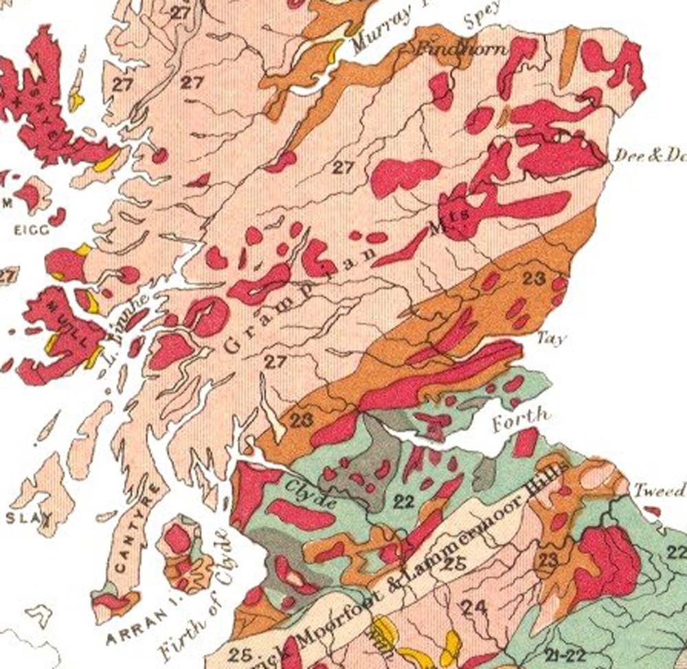
The geology of Scotland is unusually varied for a country of its size, with a large number of differing geological features.Keay & Keay (1994) page 415. There are three main geographical sub-divisions: the Highlands and Islands is a diverse area which lies to the north and west of the Highland Boundary Fault; the Central Lowlands is a rift valley mainly comprising Palaeozoic formations; and the Southern Uplands, which lie south of the Southern Uplands Fault, are largely composed of Silurian deposits. The existing bedrock includes very ancient Archean gneiss, metamorphic beds interspersed with granite intrusions created during the Caledonian mountain building period (the Caledonian orogeny), commercially important coal, oil and iron bearing carboniferous deposits and the remains of substantial Palaeogene volcanoes. During their formation, tectonic movements created climatic conditions ranging from polar to desert to tropical and a resultant diversity of fossil remains. Scotla ... [...More Info...] [...Related Items...] OR: [Wikipedia] [Google] [Baidu] |
Geology Of Norway
The geology of Norway encompasses the history of Earth that can be interpreted by rock types found in Norway, and the associated sedimentological history of soils and rock types. The Norwegian mountains were formed around 400 million years ago (Ma) during the Caledonian orogeny. Precambrian Rocks of Archean age in Norway are confined to a few 10 km-scale areas within younger metamorphic belts exposed on islands off the west coast of northern Norway and as smaller fragments locally in the Western Gneiss Region in south-central Norway. Despite intense reworking during the Caledonian orogeny in some areas, three major belts can be recognised in the Proterozoic rocks of Norway, the Neoproterozoic and Mesoproterozoic Gothian and Sveconorwegian, the Palaeoproterozoic Svecokarelian and the intervening Transscandinavian Igneous Belt of late Palaeoproterozoic age. About 1400 million years ago in the Mesoproterozoic tectonic extension and continental magmatism led to the format ... [...More Info...] [...Related Items...] OR: [Wikipedia] [Google] [Baidu] |
Geology Of The Netherlands
The geology of the Netherlands describes the geological sequence of the Netherlands. Large parts of the Netherlands today are below sea level and have in the past been covered by the sea or flooded at regular intervals. The modern Netherlands formed as a result of the interplay of the four main rivers (Rhine, Meuse, Schelde and IJssel) and the influence of the North Sea and glaciers during ice-ages. The Netherlands is mostly composed of deltaic, coastal and eolian derived sediments during the Pleistocene glacial and interglacial periods. Fairly all of the west Netherlands is composed of the Rhine-Meuse river estuary, but human intervention greatly modified the natural processes at work. Most of the western Netherlands is below sea level due to the human watermanagement, lowering the waterlevel by windmills leading to (mostly peaty) soil-subsidence leading to lowering the waterlevel. In the east of the Netherlands, remains are found of the Saale glaciation, which ended approxima ... [...More Info...] [...Related Items...] OR: [Wikipedia] [Google] [Baidu] |
Geology Of England
The geology of England is mainly sedimentary. The youngest rocks are in the south east around London, progressing in age in a north westerly direction.Southampton University retrieved 21/1/07 The Tees–Exe line marks the division between younger, softer and low-lying rocks in the south east and the generally older and harder rocks of the north and west which give rise to higher relief in those regions. The geology of England is recognisable in the landscape of its counties, the building materials of its towns and its regional extr ... [...More Info...] [...Related Items...] OR: [Wikipedia] [Google] [Baidu] |
Geology Of Denmark
The geology of Denmark includes 12 kilometers of unmetamorphosed sediments lie atop the Precambrian Fennoscandian Shield, the Norwegian-Scottish Caledonides and buried North German-Polish Caledonides. The stable Fennoscandian Shield formed from 1.45 billion years ago to 850 million years ago in the Proterozoic. The Fennoscandian Border Zone is a large fault, bounding the deep basement rock of the Danish Basin—a trough between the Border Zone and the Ringkobing-Fyn High. The Sorgenfrei-Tornquist Zone is a fault-bounded area displaying Cretaceous-Cenozoic inversion. Geologic history, stratigraphy, and tectonics Paleozoic (539-251 million years ago) Cambrian rocks record successive marine transgression and regression events. Feldspar-rich red bed sandstones deposited in windy floodplains followed by layers of glauconite-rich marine sandstones and offshore siltstone. Black alum shales deposited in the mid-Cambrian in a nearly anoxic epeireic basin with limestone layers, rich in trilob ... [...More Info...] [...Related Items...] OR: [Wikipedia] [Google] [Baidu] |
Permian Volcanism
The Permian ( ) is a geologic period and stratigraphic system which spans 47 million years from the end of the Carboniferous Period million years ago (Mya), to the beginning of the Triassic Period 251.9 Mya. It is the last period of the Paleozoic Era; the following Triassic Period belongs to the Mesozoic Era. The concept of the Permian was introduced in 1841 by geologist Sir Roderick Murchison, who named it after the region of Perm in Russia. The Permian witnessed the diversification of the two groups of amniotes, the synapsids and the sauropsids ( reptiles). The world at the time was dominated by the supercontinent Pangaea, which had formed due to the collision of Euramerica and Gondwana during the Carboniferous. Pangaea was surrounded by the superocean Panthalassa. The Carboniferous rainforest collapse left behind vast regions of desert within the continental interior. Amniotes, which could better cope with these drier conditions, rose to dominance in place of their amphi ... [...More Info...] [...Related Items...] OR: [Wikipedia] [Google] [Baidu] |
Carboniferous Volcanism
The Carboniferous ( ) is a geologic period and system of the Paleozoic that spans 60 million years from the end of the Devonian Period million years ago (Mya), to the beginning of the Permian Period, million years ago. The name ''Carboniferous'' means "coal-bearing", from the Latin '' carbō'' ("coal") and '' ferō'' ("bear, carry"), and refers to the many coal beds formed globally during that time. The first of the modern 'system' names, it was coined by geologists William Conybeare and William Phillips in 1822, based on a study of the British rock succession. The Carboniferous is often treated in North America as two geological periods, the earlier Mississippian and the later Pennsylvanian. Terrestrial animal life was well established by the Carboniferous Period. Tetrapods (four limbed vertebrates), which had originated from lobe-finned fish during the preceding Devonian, became pentadactylous in and diversified during the Carboniferous, including early amphibian lineages ... [...More Info...] [...Related Items...] OR: [Wikipedia] [Google] [Baidu] |
Large Igneous Provinces
A large igneous province (LIP) is an extremely large accumulation of igneous rocks, including intrusive (sills, dikes) and extrusive (lava flows, tephra deposits), arising when magma travels through the crust towards the surface. The formation of LIPs is variously attributed to mantle plumes or to processes associated with divergent plate tectonics. The formation of some of the LIPs in the past 500 million years coincide in time with mass extinctions and rapid climatic changes, which has led to numerous hypotheses about causal relationships. LIPs are fundamentally different from any other currently active volcanoes or volcanic systems. Definition In 1992 researchers first used the term ''large igneous province'' to describe very large accumulations—areas greater than 100,000 square kilometers (approximately the area of Iceland)—of mafic igneous rocks that were erupted or emplaced at depth within an extremely short geological time interval: a few million years or less. Maf ... [...More Info...] [...Related Items...] OR: [Wikipedia] [Google] [Baidu] |
Central Skåne Volcanic Province
The Central Skåne Volcanic Province was a site of volcanic activity in the Scania region of Sweden during the Mesozoic Era of the Earth's geological history. The volcanism began with a first and main phase in late Sinemurian to Toarcian times around 191 to 178 Ma. Then volcanism continued sporadically for another 80 million years. More than one hundred volcanic necks of basaltic composition exist in Scania evidencing this volcanism. In central Scania, volcanism was in the form of a volcanic field of cinder cones that had Strombolian eruption styles. These cones produced tuffite deposits made largely of lapilli with rare volcanic bombs. Pyroclastic materials were subsequently palagonitized or largely altered to clay minerals. While eruptions occurred on land the sea was likely very close to the area. Besides purely pyroclastic sediments, lahar deposits have also been identified around the remnants of the volcanoes. Beneath a lahar deposit at Korsaröd (Djupadal Formation), Early ... [...More Info...] [...Related Items...] OR: [Wikipedia] [Google] [Baidu] |
Central Atlantic Magmatic Province
The Central Atlantic magmatic province (CAMP) is the Earth's largest continental large igneous province, covering an area of roughly 11 million km2. It is composed mainly of basalt that formed before Pangaea broke up in the Mesozoic Era, near the end of the Triassic and the beginning of the Jurassic periods. The subsequent breakup of Pangaea created the Atlantic Ocean, but the massive igneous upwelling provided a legacy of basaltic dikes, sills, and lavas now spread over a vast area around the present central North Atlantic Ocean, including large deposits in northwest Africa, southwest Europe, as well as northeast South and southeast North America (found as continental tholeiitic basalts in subaerial flows and intrusive bodies). The name and CAMP acronym were proposed by Andrea Marzoli (Marzoli et al. 1999) and adopted at a symposium held at the 1999 Spring Meeting of the American Geophysical Union. The CAMP volcanic eruptions occurred about 201 million years ago and split ... [...More Info...] [...Related Items...] OR: [Wikipedia] [Google] [Baidu] |


.jpg)

