|
Senqunyane
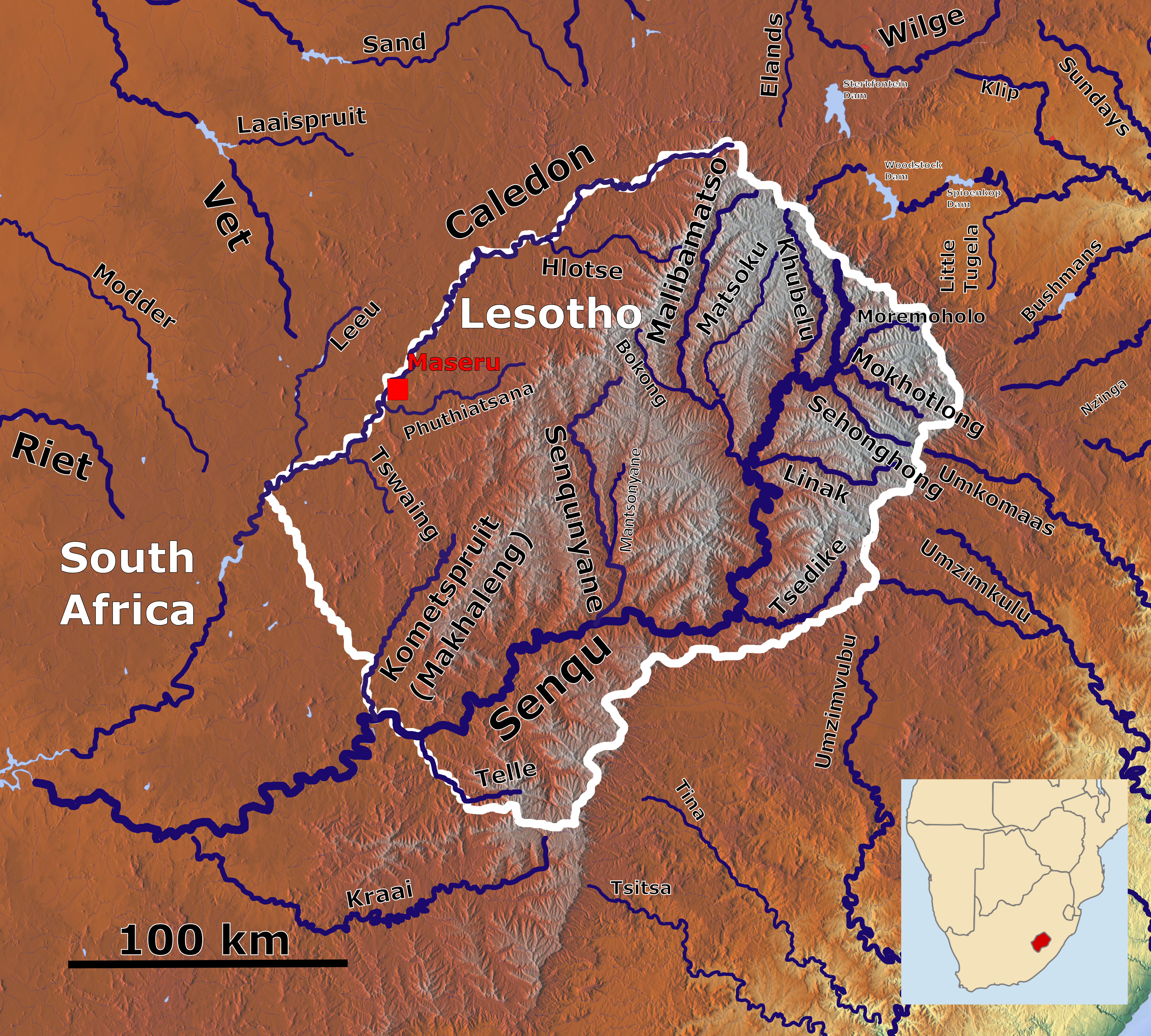
The Senqunyane River is a river of central Lesotho. The river rises in the Maluti Mountains in northwest Lesotho, and flows southwards and then westwards for 120 kilometres before joining the Senqu River (Orange River) in the southwest.Fitzpatrick, M., Blond, B., Pitcher, G., Richmond, S., and Warren, M. (2004) ''South Africa, Lesotho and Swaziland.'' Footscray, VIC: Lonely Planet The source of the Senqunyane is the meeting point of three districts: Thaba-Tseka District, Berea District and Leribe District. It forms the border between Thaba-Tseka District and first Berea and then Maseru District, as well as a small section of the Mafeteng District that is separated from the rest of its district and located high in the Maluti Mountains, for much of its length. Tributaries include the Bokong River, as well as the Jordane River and Likalaneng River, which join the Senqunyane shortly before the Mohale Dam. The Mohale Dam, opened in 2003, is part of the Lesotho Highlands Water Project, ... [...More Info...] [...Related Items...] OR: [Wikipedia] [Google] [Baidu] |
Mohale Dam
Mohale Dam is a concrete faced Embankment dam, rock-fill dam in Lesotho. It is the second dam, under Phase 1B of the series of dams of the proposed Lesotho Highlands Water Project (LHWP), which will eventually include five large dams in remote rural areas of Lesotho and South Africa. The project has been built at a cost of US$1.5 billion. The Mohale Dam was awarded the 2005 Fulton Awards by the Concrete Society of South Africa as having the "Best Construction Engineering Project and Best Construction Technique." Geography The dam is built across the Senqunyane River below its confluence with the western tributary, the Likalaneng River. Investigation of the dam site in the "Highlands of Lesotho" has revealed "rounded, steep sided valleys" where the soil cover is thin and basaltic lava is the dominant formation. The dam site has been identified with two geological features of Fault (geology), faults which needed treatment measures. The dam is located to the east of Maseru, which ... [...More Info...] [...Related Items...] OR: [Wikipedia] [Google] [Baidu] |
Lesotho Highlands Water Project
The Lesotho Highlands Water Project (LHWP) is an ongoing water supply project with a hydropower component, developed in partnership between the governments of Lesotho and South Africa. It comprises a system of several large dams and tunnels throughout Lesotho and delivers water to the Vaal River System in South Africa. In Lesotho, it involves the rivers Malibamatso, Matsoku, Senqunyane, and Senqu. It is Africa's largest water transfer scheme. The purpose of the project is to provide Lesotho with a source of revenue in exchange for the provision of water to South Africa, as well as generate hydroelectricity for Lesotho. As of 2015, royalties paid by South Africa to the Lesotho government amount to R780 million (approximately €50 million), equivalent to about 5% of Lesotho’s state income outside of taxes. The hydro-electric power has enabled Lesotho to become self-sufficient in electricity production, however criticisms have included loss of livelihoods for displaced peopl ... [...More Info...] [...Related Items...] OR: [Wikipedia] [Google] [Baidu] |
Rivers Of Lesotho
This is a list of rivers in Lesotho. This list is arranged by drainage basin, with respective tributaries indented under each larger stream's name. *Orange River (Senqu River) **Caledon River (Mohokare River) *** Little Caledon River *** Ngoe River ** Tele River ** Makhaleng River ** Senqunyane River *** Mantsonyane River ** Tsedike River ** Malibamat'so River *** Pelaneng River ** Dinakeng River ** Khubelu River ** Mokhotlong River ReferencesU.S. Central Intelligence Agency 1990 {{Africa topic, List of rivers of * |
Maluti Mountains
The Maloti Mountains are a mountain range of the highlands of the Kingdom of Lesotho. They extend for about 100 km into the South African Free State. The Maloti Range is part of the Drakensberg system that includes ranges across large areas of South Africa. “Maloti” is also the plural for Loti, the currency of the Kingdom of Lesotho. The range forms the northern portion of the boundary between the Butha-Buthe District in Lesotho and South Africa's Free State.Zunckel, Kevan. 2010. Connectivity Conservation Management: A Global Guide (with Particular Reference to Mountain Connectivity Conservation). Earthscan. p.77-79 Physiography The range forms a high alpine basalt plateau up to in height. It is located between Butha-Buthe District in Lesotho and the Free State Province of South Africa. The highest point, high Thabana Ntlenyana, is located in the north-east of the range. It is the highest peak of Southern Africa, and the highest in Africa south of the Kilimanjaro. T ... [...More Info...] [...Related Items...] OR: [Wikipedia] [Google] [Baidu] |
Senqu River
The Orange River (from Afrikaans/ Dutch: ''Oranjerivier'') is a river in Southern Africa. It is the longest river in South Africa. With a total length of , the Orange River Basin extends from Lesotho into South Africa and Namibia to the north. It rises in the Drakensberg mountains in Lesotho, flowing westwards through South Africa to the Atlantic Ocean. The river forms part of the international borders between South Africa and Lesotho and between South Africa and Namibia, as well as several provincial borders within South Africa. Except for Upington, it does not pass through any major cities. The Orange River plays an important role in the South African economy by providing water for irrigation and hydroelectric power. The river was named the Orange River in honour of the Dutch ruling family, the House of Orange, by the Dutch explorer Robert Jacob Gordon. Other names include simply the word for river, in Khoekhoegowab orthography written as !Garib, which is rendered in Afr ... [...More Info...] [...Related Items...] OR: [Wikipedia] [Google] [Baidu] |
Thaba-Tseka District
Thaba-Tseka is a district of Lesotho. Thaba-Tseka is also the name of the district's capital or camptown, which is the only town in the district. In the east, Thaba-Tseka borders on the KwaZulu-Natal Province of South Africa. Domestically, it borders on Mokhotlong District in northeast, Leribe District in north, Berea District in northwest, Maseru District in west, Mohale's Hoek District in southwest and Qacha's Nek District in the southern direction. The district is one of the major tourist attractions in Lesotho because of the second largest arch dam in Africa Katse Dam. As of 2016, the district had a population of 135,347 which was 6.92 per cent of the total population of the country. The total area of the district was 4,270 which was 14.07 per cent of the total area of the country. The density of population in the district was 30.00 per km2. As of 2008, there were 38 per cent economically active people in the district. There were totally 77,836 employed people out of a total of ... [...More Info...] [...Related Items...] OR: [Wikipedia] [Google] [Baidu] |
Berea District
: ''For the city mentioned in the Bible, see Berea (Bible).'' Berea is a district of Lesotho. In the west, Berea borders on the Free State Province of South Africa. Domestically, it borders on the following districts: Leribe District in the north, Thaba-Tseka District in southeast and Maseru District in the south. Teyateyaneng is the capital of the district. It is also home to the Kome Cave Dwellings. It is also the only district in Lesotho which is not named after its capital. As of 2016, the district had a population of 262,616 which was 13.32 per cent of the total population of the country. The total area of the district was 2,222 which was 7.32 per cent of the total area of the country. As of 2008, there were 48 per cent economically active people in the district. There were totally 53,126 employed people out of a total of 100,776 people in the district above 15 years of age. The total area planted in 2009 was 25,303 which formed 6.27 per cent of the total area planted in th ... [...More Info...] [...Related Items...] OR: [Wikipedia] [Google] [Baidu] |
Leribe District
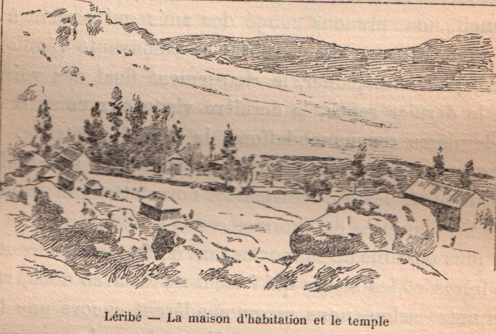
Leribè is a district of Lesotho. It has an area of 2,828 km2 and a population in 2016 of approximately 337,500. Hlotse is the capital or camptown of the district. The district has one additional town, namely Maputsoe. In the west, Leribe borders on the Free State Province of South Africa. Domestically, it borders Butha-Buthe District in the north, Mokhotlong District in the east, Thaba-Tseka District in southeast and Berea District in southwest. As of 2006, the district had a population of 293,369 which was 15.63 per cent of the total population of the country. As of 2008, 48% of the population in the district were economically active. There were 191,052 employed people out of a total of 401,258 people in the district above 15 years of age. Demographics As of 2006, the district had a population of 293,369, 15.63 per cent of the population of the country. The area of the district is 2,828 km2, 9.32% of the total area of the country. The population density in the district w ... [...More Info...] [...Related Items...] OR: [Wikipedia] [Google] [Baidu] |
Maseru District
Maseru is a district of Lesotho. Maseru is also the name of the district's capital, and is the only city in the district and also the capital of the country. It is the largest urban area in the country, and therefore the only city. The city of Maseru is located on Lesotho's western border with the Free State Province of South Africa, the frontier being the Caledon River. Maseru borders on Berea District in north, Thaba-Tseka District in the east, Mohale's Hoek District in south, and Mafeteng District in southwest. As of 2006, the district had a population of 431,998 which was 23.02 per cent of the total population of the country. The total area of the district was 4,279 which was 14.10 per cent of the total area of the country. The density of population in the district was 101.00 per km2. As of 2008, there were 52 economically active people in the district. There were totally 294,062 employed people out of a total of 585,770 people in the district above 15 years of age. Demog ... [...More Info...] [...Related Items...] OR: [Wikipedia] [Google] [Baidu] |
Lesotho
Lesotho ( ), officially the Kingdom of Lesotho, is a country landlocked as an enclave in South Africa. It is situated in the Maloti Mountains and contains the highest mountains in Southern Africa. It has an area of over and has a population of about million. It was previously the British Crown colony of Basutoland, which declared independence from the United Kingdom on 4 October 1966. It is a fully sovereign state and is a member of the United Nations, the Commonwealth of Nations, the African Union, and the Southern African Development Community. The name ''Lesotho'' roughly translates to "land of the Sotho". History Basutoland Basutoland emerged as a single polity under King Moshoeshoe I in 1822. Moshoeshoe, a son of Mokhachane, a minor chief of the Bakoteli lineage, formed his own clan and became a chief around 1804. Between 1820 and 1823, he and his followers settled at the Butha-Buthe Mountain, joining with former adversaries in resistance against the ... [...More Info...] [...Related Items...] OR: [Wikipedia] [Google] [Baidu] |
Katse Dam
The Katse Dam, a concrete arch dam on the Malibamat'so River in Lesotho, is Africa's second largest double-curvature arch dam. (The Tekezé Dam, completed in early 2009, is now Africa's largest double curvature dam). The dam is part of the Lesotho Highlands Water Project, which will eventually include five large dams in remote rural areas. The dam is just below the confluence of the Bokong River, which forms the western arm of the Katse reservoir. The potential of the project was identified by the South African civil engineer Ninham Shand in 1953 as a possible means to supplement the water supply of South Africa's industrial heartland in the Witwatersrand. The World Bank arranged a treaty between the governments of South Africa and Lesotho, allowing the project to proceed. Construction The dam was built by a consortium of Bouygues, Concor, Group 5, Hochtief, Impregilo, Kier Group and Sterling International. The dam was completed in 1996 and the reservoir filled with water ... [...More Info...] [...Related Items...] OR: [Wikipedia] [Google] [Baidu] |
Gauteng
Gauteng ( ) is one of the nine provinces of South Africa. The name in Sotho-Tswana languages means 'place of gold'. Situated on the Highveld, Gauteng is the smallest province by land area in South Africa. Although Gauteng accounts for only 1.5% of the country's land area, it is home to more than a quarter of its population (26%). Highly urbanised, the province contains the country's largest city, Johannesburg, which is also one of the largest cities in the world. Gauteng is the wealthiest province in South Africa and is considered as the financial hub of not only South Africa but the entire African continent, mostly concentrated in Johannesburg. It also contains the administrative capital, Pretoria, and other large areas such as Midrand, Vanderbijlpark, Ekurhuleni and the affluent Sandton. Gauteng is the most populous province in South Africa with a population of approximately 16.1 million people according to mid year 2022 estimates. Etymology The name ''Gauteng'' is der ... [...More Info...] [...Related Items...] OR: [Wikipedia] [Google] [Baidu] |


