|
Sarektjåkkå
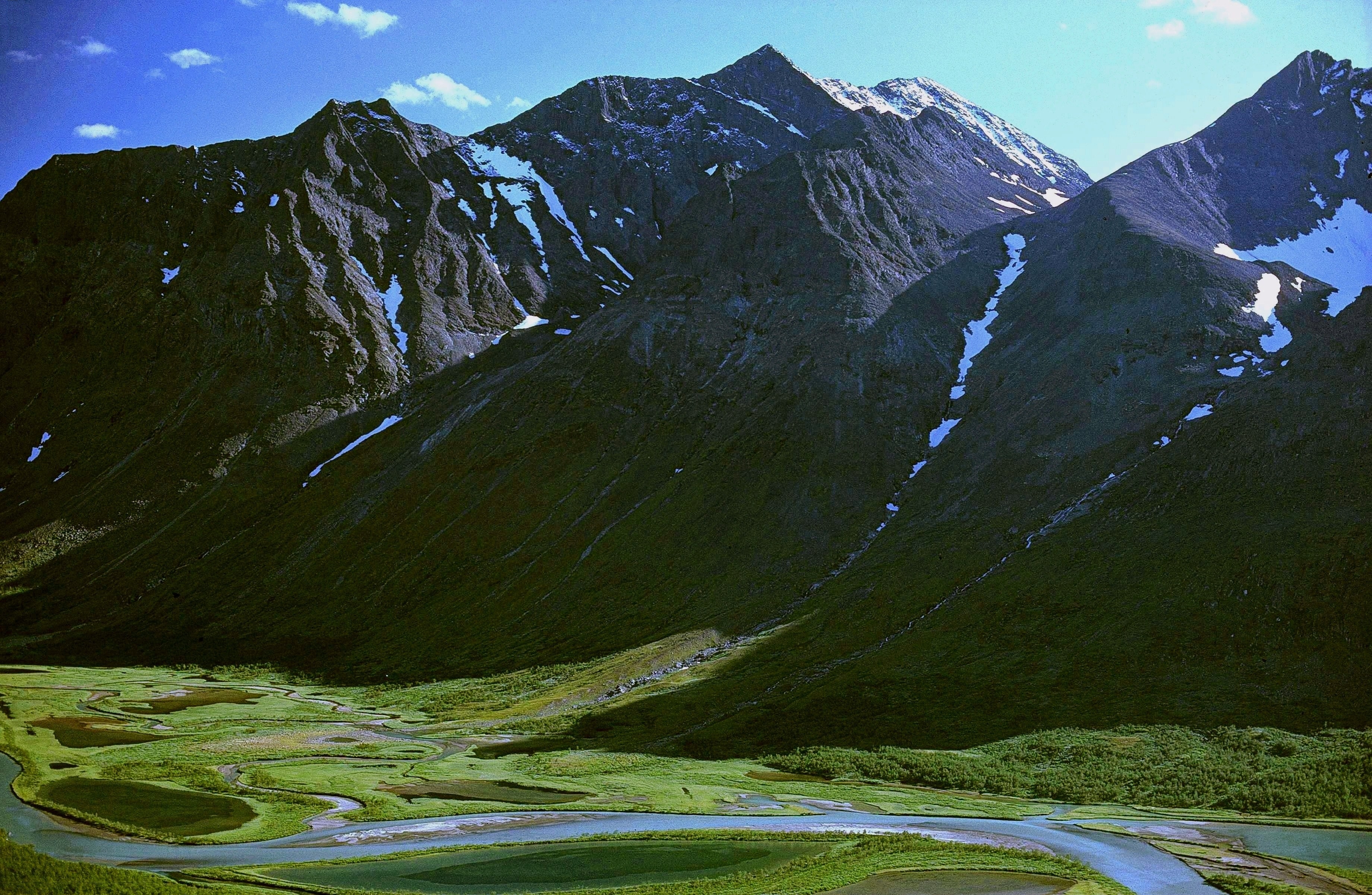
Sarektjåkkå is the second highest mountain in Sweden and the highest mountain in the Laponian area at AMSL. However its mountain peak is the 3:rd highest mountain peak in Sweden, because the two highest peaks in Sweden belongs to the mountain Kebnekaise at 2,097 (North Summit) and 2090 meters (South Summit). The mountain is located close to the eastern border of Sarek National Park, about southwest of Suorva. Climbing Sarektjåkkå is not easily accessible by any nearby roads, so the approach normally takes a day or more of backcountry hiking. Accessing the north summit, at altitude, is a moderate but steep hike up. The actual summit (''Stortoppen'') is located about southwest of the north summit via a ridge and is not as easy to reach, requiring exposed scrambling. An alternative route is to scale the summit from the south by merely steep hiking, but this requires crossing glaciers. See also * List of European ultra-prominent peaks This is a list of all the mountain ... [...More Info...] [...Related Items...] OR: [Wikipedia] [Google] [Baidu] |
Sarek National Park
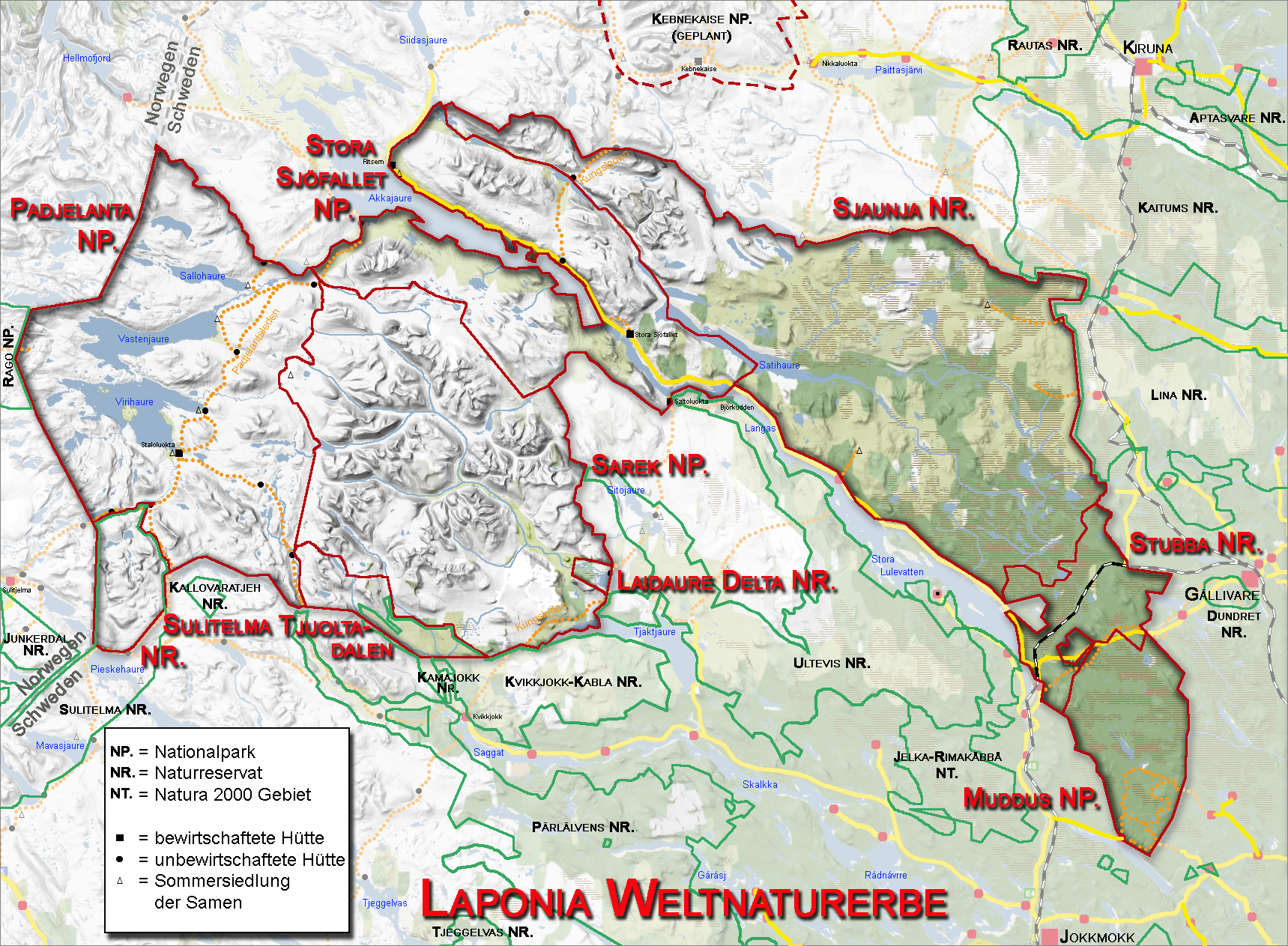
Sarek National Park () is a national park in Jokkmokk Municipality, Lapland in northern Sweden. Established in 1909, the park is among the oldest national parks in Europe. It is adjacent to two other national parks, namely Stora Sjöfallet and Padjelanta. The shape of Sarek National Park is roughly circular with an average diameter of about . The most noted features of the national park are six of Sweden's thirteen peaks over located within the park's boundaries. Among these is the second highest mountain in Sweden, Sarektjåkkå,and Áhkká which is located just outside the park. The park has about 200 mountains over , 82 of which have names. Sarek is also the name of a geographical area which the national park is part of. The Sarek mountain district includes a total of eight peaks over . Due to the long trek, the mountains in the district are seldom climbed. There are approximately 100 glaciers in Sarek National Park. Sarek is a popular area for hikers and mountaineers. Beg ... [...More Info...] [...Related Items...] OR: [Wikipedia] [Google] [Baidu] |
Scandinavian Mountains
The Scandinavian Mountains or the Scandes is a mountain range that runs through the Scandinavian Peninsula. The western sides of the mountains drop precipitously into the North Sea and Norwegian Sea, forming the fjords of Norway, whereas to the northeast they gradually curve towards Finland. To the north they form the border between Norway and Sweden, reaching high at the Arctic Circle. The mountain range just touches northwesternmost Finland but are scarcely more than hills at their northernmost extension at the North Cape (). The mountains are relatively high for a range so young and are very steep in places; Galdhøpiggen in South Norway is the highest peak in mainland Northern Europe, at ; Kebnekaise is the highest peak on the Swedish side, at , whereas the slope of Halti is the highest point in Finland, at , although the peak of Halti is situated in Norway. The Scandinavian montane birch forest and grasslands terrestrial ecoregion is closely associated with the mou ... [...More Info...] [...Related Items...] OR: [Wikipedia] [Google] [Baidu] |
Statistics Sweden
Statistics Sweden ( ; SCB, ) is the Swedish government agency operating under the Ministry of Finance and responsible for producing official statistics for decision-making, debate and research. The agency's responsibilities include: * developing, producing and disseminating statistics; * active participation in international statistical cooperation; * coordination and support of the Swedish system for official statistics, which includes 26 authorities responsible for official statistics in their areas of expertise. National statistics in Sweden date back to 1686 when the parishes of the Church of Sweden were ordered to start keeping records on the population. SCB's predecessor, the ''Tabellverket'' ("office for tabulation"), was set up in 1749, and the current name was adopted in 1858. Subjects Statistics Sweden produces statistics in several different subject areas: , the agency had approximately 1,350 employees. The offices of the agency are located in Stockholm and Öre ... [...More Info...] [...Related Items...] OR: [Wikipedia] [Google] [Baidu] |
Ultra Prominent Peak
An ultra-prominent peak, or ultra for short, is a mountain summit with a topographic prominence of or more; it is also called a P1500. The prominence of a peak is the minimum height of climb to the summit on any route from a higher peak, or from sea level if there is no higher peak. There are approximately 1,500 such peaks on Earth. Some well-known peaks, such as the Matterhorn and Eiger, are not ultras because they are connected to higher mountains by high cols and thus do not achieve enough topographic prominence. The term "ultra" originated with earth scientist Steve Fry, from his studies of the prominence of peaks in Washington (state), Washington in the 1980s. His original term was "ultra major mountain", referring to peaks with at least of prominence. Distribution Currently, over 1,500 ultras have been identified above sea level: 654 in Asia, 357 in North America, 209 in South America, 119 in Europe (including 12 in the Caucasus), 84 in Africa, 54 in Oceania, and 39 in ... [...More Info...] [...Related Items...] OR: [Wikipedia] [Google] [Baidu] |
Sweden
Sweden, formally the Kingdom of Sweden, is a Nordic countries, Nordic country located on the Scandinavian Peninsula in Northern Europe. It borders Norway to the west and north, and Finland to the east. At , Sweden is the largest Nordic country by both area and population, and is the List of European countries by area, fifth-largest country in Europe. Its capital and largest city is Stockholm. Sweden has a population of 10.6 million, and a low population density of ; 88% of Swedes reside in urban areas. They are mostly in the central and southern half of the country. Sweden's urban areas together cover 1.5% of its land area. Sweden has a diverse Climate of Sweden, climate owing to the length of the country, which ranges from 55th parallel north, 55°N to 69th parallel north, 69°N. Sweden has been inhabited since Prehistoric Sweden, prehistoric times around 12,000 BC. The inhabitants emerged as the Geats () and Swedes (tribe), Swedes (), who formed part of the sea-faring peopl ... [...More Info...] [...Related Items...] OR: [Wikipedia] [Google] [Baidu] |
Laponian Area
Laponia, or the Laponian Area, is a large mountainous wildlife area in the Lapland province in northern Sweden, more precisely in Gällivare Municipality, Arjeplog Municipality and Jokkmokk Municipality. The name comes from the Latin name for Lapland. It was made a UNESCO World Heritage Site in 1996; the bulk of it had enjoyed protected status since the early 20th century. The area was made a heritage site for both natural and cultural reasons. The total area is about , making it the world's largest unmodified nature area to be still cultured by natives—the natives in this case being the reindeer-herding Sami people. Only parts of the area is actually used for pasture by them. With such a large space, the geography of the area varies greatly; it is dominated by mountains, rivers and lakes. Each nature reserve and national park has its distinctive features. The amount of snow in winter and rain in summer is considerable. 95% of the area is protected as national parks or nat ... [...More Info...] [...Related Items...] OR: [Wikipedia] [Google] [Baidu] |
AMSL
Height above mean sea level is a measure of a location's vertical distance (height, elevation or altitude) in reference to a vertical datum based on a historic mean sea level. In geodesy, it is formalized as orthometric height. The zero level varies in different countries due to different reference points and historic measurement periods. Climate change and other forces can cause sea levels and elevations to vary over time. Uses Elevation or altitude above sea level is a standard measurement for: * Geographic locations such as towns, mountains and other landmarks. * The top of buildings and other structures. * Mining infrastructure, particularly underground. * Flying objects such as airplanes or helicopters below a Transition Altitude defined by local regulations. Units and abbreviations Elevation or altitude is generally expressed as "metres above mean sea level" in the metric system, or " feet above mean sea level" in United States customary and imperial units. Comm ... [...More Info...] [...Related Items...] OR: [Wikipedia] [Google] [Baidu] |
Kebnekaise
Kebnekaise (; from Sami language, Sami or , "Cauldron Crest") is the highest mountain in Sweden. The Kebnekaise massif, which is part of the Scandinavian Mountains, Scandinavian mountain range, has two main peaks. The glaciated southern peak used to be the highest at above sea level, but has shrunk by 24 meters during the last 50 years, making the northern icefree peak at the highest. Kebnekaise lies in Swedish Lapland, about north of the Arctic Circle and west of Kiruna near the Kungsleden hiking trail between Abisko and Hemavan. Geography The Kebnekaise massif lies within a range of the Scandinavian mountains that is bordered by the glacial valleys Ladtjovagge (Sami spelling Láddjuvággi), Tjäktjavagge (Čeakčavággi) and Vistasvagge (Visttasvággi). The highest points of the massif lie along the ridge (called "Vargryggen" in Swedish) that runs from the southern and northern summits to Kebnepakte (Giebmebákti) at . Other subsidiary peaks are Kebnetjåkka (Giebmečohkka) ... [...More Info...] [...Related Items...] OR: [Wikipedia] [Google] [Baidu] |
Suorva
Suorva () or Suorvadammen ("the Suorva Dam") is a small settlement situated at the southern parts of Akkajaure, in Stora Sjöfallet National Park, Sweden. The settlement can be reached by car (and bus, from Gällivare). It consists of a few houses and a dam operated by Vattenfall, which regulates the flow to the hydroelectric plant in Vietas located about 5 kilometers downstream. The road over the dam is normally open for hikers (not cars) and makes for a possible route into the northern parts of Sarek National Park Sarek National Park () is a national park in Jokkmokk Municipality, Lapland in northern Sweden. Established in 1909, the park is among the oldest national parks in Europe. It is adjacent to two other national parks, namely Stora Sjöfallet and ... which does not require using a boat. Climate References {{Authority control Lapland (Sweden) Populated places in Norrbotten County Hydroelectric power stations in Sweden Vattenfall Gällivare Municipality ... [...More Info...] [...Related Items...] OR: [Wikipedia] [Google] [Baidu] |
Backcountry
In geography, a backcountry, back country or backwater is a geographical area that is remote, undeveloped, isolated, or difficult to access. These areas are typically rural or mountainous and sparsely populated. Terminology Backcountry and wilderness within United States national parks The National Park Service (NPS) generally uses the term "backcountry" to refer to "primitive, undeveloped portions of parks". Developments within backcountry areas are generally limited to trails, unpaved roads, and administrative facilities associated with dispersed recreational use. Dispersed recreational use is the most prevalent human use in backcountry areas, although research activities may also occur. The NPS defines wilderness within US national parks as any "backcountry areas which have been specifically designated as part of the National Wilderness Preservation System or any other area that has been determined to possess the characteristics of wilderness as defined by Section 2( ... [...More Info...] [...Related Items...] OR: [Wikipedia] [Google] [Baidu] |
Glaciers
A glacier (; or ) is a persistent body of dense ice, a form of rock, that is constantly moving downhill under its own weight. A glacier forms where the accumulation of snow exceeds its ablation over many years, often centuries. It acquires distinguishing features, such as crevasses and seracs, as it slowly flows and deforms under stresses induced by its weight. As it moves, it abrades rock and debris from its substrate to create landforms such as cirques, moraines, or fjords. Although a glacier may flow into a body of water, it forms only on land“Glacier, N., Pronunciation.” Oxford English Dictionary, Oxford UP, June 2024, https://doi.org/10.1093/OED/7553486115. Accessed 25 Jan. 2025. and is distinct from the much thinner sea ice and lake ice that form on the surface of bodies of water. On Earth, 99% of glacial ice is contained within vast ice sheets (also known as "continental glaciers") in the polar regions, but glaciers may be found in mountain ranges on every c ... [...More Info...] [...Related Items...] OR: [Wikipedia] [Google] [Baidu] |
List Of European Ultra-prominent Peaks
This is a list of all the mountains in Europe with ultra-prominent peaks with topographic prominence greater than . European peaks by prominence The column "Col" in the chart below denotes the highest elevation to which one must descend from a peak in order to reach peaks with higher elevations; note that the elevation of any peak is the sum of its prominence and col. The above European Top 10 list excludes peaks on lands and islands that are part of European countries but are outside or on the limits of the European continent and its tectonic and geographic boundaries, like Teide (with prominence of ), Tenerife Island, Spain; Belukha peak of the Altai Mountains in Russia (with prominence of ); and Piton des Neiges (with prominence of ), Réunion, France. For ease of reference, the complete list below is divided into sections. Islands in the Atlantic, like Azores and Iceland, the Arctic archipelagos of Jan Mayen, Svalbard, and Novaya Zemlya, Mediterranean Sicily and the oth ... [...More Info...] [...Related Items...] OR: [Wikipedia] [Google] [Baidu] |


