|
Sacadin
Sacadin is the largest of the six Somaliland islands of the Zeila Archipelago, off the coast of Somaliland. It has an area of 7.2 square kilometers (about 720 hectares) and is mostly desert, although 2 portions of the island have abundant vegetation. It is 11.5 kilometers long and is located 5.4 kilometers north of the coast of Somaliland, near the border with Djibouti. Its surface area is comparatively larger than that of Gibraltar and 3 times that of Monaco. See also *Administrative divisions of Somaliland *Regions of Somaliland *Districts of Somaliland The Districts of Somaliland (also known as local government districts) are second-level administrative subdivisions of Somaliland, below the level of Regions of Somaliland, region. There are a total of 22 district, each district is rated A, B ... * Aibat References Islands of Somaliland {{Somaliland-geo-stub ... [...More Info...] [...Related Items...] OR: [Wikipedia] [Google] [Baidu] |
Somaliland
Somaliland, officially the Republic of Somaliland, is an List of states with limited recognition, unrecognised country in the Horn of Africa. It is located in the southern coast of the Gulf of Aden and bordered by Djibouti to the northwest, Ethiopia to the south and west, and Somalia to the east. Its claimed territory has an area of , with approximately 6.2 million people as of 2024. The capital and largest city is Hargeisa. Various Somali Muslim kingdoms were established in the area during the early Islamic period, including in the 14th to 15th centuries the Zeila-based Adal Sultanate. In the early modern period, successor states to the Adal Sultanate emerged, including the Isaaq Sultanate which was established in the middle of the 18th century. In the late 19th century, the United Kingdom signed agreements with various clans in the area, establishing the British Somaliland, Somaliland Protectorate, which was formally granted independence by the United Kingdom as the Sta ... [...More Info...] [...Related Items...] OR: [Wikipedia] [Google] [Baidu] |
Zeila Archipelago
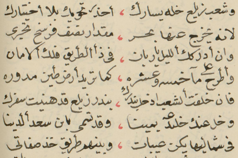
The Sa'ad ad-Din Islands (, ), also Romanized as and known as the Zeila Archipelago, are a group of islands off the northwestern coast of Somalia. They are situated near the ancient city of Zeila. The Zeila Archipelago is made of six small islands all of which are low-lying and have sandy beaches. The largest of these islands are '' Sacadin'' and '' Aibat'', which are six and nine miles off the coast of Zeila, respectively. There is also a lighthouse at Aibat. Etymology & History The name for the archipelago comes from the Sultan Sa'ad ad-Din II who was killed by the Emperor of Abyssinia on the main island in 1403. Along with his name, there are many different spellings for the island such as , , and . The archpeligo is also known as the ''Zeila Archipelago'' and the ''Sa'ad ad-Din group''. Legendary Arab explorer Ahmad ibn Mājid wrote of the archipelago and a few other notable landmarks and ports of the northern Somali coast, including Zeila, Berbera, Xiis, Alula, Rug ... [...More Info...] [...Related Items...] OR: [Wikipedia] [Google] [Baidu] |
Aibat
Aibat () is the second-largest of the six islands of the Zeila Archipelago. It has a lighthouse. It is a low and sandy island, with bushes, that is around 1.75 miles in length and around 0.55 miles in breadth. It is mostly surrounded by a reef. The island has an area of 1.58 square kilometers (158 hectares) and is located 1.9 kilometers north of Sacadin Island, the largest of the group, and about 21 kilometers east of the Djibouti border. See also *Administrative divisions of Somaliland *Regions of Somaliland *Districts of Somaliland *Sacadin Sacadin is the largest of the six Somaliland islands of the Zeila Archipelago, off the coast of Somaliland. It has an area of 7.2 square kilometers (about 720 hectares) and is mostly desert, although 2 portions of the island have abundant vegetati ... References Islands of Somaliland {{Somaliland-geo-stub ... [...More Info...] [...Related Items...] OR: [Wikipedia] [Google] [Baidu] |
Gibraltar
Gibraltar ( , ) is a British Overseas Territories, British Overseas Territory and British overseas cities, city located at the southern tip of the Iberian Peninsula, on the Bay of Gibraltar, near the exit of the Mediterranean Sea into the Atlantic Ocean (Strait of Gibraltar). It has an area of and is Gibraltar–Spain border, bordered to the north by Spain (Campo de Gibraltar). The landscape is dominated by the Rock of Gibraltar, at the foot of which is a densely populated town area. Gibraltar is home to some 34,003 people, primarily Gibraltarians. Gibraltar was founded as a permanent watchtower by the Almohad Caliphate, Almohads in 1160. It switched control between the Nasrids, Crown of Castile, Castilians and Marinids in the Late Middle Ages, acquiring larger strategic clout upon the destruction of nearby Algeciras . It became again part of the Crown of Castile in 1462. In 1704, Anglo-Dutch forces Capture of Gibraltar, captured Gibraltar from Spain during the War of the S ... [...More Info...] [...Related Items...] OR: [Wikipedia] [Google] [Baidu] |
Monaco
Monaco, officially the Principality of Monaco, is a Sovereign state, sovereign city-state and European microstates, microstate on the French Riviera a few kilometres west of the Regions of Italy, Italian region of Liguria, in Western Europe, on the Mediterranean Sea. It is a Enclave and exclave, semi-enclave bordered by France to the north, east and west. The principality is home to nearly 39,000 residents as of the 2020s, of whom about 9,883 are Monégasque people, Monégasque nationals. It is recognised as one of the wealthiest and most expensive places in the world. The official language of Monaco is French language, French. Monégasque dialect, Monégasque, English language, English and Italian language, Italian are also spoken and understood by many residents. With an area of , Monaco is the List of countries and dependencies by area, second-smallest sovereign state in the world, after Vatican City. Its population of 38,423 in 2024 makes it the List of countries by popula ... [...More Info...] [...Related Items...] OR: [Wikipedia] [Google] [Baidu] |
Administrative Divisions Of Somaliland
The administrative division of Somaliland are organized into three hierarchical levels. consists of 6 Regions of Somaliland, regions and 22 Districts of Somaliland, districts. Districts in turn contain villages. In addition, the capital Hargeisa has its own law (capital law) that is different from the law that defines administrative divisions. The administrative-territorial division of the country is established by the Law of Somaliland No. 23/2002 (), which was finally approved in 2007. Somaliland is a self-declared List of states with limited recognition, unrecognized sovereign state in the Horn of Africa, internationally considered to be part of Somalia. History Before March 21, 2008, the Somaliland government continued to use the six administrative regions covered by Somalia at the time of unification: Awdal, Waqooyi Gelbeed, Sanaag, Sool, Togdheer, Sahil. On March 22 of the same year, President of Somaliland, President Dahir Riyale Kahin issued the "Presidential Press St ... [...More Info...] [...Related Items...] OR: [Wikipedia] [Google] [Baidu] |
Regions Of Somaliland
The regions of Somaliland (; ) is divided into six administrative regions, Awdal, Sahil, Maroodi-Jeeh, Togdheer, Sanaag and Sool. These are in turn subdivided into twenty-two districts. Regions of Somaliland are the primary geographical divisions through which Somaliland is administered. A distinction is made between districts of grades A, B, C and D, with the classification being based on population, area, economy and production. Regions History British territory and independence era The local administration of British Somaliland (1884-June 26, 1960) was stipulated primarily by the Local Government Ordinance of 1953. The ordinance established councils in six districts that had divided Somaliland since 1944. The ordinance continued to be used after independence as the State of Somaliland (June 26-July 1, 1960). At the time of the integration with Italian Somaliland on July 1, 1960, there were the following six districts. *Berbera *Borama *Burao *Erigavo *Harge ... [...More Info...] [...Related Items...] OR: [Wikipedia] [Google] [Baidu] |
Districts Of Somaliland
The Districts of Somaliland (also known as local government districts) are second-level administrative subdivisions of Somaliland, below the level of Regions of Somaliland, region. There are a total of 22 district, each district is rated A, B, C, or D according to population, budget, and economic scale with the highest being A grade. The district where the state capital is located is always Class A (by Article 9 of the Local Government Law). The region with the most districts is Sanaag region (5), while the region with the fewest is Sahil, Somaliland, Sahil region (2). The notation follows the Somaliland 2019 Local Government Act. Grade of district The mayor and deputy mayor of a grade A to C district are elected by the local council. The mayor and deputy mayor are elected individually, not as a set. Grade D districts are divided into districts with provisional boundaries and districts with formal boundaries. The area of the provisional boundary district is up to 5 kilomet ... [...More Info...] [...Related Items...] OR: [Wikipedia] [Google] [Baidu] |

