|
Rupshu
Rupshu is a high elevation plateau and valley and an eponymous community development block in southeast Ladakh. It is between the Startsapuk Tso and Tso Moriri, and west of Mahe. The Salt Valley and the Puga Valley to its north are also part of the bigger Rupshu area.Home Puga Valley: The Geothermal Wonder of Ladakh With 6 Tips For Travelling accessed 5 Feb 2025. The Chumar area disputed by India-China in south-eastern Ladakh lies in Rupshu block, south of the |
Chumar
Chumar or Chumur () is a village located in south-eastern region of Ladakh, India and the centre of nomadic grazing. It is in Rupshu block, south of the Tso Moriri lake, on the bank of the Parang River (or ''Pare Chu''), close to Ladakh's border with Tibet. Since 2012, China has disputed the border region situated to the south and southeast of Chumur village within the Chumur sector. However, the Chumur village itself is undisputed and remains in India. The Indian border post at Chumur Peak, offering a view of disputed grazing lands, lies approximately 15-20 km to the south/southwest of Chumur village. In contrast, the Chinese post at Chepzi hamlet is situated 8-10 km south of Chumur village, directly opposite the Indian positions on Chumur Peak. Both Chumur village, nestled in a side valley along the Chumur Tokpo stream (a tributary of the Pare Chu river), and Chepzi are located along the course of the Pare Chu river. Chumar is reachable from east ( Hanle and Demchok), north ... [...More Info...] [...Related Items...] OR: [Wikipedia] [Google] [Baidu] |
Karzok
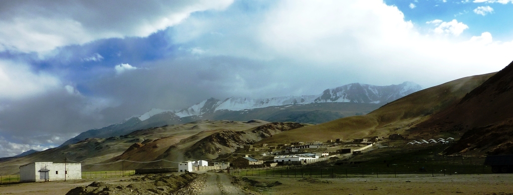
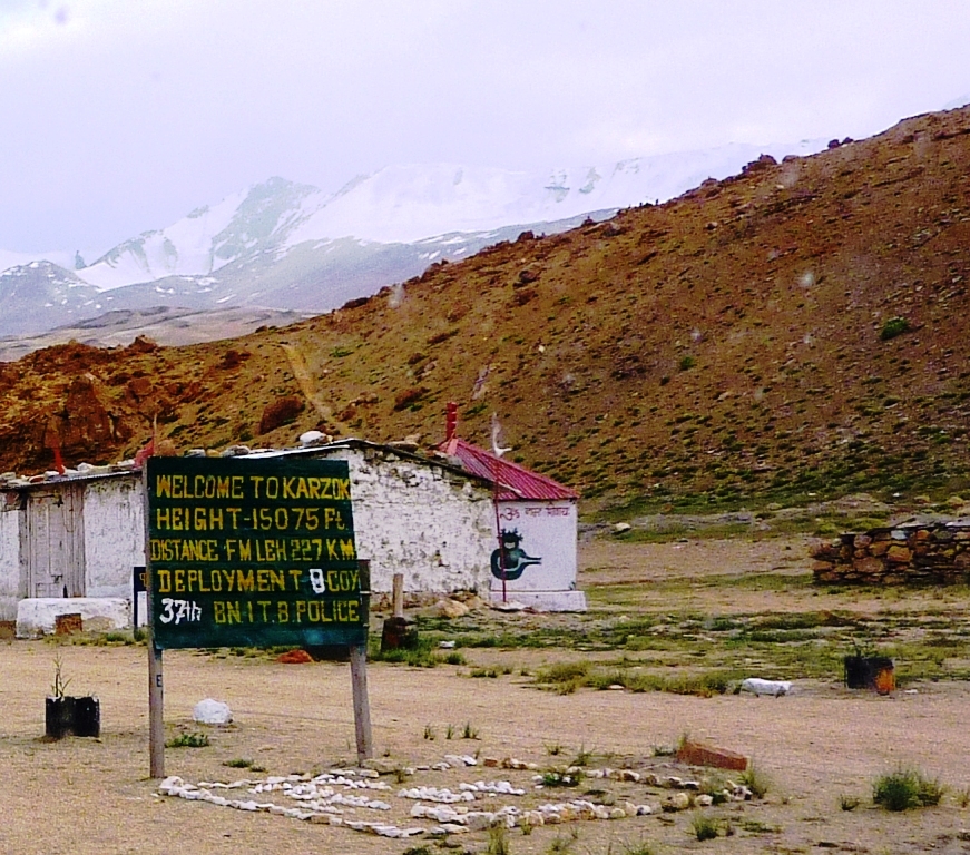
Karzok or Korzok (at an altitude of 14,995 ft or 4,570 m to 15,075 ft or 4,595 m above sea level), on the northwestern shores of the Tso Moriri lake, is a village in the Rupshu region and Community development block in India, block of the Leh district in Ladakh, India. Featuring among the List of highest cities in the world, highest permanent settlement of the world, it is located 60 southwest of Nyoma,Korzok , https://www.dangerousroads.org/asia/india/5683-korzok.html 40 km south of Puga separated by Salt Valley it is 80-100 northwest of Chumur, The Korzok Monastery, of Drukpa Lineage, Drukpa Tibetan Buddhism, Tibetan Buddhist lineage, is located here. History Karzok was on the Central Asian trade route until 1947 and was the headquarters of the Rupshu Valley. One of the kings, Rupshu Goba, who lived there with his family, built nine permanent houses there. The village has several houses, and the nomadic population who establish their tents (made of yak hair or s ... [...More Info...] [...Related Items...] OR: [Wikipedia] [Google] [Baidu] |
Tourism In Ladakh
Tourism is one of the economic contributors to the union territory of Ladakh in Northern India. This union territory is located between the Karakoram mountain range to the north and the Himalayas to the south, and is situated at a height of 11,400 ft (3,475 km). Ladakh is composed of Leh and Kargil districts. The region contains prominent Buddhist sites and has an ecotourism industry. Inner Line Permits There are no open border crossings to the neighbouring Tibet Autonomous Region and Xinjiang, administered by China, or to Gilgit-Baltistan, administered by Pakistan. No special permit is required to visit most of Ladakh, including Leh and Kargil towns. Inner Line Permit (ILP), which can be obtained online, are required for all tourists to visit the "Inner Line" areas, the geostrategic restricted military border areas, such as Nubra Valley; Pangong Tso and Durbuk block (north of the Chang La pass); Tso-Moriri and Tso Kar lakes; Dah and Hanu villages; are ... [...More Info...] [...Related Items...] OR: [Wikipedia] [Google] [Baidu] |
Geography Of Ladakh
Ladakh is an administrative territory of India that has been under its control since 1947. The geographical region of Ladakh union territory is the highest altitude plateau region in India (much of it being over 3,000 m), incorporating parts of the Himalayan and Karakoram mountain ranges and the upper Indus River and valley. Political geography Historic Ladakh consists of a number of distinct areas (mainly under Indian rule), including the fairly populous main Indus valley, the more remote Zanskar (in the south) and Nubra valleys (to the north over Khardung La in the Ladakh mountain range, a high motorable pass at ), the almost deserted Aksai Chin (under Chinese rule) and the predominantly Shi'ite Muslim Kargil and Suru valley areas in the west (Kargil being the second most important town in Ladakh). Historically populated by the Ladakhi people, continued immigration and preferential treatment to Kashmiris by the J&K government have led to demographic changes in t ... [...More Info...] [...Related Items...] OR: [Wikipedia] [Google] [Baidu] |
Tso Moriri
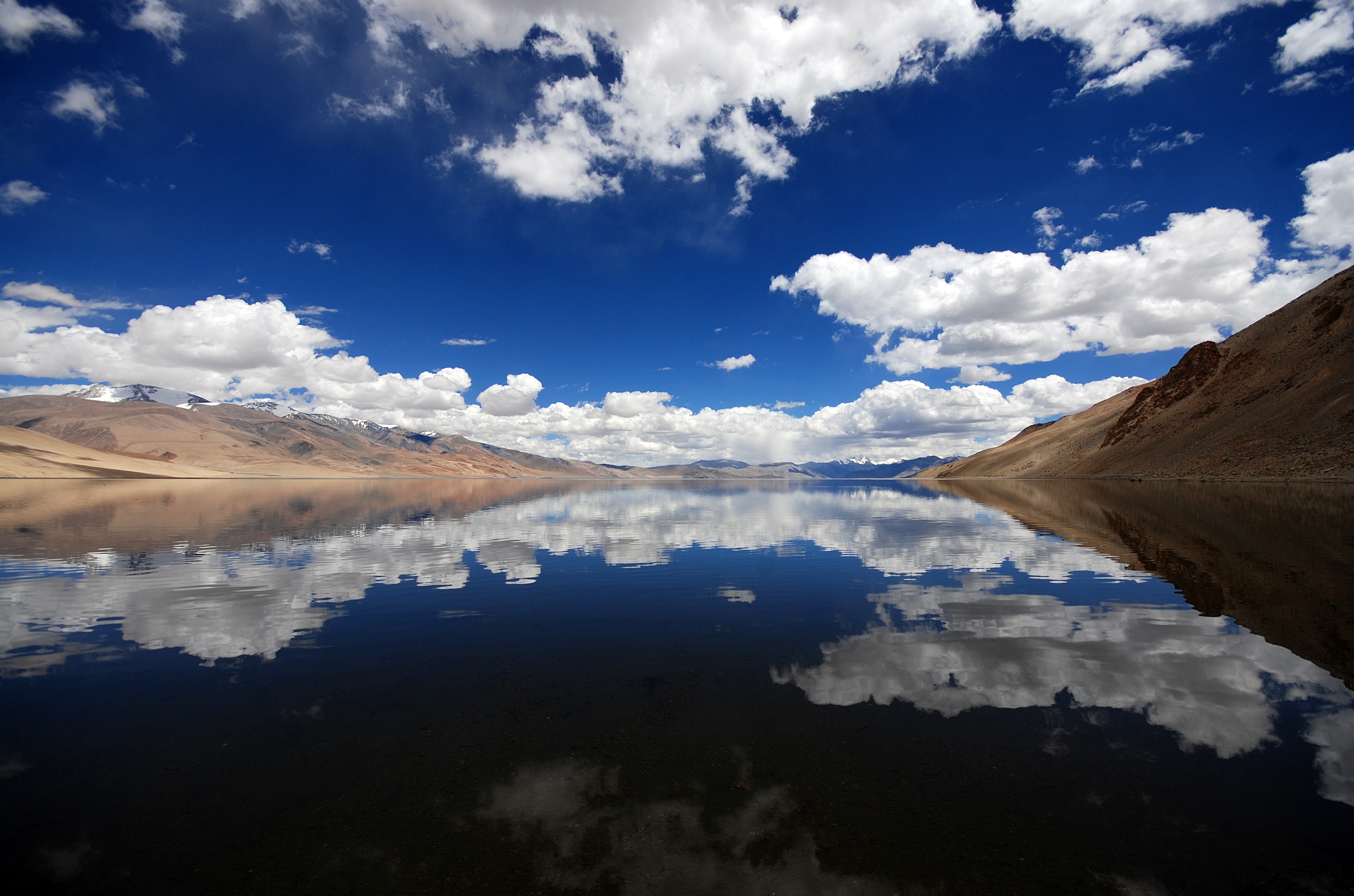
Tso Moriri or Lake Moriri , () or "Mountain Lake", is a pristine high-altitude lake and a Ramsar Wetland Site in the remote Changthang Plateau (literally: northern plains) in Leh district of the union territory of Ladakh in India. As the largest high-altitude lake entirely within India and Ladakh's Trans-Himalayan region, it spans 26 km north-south and 3-5 km wide. The lake is fed by three primary glacial streams - Karzok Phu (west), Gyama Phu (north), and Phirse Phu (southwest) - which form extensive marshes at their deltas. Though now an endorheic lake due to its blocked southern outlet, Tso Moriri maintains slightly brackish yet palatable waters. Its oligotrophic (nutrient-poor), alkaline ecosystem supports unique biodiversity. The area gained protection as the Tso Moriri Wetland Conservation Reserve, though accessibility remains limited mostly to summer months. Year-round settlements exist only at Karzok village (northwest shore) and military outposts along the eastern ... [...More Info...] [...Related Items...] OR: [Wikipedia] [Google] [Baidu] |
Parang River
The Parang River (), also called Para River () and Pare Chu () is an upstream tributary of the Sutlej River, that originates in the Indian state of Himachal Pradesh and ends in Himachal Pradesh again, but flows through Ladakh and Tibet before doing so. The origin of the river is near the Parang La pass in the Spiti subdistrict. After its circuitous journey, it joins the Spiti River near Sumdo in Himachal Pradesh and the combined river then joins Sutlej.: "... the Para River which, after passing through a small part of Tibet, later enters Spiti and joins the Spiti River." Name The name "Para River", which becomes ''Pare Chu'' in Tibetan, is based on the shepherds' ground of ''Para'' in Karab-Bargyok (in the Tibetan part of its course). In Kinnauri, the river was called ''Parati''. The Tibetans and Ladakhis were more likely to call it by the name of locale above their own, as the "Rupshu river" or "Tsotso river", Tsotso being the name of the valley in West Tibet through which ... [...More Info...] [...Related Items...] OR: [Wikipedia] [Google] [Baidu] |
Hanle (village)
Hanle (also spelt Anle) is a large historic village in the Indian union territory of Ladakh. The village of Hanle comprises six hamlets — Bhok, Dhado, Punguk, Khuldo, Naga and Tibetan Refugee habitation —within 1100 sq km Changthang Wildlife Sanctuary in Changtang#India, Changthang plateau.Hanle India's first dark sky reserve accessed 5 June 2023. It is the site of the 17th-century Hanle Monastery (gompa) of the Drukpa Lineage, Drukpa Kagyu branch of Tibetan Buddhism. Hanle is located in the Hanle River valley on an old branch of the ancient Ladakh–Tibet trade route. Hanle is the home of Hanle observatory (ISO - Indian Astronomical Observatory), the tenth (see List of highest astronomical observatories) highest optical telescope in ... [...More Info...] [...Related Items...] OR: [Wikipedia] [Google] [Baidu] |
Kargil District
Kargil district is a district in Indian-administered Ladakh in the Kashmir#Dispute, disputed Kashmir-region,The application of the term "administered" to the various regions of Kashmir and a mention of the Kashmir dispute is supported by the WP:TERTIARY, tertiary sources (a) through (e), reflecting WP:DUE, due weight in the coverage. Although "controlled" and "held" are also applied neutrally to the names of the disputants or to the regions administered by them, as evidenced in sources (h) through (i) below, "held" is also considered politicised usage, as is the term "occupied," (see (j) below). (a) (subscription required) Quote: "Kashmir, region of the northwestern Indian subcontinent ... has been the subject of dispute between India and Pakistan since the partition of the Indian subcontinent in 1947. The northern and western portions are administered by Pakistan and comprise three areas: Azad Kashmir, Gilgit, and Baltistan, the last two being part of a territory called the ... [...More Info...] [...Related Items...] OR: [Wikipedia] [Google] [Baidu] |
Changthang
The Changtang (alternatively spelled Changthang or Qangtang) is a part of the high altitude Tibetan Plateau in western and northern Tibet extending into the southern edges of Xinjiang as well as southeastern Ladakh, India, with vast highlands and giant lakes. From eastern Ladakh, the Changtang stretches approximately east into Tibet as far as modern Qinghai. The Changtang is home to the Changpa, a nomadic Tibetan people. The two largest settlements within the Tibetan Changtang are Rutog Town, which is the seat of Rutog County, and Domar Township, the seat of Shuanghu County. Climate The summers are warm but short and thunderstorms can occur at any time of year, often accompanied with hail. Meanwhile, the winters are cold and Arctic-like despite the latitude, primarily due to the high elevation. History Changtang was once ruled by a culture known as the Zhangzhung, which later merged with Tibetan culture. People The people of the Changtang are nomadic pastoralists. They are ... [...More Info...] [...Related Items...] OR: [Wikipedia] [Google] [Baidu] |
Tso Kar
The Tso Kar or Tsho kar is a fluctuating salt lake known for its size and depth situated in the Rupshu Plateau and valley in Leh district in the southern part in Union territory, Union Territory of Ladakh in India.It is located 102 km from Leh, Leh City, the capital of Ladakh. It is also recognised as India's 42nd Ramsar site. Geography and climate The Tso Kar is connected by an inlet stream at its south-west end to a small lake, Startsapuk Tso, and together they form the 9 km2 More plains Basin (geology), pool, which is dominated by the peaks of two mountains, Thugje (6050 m) and Gursan (6370 m). From the geology of the More Plains, it can be concluded that the Tso Kar in historical times ranged up to this high valley. Until a few years ago the lake was an important source of salt, which the Changpa nomads used to export to Tibet. The nomadic settlement of Thugje is located 3 km in the north. There is a tented camp on the west bank of the lake which provi ... [...More Info...] [...Related Items...] OR: [Wikipedia] [Google] [Baidu] |
Salt Valley
The Salt Valley is a wide open area in the Rupshu region, a valley in southeast Ladakh, India. The valley has a length of about 20 km and a maximum width of about 7 km. Its average elevation is 5,000 m. It can be approached from Leh across the Tanglang La pass. Geography The salt valley and wide area around it, all fall in the Changthang plateau, which also has the following geographical features: The region south of Sumdo and Kyagar La (also known as Namshang La), is referred to as the Salt Valley or Salt Lake Valley due to the salt plains along the northern shore of Tso Moriri and the area surrounding the Kyagar Tso - both of which are salt lakes.Home Puga Valley: The Geothermal Wonder of Ladakh With 6 Tips For Travelling ... [...More Info...] [...Related Items...] OR: [Wikipedia] [Google] [Baidu] |


