|
Hanle (village)
Hanle (also spelt Anle) is a large historic village in the Indian union territory of Ladakh. The village of Hanle comprises six hamlets — Bhok, Dhado, Punguk, Khuldo, Naga and Tibetan Refugee habitation —within 1100 sq km Changthang Wildlife Sanctuary in Changtang#India, Changthang plateau.Hanle India's first dark sky reserve accessed 5 June 2023. It is the site of the 17th-century Hanle Monastery (gompa) of the Drukpa Lineage, Drukpa Kagyu branch of Tibetan Buddhism. Hanle is located in the Hanle River valley on an old branch of the ancient Ladakh–Tibet trade route. Hanle is the home of Hanle observatory (ISO - Indian Astronomical Observatory), the tenth (see List of highest astronomical observatories) highest optical telescope in ... [...More Info...] [...Related Items...] OR: [Wikipedia] [Google] [Baidu] |
States And Union Territories Of India
India is a federalism, federal union comprising 28 federated state, states and 8 union territory, union territories, for a total of 36 subnational entities. The states and union territories are further subdivided into 800 List of districts in India, districts and smaller administrative divisions of India, administrative divisions by the respective subnational government. The states of India are self-governing administrative divisions, each having a State governments of India, state government. The governing powers of the states are shared between the state government and the Government of India, union government. On the other hand, the union territories are directly governed by the union government. History 1876–1919 The British Raj was a very complex political entity consisting of various imperial divisions and states and territories of varying autonomy. At the time of its establishment in 1876, it was made up of 584 princely state, constituent states and the prov ... [...More Info...] [...Related Items...] OR: [Wikipedia] [Google] [Baidu] |
Tibet
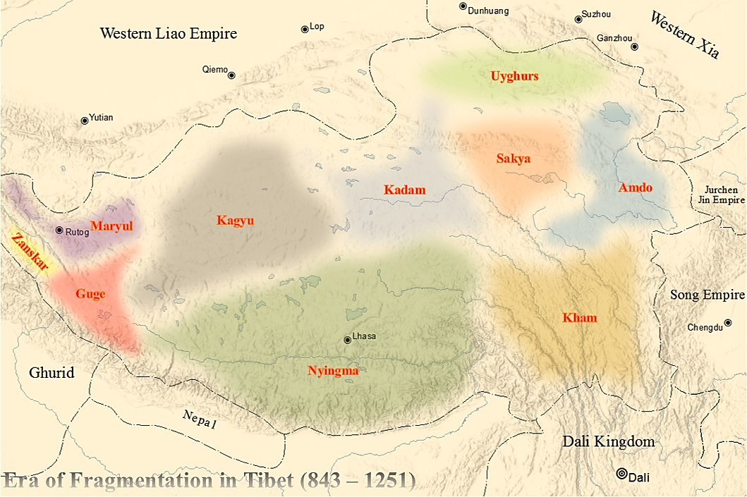
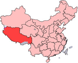
Tibet (; ''Böd''; ), or Greater Tibet, is a region in the western part of East Asia, covering much of the Tibetan Plateau and spanning about . It is the homeland of the Tibetan people. Also resident on the plateau are other ethnic groups such as Mongols, Monpa people, Monpa, Tamang people, Tamang, Qiang people, Qiang, Sherpa people, Sherpa, Lhoba people, Lhoba, and since the 20th century Han Chinese and Hui people, Hui. Tibet is the highest region on Earth, with an average elevation of . Located in the Himalayas, the highest elevation in Tibet is Mount Everest, Earth's highest mountain, rising above sea level. The Tibetan Empire emerged in the 7th century. At its height in the 9th century, the Tibetan Empire extended far beyond the Tibetan Plateau, from the Tarim Basin and Pamirs in the west, to Yunnan and Bengal in the southeast. It then divided into a variety of territories. The bulk of western and central Tibet (Ü-Tsang) was often at least nominally unified under a ser ... [...More Info...] [...Related Items...] OR: [Wikipedia] [Google] [Baidu] |
Zanskar
Zanskar, Zahar (locally) or Zangskar, is the southwestern region of Kargil district in the Indian union territory of Ladakh. The administrative centre of Zanskar is Padum. Zanskar, together with the rest of Ladakh, was briefly a part of the kingdom of Geography of Tibet, Western Tibet called Ngari Khorsum. Zanskar lies 250 km south of Kargil, Kargil City on National Highway 301 (India), NH301. In August 2024, the Ministry of Home Affairs (India), Ministry of Home Affairs announced that Zanskar will become a district (India), district in Ladakh by 2028. Etymology Zanskar ( ''zangs dkar'') appears as ''“Zangskar”'' mostly in academic studies in social sciences (anthropology, gender studies), reflecting the Ladakhi pronunciation, although the Zanskari pronunciation is Zãhar. Older geographical accounts and maps may use the alternate spelling "Zaskar". An etymological study (Snellgrove and Skorupsky, 1980) of the name reveals that its origin might refer to the natural occ ... [...More Info...] [...Related Items...] OR: [Wikipedia] [Google] [Baidu] |
Maryul
Maryul (), also called ''mar-yul'' of ''mnga'-ris'', was the western-most Tibetan kingdom based in modern-day Ladakh and some parts of Tibet. The kingdom had its capital at Shey. The kingdom was founded by Lhachen Palgyigon, during the rule of his father Kyide Nyimagon, in .: "it seems that his father bequeathed him a theoretical right of sovereignty, but the actual conquest was effected by dPal-gyi-mgon himself." It stretched from the Zoji La at the border of Kashmir to Demchok in the southeast, and included Rudok and other areas presently in Tibet. The kingdom came under the control of the Namgyal dynasty in 1460, eventually acquiring the name "Ladakh", and lasted until 1842. In that year, the Dogra general Zorawar Singh, having conquered it, made it part of the would-be princely state of Jammu and Kashmir. Etymology ''Mar-yul'' has been interpreted in Tibetan sources as lowland (of Ngari),. Scholars suspect that it was a proper name that was in use earlier, even ... [...More Info...] [...Related Items...] OR: [Wikipedia] [Google] [Baidu] |
Koyul River
Koyul is a village in the Leh district of Ladakh, India. It is located in the Nyoma tehsil, on the banks of the Koyul Lungpa river just before it joins the Indus River. Geography The village of Koyul is in the Koyul Lungpa valley, which houses an active river that joins the Indus near Fukche. The river originates at the twin passes Zulung La and Dilung La on Ladakh's border with Tibet's Zanda County and flows northeast. Koyul is about 8 km away from the junction with the Indus. Between the Koyul Lungpa and the Indus valley to the east is a ridge, which also goes by the name "Koyul ridge". China's claim line of the Demchok sector The Demchok sector is a disputed area named after the villages of Demchok, Ladakh, Demchok in Ladakh and Demchok, Ngari Prefecture, Demchok in Tibet, situated near the confluence of the Charding Nullah and Indus River. It is a part of the gr ... runs along the crest of this ridge. The Koyul village is just beyond the claim line (in undispu ... [...More Info...] [...Related Items...] OR: [Wikipedia] [Google] [Baidu] |
Zhaxigang
An alphabetical list of populated places, including cities, towns, and villages, in the Tibet Autonomous Region of western China. A *Alamdo *Alhar * Arza *Asog B * Baga *Bagar * Baidi *Baima * Baimai *Baixoi * Bamda *Banag *Banbar * Banggaidoi *Bangkor *Bangru *Bangxing * Baqên *Bar * Bêba *Bei *Bênqungdo * Bilung *Birba * Biru *Bogkamba *Boindoi * Bolo *Bongba * Boqê *Bumgyê *Bungona’og * Bünsum * Burang *Bushêngcaka C * Caina *Cakaxiang *Camco *Cawarong * Cazê *Cêgnê *Cêngdo *Cêri *Cêrwai *Chabug *Chacang *Chagla *Chagna *Chagyoi *Cha’gyüngoinba *Chalükong *Chamco *Chamda *Chamoling *Changgo *Changlung *Changmar *Charing *Chatang *Chawola *Chêcang *Chênggo *Chepzi *Chibma *Chido *Chigu *Chongkü *Chongsar *Chowa *Chubalung *Chubarong *Chuka *Chumba *Chumbu *Chunduixiang *Co Nyi *Cocholung * Codoi * Cogo * Coka *Comai *Cona (Tsona) *Co’nga * Congdü *Conggo * Coqên *Coyang * Cuoma * Cuozheqiangma D *Dagdong *Dagmo *Dagri *Dagring *Dagzhuka *D ... [...More Info...] [...Related Items...] OR: [Wikipedia] [Google] [Baidu] |
Dêmqog, Ngari Prefecture
Demchok (), KNAB Place Name Database, retrieved 27 July 2021. is a Chinese-administered village in the Zhaxigang Township, in the of China. India disputes the status and claims it as part of the that it regards as part of |
Demchok, Ladakh
Demchok (), KNAB Place Name Database, retrieved 27 July 2021. previously called New Demchok, and called Parigas () by the Chinese, is a village and military encampment in the Indian-administered Demchok sector, that is disputed between India and China. It is administered as part of the Nyoma tehsil in the Leh district of Ladakh by India, and claimed by China as part of the Tibet Autonomous Region. The Line of Actual Control (LAC) passes along the southeast side of the village, along the Charding Nullah (also called Demchok River and Lhari stream) which joins the Indus River near the village. Across the stream, less than a kilometre away, is a Chinese-administered Demchok, Ngari Prefecture, Demchok village.
|
Charding La
The Charding Nullah, traditionally known as the Lhari stream and called Demchok River by China, is a small river that originates near the Charding La pass that is also on the border between the two countries and flows northeast to join the Indus River near a peak called "Demchok Karpo" or "Lhari Karpo" (white holy peak of Demchok). There are villages on both sides of the mouth of the river called by the same name "Demchok", which is presumed to have been a single village originally, and has gotten split into two due to geopolitcal reasons. The river serves as the ''de facto'' border between China and India in the southern part of the Demchok sector. Etymology The Indian government refers to the river as "Charding Nullah" after its place of origin, the Charding La pass, with nullah meaning a mountain stream. The Chinese government uses the term "Demchok river" by the location of its mouth, near the Demchok Karpo peak and the Demchok village. Some of the historical document ... [...More Info...] [...Related Items...] OR: [Wikipedia] [Google] [Baidu] |
Pangong Tso
Pangong Tso or Pangong Lake (; zh, s=班公错, p=Bān gōng cuò; ) is an endorheic lake spanning eastern Ladakh and Ngari Prefecture, West Tibet situated at an elevation of . It is long and divided into five sublakes, called ''Pangong Tso'', ''Tso Nyak'', ''Rum Tso'' (twin lakes) and ''Nyak Tso''. Approximately 50% of the length of the overall lake lies within Tibet administered by China, 40% in Indian-administered Ladakh, and the remaining 10% is disputed and is a de facto buffer zone between India and China. The lake is wide at its broadest point. All together it covers almost 700 km2. During winter the lake freezes completely, despite being saline water. It has a land-locked basin separated from the Indus River basin by a small elevated ridge, but is believed to have been part of the Indus basin in prehistoric times. Names Historically, the lake is viewed as being made up five sublakes, which are connected through narrow water channels. The name ''Pangong Tso'' o ... [...More Info...] [...Related Items...] OR: [Wikipedia] [Google] [Baidu] |
Chushul
Chushul is a village in the Leh district of Ladakh, India. It is located in the Durbuk tehsil, in the area known as "Chushul Valley", south of the Pangong Lake and west of the Spanggur Lake. The Line of Actual Control with China runs about 5 miles east of Chushul, across the Chushul Valley. Famous as site for historical battle grounds. In August 1842 the concluding battle of the Dogra–Tibetan war with subsequent signing of the Treaty of Chushul in September 1842 for border non-proliferation took place at Chushul. On 18 November 1962 Sino-Indian War, PVC Major Shaitan Singh with his five platoons of 120 men fought to the 'last man, last round' at Rezang La (Chushul), only 6 men survived the Chinese massacre. Geography Chushul is about 10 miles south of the Pangong Lake. It is in the valley of Tsaka Chu (or "Chushul stream") which rises near the Tsaka La and flows north for about 30 miles before entering the Pangong Lake on its south bank near Thakung. The stream ... [...More Info...] [...Related Items...] OR: [Wikipedia] [Google] [Baidu] |
Ukdungle
Ukdungle is a small Indian Army military compound entirely contained within a 40 by 70 meter area in Leh district, Ladakh in northern India, 48 km west of Demchok village on the Line of Actual Control with Tibet Tibet (; ''Böd''; ), or Greater Tibet, is a region in the western part of East Asia, covering much of the Tibetan Plateau and spanning about . It is the homeland of the Tibetan people. Also resident on the plateau are other ethnic groups s .... Nurbula pass is close to this place. References {{Leh district Villages in Nyoma tehsil ... [...More Info...] [...Related Items...] OR: [Wikipedia] [Google] [Baidu] |


