|
Roeburndale
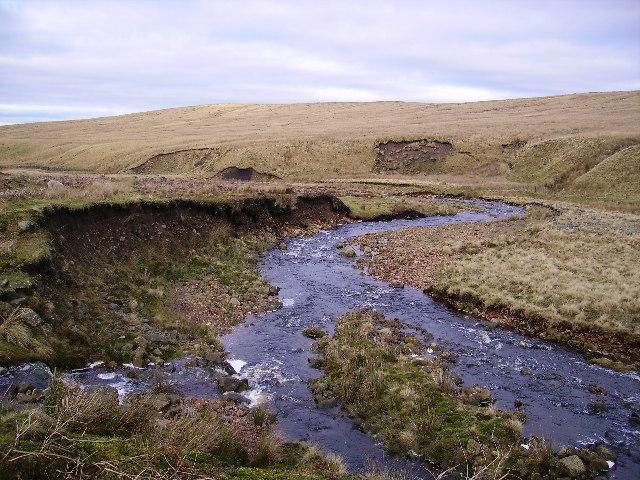
Roeburndale is a civil parish in the City of Lancaster and the English county of Lancashire. In 2001 it had a population of 76. In the 2011 census Roeburndale was grouped with Claughton. The parish includes the village of Salter. The River Roeburn flows through the parish. It gives its name to the Roeburndale geological formation. History From the Middle Ages, Roeburndale was the Chase of the Honour of Hornby Castle. On Tuesday 3 July 1979 a BAC Jet Provost crashed at Salter Fell. The pilot Flt Lt Thomas Durk Bayliff was killed. He had studied Aeronautical Engineering at Queen's University Belfast The Queen's University of Belfast, commonly known as Queen's University Belfast (; abbreviated Queen's or QUB), is a public research university in Belfast, Northern Ireland, United Kingdom. The university received its charter in 1845 as part of ... in 1977. In January 2022, one person was killed and others were injured when a bridge collapsed into the River Roeburn in Roeb ... [...More Info...] [...Related Items...] OR: [Wikipedia] [Google] [Baidu] |
Listed Buildings In Roeburndale
Roeburndale is a civil parish in Lancaster, Lancashire, England. It contains 19 listed buildings that are recorded in the National Heritage List for England The National Heritage List for England (NHLE) is England's official database of protected heritage assets. It includes details of all English listed buildings, scheduled monuments, register of historic parks and gardens, protected shipwrecks, .... All of the listed buildings are designated at Grade II, the lowest of the three grades, which is applied to "buildings of national importance and special interest". The parish is completely rural, and all the listed buildings are houses, farmhouses and farm buildings. Buildings References Citations Sources * * * * * * * * * * * * * * * * * * * * * {{DEFAULTSORT:Roeburndale Lists of listed buildings in Lancashire Buildings and structures in the City of Lancaster ... [...More Info...] [...Related Items...] OR: [Wikipedia] [Google] [Baidu] |
Roeburndale Formation
The Roeburndale Formation is a geologic formation in England. It preserves fossils dating back to the Carboniferous period. Narrowly defined, it is located around Lancaster, Garstang and Settle. It is part of a wider formation extending across Craven District and Harrogate. The British Geological Survey considers the term obsolete, and refers users to the ''Roeburndale Member'' and the ''Silsden Formation''. It is named for the River Roeburn which has its catchment within the formation. See also * List of fossiliferous stratigraphic units in England See also * Lists of fossiliferous stratigraphic units in Europe * Lists of fossiliferous stratigraphic units in the United Kingdom References * {{DEFAULTSORT:Fossiliferous stratigraphic units in England England England is a Countr ... References External links * Carboniferous System of Europe Carboniferous England Carboniferous southern paleotropical deposits {{England-stub ... [...More Info...] [...Related Items...] OR: [Wikipedia] [Google] [Baidu] |
River Roeburn
The River Roeburn is a river in Lancashire, England England is a Countries of the United Kingdom, country that is part of the United Kingdom. It is located on the island of Great Britain, of which it covers about 62%, and List of islands of England, more than 100 smaller adjacent islands. It .... Sourced at Salter Fell, the Roeburn flows northwards through Roeburndale to Wray, where it joins the River Hindburn. Flash flooding of the river in 1967 caused substantial damage to the village of Wray. References External links Roeburn, River Roeburn Forest of Bowland 3Roeburn {{England-river-stub ... [...More Info...] [...Related Items...] OR: [Wikipedia] [Google] [Baidu] |
City Of Lancaster
The City of Lancaster, or simply ''Lancaster'' (), is a non-metropolitan district, local government district with City status in the United Kingdom, city status in Lancashire, England. It is named after its largest settlement, Lancaster, Lancashire, Lancaster, and also includes the towns of Carnforth, Heysham and Morecambe and a wider rural hinterland. The district has a population of (), and an area of . Much of the district's rural area is recognised for its natural beauty; it includes part of the Yorkshire Dales National Park and parts of the designated Area of Outstanding Natural Beauty, Areas of Outstanding Natural Beauty of Arnside and Silverdale and the Forest of Bowland. The neighbouring districts are Westmorland and Furness, North Yorkshire (district), North Yorkshire, Ribble Valley and Borough of Wyre, Wyre. History The town of Lancaster was an ancient borough, with its earliest known charter dating from 1193. A later charter in 1337 gave it the right to appoint a m ... [...More Info...] [...Related Items...] OR: [Wikipedia] [Google] [Baidu] |
Civil Parishes In Lancashire
A civil parish is a subnational entity, forming the lowest unit of local government in England. There are 219 civil parishes in the ceremonial county of Lancashire; Blackpool is completely unparished; Borough of Pendle, Pendle and Ribble Valley are entirely parished. At the 2001 census, there were 587,074 people living in the 219 parishes, accounting for 41.5 per cent of the county's population. History Parishes arose from Church of England divisions, and were originally purely ecclesiastical divisions. Over time they acquired civil administration powers.Angus Winchester, 2000, ''Discovering Parish Boundaries''. Shire Publications. Princes Risborough, 96 pages The Highways Act 1555 made parishes responsible for the upkeep of roads. Every adult inhabitant of the parish was obliged to work four days a year on the roads, providing their own tools, carts and horses; the work was overseen by an unpaid local appointee, the ''Surveyor of Highways''. The poor were looked after by the ... [...More Info...] [...Related Items...] OR: [Wikipedia] [Google] [Baidu] |
Claughton, Lancaster
Claughton ( ) is a small village and civil parish in the City of Lancaster in Lancashire, England. The village is on the A683 road east of Lancaster and at the time of the 2001 census had a population of 132. In the 2011 census Claughton was grouped with Roeburndale (2001 pop. 76) to give a total of 223. North of the village is the River Lune, and to the south is Claughton Moor and the fells of the Forest of Bowland. Local government Claughton is part of the Lower Lune Valley ward, which elects two councillors to Lancaster City Council every four years. Industry There is a brickworks, Claughton Brickworks, in the village. Ropeway conveyors, which transport clay from Claughton Moor to the Claughton Brickworks, are suspended above the road ( A683). Religious sites St Chad's Church was closed by the Church of England in 2002 due to a decline in the number of worshippers and the fact that the building was in need of modernisation. The church was part of the Hornby wit ... [...More Info...] [...Related Items...] OR: [Wikipedia] [Google] [Baidu] |
United Kingdom Census 2011
A Census in the United Kingdom, census of the population of the United Kingdom is taken every ten years. The 2011 census was held in all countries of the UK on 27 March 2011. It was the first UK census which could be completed online via the Internet. The Office for National Statistics (ONS) is responsible for the census in England and Wales, the General Register Office for Scotland (GROS) is responsible for the census in Scotland, and the Northern Ireland Statistics and Research Agency (NISRA) is responsible for the census in Northern Ireland. The Office for National Statistics is the executive office of the UK Statistics Authority, a non-ministerial department formed in 2008 and which reports directly to Parliament. ONS is the UK Government's single largest statistical producer of independent statistics on the UK's economy and society, used to assist the planning and allocation of resources, policy-making and decision-making. ONS designs, manages and runs the census in England an ... [...More Info...] [...Related Items...] OR: [Wikipedia] [Google] [Baidu] |
Civil Parish
In England, a civil parish is a type of administrative parish used for local government. It is a territorial designation which is the lowest tier of local government. Civil parishes can trace their origin to the ancient system of parishes, which for centuries were the principal unit of secular and religious administration in most of England and Wales. Civil and religious parishes were formally split into two types in the 19th century and are now entirely separate. Civil parishes in their modern form came into being through the Local Government Act 1894 ( 56 & 57 Vict. c. 73), which established elected parish councils to take on the secular functions of the parish vestry. A civil parish can range in size from a sparsely populated rural area with fewer than a hundred inhabitants, to a large town with a population in excess of 100,000. This scope is similar to that of municipalities in continental Europe, such as the communes of France. However, unlike their continental Euro ... [...More Info...] [...Related Items...] OR: [Wikipedia] [Google] [Baidu] |
Lancashire
Lancashire ( , ; abbreviated ''Lancs'') is a ceremonial county in North West England. It is bordered by Cumbria to the north, North Yorkshire and West Yorkshire to the east, Greater Manchester and Merseyside to the south, and the Irish Sea to the west. The largest settlement is Preston, Lancashire, Preston, and the county town is the city of Lancaster, Lancashire, Lancaster. The county has an area of and a population of 1,490,300. Preston is located near the centre of the county, which is urbanised and includes the towns of Blackburn and Burnley; the seaside resort of Blackpool lies to the west, and Lancaster, Lancashire, Lancaster is in the north. For Local government in England, local government purposes the county comprises a non-metropolitan county, with twelve districts, and two Unitary authorities of England, unitary authority areas: Blackburn with Darwen and Borough of Blackpool, Blackpool. Lancashire County Council and the two unitary councils collaborate through the ... [...More Info...] [...Related Items...] OR: [Wikipedia] [Google] [Baidu] |
Chase (land)
''Chase'' is a term used in the United Kingdom to define a type of land reserved for hunting use by its owner. Similarly, a ''Royal Chase'' is a type of Crown Estate by the same description, where the hunting rights are reserved for a member of the British Royal Family. The term ‘chase’ is also used in Australia to describe some national parks. Flinders Chase National Park is on Kangaroo Island in South Australia and Ku-ring-gai Chase National Park is in New South Wales. Rights and history The ''Victoria County History'' describes a chase as: "like a forest, uninclosed, and only defined by metes ouses and farmsteads withinand bounds ills, highways, watercourses etc but it could be held by a subject. Offences committed therein were, as a rule, punishable by the common law and not by forest jurisdiction." Chases are often identified by open clearings, soil type, and retaining additional heath rather than forests for hunting purposes. Chases faced mass enclosure by Pr ... [...More Info...] [...Related Items...] OR: [Wikipedia] [Google] [Baidu] |
English Feudal Barony
In the kingdom of England, a feudal barony or barony by tenure was the highest degree of feudal land tenure, namely ''per baroniam'' (Latin for "by barony"), under which the land-holder owed the service of being one of the king's barons. The duties owed by and the privileges granted to feudal barons are not exactly defined, but they involved the duty of providing soldiers to the royal feudal army on demand by the king, and the privilege of attendance at the king's feudal court, the '' Magnum Concilium'', the precursor of parliament. If the estate-in-land held by barony contained a significant castle as its '' caput baroniae'' and if it was especially large – consisting of more than about 20 knight's fees (each loosely equivalent to a manor) – then it was termed an honour. The typical honour had properties scattered over several shires, intermingled with the properties of others. This was a specific policy of the Norman kings, to avoid establishing any one area under the ... [...More Info...] [...Related Items...] OR: [Wikipedia] [Google] [Baidu] |
Hornby Castle, Lancashire
Hornby Castle is a country house, developed from a medieval castle, standing to the east of the village of Hornby in the Lune Valley, Lancashire, England. It occupies a position overlooking the village in a curve of the River Wenning. The house is recorded in the National Heritage List for England as a designated Grade I listed building. History It is thought that the castle was originally built for the Neville family in the 13th century; this is the most likely date of the base of the tower at the back of the castle. In 1285, Margaret de Neville was the owner and "had writ for livery" at Hornby Castle. The polygonal tower rising from this base dates from the 16th century, and was probably built for Sir Edward Stanley, 1st Baron Monteagle. His son, the second Baron Monteagle, took part in suppressing the Rising of the North in 1536. The third Baron Monteagle sold off a lot of the land and on his death in 1581 was succeeded by an only daughter, Elizabet ... [...More Info...] [...Related Items...] OR: [Wikipedia] [Google] [Baidu] |


