|
Phoenix-class Sloop
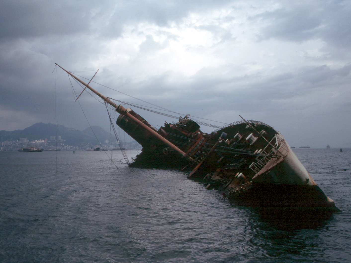
The ''Phoenix'' class was a two-ship ship class, class of 6-gun screw steel sloop-of-war, sloops built for the Royal Navy in 1895. Both ships participated in the suppression of the Boxer Rebellion, but ''Phoenix'' was destroyed in a typhoon while alongside in Hong Kong in 1906. ''Algerine'' became a depot ship at Esquimalt, was sold in 1919, and was finally wrecked in 1923. Design ''Phoenix'' and ''Algerine'' were constructed of steel and powered by both barquentine-rigged sails and a twin-screw steam engine developing 1,400 horsepower. They were essentially a twin-screw version of the Alert-class sloop, ''Alert''-class sloop. Operational lives Screw sloops like ''Phoenix'' had been obsolete for many years, but they remained ideal for patrolling British Empire, Britain's far flung maritime empire, and both ''Phoenix'' and ''Algerine'' were deployed to the China Station. Both ships recommissioned at Hong Kong and served in Chinese waters during the Boxer Rebellion. In June 19 ... [...More Info...] [...Related Items...] OR: [Wikipedia] [Google] [Baidu] |
HMS Algerine (1895)
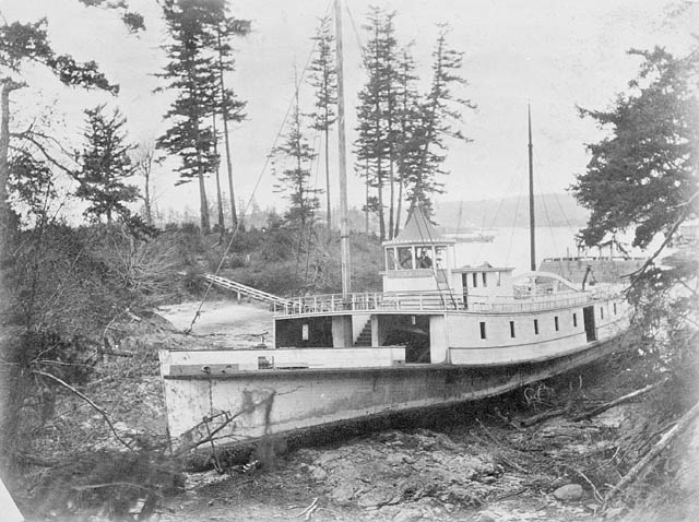
HMS ''Algerine'' was a steel screw Sloop-of-war, sloop of the Royal Navy. She was launched at Devonport in 1895, saw action in China during the Boxer Rebellion, and later served on the Pacific Station. She was stripped of her crew at Esquimalt in 1914, and transferred to the Royal Canadian Navy in 1917, being commissioned as HMCS ''Algerine''. She was sold as a salvage vessel in 1919 and wrecked in 1923. Design ''Algerine'' was a ''Phoenix''-class steel screw sloop mounting 10 guns. She and her sister ship, ''Phoenix'', were designed by William Henry White, Sir William White, the Admiralty Chief Constructor. The class was essentially a twin-screw version of the . The ship had length overall and measured Length between perpendiculars, between perpendiculars. The vessel had a Beam (nautical), beam of and a Draft (ship), draught of . ''Algerine'' was constructed of steel and given a protective deck of steel armour over her machinery and boilers. Propulsion As built the cla ... [...More Info...] [...Related Items...] OR: [Wikipedia] [Google] [Baidu] |
British Empire
The British Empire comprised the dominions, Crown colony, colonies, protectorates, League of Nations mandate, mandates, and other Dependent territory, territories ruled or administered by the United Kingdom and its predecessor states. It began with the English overseas possessions, overseas possessions and trading posts established by Kingdom of England, England in the late 16th and early 17th centuries, and colonisation attempts by Kingdom of Scotland, Scotland during the 17th century. At its height in the 19th and early 20th centuries, it became the List of largest empires, largest empire in history and, for a century, was the foremost global power. By 1913, the British Empire held sway over 412 million people, of the world population at the time, and by 1920, it covered , of the Earth's total land area. As a result, Westminster system, its constitutional, Common law, legal, English language, linguistic, and Culture of the United Kingdom, cultural legacy is widespread. ... [...More Info...] [...Related Items...] OR: [Wikipedia] [Google] [Baidu] |
HMNB Devonport
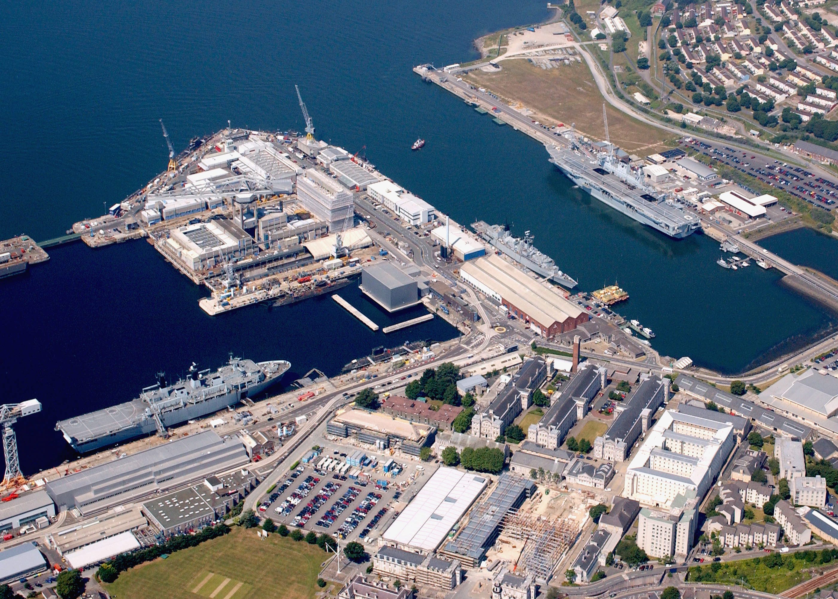
His Majesty's Naval Base, Devonport (HMNB Devonport) is one of three operating bases in the United Kingdom for the Royal Navy (the others being HMNB Clyde and HMNB Portsmouth) and is the sole nuclear repair and refuelling facility for the Royal Navy. HMNB Devonport is located in Devonport, Devon, Devonport, in the west of the city of Plymouth, England. The base began as a Royal Navy Dockyard in the late 17th century, designed and built on open ground by Edmund Dummer (naval engineer), Edmund Dummer as an integrated facility for the repair and maintenance of warships, centred on his pioneering stone dry dock (one of the earliest stepped docks in the world). Over the next two centuries it expanded, reaching its present extent in the 20th century. Historically, the yard was also used for shipbuilding: over 300 naval vessels were built there, the last being HMS Scylla (F71), HMS ''Scylla'' (launched in 1968). The yard was known as HM Dockyard, Plymouth until 1843, when it was ren ... [...More Info...] [...Related Items...] OR: [Wikipedia] [Google] [Baidu] |
British Columbia
British Columbia is the westernmost Provinces and territories of Canada, province of Canada. Situated in the Pacific Northwest between the Pacific Ocean and the Rocky Mountains, the province has a diverse geography, with rugged landscapes that include rocky coastlines, sandy beaches, forests, lakes, mountains, inland deserts and grassy plains. British Columbia borders the province of Alberta to the east; the territories of Yukon and Northwest Territories to the north; the U.S. states of Washington (state), Washington, Idaho and Montana to the south, and Alaska to the northwest. With an estimated population of over 5.7million as of 2025, it is Canada's Population of Canada by province and territory, third-most populous province. The capital of British Columbia is Victoria, British Columbia, Victoria, while the province's largest city is Vancouver. Vancouver and its suburbs together make up List of census metropolitan areas and agglomerations in Canada, the third-largest metropolit ... [...More Info...] [...Related Items...] OR: [Wikipedia] [Google] [Baidu] |
Principe Channel
Principe Channel is a strait on the North Coast of British Columbia, Canada, located between Banks Island (W) and Pitt Island (E). "Principe" means "prince" in Spanish Spanish might refer to: * Items from or related to Spain: **Spaniards are a nation and ethnic group indigenous to Spain **Spanish language, spoken in Spain and many countries in the Americas **Spanish cuisine **Spanish history **Spanish culture .... Notes * References North Coast of British Columbia Spanish history in the Pacific Northwest Channels of British Columbia {{BritishColumbiaNorthCoast-geo-stub ... [...More Info...] [...Related Items...] OR: [Wikipedia] [Google] [Baidu] |
Marine Salvage
Marine salvage is the process of recovering a ship and its cargo after a shipwreck or other maritime casualty. Salvage may encompass towing, lifting a vessel, or effecting repairs to a ship. Salvors are normally paid for their efforts. However, protecting the coastal environment from oil spillages or other Contamination, contaminants from a modern ship can also be a motivator, as oil, cargo, and other pollutants can easily leak from a wreck and in these instances, governments or authorities may organise the salvage. Before the invention of radio, salvage services would be given to a stricken vessel by any passing ship. Today, most salvage is carried out by specialist salvage firms with dedicated crews and equipment. Law of salvage, The legal significance of salvage is that a successful salvorsalvor: A person or company involved in salvage activities. is entitled to a reward, which is a proportion of the total value of the ship and its cargo. The bounty is determined subsequen ... [...More Info...] [...Related Items...] OR: [Wikipedia] [Google] [Baidu] |
West Coast Of The United States
The West Coast of the United States, also known as the Pacific Coast and the Western Seaboard, is the coastline along which the Western United States meets the North Pacific Ocean. The term typically refers to the Contiguous United States, contiguous U.S. states of California, Oregon, and Washington (state), Washington, but it occasionally includes Alaska and Hawaii in bureaucratic usage. For example, the United States Census Bureau, U.S. Census Bureau considers both states to be part of a larger U.S. geographic division. Definition There are conflicting definitions of which states comprise the West Coast of the United States, but the West Coast always includes California, Oregon, and Washington (state), Washington as part of that definition. Under most circumstances, however, the term encompasses the three contiguous states and Alaska, as they are all located in North America. For census purposes, Hawaii is part of the West Coast, along with the other four states. ''Encyclopædia ... [...More Info...] [...Related Items...] OR: [Wikipedia] [Google] [Baidu] |
Esquimalt
The Township of Esquimalt () is a municipality at the southern tip of Vancouver Island, in British Columbia, Canada. It is bordered to the east by the provincial capital, Victoria, British Columbia, Victoria, to the south by the Strait of Juan de Fuca, to the west by Esquimalt Harbour and Royal Roads, to the northwest by the New Songhees 1A Indian reserve and the town of View Royal, and to the north by a narrow inlet of water called the Gorge, across which is the district municipality of Saanich, British Columbia, Saanich. It is almost tangential to Esquimalt 1 Indian Reserve near Admirals Road. It is one of the 13 municipalities of Greater Victoria, British Columbia, Greater Victoria and part of the Capital Regional District. Esquimalt had a population of 17,533 in 2021. It covers . It is CFB Esquimalt, home to the Pacific fleet of the Royal Canadian Navy. History The region now known as Esquimalt was settled by First Nations in Canada, First Nations people approximately 400 ... [...More Info...] [...Related Items...] OR: [Wikipedia] [Google] [Baidu] |
Typhoon
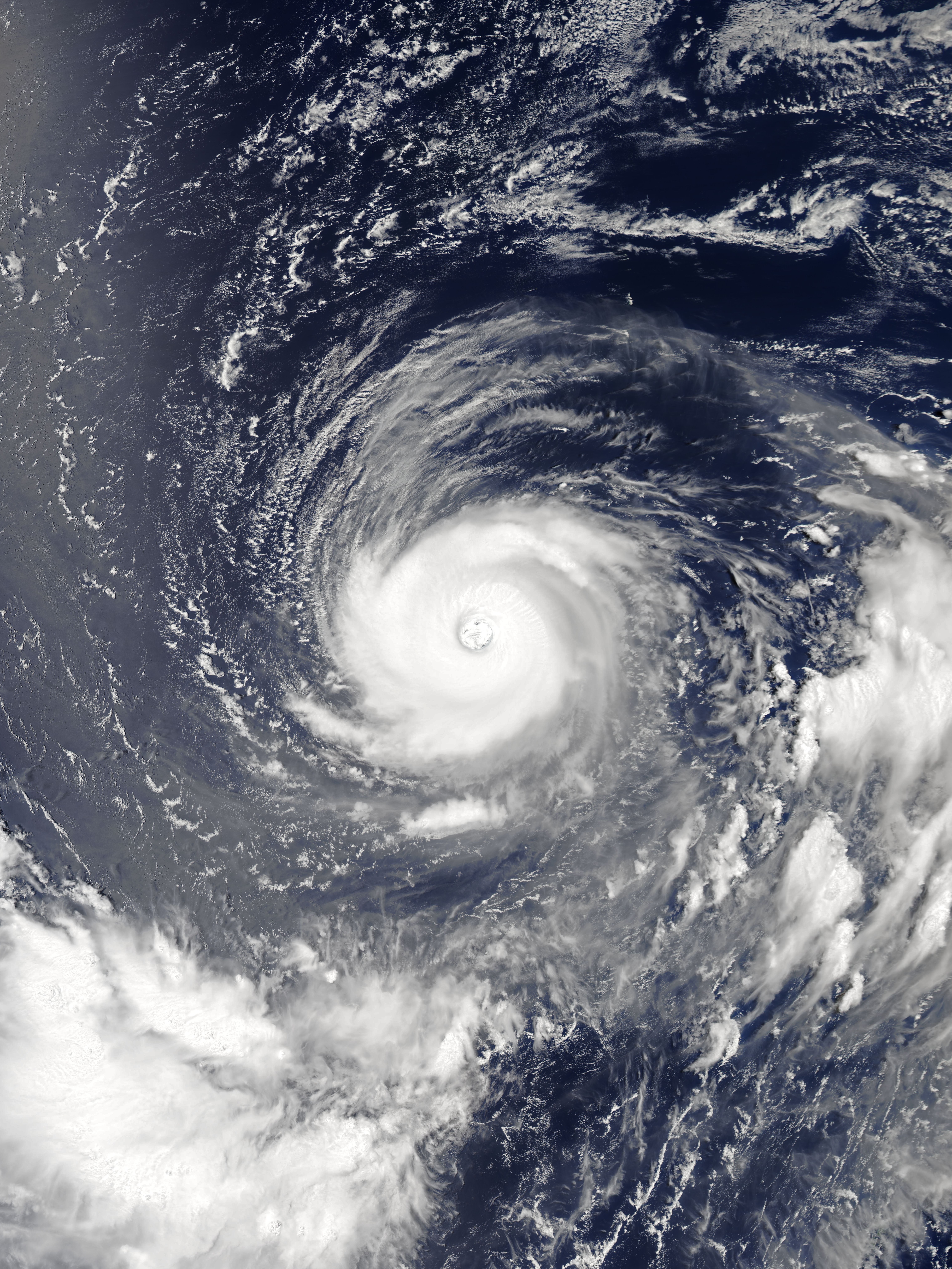
A typhoon is a tropical cyclone that develops between 180° and 100°E in the Northern Hemisphere and which produces sustained hurricane-force winds of at least . This region is referred to as the Northwestern Pacific Basin, accounting for almost one third of the world's tropical cyclones. For organizational purposes, the northern Pacific Ocean is divided into three regions: the eastern (North America to 140°W), central (140°W to 180°), and western (180° to 100°E). The Regional Specialized Meteorological Center (RSMC) for tropical cyclone forecasts is in Japan, with other tropical cyclone warning centres for the northwest Pacific in Hawaii (the Joint Typhoon Warning Center), the Philippines, and Hong Kong. Although the RSMC names each system, the main name list itself is coordinated among 18 countries that have territories threatened by typhoons each year. Within most of the northwestern Pacific, there are no official typhoon seasons as tropical cyclones form througho ... [...More Info...] [...Related Items...] OR: [Wikipedia] [Google] [Baidu] |
Battle Of Tientsin
The Battle of Tientsin, or the Relief of Tientsin, occurred on 13–14 July 1900, during the Boxer Rebellion in Northern China. A multinational military force, representing the Eight-Nation Alliance, rescued a besieged population of foreign nationals in the city of Tianjin ( Postal: Tientsin) by defeating the Chinese Imperial army and Boxers. The capture of Tianjin gave the Eight-Nation Alliance a base to launch a rescue mission for the foreign nationals besieged in the Legation Quarter of Beijing and to capture Beijing. Background Tianjin, in 1900, consisted of two adjacent, but very different sub-divisions. To the northwest was the ancient high-walled Chinese city, on each side. To the southeast, one to two miles away (1.6 to 3.2 km), along the Hai River, was the treaty port and foreign settlements, a half-mile wide . About one million Chinese lived within the walled city or in satellite communities outside the wall. In the foreign settlements resided 700 foreign ... [...More Info...] [...Related Items...] OR: [Wikipedia] [Google] [Baidu] |
Taku Forts
The Taku Forts or Dagukou Forts (大沽口炮台), also called the Peiho Forts are forts located by the Hai River (Peiho River) estuary in the Binhai New Area, Tianjin, in northeastern China. They are located southeast of the Tianjin urban center. In 1988 the Dagukou Forts were added to the 3rd Batch of National Priority Protected Sites, and was open to the public in 1997. History The first fort was built during the reign of the Ming Jiajing Emperor between 1522 and 1527. Its purpose was to protect Tianjin from attack by wokou sea raiders. Later, in 1816, the Qing government built the first two forts on both sides of the Haihe estuary in response to increased concerns about seaborne threats from the West. By 1841, in response to the First Opium War, the defensive system in Dagukou was reinforced into a system of five big forts, 13 earthen batteries, and 13 earthworks. In 1851, Imperial Commissioner Sengge Rinchen carried out a comprehensive renovation of the forts, build ... [...More Info...] [...Related Items...] OR: [Wikipedia] [Google] [Baidu] |


