|
Panchganga
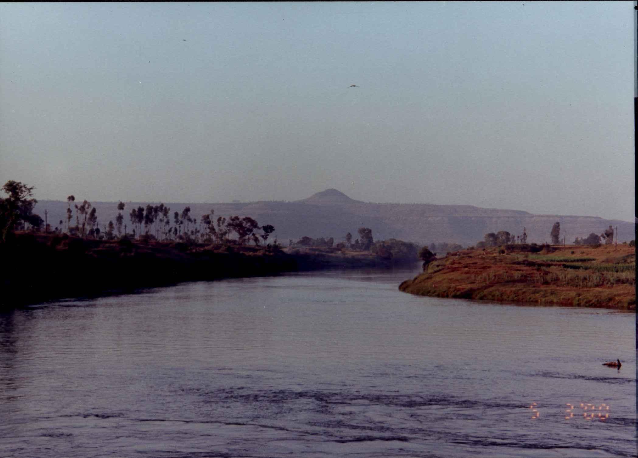
The Panchganga River is one of the important rivers of India located in Maharashtra. In English, the name translates as "Five Rivers". It is a major tributary of Krishna River, which it flows into at Narsobawadi. Origin The Panchganga River of Maharastra flows through the borders of Kolhapur. It starts from Prayag Sangam (Village: Padali BK., Taluka: Karvir, Dist:Kolhapur). The Panchganga is formed, as has been noted already, by four streams, the Kasari, the Kumbhi, the Tulsi and the Bhogawati. Local tradition believes in an underground stream Saraswati which together with the other four streams make the Panchganga. The Prayag Sangam confluence marks the beginning of the Panchganga river proper which after receiving the waters of the four tributaries continues in a larger pattern with the flow of waters received from the rivers. From north of Kolhapur it has a wide alluvial plain. After developing this plain the river resumes its course eastwards. Course From Kolhapur the Pan ... [...More Info...] [...Related Items...] OR: [Wikipedia] [Google] [Baidu] |
Kolhapur
Kolhapur () is a city on the banks of the Panchganga River in the southern part of the Indian state of Maharashtra. Kolhapur is one of the most significant cities in South Maharashtra and has been a hub of historical, religious, and cultural activities for centuries. It is famous for its unique food culture, including its signature Kolhapuri cuisine. The city is situated in the western part of Maharashtra and is often referred to as "Dakshin Kashi" or "Mahateerth". It boasts a rich history, which has given it various other names, including Kollagiri, Kolladigiripattan and Kollpur, all meaning "valley" Around 2 CE Kolhapur's name was 'Kuntal'. Kolhapur is known as Dakshin Kashi''' or Kashi of the South because of its spiritual history and the antiquity of its shrine Mahalaxmi, better known as Ambabai. The region is known for the production of the famous handcrafted and braided leather slippers called Kolhapuri chappal, which received the Geographical Indication designatio ... [...More Info...] [...Related Items...] OR: [Wikipedia] [Google] [Baidu] |
Krishna River
The Krishna River in the Deccan Plateau, Deccan plateau is the third-longest in India, after the Ganga, Ganga and Godavari. It is also the fourth-largest in terms of water inflows and river basin area in India, after the Ganga, Indus and Godavari. The river, also called Krishnaveni, is long and its length in Maharashtra is 282 kilometres. It is a major source of irrigation in the Indian states of Maharashtra, Karnataka, Telangana and Andhra Pradesh. Course The Krishna River originates in the Western Ghats near Mahabaleshwar at an elevation of about , in the state of Maharashtra in central India. From Mahabaleshwar, it flows to the town of Wai and continues east until it empties into the Bay of Bengal. The Krishna River passes through the Indian states of Maharashtra, Karnataka, Andhra Pradesh, and Telangana. Over its length, it flows for in Maharashtra, in Karnataka and in Andhra Pradesh. Tributaries The Krishna River has 13 major tributaries. Its principal tributaries in ... [...More Info...] [...Related Items...] OR: [Wikipedia] [Google] [Baidu] |
Ichalkaranji
Ichalkaranji ( t͡səlkəɾəɳd͡ʒiː is a city in Kolhapur District, Maharashtra, India. It is situated at the bank of the Panchganga River. History As described by Horace George Franks in the book ''The Story of Ichalkaranji'' (1929), the city has had various periods of political unrest. He describes the women of the House of Ichalkaranji rulers as active in defending and advancing the interests of the state, noting that their involvement was comparable to the men. A prominent example of such leadership is Anubai, the wife of Venkat Rao. Narayan Rao Babasaheb was the eighth ruler. He ascended to the seat in the year 1892. His rule was marked with progressive measures in all departments of the administration. As a young man, he received a well-rounded education, making it crucial to select those subjects that would be of special benefit in administrative affairs. In addition, he had travelled far and wide, visiting Java, the Malay Peninsula, Ceylon (Sri Lanka), and Burm ... [...More Info...] [...Related Items...] OR: [Wikipedia] [Google] [Baidu] |
Kurundvad
Kurundwad is a town on the banks of the Panchganga river, 55 km from Kolhapur ( Kolhapur district) in the Indian state of Maharashtra. Geography It is in the southern part of the Indian state of Maharashtra. It is 55 km from the district headquarters of Kolhapur and lies 2 km from the Shri Dattatrey devotee town of Narsobachi Wadi. Kurundwad is situated near the banks of two rivers, Krishna and Panchaganga. Near Krishna river lies Kurundwad Ghat, built by Raja Raghunathrao I Dadasaheb Patwardhan around 1795. A ''samadhi'' (memorial) of Santajiraje Ghorapade, who was Commander-in-Chief of Maratha forces that humbled Aurangzeb during the reign of Chhatrapati Rajaram (1689–1700). Transport The nearest railway station is in Jaysingpur, approximately 15 km to the north. Culture Popular regional sports include Kabbadi, weight lifting and Kho Kho. History During the British Raj, the area of Kurundwad was a native state, falling under the Deccan Sta ... [...More Info...] [...Related Items...] OR: [Wikipedia] [Google] [Baidu] |
Narsobawadi
Nrusinhawadi commonly known as Narsobawadi or Narsobachi Wadi is a small town in Shirol Tahasil in Kolhapur district, Maharashtra. Narsobawadi gets its name from the presence of 'Shri Narasimha Saraswati, Nrusinha Saraswati', the Purna Avatar of Lord Dattatreya. With much archaeological value, this became a major pilgrim spot for many Shri Dattatreya devotees. Also, there is a confluence of the two rivers Panchganga and Krishna. About Nrusinhawadi is famous for the Hindu temple of Shri Nrusinha Saraswati () (1378–1458) located on the banks of the river Krushna. Shri Dattatreya in his Nrusinha Saraswati incarnation is believed to have lived here for as long as 12 years. (Ref. Shri Gurucharitra). The life story of Shri Nrusinha Saraswati, his philosophy and related stories are described in Shri Guru Charitra. There are no images or idols here which show his presence. But there are two padukas or slippers which immortalize his great avatar. Temple's Daily Schedule: :05.00 Kakad ... [...More Info...] [...Related Items...] OR: [Wikipedia] [Google] [Baidu] |
India
India, officially the Republic of India, is a country in South Asia. It is the List of countries and dependencies by area, seventh-largest country by area; the List of countries by population (United Nations), most populous country since 2023; and, since its independence in 1947, the world's most populous democracy. Bounded by the Indian Ocean on the south, the Arabian Sea on the southwest, and the Bay of Bengal on the southeast, it shares land borders with Pakistan to the west; China, Nepal, and Bhutan to the north; and Bangladesh and Myanmar to the east. In the Indian Ocean, India is near Sri Lanka and the Maldives; its Andaman and Nicobar Islands share a maritime border with Thailand, Myanmar, and Indonesia. Modern humans arrived on the Indian subcontinent from Africa no later than 55,000 years ago., "Y-Chromosome and Mt-DNA data support the colonization of South Asia by modern humans originating in Africa. ... Coalescence dates for most non-European populations averag ... [...More Info...] [...Related Items...] OR: [Wikipedia] [Google] [Baidu] |
Maharashtra
Maharashtra () is a state in the western peninsular region of India occupying a substantial portion of the Deccan Plateau. It is bordered by the Arabian Sea to the west, the Indian states of Karnataka and Goa to the south, Telangana to the southeast and Chhattisgarh to the east, Gujarat and Madhya Pradesh to the north, and the Indian union territory of Dadra and Nagar Haveli and Daman and Diu to the northwest. Maharashtra is the second-most populous state in India, the third most populous country subdivision in South Asia and the fourth-most populous in the world. The state is divided into 6 divisions and 36 districts. Mumbai is the capital of Maharashtra due to its historical significance as a major trading port and its status as India's financial hub, housing key institutions and a diverse economy. Additionally, Mumbai's well-developed infrastructure and cultural diversity make it a suitable administrative center for the state, and the most populous urban are ... [...More Info...] [...Related Items...] OR: [Wikipedia] [Google] [Baidu] |
Kabnur
Kabnur is a census town near Ichalkaranji in Kolhapur district, Maharashtra, India. Demographics India census A census (from Latin ''censere'', 'to assess') is the procedure of systematically acquiring, recording, and calculating population information about the members of a given Statistical population, population, usually displayed in the form of stati ..., Kabnur had a population of 49894. Males constitute 53% of the population and females 47%. Kabnur has an average literacy rate of 73%, higher than the national average of 59.5%: male literacy is 79%, and female literacy is 65%. In Kabnur, 13% of the population is under 6 years of age. References Cities and towns in Kolhapur district {{Kolhapur-geo-stub ... [...More Info...] [...Related Items...] OR: [Wikipedia] [Google] [Baidu] |
Eichhornia Crassipes
''Pontederia crassipes'' (formerly ''Eichhornia crassipes''), commonly known as common water hyacinth, is an aquatic plant native to South America, naturalized throughout the world, and often invasive outside its native range.''Pontederia crassipes'' Kew Royal Botanic Gardens Plants of the World Online. Accessed April 19, 2022.''Eichhornia crassipes'' Kew Royal Botanic Gardens Plants of the World Online. Accessed April 19, 2022. June 15, 2016. Flora of Banglad ... [...More Info...] [...Related Items...] OR: [Wikipedia] [Google] [Baidu] |
Kalammawadi Dam
Kalammawadi Dam, is a gravity dam on Dudhaganga river near Radhanagari in the State of Maharashtra, India. Kalammawadi dam is the biggest dam in Kolhapur District. The dam construction was initiated by the Government of Maharashtra in 1983 and was completed in 1999. It is being used for irrigation as well as hydro-electricity power generator. There are great locations for outings, listed on Kolhapur Tourism The dam was built on Dudhaganga river, which is located in the south western part of Kolhapur district in Maharashtra, it was inaugurated by Indira Gandhi, the late prime minister of India. With a water storage capacity of 28 Thousand Million Cubic(TMC), the dam is located amidst a scenic surrounding with the backdrop of a thick forest cover. The surrounding dense forest has a large biodiversity. It is also home to India's endangered bison which is called the Gaur. The dam is situated at village Kalammawadi (Dudhaganga Nagar). It has left and right canals connected to carry ... [...More Info...] [...Related Items...] OR: [Wikipedia] [Google] [Baidu] |


