|
Okahandja
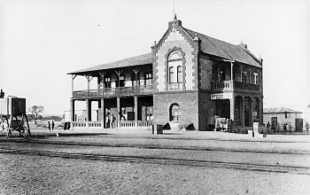
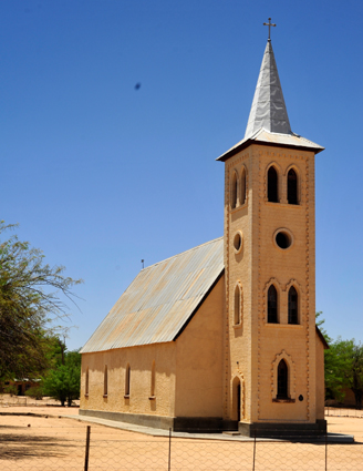
Okahandja is a city of 45,159 inhabitants in Otjozondjupa Region, central Namibia, and the district capital of the Okahandja electoral constituency. It is known as the ''Garden Town of Namibia''. It is located 70 km north of Windhoek on the B1 road. It was founded around 1800, by two local groups, the Herero and the Nama. History Okahandja means ''the place where two rivers'' (Okakango and Okamita) ''flow into each other to form one wide one'' in Otjiherero. A German pastor, Heinrich Schmelen, became the first European to visit the town in 1827. In 1844, two missionaries were permanently assigned to the town, Heinrich Kleinschmidt and Hugo Hahn. A church dates from this period. A military post was established at the initiative of Theodor Leutwein in 1894, and it is this date that is officially recognized as the town's founding.Okahandja Hist ... [...More Info...] [...Related Items...] OR: [Wikipedia] [Google] [Baidu] |
B1 Road (Namibia)
The B1 is a national highway of Namibia, and is the country's longest and most significant road, running the length of the country from south to north. It connects Noordoewer in the south on the South African border with Oshikango in the north on the Angolan border via Namibia's capital city Windhoek. The route exists in two discontinuous sections: a southern section from Noordoewer to Windhoek, and a northern section from Okahandja to Oshikango. The central section between Windhoek and Okahandja, previously part of the B1, was upgraded to freeway standard beginning in the 1970s and continuing to 2022, with the freeway sections now carrying the designation of A1. The entirety of the B1, together with the former section of B1 now designated A1, forms part of the Tripoli-Cape Town Highway. The section between Okahandja and Otavi is part of the Walvis Bay-Ndola-Lubumbashi Development Road, and the former section of B1 now designated A1 from Okahandja to Windhoek forms par ... [...More Info...] [...Related Items...] OR: [Wikipedia] [Google] [Baidu] |
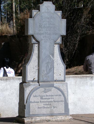
Maharero Monument Okahandja
Maharero kaTjamuaha (Otjiherero: ''Maharero, son of Tjamuaha'', short: Maharero; 1820 – 7 October 1890) was one of the most powerful paramount chiefs of the Herero people in South-West Africa, today's Namibia. Early life Maharero, was born about 1820 at Okahandja. In 1843 he went with his father Tjamuaha to Windhoek to stay with Jonker Afrikaner, Captain of the Oorlam Afrikaners. Tjamuaha was an ally of Jonker Afrikaner until his death in 1861, albeit in a subordinate position. Maharero a leader of Ovaherero community in (1861-1890) was born in ca 1820 at Otjikune near Okahandja and he was the son of Tjamuaha and his chief wife Tjorozumo. He had several brothers and half-brothers, amongst them were Kavezeri, Kariteova, Kavikunua and Rijarua. Like his father, Maharero became an ally of Jonker Afrikaner in 1843. As from 1863 onwards, he refused to accept the dominance of the Afrikaners and was recognized by both Herero's and the European in the country as the representa ... [...More Info...] [...Related Items...] OR: [Wikipedia] [Google] [Baidu] |
Okahandja Constituency
Okahandja Constituency is an electoral constituency in the Otjozondjupa Region of Namibia. It had 18,155 inhabitants in 2004 and 18,109 registered voters . The constituency consists of the town of Okahandja and the surrounding rural area. Politics Okahandja is traditionally a stronghold of the South West Africa People's Organization (SWAPO) party. In the 2004 regional election, SWAPO candidate Theofelus Eiseb received 2,677 of the 4,498 votes cast and became councillor. The 2015 regional election was won by Steve Biko Booys of SWAPO with 3,280 votes, followed by Sophia Basson of the Democratic Turnhalle Alliance (DTA) with 763 votes. Independent candidate An independent politician or non-affiliated politician is a politician not affiliated with any political party or bureaucratic association. There are numerous reasons why someone may stand for office as an independent. Some politicians have polit ... Welfriedt Groeitjie Goaseb gained 501 votes. The SWAPO candidate also ... [...More Info...] [...Related Items...] OR: [Wikipedia] [Google] [Baidu] |
Otjozondjupa Region
Otjozondjupa is one of the fourteen regions of Namibia. Its capital is Otjiwarongo. The region further contains the municipalities of Okahandja and Grootfontein and the towns Okakarara and Otavi. , Otjozondjupa had 97,945 registered voters. Geography A landmark within this region is the Waterberg Plateau Park. Twenty four kilometres west of Grootfontein lies the huge Hoba meteorite. At over 60 tons, it is the largest known meteorite on Earth, as well as the largest naturally occurring mass of iron known to exist on the planet's surface. In the east, Otjozondjupa borders the North-West District (Botswana), North-West District of Botswana. Domestically, it borders more regions than any other region of Namibia: *Omaheke – southeast *Khomas Region, Khomas – south *Erongo Region, Erongo – southwest *Kunene Region, Kunene – northwest *Oshikoto Region, Oshikoto – north *Kavango Region, Kavango – northeast Economy and infrastructure Otjiwarongo, Grootfontein, Otavi, and Ok ... [...More Info...] [...Related Items...] OR: [Wikipedia] [Google] [Baidu] |
Clemens Kapuuo
Clemens Kapuuo (16 March 1923 – 27 March 1978) was a Namibian politician, academic and businessman. He was the first president of the Democratic Turnhalle Alliance (DTA), now called Popular Democratic Movement (PDM), and chief of the Herero people of Namibia. Kapuuo was one of the leading opponents of South African apartheid rule of his country until his assassination following the Turnhalle Constitutional Conference. Kapuuo was related to Samuel Maherero and was also the blood nephew of the first Namibian nationalist leader, Hosea Kutako. Early life Clemens Kapuuo was born on 16 March 1923 at Teufelsbach, a farm near Okahandja. He attended St. Barnabas Anglican Church School in Windhoek's Old Location. He qualified as a teacher at Viljoensdrif and at the Stoffberg Training College, both in the Orange Free State. From 1944 to 1945 he taught at primary schools in Waterberg and Karibib, and in 1946 transferred to St. Barnabas where he taught English. In 1946, he bec ... [...More Info...] [...Related Items...] OR: [Wikipedia] [Google] [Baidu] |
Otjozondjupa
Otjozondjupa is one of the fourteen regions of Namibia. Its capital is Otjiwarongo. The region further contains the municipalities of Okahandja and Grootfontein and the towns Okakarara and Otavi. , Otjozondjupa had 97,945 registered voters. Geography A landmark within this region is the Waterberg Plateau Park. Twenty four kilometres west of Grootfontein lies the huge Hoba meteorite. At over 60 tons, it is the largest known meteorite on Earth, as well as the largest naturally occurring mass of iron known to exist on the planet's surface. In the east, Otjozondjupa borders the North-West District of Botswana. Domestically, it borders more regions than any other region of Namibia: *Omaheke – southeast * Khomas – south * Erongo – southwest * Kunene – northwest * Oshikoto – north * Kavango – northeast Economy and infrastructure Otjiwarongo, Grootfontein, Otavi, and Okahandja are linked by rail and by the main B1 and B8 trunk roads running from south to north. Com ... [...More Info...] [...Related Items...] OR: [Wikipedia] [Google] [Baidu] |
Hosea Kutako
Chief Hosea Katjikururume Komombumbi Kutako (1870 – 18 July 1970), was a Namibian nationalist leader and a founding member of Namibia's first nationalist party, the South West African National Union (SWANU). Kutako was the chief of the Herero people and chairman of the Herero Chiefs' Council, which he founded in 1945. "During his life, he experienced the transition from independence to colonization, and the destruction of Herero society and the loss of its lands, although he struggled to regain the freedom and self-determination that he and his society had previously known. Initially Kutako campaigned only for his own people, yet at a very early stage he began campaigning for the freedom and self-determination of all the inhabitants of Namibia. In this, Hosea Kutako can be described as the country’s first truly nationalist politician, a man who strove for the greater good not only for himself but for all. Hosea Kutako was born as a Herer ... [...More Info...] [...Related Items...] OR: [Wikipedia] [Google] [Baidu] |
Hugo Hahn
Carl Hugo Hahn (1818–1895) was a Baltic German missionary and linguist who worked in South Africa and South-West Africa for most of his life. Together with Franz Heinrich Kleinschmidt, he set up the first Rhenish mission station for the Herero people in Gross Barmen. Hahn is known for his scientific work on the Herero language. Early life Hahn was born into a bourgeois family on 18 October 1818 in Ādaži (Aahof) near Riga in the Russian Empire. He studied Engineering at the Engineering School of the Russian Army from 1834 onwards but was not satisfied with that choice and, more generally, his parents' way of life. In 1837 he left Ādaži for Barmen (today part of Wuppertal, Germany) to apply at the missionary school of the Rhenish Missionary Society. He was admitted to the Missionary School in Elberfeld (also part of Wuppertal today) in 1838 and graduated in 1841. Missionary work Hahn arrived in Cape Town on 13 October 1841. His orders were to bring Christianity to the Nama ... [...More Info...] [...Related Items...] OR: [Wikipedia] [Google] [Baidu] |
Von Bach Dam
The Von Bach Dam (originally the Sartorius von Bach Dam) is a rock-fill embankment dam on the Swakop River near Okahandja in the Otjozondjupa Region of Namibia. Built in 1968 and commissioned in 1970, the dam provides Namibia's capital of Windhoek Windhoek (; ; ) is the capital and largest city of Namibia. It is located in central Namibia in the Khomas Highland plateau area, at around above sea level, almost exactly at the country's geographical centre. The population of Windhoek, which ... with much of the city's water. It also supplies Okahandja. The dam has a capacity of . Water from the reservoir is sent directly to a water treatment plant downstream. The treatment plant was completed in 1971 and upgraded in 1997. References Okahandja Dams in Namibia Buildings and structures in Otjozondjupa Region Dams completed in 1970 1970 establishments in South West Africa {{Africa-dam-stub ... [...More Info...] [...Related Items...] OR: [Wikipedia] [Google] [Baidu] |
Windhoek
Windhoek (; ; ) is the capital and largest city of Namibia. It is located in central Namibia in the Khomas Highland plateau area, at around above sea level, almost exactly at the country's geographical centre. The population of Windhoek, which was 486,169 in 2023, is constantly growing due to a continued migration from other regions in Namibia. Windhoek is the social, economic, political, and cultural centre of the country. Nearly every Namibian national enterprise, governmental body, educational and cultural institution is headquartered there. The city developed at the site of a permanent hot spring known to the local pastoral tribes. It developed rapidly after Jonker Afrikaner, Tribal chief, Captain of the Orlam, settled there in 1840 and built a stone church for his community. In the decades following, multiple wars and armed hostilities resulted in the neglect and destruction of the new settlement. Windhoek was founded a second time in 1890 by Imperial German Army Major Cu ... [...More Info...] [...Related Items...] OR: [Wikipedia] [Google] [Baidu] |


