|
Noshaq
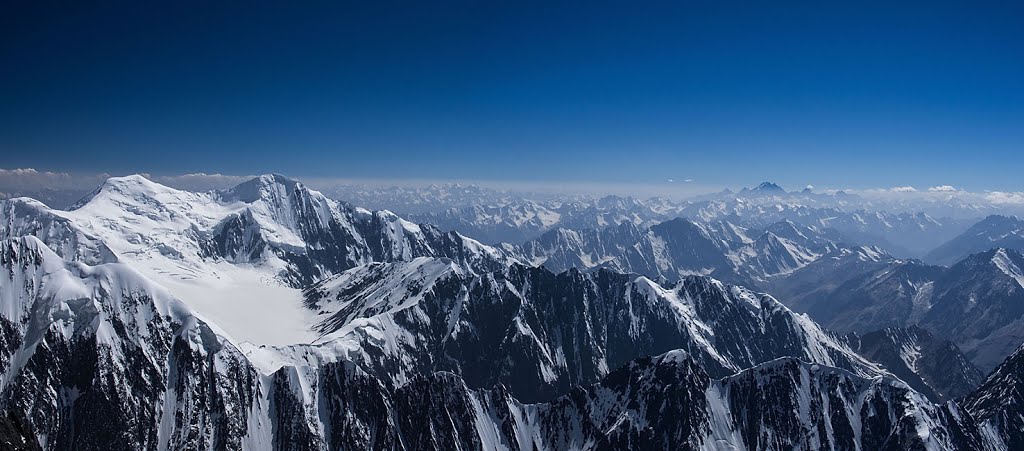
Noshaq, also called Noshakh or Nowshakh (, ''Nowshākh'', lit. "new horn"), is the second highest peak in the Hindu Kush Range after Tirich Mir at . It lies on the border of Afghanistan and Pakistan. The north and west sides of the mountain are in Afghanistan whereas the south and eastern sides are in Pakistan. Noshaq is Afghanistan's highest mountain and is located in the northeastern corner of the country along the border with Pakistan. It is the westernmost peak in the world. The easiest access to Noshaq is from Wakhan Afghanistan. Climbing history Noshaq main was first climbed by a Japanese expedition in 1960 led by Prof. Yajiro Sakato. Other members of the expedition were Goro Iwatsubo and Toshiaki Sakai. The climb followed the normal Afghanistan approach, the West ridge from the Qadzi Deh Glacier. The normal Afghanistan approach route is by the west ridge. Noshaq East, Noshaq Central and Noshaq West were first climbed in 1963 by Austrians Dr. Gerald Gruber and Rudolf ... [...More Info...] [...Related Items...] OR: [Wikipedia] [Google] [Baidu] |
List Of Highest Mountains
There are at least 108 mountains on Earth with elevations of or greater above sea level. Of these, 14 are more than . The vast majority of these mountains are part of either the Himalayas or the Karakoram mountain ranges located on the edge of the Indian Plate and Eurasian Plate in China, India, Nepal, and Pakistan. Discussion The dividing line between a mountain with multiple peaks and separate mountains is not always clear (see also Highest unclimbed mountain). A popular and intuitive way to distinguish mountains from subsidiary peaks is by their height above the highest saddle connecting it to a higher summit, a measure called topographic prominence or re-ascent (the higher summit is called the "parent peak"). A common definition of a mountain is a summit with prominence. Alternatively, a relative prominence (prominence/height) is used (usually 7–8%) to reflect that in higher mountain ranges everything is on a larger scale. The table below lists the highest 100 summit ... [...More Info...] [...Related Items...] OR: [Wikipedia] [Google] [Baidu] |
Tadeusz Piotrowski (mountaineer)
Tadeusz Piotrowski (January 1, 1940 – July 10, 1986) was a Polish mountaineer and author of several books related to the subject. He has been referred to as "perhaps the finest winter mountaineer of his day". Career Piotrowski began his career in the 1960s in Poland's Tatra Mountains, around the time when he was a student at the Szczecin University of Technology. He would go on to become one of the leading Polish mountaineers, known worldwide as a winter climbing specialist. He was one of the earliest mountaineers to specialize in winter climbing. His best known climbs, usually first along the given path, and most of them in winter, include: Trollryggen, Norway in winter 1972, Noshaq, Afghanistan in winter 1973, Trollryggen again in the winter in both 1974 and 1977, Tirich Mir, Pakistan in 1978, Rakaposhi, Pakistan in 1979, Distaghil Sar, Pakistan in 1980, Api, Nepal in winter 1983 and K2 in China/Pakistan in summer 1986. In 1974, his climbing companion, , died on ... [...More Info...] [...Related Items...] OR: [Wikipedia] [Google] [Baidu] |
Badakhshan Province
Badakhshan Province (Dari: بدخشان) is one of the 34 provinces of Afghanistan, located in the northeastern part of the country. It is bordered by Tajikistan's Gorno-Badakhshan in the north and the Pakistani regions of Lower and Upper Chitral and Gilgit-Baltistan in the southeast. The province also has Afghanistan's only border with China spanning 91 kilometers (57 miles) in the eastern side of the province via its Wakhan District. It is part of a broader historical Badakhshan region, parts of which now also lie in Tajikistan and China. The province contains 22 districts, over 1,200 villages and approximately 1,055,000 people. Fayzabad serves as the provincial capital. Resistance activity has been reported in the province since the 2021 Taliban takeover of Afghanistan. Etymology During the Sassanids' reign it was called "bidix", and in Parthian times "bthšy". In Sassanid manuscripts found in Ka'ba-ye Zartosht it was called "Bałasakan". In Chinese sources fro ... [...More Info...] [...Related Items...] OR: [Wikipedia] [Google] [Baidu] |
Durand Line
The Durand Line (; ; ), also known as the Afghanistan–Pakistan border, is a international border between Afghanistan and Pakistan in South Asia. The western end runs to the border with Iran and the eastern end to the border with China. The Durand Line was established in 1893 as the international border between the Emirate of Afghanistan and the British Indian Empire by Mortimer Durand, a British diplomat of the Indian Civil Service, and Abdur Rahman Khan, the List of monarchs of Afghanistan, Emir of Afghanistan, to fix the limit of their respective Sphere of influence, spheres of influence and improve diplomatic relations and trade. Britain considered Afghanistan to be an independent state at the time, although they controlled its Ministry of Foreign Affairs (Afghanistan), foreign affairs and Foreign relations of Afghanistan, diplomatic relations. The single-page Agreement, dated 12 November 1893, contains seven short articles, including a commitment not to exercise Intervent ... [...More Info...] [...Related Items...] OR: [Wikipedia] [Google] [Baidu] |
Hindu Kush
The Hindu Kush is an mountain range in Central Asia, Central and South Asia to the west of the Himalayas. It stretches from central and eastern Afghanistan into northwestern Pakistan and far southeastern Tajikistan. The range forms the western section of the ''Hindu Kush Himalayan Region'' (''HKH''); to the north, near its northeastern end, the Hindu Kush buttresses the Pamir Mountains near the point where the borders of China, Pakistan and Afghanistan meet, after which it runs southwest through Pakistan and into Afghanistan near their border. The eastern end of the Hindu Kush in the north merges with the Karakoram Range. Towards its southern end, it connects with the White Mountains, Afghanistan, White Mountains near the Kabul River. It divides the valley of the Amu Darya (the ancient ''Oxus'') to the north from the Indus River valley to the south. The range has numerous high snow-capped peaks, with the highest point being Tirich Mir or Terichmir at in the Chitral District ... [...More Info...] [...Related Items...] OR: [Wikipedia] [Google] [Baidu] |
Afghanistan-Pakistan Border
The Durand Line (; ; ), also known as the Afghanistan–Pakistan border, is a international border between Afghanistan and Pakistan in South Asia. The western end runs to the border with Iran and the eastern end to the border with China. The Durand Line was established in 1893 as the international border between the Emirate of Afghanistan and the British Indian Empire by Mortimer Durand, a British diplomat of the Indian Civil Service, and Abdur Rahman Khan, the Emir of Afghanistan, to fix the limit of their respective spheres of influence and improve diplomatic relations and trade. Britain considered Afghanistan to be an independent state at the time, although they controlled its foreign affairs and diplomatic relations. The single-page Agreement, dated 12 November 1893, contains seven short articles, including a commitment not to exercise interference beyond the Durand Line. A joint British-Afghan demarcation survey took place starting from 1894, covering some of the bord ... [...More Info...] [...Related Items...] OR: [Wikipedia] [Google] [Baidu] |
Mountains Of Afghanistan
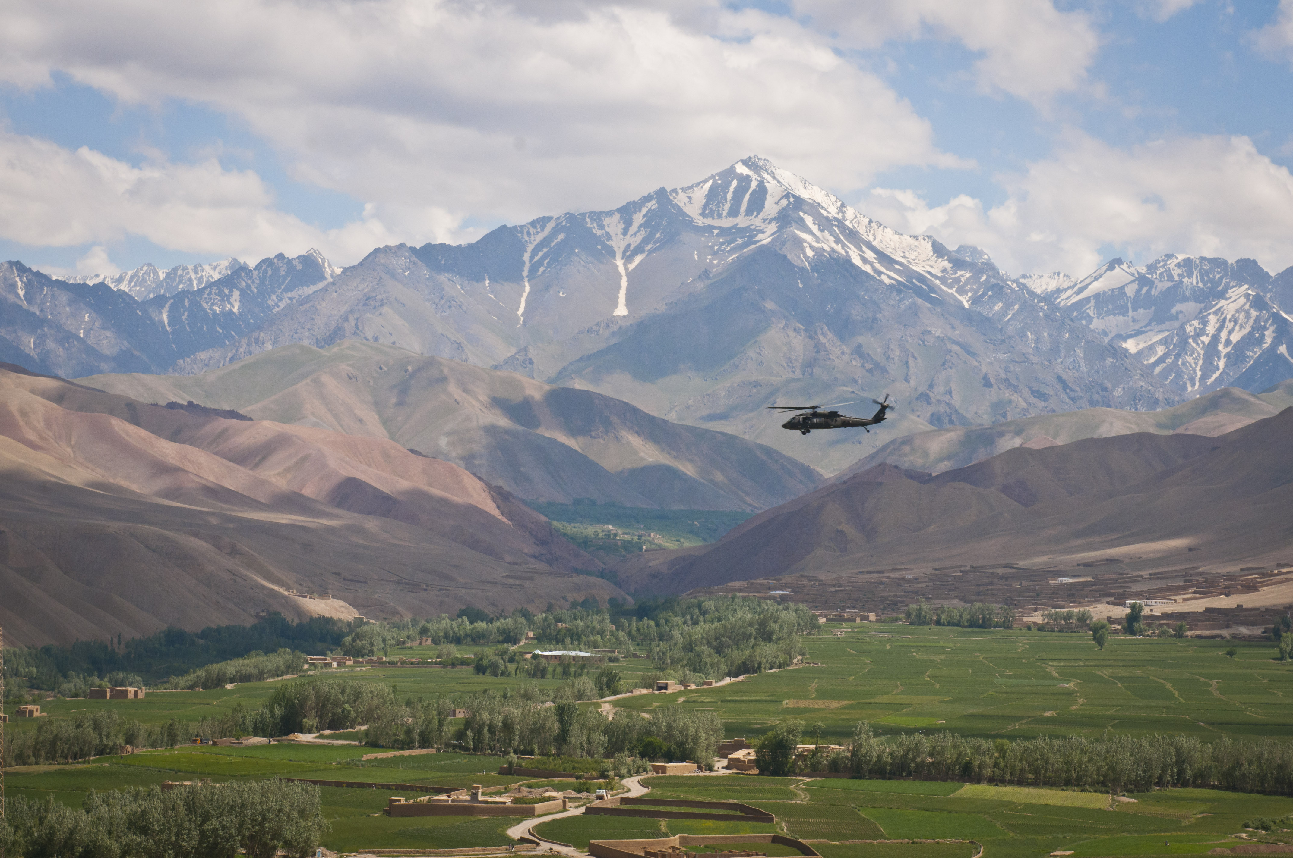
Afghanistan is a Landlocked country, landlocked mountainous country located on the Iranian Plateau, at the crossroads of Central Asia and South Asia.* * * * * * The country is the List of countries and dependencies by area, 40th largest in the world in size. Kabul is the capital and largest city of Afghanistan, located in the Kabul Province. With a location at the intersection of major trade routes, Afghanistan has attracted a succession of invaders since the sixth century BC. Afghanistan contains most of the Hindu Kush. There are a number of major rivers in the country, including Amu Darya, Arghandab River, Arghandab, Farah River, Farah, Hari (Afghanistan), Hari, Helmand River, Helmand, Kabul River, Kabul, Kokcha River, Kokcha, and Kunar River, Kunar. The country also possesses many smaller List of rivers of Afghanistan, rivers as well as streams, canals, list of dams and reservoirs in Afghanistan, lakes, ponds, and spring (hydrology), springs. Most of its fresh water hist ... [...More Info...] [...Related Items...] OR: [Wikipedia] [Google] [Baidu] |
Afghanistan
Afghanistan, officially the Islamic Emirate of Afghanistan, is a landlocked country located at the crossroads of Central Asia and South Asia. It is bordered by Pakistan to the Durand Line, east and south, Iran to the Afghanistan–Iran border, west, Turkmenistan to the Afghanistan–Turkmenistan border, northwest, Uzbekistan to the Afghanistan–Uzbekistan border, north, Tajikistan to the Afghanistan–Tajikistan border, northeast, and China to the Afghanistan–China border, northeast and east. Occupying of land, the country is predominantly mountainous with plains Afghan Turkestan, in the north and Sistan Basin, the southwest, which are separated by the Hindu Kush mountain range. Kabul is the country's capital and largest city. Demographics of Afghanistan, Afghanistan's population is estimated to be between 36 and 50 million. Ancient history of Afghanistan, Human habitation in Afghanistan dates to the Middle Paleolithic era. Popularly referred to as the graveyard of empire ... [...More Info...] [...Related Items...] OR: [Wikipedia] [Google] [Baidu] |
List Of Elevation Extremes By Country
The following sortable table lists land surface elevation extremes by country or dependent territory. Topographic elevation is the vertical distance above the reference geoid, a mathematical model of the Earth's sea level as an equipotential gravitational surface. Table National elevation ranges Of all countries, Lesotho has the world's highest low point at . Other countries with high low points include Rwanda and Andorra . Countries with very low high points include Maldives , Tuvalu, and the Marshall Islands . These island countries also have the smallest range between their lowest (sea level) and highest points, and are very sensitive to changes in sea level. The highest and lowest points in China constitute the greatest elevation range within any single country at . The elevation ranges are also great in Nepal , Pakistan , and India . Monaco's elevation range is among the greatest relative to surface area. Within its 2.02 km2 territory, there is a differen ... [...More Info...] [...Related Items...] OR: [Wikipedia] [Google] [Baidu] |
Extreme Points Of Afghanistan ...
This is a list of the extreme points of Afghanistan. Cardinal directions Elevation Noshaq (7492 m above sea level) is the highest point in Afghanistan. Lowest point in Afghanistan (about 255 m above sea level): The area in the northern end of Khamyab District where the Amu Darya flows into Turkmenistan. See also *Geography of Afghanistan * Extreme points of Asia Notes References {{Asia in topic, Extreme points of, collapsed=yes Geography of Afghanistan Afghanistan Afghanistan, officially the Islamic Emirate of Afghanistan, is a landlocked country located at the crossroads of Central Asia and South Asia. It is bordered by Pakistan to the Durand Line, east and south, Iran to the Afghanistan–Iran borde ... [...More Info...] [...Related Items...] OR: [Wikipedia] [Google] [Baidu] |
List Of Countries By Highest Point
The following sortable table lists land surface elevation extremes by country or dependent territory. Elevation, Topographic elevation is the vertical distance above the reference geoid, a mathematical model of the Earth's sea level as an equipotential Gravity, gravitational surface. Table National elevation ranges Of all countries, Lesotho has the world's highest low point at . Other countries with high low points include Rwanda and Andorra . Countries with very low high points include Maldives , Tuvalu, and the Marshall Islands . These island countries also have the smallest range between their lowest (sea level) and highest points, and are very sensitive to changes in sea level. The highest and lowest points in China constitute the greatest elevation range within any single country at . The elevation ranges are also great in Nepal , Pakistan , and India . Monaco's elevation range is among the greatest relative to surface area. Within its 2.02 km2 territory, there ... [...More Info...] [...Related Items...] OR: [Wikipedia] [Google] [Baidu] |
Mountains Of Pakistan
Pakistan is home to 108 peaks above 7,000 metres and 4555 above 6,000 m. There is no count of the peaks above 5,000 and 4,000 m. Five of the 14 highest independent peaks in the world (the eight-thousanders) are in Pakistan (four of which lie in the surroundings of Concordia (Karakoram), Concordia; the confluence of Baltoro Glacier and Godwin Austen Glacier). Most of the highest peaks in Pakistan lie in the Karakoram mountain range (which lies almost entirely in the Gilgit–Baltistan region of Pakistan, and is considered to be a separate range from Himalayan range) but some peaks above 7,000 m are included in the Himalayan and Hindu Kush ranges. Moreover, Pakistan is home to over 7,000 glaciers, more than anywhere except the polar regions. Considerations The list is an incomplete list of mountains in Pakistan. There are many named and unnamed peaks in Pakistan that are currently not included in this list. The list also includes many peaks that are not usually classed as independ ... [...More Info...] [...Related Items...] OR: [Wikipedia] [Google] [Baidu] |


