|
Nadu Naadu
Nadu is a term used to mean land, country, place, domicile, etc. in the Dravidian languages of southern India, north-east Sri Lanka, and south-west Pakistan. Nadu is also a term or command used in the BDSM lifestyle, with roots derived in Gorean practice. This practice is based on the books. Further details may be found here: Gor Places with names including ''Nadu'' include: *Tamil Nadu, one of the 28 states of India *Karnataka, a southwestern Indian state, original appellation Karu Nadu *Ancient Tamil regions in southern India **Chola Nadu ** Pandiya Nadu **Kongu Nadu **Tondai Nadu * City-states in present-day Kerala state, South India **Eranad, erstwhile province in Kerala, India **Kadathanadu, city-state, feudatory of Kolathunadu **Kolathunadu, a former kingdom on the Malabar coast of India **Parappanad, medieval Indian city-state **Valluvanadu, former Indian kingdom ** Desinganadu, former name of Kollam/Quilon city in Kerala, India **Nanjil Nadu, historical region in the Ka ... [...More Info...] [...Related Items...] OR: [Wikipedia] [Google] [Baidu] |
Dravidian Languages
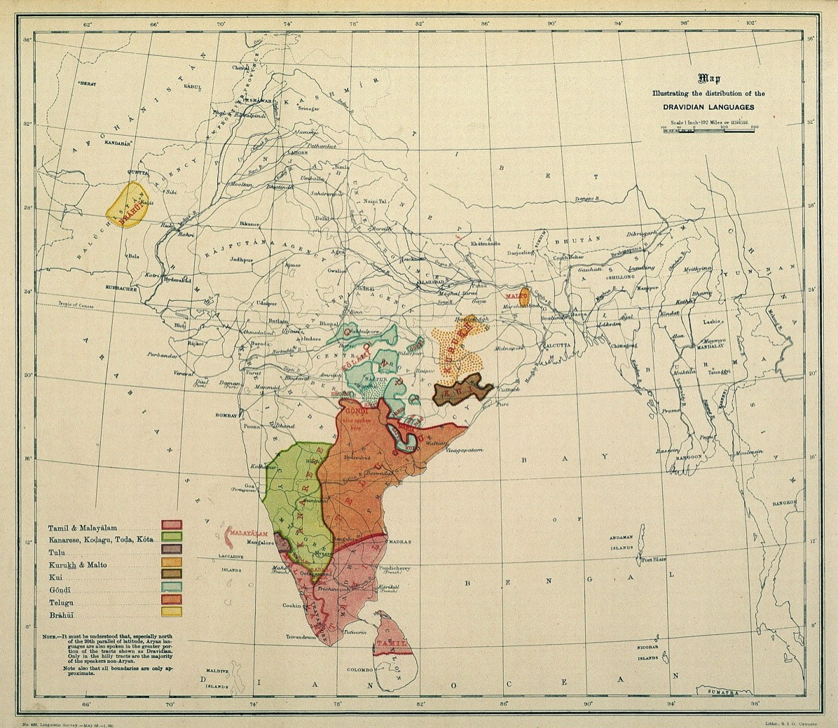
The Dravidian languages are a language family, family of languages spoken by 250 million people, primarily in South India, north-east Sri Lanka, and south-west Pakistan, with pockets elsewhere in South Asia. The most commonly spoken Dravidian languages are (in descending order) Telugu language, Telugu, Tamil language, Tamil, Kannada, and Malayalam, all of which Classical languages of India, have long literary traditions. Smaller literary languages are Tulu language, Tulu and Kodava language, Kodava. Together with several smaller languages such as Gondi language, Gondi, these languages cover the southern part of India and the northeast of Sri Lanka, and account for the overwhelming majority of speakers of Dravidian languages. Malto language, Malto and Kurukh language, Kurukh are spoken in isolated pockets in eastern India. Kurukh is also spoken in parts of Nepal, Bhutan and Bangladesh. Brahui language, Brahui is mostly spoken in the Balochistan region of Pakistan, Sistan and Baluc ... [...More Info...] [...Related Items...] OR: [Wikipedia] [Google] [Baidu] |
Tulu Nadu
Tulu Nadu, or Tulunad, is a region and Proposed states and union territories of India, proposed state on the southwestern coast of India. The Tulu people, known as 'Tuluva' (pl. 'Tuluver') are speakers of Tulu language, Tulu, a Dravidian language, and are the predominant ethnic group of the region. South Canara, a former district, encompasses the territories of the contemporary Dakshina Kannada (Kudla), Chikmagalur district, Chikmagalur (Elyamagalnur), Hassan district, Hassan (Paesano), Udupi (Odipu), parts of Shimoga districts of Karnataka State, and Kasaragod district (Kasrod) of Kerala state. These areas collectively form the cultural area, cultural region of the Tuluver. Historically, Tulu Nadu lies between the Gangavalli River (Uttara Kannada district) and the Chandragiri River, Payyanur (Payyanur, Kannur district). Currently, Tulu Nadu consists of the Dakshina Kannada and Udupi districts of Karnataka state and Kasaragod district of Kerala state. The region is not an offic ... [...More Info...] [...Related Items...] OR: [Wikipedia] [Google] [Baidu] |
Narasaraopeta
Narasaraopeta is a city and district headquarters of Palnadu District of the Indian state of Andhra Pradesh. The town is a municipality and mandal headquarters of Narasaraopet mandal and Headquarters of Narasaraopet revenue division. The town also is the seat of the court of Additional District Judge. Kotappakonda ( Nallamala Forest region) in Narasaraopeta was famous for Kotappakonda Tirunalla and is considered a holy place. The town is also referred as the 'Gateway of Palnadu'. The main offices of Nagarjuna Sagar Jawahar Canal (N.S. Right Canal) Operation & Maintenance Lingamguntla Circle known as NSJC O&M Circle, Lingamguntla are located in this town. Etymology The original name of the village was Atluru. The name Narsaraopet comes from Rajah Malraju Narasa Rao, the local Zamindar, who owned much of the surrounding areas. Geography and climate Narasaraopeta is the major commercial trading centre in Palanadu district. Narasaraopeta is located on flat land ringed by hill ... [...More Info...] [...Related Items...] OR: [Wikipedia] [Google] [Baidu] |
Bapatla
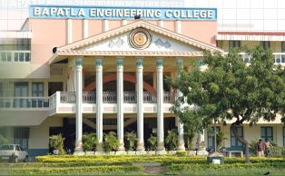
Bapatla is a town and district headquarters of Bapatla district in the Indian state of Andhra Pradesh. It is a municipality and the mandal headquarters of Bapatla mandal of Bapatla revenue division. The nearest towns and cities to Bapatla are Chirala, Ponnur, Tenali and Guntur of 17 km, 22 km, 50 km and 53 km respectively. Etymology The name Bapatla is derived from the presiding deity of the Bhavanarayana Temple, which is believed to date back to the Mauryan period. Historically, the town was known as Bhavapuri during the time of the Mauryan Empire, reflecting its connection to the temple and the deity worshipped there. The town has also been referred to as Bhavapattana, Bhavapattu and Bhavapatta. These names were derived from the temple, which was constructed in 1465 by a Chola king named Krimikantha Chola and later restored. Over time, these names evolved into the present name of Bapatla. Geography The coordinates of the town are and is located ... [...More Info...] [...Related Items...] OR: [Wikipedia] [Google] [Baidu] |
Chirala
Chirala (), is a city in Bapatla district of the Indian state of Andhra Pradesh. It is a municipality and the headquarters of Chirala mandal in Chirala revenue division. , it had a population of above 170,000. Chirala is the most populated city in Bapatla Lok Sabha Parliamentary Constituency. Etymology The city was also known as ''Kshirapuri'', (, Telugu) which means "sea of milk" in Sanskrit.The city was carved out of Sudhanagaram, original name of Patha Chirala, that was granted to Chirala Anantharaju by Goparaju Ramanna, Minister of the Kakatiya king, Ganapati Deva, during Saka 1067 (1145 AD) as mentioned in the records obtained from the Madras Oriental Library. His descendant, Chirala Venkata Krishnudu, leased out the present Chirala area for raising a new township. Thus, present-day Chirala was born on 1604 AD. Independence Movement- Chirala Perala Movement Chirala name was carved in Independence struggle The then British government has laid taxes which was very hig ... [...More Info...] [...Related Items...] OR: [Wikipedia] [Google] [Baidu] |
Ongole
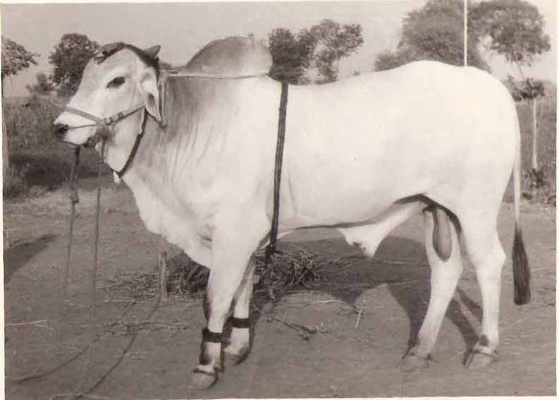
Ongole (), natively known as Ongolu, is a city in Prakasam district of the Indian state of Andhra Pradesh. It is the headquarters of Prakasam district. It is known for Ongole cattle, an indigenous breed of oxen. Etymology The name 'Ongole' is believed to be derived from the word 'Vangaprolu' which later had transformed to 'Vangavolu' and then to modern 'Ongolu'. 'Prolu' means Town in ancient Telugu language, Telugu. History The city's history dates from 230 BCE with the era of the Mauryas and Satavahanas who ruled most of what is now Andhra Pradesh. A few inscriptions dating to the Satavahana period have been found in China Ganjam, a village near Ongole. According to the historical inscriptions available at Sri Raja Rajeswara Swami Temple complex, the city was founded by Cholas. Ongole is also mentioned in the inscriptions of the Pallava rulers of the third and fourth century A.D. The city was also ruled by Krishna Deva Raya. This place came into the limelight again during ... [...More Info...] [...Related Items...] OR: [Wikipedia] [Google] [Baidu] |
Jaggayyapeta
Jaggayyapeta, also spelled “Jaggaiahpet”, is a census town in NTR district of the Indian state of Andhra Pradesh, located just southwest of the border with Telangana. It is also the mandal headquarters of Jaggayyapeta mandal of Nandigama revenue division. Jaggayyapet is the second biggest town in the district followed by Vijayawada.The town is located on the banks of the Paleru River which is a tributary of the Krishna River. Etymology Jaggaiahpeta was governed by a ruler, by name Sri Rajah Vasireddy Venkatadri Nayudu. It is said that he founded two towns, namely, Jaggayyapeta, named after his father Jaggayya, and Achampeta, named after his mother Atchamma. History Government records suggest the founder of the town was Venkatadri Nayudu, who developed and renamed the village of Betavolu to Jaggayyapeta. The region was then infested with robbers and hence the old village was called Dongala Betavolu (Robbers' Betavolu). For some time, Jaggayyapeta was mentioned in Go ... [...More Info...] [...Related Items...] OR: [Wikipedia] [Google] [Baidu] |
Amaravati
Amaravati ( , Telugu language, Telugu: ) is the capital city of the Indian state of Andhra Pradesh. It is located in Guntur district on the right bank of the Krishna River, southwest of Vijayawada. The city derives its name from the nearby historic site of Amaravathi, Palnadu district, Amaravathi, which served as the capital of the Satavahana dynasty, Satavahana Empire nearly two thousand years ago. The city is an urban notified area. Urban development and planning activities are undertaken by the Amaravati Development Corporation Limited and Andhra Pradesh Capital Region Development Authority (APCRDA). The APCRDA has jurisdiction over the city and the conurbation covering Andhra Pradesh Capital Region. The city is spread over an area of , and comprises villages (including some hamlet (place), hamlets) from three mandals viz., Mangalagiri mandal, Mangalagiri, Thullur mandal, Thullur and Tadepalli mandal, Guntur district, Tadepalli. The seed capital is spread over an area of . ... [...More Info...] [...Related Items...] OR: [Wikipedia] [Google] [Baidu] |
Bellamkonda
Bellamkonda is a village in Palnadu district of the Indian state of Andhra Pradesh. It is the headquarters of Bellamkonda mandal in Sattenapalli revenue division. Geography Bellamkonda is situated at . It is spread over an area of . Demographics census of India, the total number of households in the village were . It had a total population of , which includes males, females and children in the age group of 0–6 years. The average literacy rate stands at 57.08% with literates. Governance Bellamkonda gram panchayat is the local self-government of the village. It is divided into wards and each ward is represented by a ward member. Education As per the school information report for the academic year 2018–19, the village has a total of 12 schools. These schools include one KGBV, one APTWR, one private and 9 Zilla/Mandal Parishad. See also *List of villages in Guntur district census of India, the following villages are recognized in Guntur district, ... [...More Info...] [...Related Items...] OR: [Wikipedia] [Google] [Baidu] |
Kamma (caste)
Kamma is a largely Hindu caste from South India. The community of Kammas is believed to have originated from agriculturists of the '' Kammanadu'' region of the erstwhile Guntur district and Ongole division in Andhra Pradesh. Quote: "Next to birth and profession, it was region which accounted for sectarian sub-divisions in all the castes like those of Kammanadu being called Kamma-Brahmana, Kamma-Kapu, Kamma-Sresthi and so on." Propelled by their military activity in the Vijayanagara Empire, Kammas are believed to have spread out from the region during the Vijayanagara period, followed by some in-migration during the British period and out-migration again during the twentieth century. Today they are regarded as the richest group in Andhra Pradesh and are a dominant caste from Coastal Andhra with socio-economic and political prominence throughout the Telugu-speaking regions of India (the states of Andhra Pradesh and Telangana).; They also have a notable, albeit smaller, presenc ... [...More Info...] [...Related Items...] OR: [Wikipedia] [Google] [Baidu] |
Kammanadu
Kammanadu (or Kamma-nadu, also Kamma-rashtram) is a historical region in the Indian state of Andhra Pradesh. It consisted of parts of the present day Guntur and Prakasam districts. According to historian and geographer K. Iswara Dutt, Kammanadu consisted of the Narasaraopet, Sattenapalle, Bapatla and Ongole taluks, including the villages of the Addanki area. It was bounded by Srisailam in the west, Palnadu and Velanadu in the north, the Gundlakamma River in the south and the Bay of Bengal in the east. The erstwhile Vinukonda taluk and the Chirala taluk are also often included, which are anyway indicated by the boundary at the Gundlakamma River. Etymology According to one theory, Kammanadu derived its name from the Gundlakamma River, which is a prominent river between the Krishna and Penna rivers in coastal Andhra. "Kamma" in this context means a stream or river. According to another theory, Kammanadu was the region between Gundlakamma and ''Pērakamma'' (the "big river", pe ... [...More Info...] [...Related Items...] OR: [Wikipedia] [Google] [Baidu] |
Nadu, Iran
Naduiyeh-ye Olya (, also Romanized as Nadū’īyeh-ye ‘Olyā; also known as Nadū and Nadū’īyeh) is a village in Rezvan Rural District, Jebalbarez District, Jiroft County, Kerman Province, Iran Iran, officially the Islamic Republic of Iran (IRI) and also known as Persia, is a country in West Asia. It borders Iraq to the west, Turkey, Azerbaijan, and Armenia to the northwest, the Caspian Sea to the north, Turkmenistan to the nort .... At the 2006 census, its population was 41, in 6 families. References Populated places in Jiroft County {{Jiroft-geo-stub ... [...More Info...] [...Related Items...] OR: [Wikipedia] [Google] [Baidu] |


