|
Mücü
Mücü (also, Myudzhyu) is a village and municipality in the Ismailli Rayon of Azerbaijan. It has a population of 229. The working population is mostly engaged in agriculture. The city is supplied with electricity. The region of the village is located in the "Bado-Basgal" tourism region. The tourism route going through the "Khan" , "Fit daghi" and "Haram towers" passes close to the village. History Although the precise history of the village is not known, it is agreed that the village was founded around the time of Caucasian Albania. Reference to the Caucasian Albania in the village can be found on the higher areas of the village, where remains of residences of Albanians can be found. Geography and Climate The terrain of the village is mountainous. The summers are calm, afternoons hot and nights cold. The winters are very cold. Population According to the population census in 1999, the population of the village was 299. In 2009 the population fell to 249 people.The populati ... [...More Info...] [...Related Items...] OR: [Wikipedia] [Google] [Baidu] |
Administrative Divisions Of Azerbaijan
Azerbaijan is administratively divided into 67 districts () and 11 cities () that are subordinate to the Republic. Out of these districts and cities, 7 districts and 1 city are located within the Nakhchivan Autonomous Republic. The districts are further divided into Municipalities of Azerbaijan, municipalities (). Additionally, the districts of Azerbaijan are grouped into 14 Economic regions of Azerbaijan, Economic Regions (). On 7 July 2021, President of Azerbaijan Ilham Aliyev signed a decree "On the new division of economic regions in the Republic of Azerbaijan". Administrative divisions Contiguous Azerbaijan The list below represents the districts of contiguous Azerbaijan. For those of the Nakhchivan exclave, see further below. Nakhchivan Autonomous Republic The seven districts and one municipality of the Nakhchivan Autonomous Republic are listed below. Economic regions Nagorno-Karabakh The territory of former Nagorno-Karabakh Autonomous Oblast presently ... [...More Info...] [...Related Items...] OR: [Wikipedia] [Google] [Baidu] |
Ismailli Rayon
Ismayilli District () is one of the 66 districts of Azerbaijan. It is located in the north of the country, in the Mountainous Shirvan Economic Region. The district borders the districts of Qabala, Quba, Goychay, Kurdamir, Agsu, Shamakhi, and the Russian Republic of Dagestan. Its capital and largest city is Ismayilli. As of 2020, the district had a population of 87,400. It is believed that this district was named after a highly respected elder and philanthropist in the community, Ismayil Baghiyev. History Ismayilli district was created with the center in the Ismayilli village on November 21, 1931. Before the establishment of the district, one of its parts was in Goychay district, another one in Shamakhi district and the smallest part within Shaki district. Ismayilli district has a number of ancient historical monuments. Significant measures are taken for the development of tourism. The Ismayilli city had been a village until 1959, a settlement until 1967, and after tha ... [...More Info...] [...Related Items...] OR: [Wikipedia] [Google] [Baidu] |
Azerbaijan Time
Azerbaijan Time () is the standard time zone in Azerbaijan, four hours ahead of UTC ( UTC+04:00). The daylight saving time adjustment, Azerbaijan Summer Time (), was one hour ahead at UTC+05:00; it was introduced in 1997 and discontinued in March 2016. Azerbaijan Time is the same as Samara Time (Russia), United Arab Emirates Standard Time, Georgia Time, Armenia Time and Seychelles Time. History Azerbaijan, formerly the Azerbaijan Soviet Socialist Republic (Azerbaijan SSR), adhered to timekeeping regulations instituted by the Soviet Union The Union of Soviet Socialist Republics. (USSR), commonly known as the Soviet Union, was a List of former transcontinental countries#Since 1700, transcontinental country that spanned much of Eurasia from 1922 until Dissolution of the Soviet .... In 1930, the Council of People’s Commissars of the USSR implemented " Decree Time," which mandated a one-hour advancement of standard time across the entire Soviet territory. This mov ... [...More Info...] [...Related Items...] OR: [Wikipedia] [Google] [Baidu] |
Ismailli
Ismayilli () is a city and the capital of the Ismayilli District of Azerbaijan. It has a population of 28,776 in 2021 History The territory of the district was part of the Albania state, which was formed in the late 4th century and early 3rd century BC, long before it was erected. Historical facts prove that Mehranis, who belonged to Javanshir, had created Girdiman's prince in Ismayilli territory. Javanshir was of this generation. There is a fortress called Javanshir on the coast of Akchay, 4 km north of the village of Talantan. Ismayilli district, located in the northeastern part of Azerbaijan, was founded in 1931. At first, the administrative centre of the district was in the Basgal village and was soon transferred to Ismayilli village. Until the district was organized, a large part of its territory was part of the Goychay district, part of the Shamakhi district, and a small part of Sheki's district. Ismayilli was the village until 1959, until 1967, it was a city-type s ... [...More Info...] [...Related Items...] OR: [Wikipedia] [Google] [Baidu] |
Azerbaijan
Azerbaijan, officially the Republic of Azerbaijan, is a Boundaries between the continents, transcontinental and landlocked country at the boundary of West Asia and Eastern Europe. It is a part of the South Caucasus region and is bounded by the Caspian Sea to the east, Russia's republic of Dagestan to the north, Georgia (country), Georgia to the northwest, Armenia and Turkey to the west, and Iran to the south. Baku is the capital and largest city. The territory of what is now Azerbaijan was ruled first by Caucasian Albania and later by various Persian empires. Until the 19th century, it remained part of Qajar Iran, but the Russo-Persian wars of Russo-Persian War (1804–1813), 1804–1813 and Russo-Persian War (1826–1828), 1826–1828 forced the Qajar Empire to cede its Caucasian territories to the Russian Empire; the treaties of Treaty of Gulistan, Gulistan in 1813 and Treaty of Turkmenchay, Turkmenchay in 1828 defined the border between Russia and Iran. The region north o ... [...More Info...] [...Related Items...] OR: [Wikipedia] [Google] [Baidu] |
Caucasian Albania
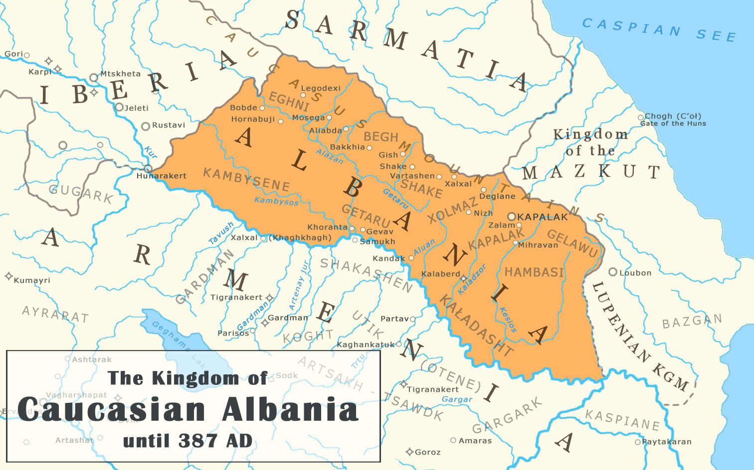
Caucasian Albania is a modern exonym for a former state located in ancient times in the Caucasus, mostly in what is now Azerbaijan (where both of its capitals were located). The modern endonyms for the area are ''Aghwank'' and ''Aluank'', among the Udi people, who regard themselves as descended from the inhabitants of Caucasian Albania. However, its original endonym is unknown. The name Albania is derived from the Ancient Greek name and Latin , created from Greek sources that incorrectly translated the Armenian language. The prefix "Caucasian" is used to avoid confusion with Albania in the Balkans, which has no geographical or historical connections to Caucasian Albania. Little is known of the region's prehistory, including the origins of Caucasian Albania as a geographical and/or ethnolinguistic concept. In the 1st century BC and the 1st century AD, the area south of the Greater Caucasus and north of the Lesser Caucasus was divided between Caucasian Albania in the east, Kingd ... [...More Info...] [...Related Items...] OR: [Wikipedia] [Google] [Baidu] |
Mountain Jews
Mountain Jews are the Mizrahi Jews, Mizrahi Jewish subgroup of the eastern and northern Caucasus, mainly Azerbaijan, and various republics in the Russian Federation: Chechnya, Ingushetia, Dagestan, Karachay-Cherkessia, and Kabardino-Balkaria. Mountain Jews took shape as a community after Qajar Iran ceded the areas in which they lived to the Russian Empire as part of the Treaty of Gulistan of 1813. The forerunners of the Mountain Jewish community have inhabited Ancient Persia since the 5th century BCE. The language spoken by Mountain Jews, called Judeo-Tat, is an ancient Southwest Iranian language which integrates many elements of Biblical Hebrew, Ancient Hebrew."Mountain Jews: customs and daily life in the Caucasus'', Leʼah Miḳdash-Shema", Liya Mikdash-Shamailov, Muzeʼon Yiśraʼel (Jerusalem), UPNE, 2002, page 17'' It is believed that Mountain Jews in Persia, as early as the 8th century BCE, continued to migrate east; settling in mountainous areas of the Caucasus. Mountain ... [...More Info...] [...Related Items...] OR: [Wikipedia] [Google] [Baidu] |
Shamakhy Khanate
Shamakhy khanate was a feudal state on the modern territory of Azerbaijan Azerbaijan, officially the Republic of Azerbaijan, is a Boundaries between the continents, transcontinental and landlocked country at the boundary of West Asia and Eastern Europe. It is a part of the South Caucasus region and is bounded by ... in the 18th century. Diarchy existed in Shamakhy khanate. Part of the khanate was governed by Mahammad Hasan khan, other parts was governed by Mahammad Said and Agasi brothers. Mahammad Said khan unified Shamakhy khanate in 1763 and Shamakhy city became the centre of khanate. In 1767, Guba and Shaki khanates attacked the Shamakhy and territory of the khanate was divided between them. In 1790, Shirvan khans restored their authorities. Rulers * Haji Mahammadali Khan 1747-1763 * Mahammadsaid Khan, Agasi Khan 1748-1768 * Mustafa Khan 1792-1820 See also * Khanates of the Caucasus References External links Realities of Azerbaijan 1917-1920Shamakhi. Image by Em ... [...More Info...] [...Related Items...] OR: [Wikipedia] [Google] [Baidu] |


