|
Mustapha Djazaïri
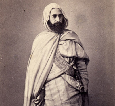
Mustapha ibn Muhieddine (1814–1863; '), known as Emir Mustapha, Sidi Moustafa, Moustafa El Hassani El Djazairi, was an Algerian religious and military leader who led a struggle against the Invasion of Algiers in 1830, French colonial invasion in the mid-19th century with his brother, Emir Abdelkader. Family Mustapha was one of Mahieddine's sons and the younger brother of Emir Abdelkader. He married one of his cousins, with whom he had three sons and two daughters. In memory of his father, one of his sons was named Mahieddine, who married his cousin Zeyneb, the daughter of his uncle Emir Abdelkader. French conquest Mustapha strove to gain influence in the Emirate of Abdelkader and took an important part in the affairs of the Algerian country. Sahara tribes In 1836, Mustapha tried proclaim himself Sheikh of the Algerian Sahara tribe who had rallied to Abdelkader, but his attempt failed and he was struck with disgrace. However, he deeply apologised, so Abdelkader appoin ... [...More Info...] [...Related Items...] OR: [Wikipedia] [Google] [Baidu] |
Guittena
Guittena is a town and Communes of Algeria, commune in Mascara Province, Algeria. Notable people * Emir Abdelkader (1808–1883) * Emir Mustapha (1814–1863) References Communes of Mascara Province {{MascaraDZ-geo-stub ... [...More Info...] [...Related Items...] OR: [Wikipedia] [Google] [Baidu] |
Tlemcen
Tlemcen (; ) is the second-largest city in northwestern Algeria after Oran and is the capital of Tlemcen Province. The city has developed leather, carpet, and textile industries, which it exports through the port of Rachgoun. It had a population of 140,158, as of the 2008 census. A major centre of the Medieval Muslim Algeria, Central Maghreb, the city is a mix of Arabs, Arab, Berbers, Berber, al-Andalus, 'Āndalusī, Ottoman Empire, Ottoman, and Western influence on Africa, Western influences. From this mosaic of influences, the city derives the title of capital of Andalusian art in Algeria. Various titles are attributed to the city including "the Pearl of the Maghreb", "the African Granada" and "the Medina of the West". Etymology The name Tlemcen (''Tilimsān'') was given by the Zayyanid King Yaghmurasen Ibn Zyan. One possible etymology is that it comes from a Berber languages, Berber word ''tilmas'' 'spring, water-hole', or from the combination of the Berber words ''tala'' 'fou ... [...More Info...] [...Related Items...] OR: [Wikipedia] [Google] [Baidu] |
Maximilien Joseph Schauenburg
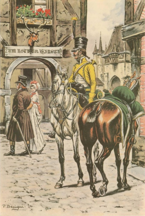
''Maréchal de camp'' Maximilien Joseph Schauenburg (30 April 1784 – 19 September 1838) was a French Army officer who participated in the French conquest of Algeria. Family Born on 30 April 1784 in Saint Stephen's Church near Strasbourg, he is the son of Alexis Balthazar Henri Schauenburg (1748-1831) and Sophie Louise Albertini d'Ichtersheim. Before 1825 he married Octavia Françoise Caroline de Berckheim who died in 1827, then he remarried in 1829 with Ursule Hortense Delorme (1799-1871), of whom he had an only son Pierre Maximilien Arthur Schauenburg. Publications Maximilien Joseph Schauenburg wrote several contributions in the military field, including: * Translation from German in 1821 of the work ''"Tactics of the cavalry"'' () by Count Friedrich Wilhelm von Bismarck (1783–1860). * ''"From the Company Squadron"'' () on 12 February 1835 and published in the magazine ''"Le Spectateur Militaire"''. * ''"Clothing and harness of the light cavalry"'' () on 6 November 1 ... [...More Info...] [...Related Items...] OR: [Wikipedia] [Google] [Baidu] |
Alexandre Charles Perrégaux
Alexandre Charles Perrégaux (21 October 1791 – 6 November 1837) was a French Army officer who participated in the French conquest of Algeria. Family Alexandre Charles Perrégaux was born in Neuchâtel on 21 October 1791, the second son of Charles Albert Henri Perregaux (1757-1831) who was state councilor, colonel inspector of militias and knight of the red eagle. He had married Cécile de Pourtalès in Neuchâtel on 5 December 1825. Cécile, who was born on 9 September 1804, predeceased her husband, dying in Paris on 24 March 1830. The couple had no surviving children. Injury and death Perrégaux took part in the Expedition of the Col des Beni Aïcha, and was present at the Siege of Constantine on 12 October 1837 when General Charles-Marie Denys de Damrémont was killed by a cannonball. While attempting to reach Damrémont and recover his body, Perrégaux was struck by a bullet which passed through his nose and into the palate of his mouth. He was knocked unconscious an ... [...More Info...] [...Related Items...] OR: [Wikipedia] [Google] [Baidu] |
Algiers
Algiers is the capital city of Algeria as well as the capital of the Algiers Province; it extends over many Communes of Algeria, communes without having its own separate governing body. With 2,988,145 residents in 2008Census 14 April 2008: Office National des Statistiques de l'Algérie (web). and an estimated 3,004,130 residents in 2025 in an area of , Algiers is the largest city in List of cities in Algeria, Algeria, List of coastal settlements of the Mediterranean Sea, the third largest city on the Mediterranean, List of largest cities in the Arab world, sixth in the Arab World, and List of cities in Africa by population, 11th in Africa. Located in the north-central portion of the country, it extends along the Bay of Algiers surrounded by the Mitidja Plain and major mountain ranges. Its favorable location made it the center of Regency of Algiers, Ottoman and French Algeria, French cultural, political, and architectural influences for the region, shaping it to be the diverse met ... [...More Info...] [...Related Items...] OR: [Wikipedia] [Google] [Baidu] |
Charles-Marie Denys De Damrémont
Charles-Marie Denys, comte de Damrémont (8 February 1783 – 12 October 1837) was a French general and military governor of French Algeria. He was killed in combat during the siege of Constantine. Early life Charles-Marie Denys was born in Chaumont, Haute-Marne on 8 February 1783. His father was Antoine Denys de Damrémont (1730-1807) who belonged to a family of merchants from Bologna and who got rich in forges in the 17th century. Military training He entered the military school at Fontainebleau in 1803. After graduating from the school on 1804 he became a lieutenant in the 12th regiment of chasseurs à cheval. Campaigns of Napoleon He took part in the Wars of the War of the Third Coalition, Third and War of the Fourth Coalition, Fourth Coalitions. In 1807 he became aide-de-camp to Jean-Marie Defrance, General Defrance and afterwards to Auguste de Marmont, Marshal Marmont. In 1811 and 1812 Damrémont served in the Peninsular War but in 1813 he transferred to the Grande Armé ... [...More Info...] [...Related Items...] OR: [Wikipedia] [Google] [Baidu] |
Djurdjura
The Djurdjura (Berber: ''Adrar n Jerjer','' ) is a mountain range of the Tell Atlas, part of the Atlas Mountain System. It is located in Kabylie, Algeria. Geography The Djurdjura is a massif made up of two differentiated ranges, one in the north with the Haïzer and Akouker subranges and the other in the south. Its highest point, Lalla Khedidja known in Kabylian as ''Tamgut Aâlayen'', has an elevation of and it is located in the southern range. Other notable summits are the 2,305 m high Ich n'Timedouine (أكارو تيمدواي), a peak located in the central area of the massif, highest point of the Akouker subrange. Adrar n'Hayzer (أدرار نن هيدزر), the highest point of the Haïzer subrange, is a 2,164 m tall summit rising above Bouira and the high valley of Oued Dhous. The Thaletat is a 1,638 m high rocky mountain with a very original shape located in Tizi Ouzou Province. Other notable features of the Djurdjura range are the 1,750 m high Tirourda Pass ... [...More Info...] [...Related Items...] OR: [Wikipedia] [Google] [Baidu] |
Khachna
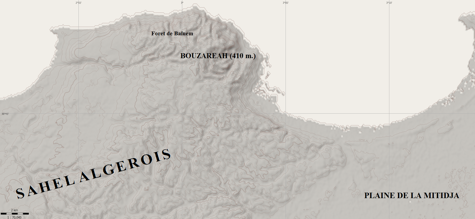
The Khachna Range (, ''Jibal Khashna''; Berber ''Adrar n Kheshna'') is a mountain range of the Tell Atlas, part of the Atlas Mountain System. It is located in Kabylie, Algeria. Geography The ''Khachna'' is a massif made up of two differentiated ranges, one in the north between Thénia and Zemmouri, and the other in the south between Thénia and Lakhdaria. Its highest point, '' Bouzegza Mount'' known in Kabylian as ''Athrar Azegzaw'', has an elevation of and it is located in the southern subrange. Other notable summits are the 710 m high Djerrah Mount, a peak located in the central area of the massif, a second highest point of the southern subrange. Villages This mountain range is home to dozens of villages including: Summits Several mountain peaks are found in this mountain range: * (1032 m) * Djerrah Mount (740 m) * Ighil Zenabir Mount (630 m) * Ben Norah Mount (467 m) * Sidi Fredj Mount (452 m) * Bouarous Mount (444 m) * Soumâa Mount (430 m) * Bouzareah Mounta ... [...More Info...] [...Related Items...] OR: [Wikipedia] [Google] [Baidu] |
Zawiyas In Algeria
The Zawiyas in Algeria are religious buildings located in Algeria honoring the memory of patron saints and dedicated to Quranic and religious education. They are associated with Sufism, with each affiliated to a tariqa (torouq) brotherhood under the supervision of the Ministry of Religious Affairs and Endowments (Algeria), Ministry of Religious Affairs and Endowments, in accordance with the precepts of the Algerian Islamic reference. History The history of the Zawiya (institution), zawiyas in Algeria is linked to that of the Sufi brotherhoods or tourouqs. With the advent of the fifteenth century, the movement to create these spiritual retreat (spiritual), retreats intensified, as the Muslim world in the Machrek as in the Maghreb declined. The large Muslim cities lost their scientific and spiritual influence when the last Muslim dynasties lost educational and initiatory control over the mass of Muslim faithful due to the fragmentation of territories between rival emirates. T ... [...More Info...] [...Related Items...] OR: [Wikipedia] [Google] [Baidu] |
Marabout
In the Muslim world, the marabout () is a Sayyid, descendant of Muhammad (Arabic: سـيّد, Romanization of Arabic, romanized: ''sayyid'' and ''sidi'' in the Maghreb) and a Islam, Muslim religious leader and teacher who historically had the function of a chaplain serving as a part of an Islam and war, Islamic army, notably in North Africa and the Sahara region, in West Africa, and historically in the Maghreb. The marabout is often a scholar of the Quran, or religious teacher. Others may be wandering Asceticism#Islam, holy men who survive on Zakat, alms or as spiritual directors of Muslim religious communities, often as ''Murshid, muršid'' ("guide") of Tariqa, Sufi orders. The term "marabout" is also used for the mausolea of such religious leaders (cf. ''Maqam (shrine), maqām'', ''Mazar (mausoleum), mazār'', in Palestine (region), Palestine also ''Wali, walī/velī''). West Africa Muslim religious teachers Muslim Tariqa, Sufi brotherhoods were one of the main organizing f ... [...More Info...] [...Related Items...] OR: [Wikipedia] [Google] [Baidu] |
Oued Isser
The Oued Isser is a river of Algeria. It begins in Médéa Province, is the main river, with Oued Sébaou of the Medea, which runs through the Lower Kabylie of Djurdjura (or the current province of Boumerdès) Wilaya of Bouira, then flows into the Mediterranean near the coastal town of Djinet in Lower Kabylia, attached to the province of Boumerdes. The Oued Isser derives its name from the Roman name Serbetes, but other documentary sources give the name Serbetes to the Oued Sébaou. The hydronymy of the Oued Isser is very interesting from the point of view of the various linguistic appellations that designate it (Berber, Latin, Arabic and French). Geography The Oued Isser is the receptacle of the waters of the southern slope of the Khachna massif and the Blida Atlas. In Draâ Tabel in the Beni Ostman, at 420 meters above sea level, it takes the name Oued Isser, which it keeps until its mouth in the Mediterranean Sea. Its sources sprout from a great number of points, almost ... [...More Info...] [...Related Items...] OR: [Wikipedia] [Google] [Baidu] |
Kabylia
Kabylia or Kabylie (; in Kabyle: Tamurt n leqbayel; in Tifinagh: ⵜⴰⵎⵓⵔⵜ ⵏ ⵍⴻⵇⴱⴰⵢⴻⵍ; ), meaning "Land of the Tribes" is a mountainous coastal region in northern Algeria and the homeland of the Kabyle people. It is part of the Tell Atlas mountain range and is located at the edge of the Mediterranean. Kabylia covers two provinces of Algeria: Tizi Ouzou and Béjaïa. Gouraya National Park and Djurdjura National Park are also located in Kabylia. Name During the French colonization of Algeria, the French invented the term 'Kabylia', a term never used by the Arab and Berber populations of Algeria prior to the French invasion. The word 'Kabyle' is a distortion of the Arabic word ''qaba'il'' (قبائل) which has two meanings, the first one is tribes that live among sedentary populations and the second is 'to accept', which Arabs after the Muslim conquest of the Maghreb used for local populations that accepted Islam. History Antiquity Kabylia was a ... [...More Info...] [...Related Items...] OR: [Wikipedia] [Google] [Baidu] |


