|
Motutapu
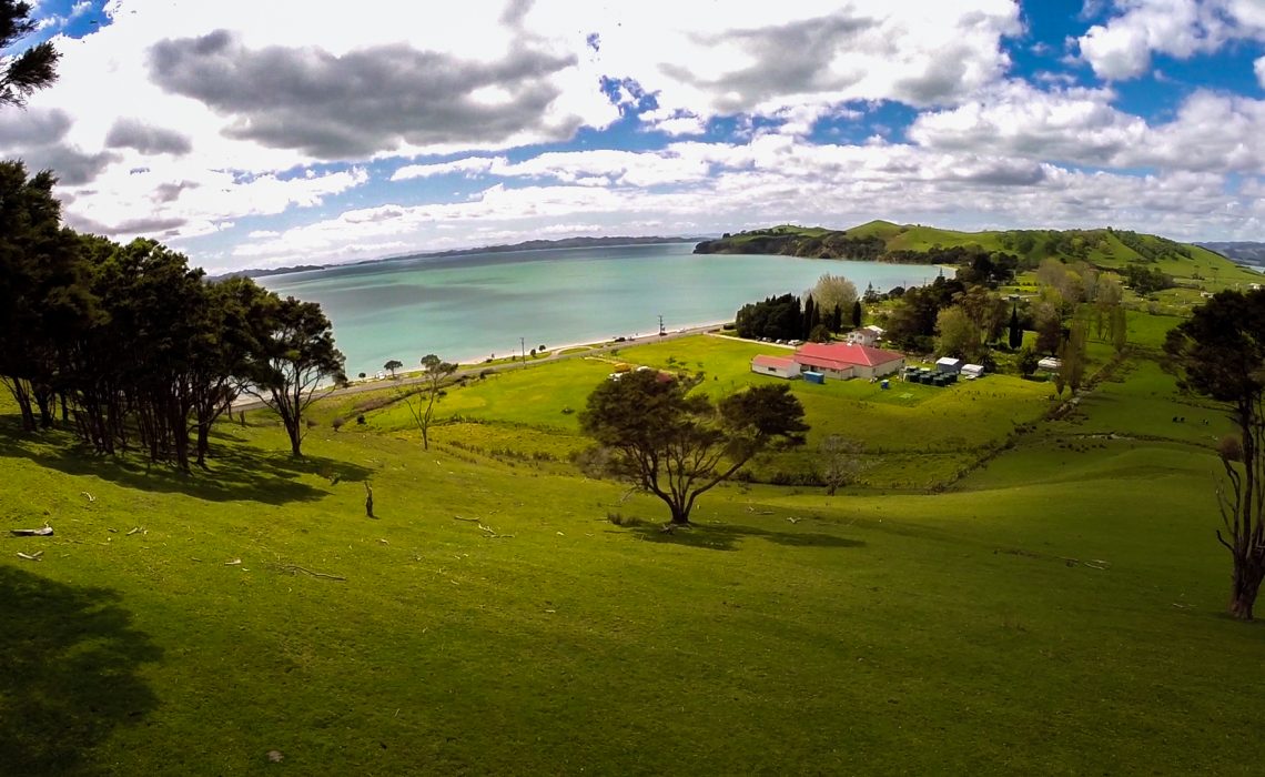
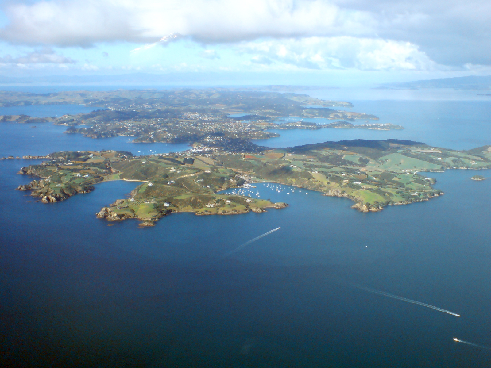
Motutapu Island is a island in the Hauraki Gulf to the northeast of the city of Auckland, New Zealand. The island is part of the Hauraki Gulf Maritime Park. The island can be accessed via regular ferry services departing from Auckland City. Etymology Motutapu's full name in Māori, rarely used, is , , a tohunga (tribal priest) of the Tainui tribe. , meaning 'sacred' or 'sanctuary' island, is a term used for various islands in a number of Polynesian cultures. Geography Approximately 18,000 years ago during the Last Glacial Maximum when sea levels were over 100 metres lower than present day levels, Motutapu Island was landlocked to the North Island, surrounded by a vast coastal plain where the Hauraki Gulf exists today. Sea levels began to rise 7,000 years ago, after which Motutapu became an island separated from the rest of New Zealand. The island is now linked by an artificial causeway to the much younger volcanic island cone of Rangitoto. Prior to the emergence of the ... [...More Info...] [...Related Items...] OR: [Wikipedia] [Google] [Baidu] |
Rangitoto Island
Rangitoto Island is a volcanic island in the Hauraki Gulf near Auckland, New Zealand. The wide island is a symmetrical shield volcano cone capped by central scoria cones, reaching a height of . Rangitoto is the youngest and largest of the approximately 50 volcanoes of the Auckland volcanic field, having erupted in two phases about 1450 CE and 1500 CE and covering an area of . It is separated from the mainland of Auckland's North Shore, New Zealand, North Shore by the Rangitoto Channel. Since World War II, it has been linked by a causeway to the much older, non-volcanic Motutapu Island. is Māori language, Māori for 'Bloody Sky',What happened to local Maori? (from the Rangitoto page on the GNS Science website) with the name coming from the full phrase ("The days of the bleeding of Tama-te-kapua"). Tama ... [...More Info...] [...Related Items...] OR: [Wikipedia] [Google] [Baidu] |
Tara Te Irirangi
Tara Te Irirangi (1780s–1852) also known as Te Tara ki Moehau or Ōtara Te Irirangi, was paramount chief of Ngāi Tai ki Tāmaki or Ngāti Tai, a Māori tribe of the eastern Auckland region of New Zealand , encompassing parts of the Hauraki Gulf and Wairoa River (Auckland), Wairoa Valley, as well as Ōtara, Clevedon, Maraetai and Howick. Te Irirangi was the great-grandson of Te Wana, a leading rangatira and well-known warrior of Ngāi Tai, who, during his life, strengthened Ngāi Tai control over the Maraetai-Wairoa area. Tara Te Irirangi died in 1852, after falling ill, his daughter Ngeungeu having been kidnapped by Nga Puhi who sided with the crown to arrange a marriage to a Scotsman losing her Mother tongue as arranged by the crown, extradited her from her father, he passed away at the mouth of the Wairoa River. He was interred in his waka in the Ngāi Tai burial swamps within the west bank of the river. Early leadership Prior to his time as ariki (paramount chief), Te ... [...More Info...] [...Related Items...] OR: [Wikipedia] [Google] [Baidu] |
Tainui (canoe)
''Tainui'' was one of the Māori migration canoes, great ocean-going canoes in which Polynesians migrated to New Zealand approximately 800 years ago. It was commanded by the chief Hoturoa, who had decided to leave Hawaiki because over-population had led to famine and warfare. The ship first reached New Zealand at Cape Runaway, Whangaparāoa in the Bay of Plenty and then skirted around the north coast of the North Island, finally landing at Kawhia in the western Waikato. The crew of the ''Tainui'' were the ancestors of the iwi that form the Tainui confederation. Crafting The Tainui waka (canoe), waka (canoe) was made from a great tree, at a place in Hawaiki known then as Maungaroa, on the spot where a stillborn child had been buried. According to Te Tāhuna Herangi the waka was named after the child who had been called Tainui. The canoe was made by Rakatāura, an expert boat builder in the tradition of Rātā (Māori mythology), Rātā, or according to Wirihana Aoterangi by R ... [...More Info...] [...Related Items...] OR: [Wikipedia] [Google] [Baidu] |
Hauraki Gulf
The Hauraki Gulf / Tīkapa Moana is a coastal feature of the North Island of New Zealand. It has an area of 4000 km2, Zeldisl, J. R. et al. (1995) Salp grazing: effects on phytoplankton abundance, vertical distribution and taxonomic composition in a coastal habitat. Marine Ecology Progress Series, Vol. 126, p 267-283 and lies between, in anticlockwise order, the , the Hauraki Plains, the Coromandel Peninsula, and |
Ngāi Tai Ki Tāmaki
Ngāi Tai ki Tāmaki is a Māori people, Māori tribe that is based in the area around Clevedon, New Zealand, Clevedon, part of the Auckland region (''Tāmaki'' in the Māori language). It is one of the twelve members of the Hauraki Collective of tribes. The founding ancestors of Ngāi Tai ki Tāmaki came to New Zealand in the ''Tainui (canoe), Tainui'' migration canoe and left it when it was dragged across Portages of New Zealand#Te Tō Waka, Te Tō Waka, the portage from the Tāmaki River to the Manukau Harbour. Their descendants occupied parts of the Hauraki Gulf, including east Auckland as far inland as Ōtara, and Maungarei, as well as Clevedon, Maraetai and Howick, New Zealand, Howick. Te Irirangi Drive, a major highway in Manukau City, is named after one of their ''rangatira'' (chiefs), Tara Te Irirangi. Ngāi Tai has a marae at Umupuia Beach, between Maraetai and Clevedon. They also use the Ngāti Tamaoho marae at Karaka, New Zealand, Karaka. In 2015 the Crown sett ... [...More Info...] [...Related Items...] OR: [Wikipedia] [Google] [Baidu] |
Waiheke Island
Waiheke Island is the second-largest island (after Great Barrier Island) in the Hauraki Gulf of New Zealand. Its ferry terminal in Matiatia Bay at the western end is from the central-city terminal in Auckland. It is the most populated island in the gulf, with permanent residents, and the List of islands of New Zealand, third most populous island in New Zealand (behind the two main islands). An additional estimated 3,400 people have second homes or holiday homes on the island. It is more densely populated than the North Island, North and South Islands. It is the most accessible island in the gulf, with regular passenger and Roll-on/roll-off, car-ferry services, a helicopter operator based on the island, and other air links. In November 2015, Lonely Planet rated Waiheke Island the fifth-best region in the world to visit in 2016. Geography Overview The island is off the coast of the North Island. It is in length from west to east, varies in width from , and has a surface are ... [...More Info...] [...Related Items...] OR: [Wikipedia] [Google] [Baidu] |
Adze
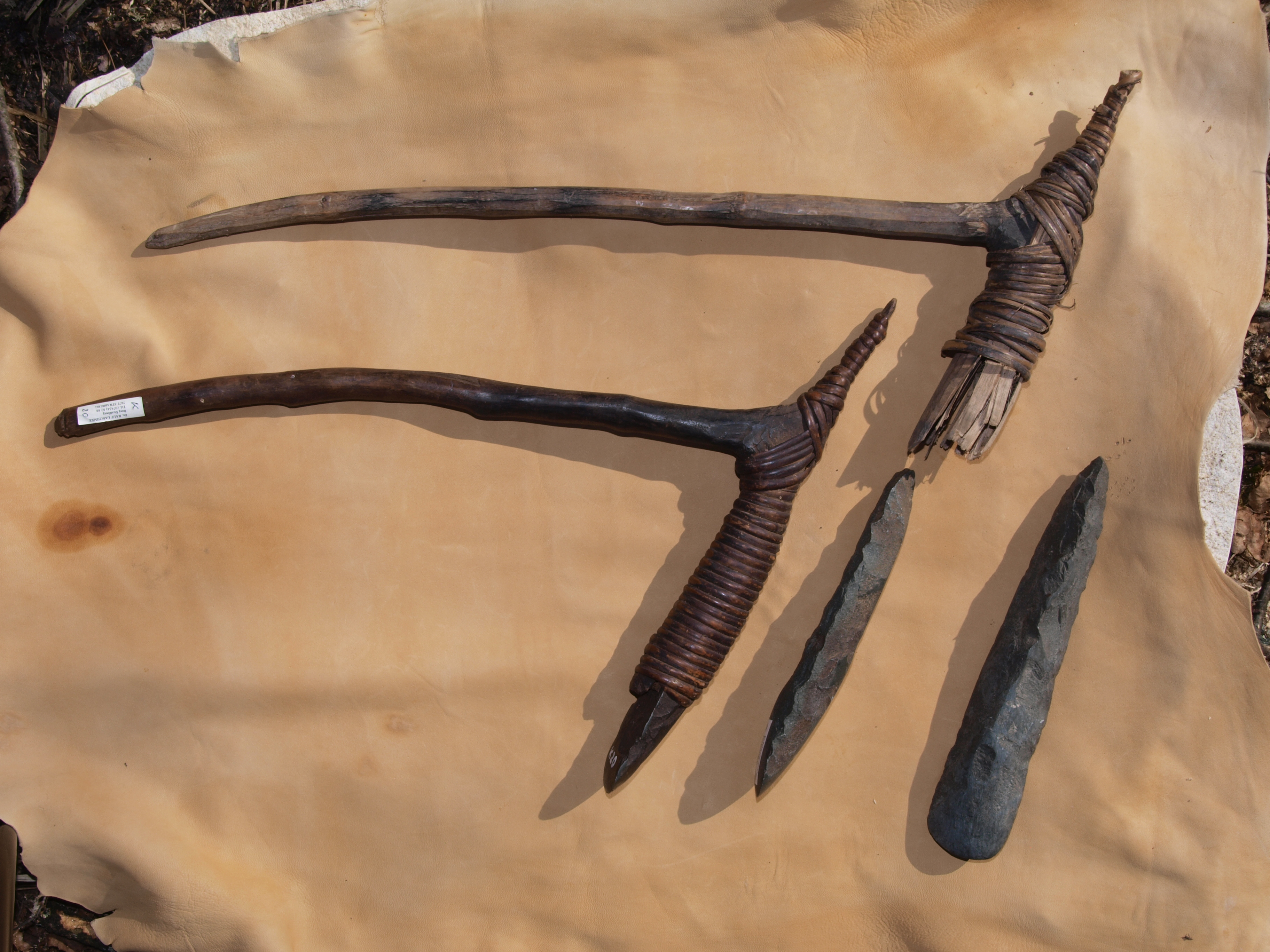
An adze () or adz is an ancient and versatile cutting tool similar to an axe but with the cutting edge perpendicular to the handle rather than parallel. Adzes have been used since the Stone Age. They are used for smoothing or carving wood in hand woodworking, and as a Hoe (tool), hoe for agriculture and horticulture. Two basic forms of an adze are the hand adze (short hoe)—a short-handled tool swung with one hand—and the foot adze (hoe)—a long-handled tool capable of powerful swings using both hands, the cutting edge usually striking at foot or shin level. A similar tool is called a mattock, which differs by having two blades, one perpendicular to the handle and one parallel. History Africa The adze is depicted in ancient Egyptian art from the Old Kingdom onward. Originally the adze blades were made of stone, but already in the Predynastic Egypt, Predynastic Period copper adzes had all but replaced those made of flint. Stone blades were fastened to the handle by tying ... [...More Info...] [...Related Items...] OR: [Wikipedia] [Google] [Baidu] |
Sweet Potato
The sweet potato or sweetpotato (''Ipomoea batatas'') is a dicotyledonous plant in the morning glory family, Convolvulaceae. Its sizeable, starchy, sweet-tasting tuberous roots are used as a root vegetable, which is a staple food in parts of the world. Cultivars of the sweet potato have been bred to bear tubers with flesh and skin of various colors. Moreover, the young shoots and leaves are occasionally eaten as greens. The sweet potato and the potato are in the order Solanales, making them distant relatives. Although darker sweet potatoes are often known as "yams" in parts of North America, they are even more distant from actual yams, which are monocots in the order Dioscoreales. The sweet potato is native to the tropical regions of South America in what is present-day Ecuador. Of the approximately 50 genera and more than 1,000 species of Convolvulaceae, ''I. batatas'' is the only crop plant of major importance—some others are used locally (e.g., ''I. aquatica'' "ka ... [...More Info...] [...Related Items...] OR: [Wikipedia] [Google] [Baidu] |
Maraetai
Maraetai is a coastal town to the east of Auckland in New Zealand, on the Pōhutukawa Coast. Part of the traditional rohe of Ngāi Tai Ki Tāmaki, the area developed into a coastal holiday community in the early 20th Century. Geography Maraetai is located adjacent to the Tāmaki Strait, in the Hauraki Gulf of New Zealand, 24 kilometres east of the Auckland City Centre. Maraetai has a number of bays and beaches, including Omana Beach, Te Pene Beach, Ohinerangi Beach, Waiomanu Beach and Magazine Bay. The closest town, Beachlands, New Zealand, Beachlands, lies approximately 4 kilometres to the west. History Māori history The Pōhutukawa Coast was visited by the ''Tainui (canoe), Tainui'' migratory waka around the year 1300. Tainui followers of Manawatere, who identified as Ngā Oho, decided to settle the area between the Pōhutukawa Coast and Tūwakamana (Cockle Bay, New Zealand, Cockle Bay). Ngāi Tai ki Tāmaki, the tangata whenua, mana whenua of the area, descend from these ... [...More Info...] [...Related Items...] OR: [Wikipedia] [Google] [Baidu] |
Maungatautari
Maungatautari is a mountain near Cambridge in the Waikato region in New Zealand's central North Island. The mountain is an extinct stratovolcano. It is a prominent peak and is visible across the Waipa District. The mountain is the site of Sanctuary Mountain Maungatautari a large ecological sanctuary and restoration project. History According to Waikato Tainui oral history, the mountain was named by Rakatāura / Hape, the tohunga of the ''Tainui'' migratory canoe. After settling at the Kawhia Harbour, Rakatāura and his wife Kahukeke explored the interior of the Waikato. The New Zealand Ministry for Culture and Heritage gives a translation of "mountain of the upright stick" for . Geology Maungatautari is an extinct andesitic-dacitic stratovolcano with a prominence of at least above its surroundings and an estimated age of 1.8 ± 0.10 million years. Its eroded flanks take in most of the surrounding district of the same name as its edifice is between to in diameter but ... [...More Info...] [...Related Items...] OR: [Wikipedia] [Google] [Baidu] |
Ngāpuhi
Ngāpuhi (also known as Ngāpuhi-Nui-Tonu or Ngā Puhi) is a Māori iwi associated with the Northland regions of New Zealand centred in the Hokianga, the Bay of Islands, and Whangārei. According to the 2023 New Zealand census, the estimated population of Ngāpuhi is 184,470. This compares to 125,601 in 2001, 102,981 in 2006, 122,214 in 2013. and 165,201 in 2018. It is formed from 150 hapū or subtribes, with 55 marae. Despite such diversity, the people of Ngāpuhi maintain their shared history and self-identity. Te Rūnanga ā Iwi o Ngāpuhi, based in Kaikohe, administers the iwi. The Rūnanga acts on behalf of the iwi in consultations with the New Zealand government. It also ensures the equitable distribution of benefits from the 1992 fisheries settlement with the government, and undertakes resource management and education initiatives. History Origins of Ngāpuhi Ngāpuhi, like most iwi, trace their pre-history back to the land of Hawaiki, most likely from Raiatea. ... [...More Info...] [...Related Items...] OR: [Wikipedia] [Google] [Baidu] |
Hongi Hika
Hongi Hika ( – 6 March 1828) was a New Zealand Māori rangatira (chief) and war leader of the iwi of Ngāpuhi. He was a pivotal figure in the early years of regular European contact and settlement in New Zealand. As one of the first Māori leaders to understand the advantages of European muskets in warfare, he used European weapons to overrun much of northern New Zealand in the early nineteenth century Musket Wars. He was however not only known for his military prowess; Hongi Hika encouraged Pākehā (European) settlement, built mutually beneficial relationships with New Zealand's first missionaries, introduced Māori to Western agriculture and helped put the Māori language into writing. He travelled to England and met King George IV. His military campaigns, along with the other Musket Wars, were one of the most important motivators for the British annexation of New Zealand and subsequent Treaty of Waitangi with Ngāpuhi and many other iwi. Early life and campaigns: 177 ... [...More Info...] [...Related Items...] OR: [Wikipedia] [Google] [Baidu] |


