|
Mont Rougemont
Mont Rougemont (; Abenaki: Wigwômedenek) is part of the Monteregian Hills in southern Quebec. It is composed of igneous rock and hornfels. The summit stands above sea level. The mountain is mostly covered with sugar maple-dominated forest. Apple orchards and vineyards are cultivated on many of the lower slopes, and much of the fruit is used to make cider. Geology The igneous material is composed almost entirely of mafic and ultramafic rock such as gabbro and olivine-bearing clinopyroxenite. These rocks outcrop in some places and are otherwise covered by dark brown stony loam, sandy loam or loamy sand which has been mapped as Montarville series.https://sis.agr.gc.ca/siscan/publications/surveys/pq/pq49b/pq49b_report.pdf Étude pédologique du comté de Rouville, Québec, 1999. Mont Rougemont might be the deep extension of a vastly eroded ancient volcanic complex, which was probably active about 125 million years ago. [...More Info...] [...Related Items...] OR: [Wikipedia] [Google] [Baidu] |
Rougemont, Quebec
Rougemont () is a municipality in the Canadian province of Quebec, located within the Rouville Regional County Municipality in the Montérégie region about 18 kilometers southwest of Saint-Hyacinthe. The population as of the Canada 2021 Census was 2,696. While it is known for its apple orchards and sugar shacks, Rougemont is also the location of Mont Rougemont and Rougemont Airport. History Rougemont was created in 2000 from the merger of the village of Rougemont and the parish of Saint-Michel-de-Rougemont. Demographics Population Population trend: Language Mother tongue language (2021) Education The South Shore Protestant Regional School Board previously served the municipality.King, M.J. (Chairperson of the board).South Shore Protestant Regional School Board (St. Johns, PQ). '' The News and Eastern Townships Advocate''. Volume 119, No. 5. Thursday December 16, 1965. p. 2. Retrieved from Google News on November 23, 2014. See also *List of municipalities in Queb ... [...More Info...] [...Related Items...] OR: [Wikipedia] [Google] [Baidu] |
Apple
An apple is a round, edible fruit produced by an apple tree (''Malus'' spp.). Fruit trees of the orchard or domestic apple (''Malus domestica''), the most widely grown in the genus, are agriculture, cultivated worldwide. The tree originated in Central Asia, where its wild ancestor, ''Malus sieversii'', is still found. Apples have been grown for thousands of years in Eurasia before they were introduced to North America by European colonization of the Americas, European colonists. Apples have cultural significance in many mythological, mythologies (including Norse mythology, Norse and Greek mythology, Greek) and religions (such as Christianity in Europe). Apples grown from seeds tend to be very different from those of their parents, and the resultant fruit frequently lacks desired characteristics. For commercial purposes, including botanical evaluation, apple cultivars are propagated by clonal grafting onto rootstocks. Apple trees grown without rootstocks tend to be larger and ... [...More Info...] [...Related Items...] OR: [Wikipedia] [Google] [Baidu] |
Mountains Of Quebec Under 1000 Metres
A mountain is an elevated portion of the Earth's crust, generally with steep sides that show significant exposed bedrock. Although definitions vary, a mountain may differ from a plateau in having a limited summit area, and is usually higher than a hill, typically rising at least above the surrounding land. A few mountains are isolated summits, but most occur in mountain ranges. Mountains are formed through tectonic forces, erosion, or volcanism, which act on time scales of up to tens of millions of years. Once mountain building ceases, mountains are slowly leveled through the action of weathering, through slumping and other forms of mass wasting, as well as through erosion by rivers and glaciers. High elevations on mountains produce colder climates than at sea level at similar latitude. These colder climates strongly affect the ecosystems of mountains: different elevations have different plants and animals. Because of the less hospitable terrain and climate, mountains te ... [...More Info...] [...Related Items...] OR: [Wikipedia] [Google] [Baidu] |
Landforms Of Montérégie
A landform is a land feature on the solid surface of the Earth or other planetary body. They may be natural or may be anthropogenic (caused or influenced by human activity). Landforms together make up a given terrain, and their arrangement in the landscape is known as topography. Landforms include hills, mountains, canyons, and valleys, as well as shoreline features such as bays, peninsulas, and seas, including submerged features such as mid-ocean ridges, volcanoes, and the great oceanic basins. Physical characteristics Landforms are categorized by characteristic physical attributes such as elevation, slope, orientation, structure stratum, stratification, rock exposure, and soil type. Gross physical features or landforms include intuitive elements such as berms, cliffs, hills, mounds, peninsulas, ridges, rivers, valleys, volcanoes, and numerous other structural and size-scaled (e.g. ponds vs. lakes, hills vs. mountains) elements including various kinds of inland and oceanic b ... [...More Info...] [...Related Items...] OR: [Wikipedia] [Google] [Baidu] |
Great Meteor Hotspot Track
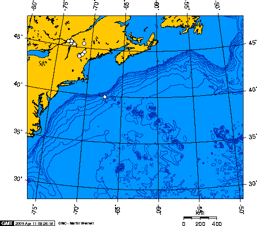
The New England hotspot, also referred to as the Great Meteor hotspot and sometimes the Monteregian hotspot, is a volcano, volcanic hotspot (geology), hotspot in the North Atlantic Ocean. It created the Monteregian Hills intrusions in Montreal and Montérégie, the White Mountains (New Hampshire), White Mountains intrusions in New Hampshire, the New England Seamounts, New England and Corner Rise Seamounts, Corner Rise seamounts off the coast of North America, and the Seewarte Seamounts east of the Mid-Atlantic Ridge on the African Plate, the latter of which include its most recent eruptive center, the Great Meteor Seamount. The New England, Great Meteor, or Monteregian hotspot track has been used to estimate the movement of the North American Plate away from the African Plate from the early Cretaceous period to the present using the fixed hotspot reference frame. Geologic history The geologic history of the New England hotspot is the subject of much debate among geoscientists. T ... [...More Info...] [...Related Items...] OR: [Wikipedia] [Google] [Baidu] |
New England Hotspot
The New England hotspot, also referred to as the Great Meteor hotspot and sometimes the Monteregian hotspot, is a volcanic hotspot in the North Atlantic Ocean. It created the Monteregian Hills intrusions in Montreal and Montérégie, the White Mountains intrusions in New Hampshire, the New England and Corner Rise seamounts off the coast of North America, and the Seewarte Seamounts east of the Mid-Atlantic Ridge on the African Plate, the latter of which include its most recent eruptive center, the Great Meteor Seamount. The New England, Great Meteor, or Monteregian hotspot track has been used to estimate the movement of the North American Plate away from the African Plate from the early Cretaceous period to the present using the fixed hotspot reference frame. Geologic history The geologic history of the New England hotspot is the subject of much debate among geoscientists. The conventional opinion is that volcanic activity associated with the hotspot results from movement ... [...More Info...] [...Related Items...] OR: [Wikipedia] [Google] [Baidu] |
Clinopyroxenite
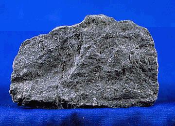
Pyroxenite is an ultramafic igneous rock consisting essentially of minerals of the pyroxene group, such as augite, diopside, hypersthene, bronzite or enstatite. Pyroxenites are classified into clinopyroxenites, orthopyroxenites, and the websterites which contain both types of pyroxenes (see diagram below). Closely allied to this group are the hornblendites, consisting essentially of hornblende and other amphiboles. They are essentially of igneous origin, though some pyroxenites are included in the metamorphic Lewisian complex of Scotland where the pyroxene-rich rocks result from the type of contact metamorphism known as pyroxene-hornfels facies, have siliceous sediment or basaltic protoliths, and are respectively metapelites and metabasites. Intrusive and mantle pyroxenites Igneous pyroxenites are closely allied to gabbros and norites, from which they differ by the absence of feldspar, and to peridotites, which are distinguished from them by containing more than 40% olivine. T ... [...More Info...] [...Related Items...] OR: [Wikipedia] [Google] [Baidu] |
Olivine
The mineral olivine () is a magnesium iron Silicate minerals, silicate with the chemical formula . It is a type of Nesosilicates, nesosilicate or orthosilicate. The primary component of the Earth's upper mantle (Earth), upper mantle, it is a common mineral in Earth's subsurface, but weathers quickly on the surface. Olivine has many uses, such as the gemstone peridot (or chrysolite), as well as industrial applications like metalworking processes. The ratio of magnesium to iron varies between the two endmember (mineralogy), endmembers of the solid solution series: forsterite (Mg-endmember: ) and fayalite (Fe-endmember: ). Compositions of olivine are commonly expressed as Mole (unit), molar percentages of forsterite (Fo) and/or fayalite (Fa) (''e.g.'', Fo70Fa30, or just Fo70 with Fa30 implied). Forsterite's melting temperature is unusually high at atmospheric pressure, almost , while fayalite's is much lower – about . Melting temperature varies smoothly between the two end ... [...More Info...] [...Related Items...] OR: [Wikipedia] [Google] [Baidu] |
Gabbro
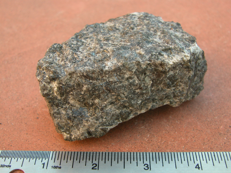
Gabbro ( ) is a phaneritic (coarse-grained and magnesium- and iron-rich), mafic intrusive igneous rock formed from the slow cooling magma into a holocrystalline mass deep beneath the Earth's surface. Slow-cooling, coarse-grained gabbro is chemically equivalent to rapid-cooling, fine-grained basalt. Much of the Earth's oceanic crust is made of gabbro, formed at mid-ocean ridges. Gabbro is also found as plutons associated with continental volcanism. Due to its variant nature, the term ''gabbro'' may be applied loosely to a wide range of intrusive rocks, many of which are merely "gabbroic". By rough analogy, gabbro is to basalt as granite is to rhyolite. Etymology The term "gabbro" was used in the 1760s to name a set of rock types that were found in the ophiolites of the Apennine Mountains in Italy. It was named after Gabbro, a hamlet near Rosignano Marittimo in Tuscany. Then, in 1809, the German geologist Christian Leopold von Buch used the term more restrictively in his d ... [...More Info...] [...Related Items...] OR: [Wikipedia] [Google] [Baidu] |
Ultramafic
Ultramafic rocks (also referred to as ultrabasic rocks, although the terms are not wholly equivalent) are igneous and meta-igneous rocks with a very low silica content (less than 45%), generally >18% MgO, high FeO, low potassium, and are usually composed of greater than 90% mafic minerals (dark colored, high magnesium and iron content). Earth's mantle is composed of ultramafic rocks. Ultrabasic is a more inclusive term that includes igneous rocks with low silica content that may not be extremely enriched in Fe and Mg, such as carbonatites and ultrapotassic igneous rocks. Intrusive ultramafic rocks Intrusive ultramafic rocks are often found in large, layered ultramafic intrusions where differentiated rock types often occur in layers. Such cumulate rock types do not represent the chemistry of the magma from which they crystallized. The ultramafic intrusives include the dunites, peridotites and pyroxenites. Other rare varieties include troctolite which has a greater pe ... [...More Info...] [...Related Items...] OR: [Wikipedia] [Google] [Baidu] |
Mafic
A mafic mineral or rock is a silicate mineral or igneous rock rich in magnesium and iron. Most mafic minerals are dark in color, and common rock-forming mafic minerals include olivine, pyroxene, amphibole, and biotite. Common mafic rocks include basalt, diabase and gabbro. Mafic rocks often also contain calcium-rich varieties of plagioclase feldspar. Mafic materials can also be described as ferromagnesian. History The term ''mafic'' is a portmanteau of "magnesium" and "ferric" and was coined by Charles Whitman Cross, Joseph P. Iddings, Louis V. Pirsson, and Henry Stephens Washington in 1912. Cross' group had previously divided the major rock-forming minerals found in igneous rocks into ''salic'' minerals, such as quartz, feldspars, or feldspathoids, and ''femic'' minerals, such as olivine and pyroxene. However, micas and aluminium-rich amphiboles were excluded, while some calcium minerals containing little iron or magnesium, such as wollastonite or apatite, were included in t ... [...More Info...] [...Related Items...] OR: [Wikipedia] [Google] [Baidu] |


