|
Miletouteichos
Miletouteichos ( grc, Μιλητουτεῖχος) was a Greek town located near the coast of the Propontis in ancient Mysia. It is mentioned in the '' Hellenica Oxyrhynchia'': in the year 395 BCE, the troops of Agesilaus II, king of Sparta, departing from Cius, attacked Miletouteichos, but they could not take it and they retired, marching next by the Rhyndacus river to Dascylium. Scholars have debated the name. The toponym also appears in an inscription where a theorodokos is mentioned in Miletouteichos around 330 BCE. It may be that the place-name appears in an Athenian decree of the year 410/09 BCE. Some scholars have identified Miletouteichos with Miletopolis, but others contend that they are two different cities. Another possibility that has been suggested is to identify it with the city of Apollonia ad Rhyndacum. It has been suggested as possible site of Miletouteichos is northwest of Lake Apolloniatis, in the current Uluabat Ulubad or Uluabat, in the By ... [...More Info...] [...Related Items...] OR: [Wikipedia] [Google] [Baidu] |
Uluabat
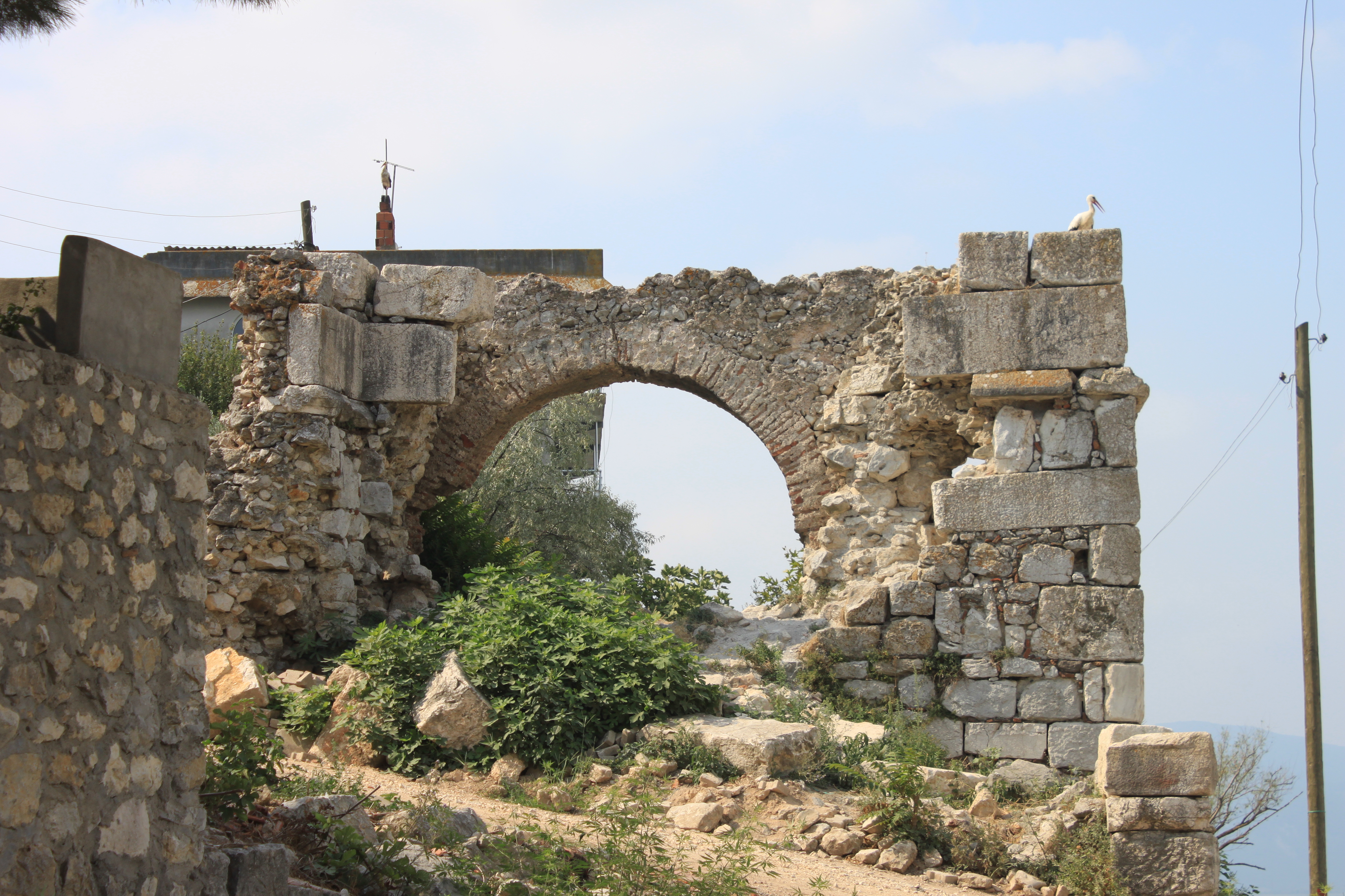
Ulubad or Uluabat, in the Byzantine period Lopadion ( grc, Λοπάδιον), Latinized as Lopadium, is a settlement near the town of Karacabey in the Bursa Province of northwestern Turkey. It was sited on the ancient Miletouteichos. History Uluabat is located on the banks of the Mustafakemalpaşa River (ancient and medieval Rhyndacus). It is first mentioned by Theodore of Stoudios in one of his letters, as the site of a ''xenodocheion'' (caravanserai). By the late 11th century, it featured a market town. The existence of a 4th-century bridge carrying the road between Cyzicus on the Sea of Marmara to the interior of Asia Minor made it a place of some strategic importance, especially in the wars of the Komnenian emperors against the Seljuk Turks in the 11th–12th centuries, during which it is best known. Alexios I Komnenos (r. 1081–1118) fought the Turks in the vicinity, and in 1130, his successor John II Komnenos (r. 1118–43) built there a great fortress which bec ... [...More Info...] [...Related Items...] OR: [Wikipedia] [Google] [Baidu] |
Propontis
The Sea of Marmara,; grc, Προποντίς, Προποντίδα, Propontís, Propontída also known as the Marmara Sea, is an inland sea located entirely within the borders of Turkey. It connects the Black Sea to the Aegean Sea via the Bosporus and Dardanelles straits, separating the country's European and Asian sides. The Sea of Marmara is a small sea with an area of , and dimensions of . Its greatest depth is . Name The Sea of Marmara is named after the largest island to its south side which is called Marmara Island because it is rich in marble (Greek (''mármaron'') "marble)." In classical antiquity it was known as the Propontis, which is derived from the Greek words ''pro-'' (before) and ''pontos'' (sea) and reflects the fact that the Ancient Greeks used to sail through it to reach the Black Sea that they called Pontos. Mythology In Greek mythology, a storm on the Propontis brought the Argonauts back to an island they had left, precipitating a battle in whic ... [...More Info...] [...Related Items...] OR: [Wikipedia] [Google] [Baidu] |
Ancient Mysia
Mysia (UK , US or ; el, Μυσία; lat, Mysia; tr, Misya) was a region in the northwest of ancient Asia Minor ( Anatolia, Asian part of modern Turkey). It was located on the south coast of the Sea of Marmara. It was bounded by Bithynia on the east, Phrygia on the southeast, Lydia on the south, Aeolis on the southwest, Troad on the west, and the Propontis on the north. In ancient times it was inhabited by the Mysians, Phrygians, Aeolian Greeks and other groups. Geography The precise limits of Mysia are difficult to assign. The Phrygian frontier was fluctuating, while in the northwest the Troad was only sometimes included in Mysia. The northern portion was known as "Lesser Phrygia" or ( grc, μικρὰ Φρυγία, mikra Phrygia; la, Phrygia Minor), while the southern was called "Greater Phrygia" or "Pergamene Phrygia". Mysia was in later times also known as Hellespontine Phrygia ( grc, Ἑλλησποντιακὴ Φρυγία, Hellespontiake Phrygia; la, Phryc ... [...More Info...] [...Related Items...] OR: [Wikipedia] [Google] [Baidu] |
Hellenica Oxyrhynchia
''Hellenica Oxyrhynchia'' is an Ancient Greek history of classical Greece in the late 5th and early 4th centuries BCE, of which papyrus fragments were unearthed at Oxyrhynchus, in Egypt. The author, whose name is not recorded in the surviving fragments, is usually known by scholars simply as "P" (for "papyrus"). Overview One of the two major fragments, called the ''London papyrus,'' found in 1906, deals with battles in the late Peloponnesian War, particularly the Battle of Notium. The other, the ''Florentine papyrus'', found in 1934, deals with events in the early 4th century BCE. The entire history seems to have been a continuation of Thucydides covering events from 411 BCE to 394 BCE, much like Xenophon's ''Hellenica'' ( a fragment of which has also been found at Oxyrhynchus). The discovery of the first papyrus in 1906 led to a shift in the degree of credence that historians assigned to the ancient sources of the period. In the 19th century, Xenophon, a contemporary of the e ... [...More Info...] [...Related Items...] OR: [Wikipedia] [Google] [Baidu] |
Agesilaus II
Agesilaus II (; grc-gre, Ἀγησίλαος ; c. 442 – 358 BC) was king of Sparta from c. 399 to 358 BC. Generally considered the most important king in the history of Sparta, Agesilaus was the main actor during the period of Spartan hegemony that followed the Peloponnesian War (431–404 BC). Although brave in combat, Agesilaus lacked the diplomatic skills to preserve Sparta's position, especially against the rising power of Thebes, which reduced Sparta to a secondary power after its victory at Leuctra in 371 BC. Despite the traditional secrecy fostered by the Spartiates, the reign of Agesilaus is particularly well-known thanks to the works of his friend Xenophon, who wrote a large history of Greece (the ''Hellenica'') covering the years 411 to 362 BC, therefore extensively dealing with Agesilaus' rule. Xenophon furthermore composed a panegyric biography of his friend, perhaps to clean his memory from the criticisms voiced against him. Another historical tradition—muc ... [...More Info...] [...Related Items...] OR: [Wikipedia] [Google] [Baidu] |
Ancient Sparta
Sparta ( Doric Greek: Σπάρτα, ''Spártā''; Attic Greek: Σπάρτη, ''Spártē'') was a prominent city-state in Laconia, in ancient Greece. In antiquity, the city-state was known as Lacedaemon (, ), while the name Sparta referred to its main settlement on the banks of the Eurotas River in Laconia, in south-eastern Peloponnese. Around 650 BC, it rose to become the dominant military land-power in ancient Greece. Given its military pre-eminence, Sparta was recognized as the leading force of the unified Greek military during the Greco-Persian Wars, in rivalry with the rising naval power of Athens. Sparta was the principal enemy of Athens during the Peloponnesian War (431–404 BC), from which it emerged victorious after the Battle of Aegospotami. The decisive Battle of Leuctra in 371 BC ended the Spartan hegemony, although the city-state maintained its political independence until its forced integration into the Achaean League in 192 BC. The city neverthe ... [...More Info...] [...Related Items...] OR: [Wikipedia] [Google] [Baidu] |
Cius
Cius (; grc-gre, Kίος or Κῖος ''Kios''), later renamed Prusias on the Sea (; la, Prusias ad Mare) after king Prusias I of Bithynia, was an ancient Greek city bordering the Propontis (now known as the Sea of Marmara), in Bithynia and in Mysia (in modern northwestern Turkey), and had a long history, being mentioned by Herodotus, Xenophon, Aristotle, Strabo and Apollonius Rhodius. Geography Cius was strategically placed at the head of a gulf in the Propontis, called the gulf of Cius, or ''Cianus Sinus''. Herodotus calls it Cius of Mysia; and also Xenophon, from which it appears that Mysia, even in Xenophon's time, extended at least as far east as the head of the gulf of Cius. Pliny the Elder reports that Cius was a Milesian colony. It was at the foot of Mount Arganthonius, and there was a myth that Hylas, one of the companions of Heracles on the voyage to Colchis, was carried off by the nymphs when he went to get water here; and also that Cius, another companion of ... [...More Info...] [...Related Items...] OR: [Wikipedia] [Google] [Baidu] |
Dascylium
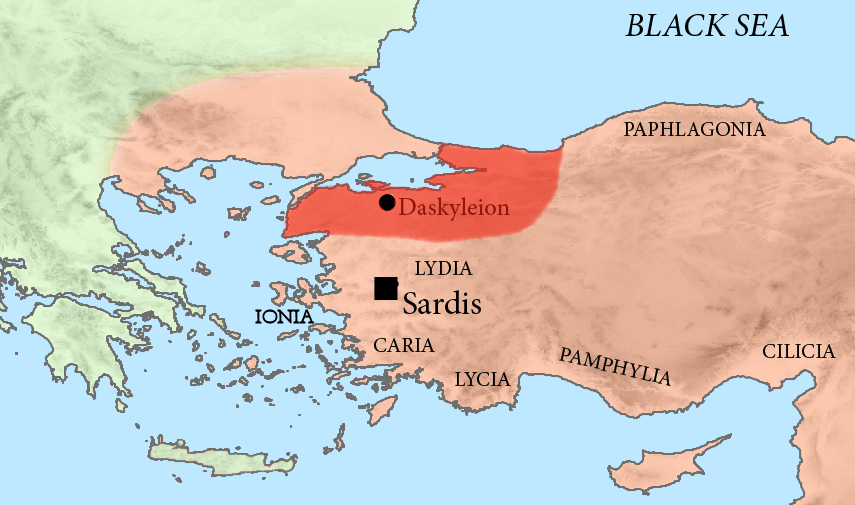
Dascylium, Dascyleium, or Daskyleion ( grc, Δασκύλιον, Δασκυλεῖον), also known as Dascylus, was a town in Anatolia some inland from the coast of the Propontis, at modern Ergili, Turkey. Its site was rediscovered in 1952 and has since been excavated. History Excavations have shown that the site was inhabited in the Bronze Age. Phrygians settled there before 750 BC. It came under the control of Lydia. It was then said to be named after Dascylus, the father of Gyges. After the Conquests of Cyrus the Great in 547 BC, Dascylium was chosen as the seat of the Persian satrapy of Hellespontine Phrygia, comprising lands of the Troad, Mysia and Bithynia. Pharnabazus was satrap of Darius III there, until Alexander the Great appointed Calas, who was replaced by Arrhidaeus in the Treaty of Triparadisus. According to Strabo, Hellespontine Phrygia and Phrygia Epictetus comprised Lesser Phrygia (Mysia). Others geographers arranged it differently. It was a member o ... [...More Info...] [...Related Items...] OR: [Wikipedia] [Google] [Baidu] |
Theorodokos
The ''theorodokoi'' (Greek: , ) in ancient Greece Ancient Greece ( el, Ἑλλάς, Hellás) was a northeastern Mediterranean civilization, existing from the Greek Dark Ages of the 12th–9th centuries BC to the end of classical antiquity ( AD 600), that comprised a loose collection of cult ... were sacred envoy-receivers whose duty was to host and assist the '' theoroi'' (θεωροί, "viewers") before the Panhellenic games and festivals... A ''theorodokos'' was sometimes appointed by the community in which he lived but sometimes by the community that sent out the '' theoroi''. To have a favorable report from the theoroi visiting the host city for a festival or games, the city-state assigned an affluent person to be a theorodokos. This was because in most cases the theorodokos was to bear the cost of hosting the theoroi, and to have adequate accommodations for the theoroi, the theorodokoi needed sufficient personal wealth. To have the desired favorable report from a theoro ... [...More Info...] [...Related Items...] OR: [Wikipedia] [Google] [Baidu] |
Miletopolis
Miletopolis ( grc, Μιλητόπολις) or Miletoupolis (Μιλητούπολις) was a town in the north of ancient Mysia, at the confluence of the rivers Macestus and Rhyndacus, and on the west of the lake which derives its name from the town. It was a Milesian colony. Strabo mentions that a part of the inhabitants of the town were transferred to Gargara at some indeterminant time. It was Christianised at an early date and remains a bishopric of the Greek Orthodox Church and a titular see of the Roman Catholic Church. The current Greek Orthodox Bishop to hold the title of Miletopolis is Bishop Iakovos of Miletopolis who serves as an assistant bishop in the Greek Orthodox Archdiocese of Australia. Its site is located near Karacabey Karacabey is a town and district of Bursa Province in the Marmara Region of Turkey. It is located just west of the Simav River near its confluence with the Adirnaz River. District of Karacabey borders districts of Mudanya and Nilüfe ... [...More Info...] [...Related Items...] OR: [Wikipedia] [Google] [Baidu] |
Apollonia Ad Rhyndacum
Apollonia or Apollonia-on-the-Rhyndacus ( grc, Ἀπολλωνία ἐπὶ Ῥυνδακῷ, ''Apollōnía épì Ryndakō''; la, Apollonia ad Rhyndacum) was an ancient town opposite the delta of the Rhyndacus river in northwestern Anatolia and corresponds today to the town of Gölyazı. Location Nine cities known as Apollonia were build during antiquity in Anatolia. Strabo placed Apollonia-on-the-Rhyndacus in Mysia, causing some to misidentify Uluabat as Apollonia on the western shore of Lake Uluabat. However, the site is actually the promontory tombolo on the northeastern shore, near modern Gölyazı. Lake Uluabat extends from east to west and is studded with several islands and peninsulas, on one of which the city of Apollonia was built. The name of “Apollonia ad Rhyndacum” was likely chosen in order to differentiate from the other cities in the antiquity with reference to the stream “Rhyndacus (Adranos)” located close to the city and stemming from Aizanoi ( Çavd ... [...More Info...] [...Related Items...] OR: [Wikipedia] [Google] [Baidu] |

.jpg)


