|
Middlestown
Middlestown is a small village in the City of Wakefield, Wakefield District in West Yorkshire, England. The village is in the civil parish of Sitlington and located halfway between the city of Wakefield and the town of Huddersfield, and is south east of Dewsbury. History The villages of Middlestown, Netherton, Wakefield, Netherton, Overton, Wakefield, Overton and Midgley are built around and overlook the Coxley Valley. Whilst the village is not recorded in the Domesday Book, the place-name is recorded as far back as 1322 as ''Middles(c)hitelington''. This was originally ''Middle Shitlington'', the Middle part of that parish, which was renamed to Sitlington in 1929, to avoid the rude inference of the word ''Shit''. The Middlestown built-up area contains two Nature Reserves, managed by Yorkshire Wildlife Trust, and is also home to the National Coal Mining Museum for England in neighbouring Overton. The population of the built-up area at the 2011 Census for England and Wales, 2011 ... [...More Info...] [...Related Items...] OR: [Wikipedia] [Google] [Baidu] |
Sitlington
Sitlington, historically Shitlington, was a township in the ancient ecclesiastical parish of Thornhill in the wapentake of Agbrigg and Morley in the West Riding of Yorkshire comprising the villages and hamlets of Middlestown, Netherton, Overton and Midgley. The ''h'' was dropped from Shitlington and Sitlington was adopted in 1929 with the approval of the county council. The population of the civil parish at the 2011 census was 5,963. History Toponymy Shitlington has Anglo-Saxon origins. It possibly began as the settlement, ''tun'', connected with ''scyttel'' (either a personal name or a bar or gate which bolts shut) or might mean a farm or settlement on a steep slope. The village is recorded as "Schelingtone" in the '' Domesday Book''. Other spellings have included Shytlington, Sittlington, Schetlinton, and Scyllinton. Netherton was recorded as Schiteliton Inferior in the 13th century and subsequently as Nether Shitlington. It means the "lower town". Middlestown was Mi ... [...More Info...] [...Related Items...] OR: [Wikipedia] [Google] [Baidu] |
Listed Buildings In Sitlington
Sitlington is a civil parish in the metropolitan borough of the City of Wakefield, West Yorkshire, England. The parish contains ten listed buildings that are recorded in the National Heritage List for England. Of these, two are listed at Grade II*, the middle of the three grades, and the others are at Grade II, the lowest grade. The parish contains the villages of Middlestown, Netherton, and Overton, and the surrounding countryside. In the parish is the large house, Netherton Hall, which is listed together with associated structures. Also in the parish is the former Caphouse Colliery, later the National Coal Mining Museum for England The National Coal Mining Museum for England is based at the site of Caphouse Colliery in Overton, Wakefield, West Yorkshire, England. It opened in 1988 as the Yorkshire Mining Museum and was granted national status in 1995. History Caphouse ..., which contains two listed buildings. The other listed buildings consist of fa ... [...More Info...] [...Related Items...] OR: [Wikipedia] [Google] [Baidu] |
Overton, Wakefield
Overton is a village between Wakefield and Huddersfield in West Yorkshire, England. The village is situated approximately south-west of Wakefield, south of Ossett, west of Netherton, Wakefield, Netherton and 4 miles south-west of Horbury. Overton is conjoined at its north-east to the larger village of Middlestown. Coxley Woods are less than to the south-east. Overton was historically called 'Over Shitlington',"Thornhill: Shitlington" ''The National Gazetteer of Great Britain and Ireland'' 1868. Retrieved 15 January 2015 and was one of four villages in the Township (England), township of 'Shitlington' in the civil parish of Thornhill, West Yorkshire, Thornhill. In 1881 Overton was in the County court#England and Wales, county court district and Poor Law Union of Wakefield. Village occupati ... [...More Info...] [...Related Items...] OR: [Wikipedia] [Google] [Baidu] |
A642 Road
The A642 is an A-road in West Yorkshire, England which runs from Huddersfield to the A64 near Leeds. It partly follows the route of a historic turnpike road, which is evidenced by surviving toll houses. The road begins at Waterloo east of the town centre at the junction with A629 and continues via Lepton to Grange Moor where the A637 branches off. From there it passes through Middlestown and Horbury (on the Horbury bypass) and leads to the junction with A638 west of Wakefield City Centre. In Wakefield it follows the route of A638 and A61, branching off the latter north of the city centre and continuing via Stanley, Junction 30 of the M62 Motorway, Oulton, Swillington, and Garforth before meeting the M1 Motorway at Junction 47, where also A656 joins. North of the latter, the road continues as B1217. It is joined by B6433 in Lepton and B6118 in Grange Moor, crosses B6117 in Horbury Bridge, A639 in Oulton, B6475 in Lupset, and A61 in Wakefield City Centre. Branch ... [...More Info...] [...Related Items...] OR: [Wikipedia] [Google] [Baidu] |
National Coal Mining Museum For England
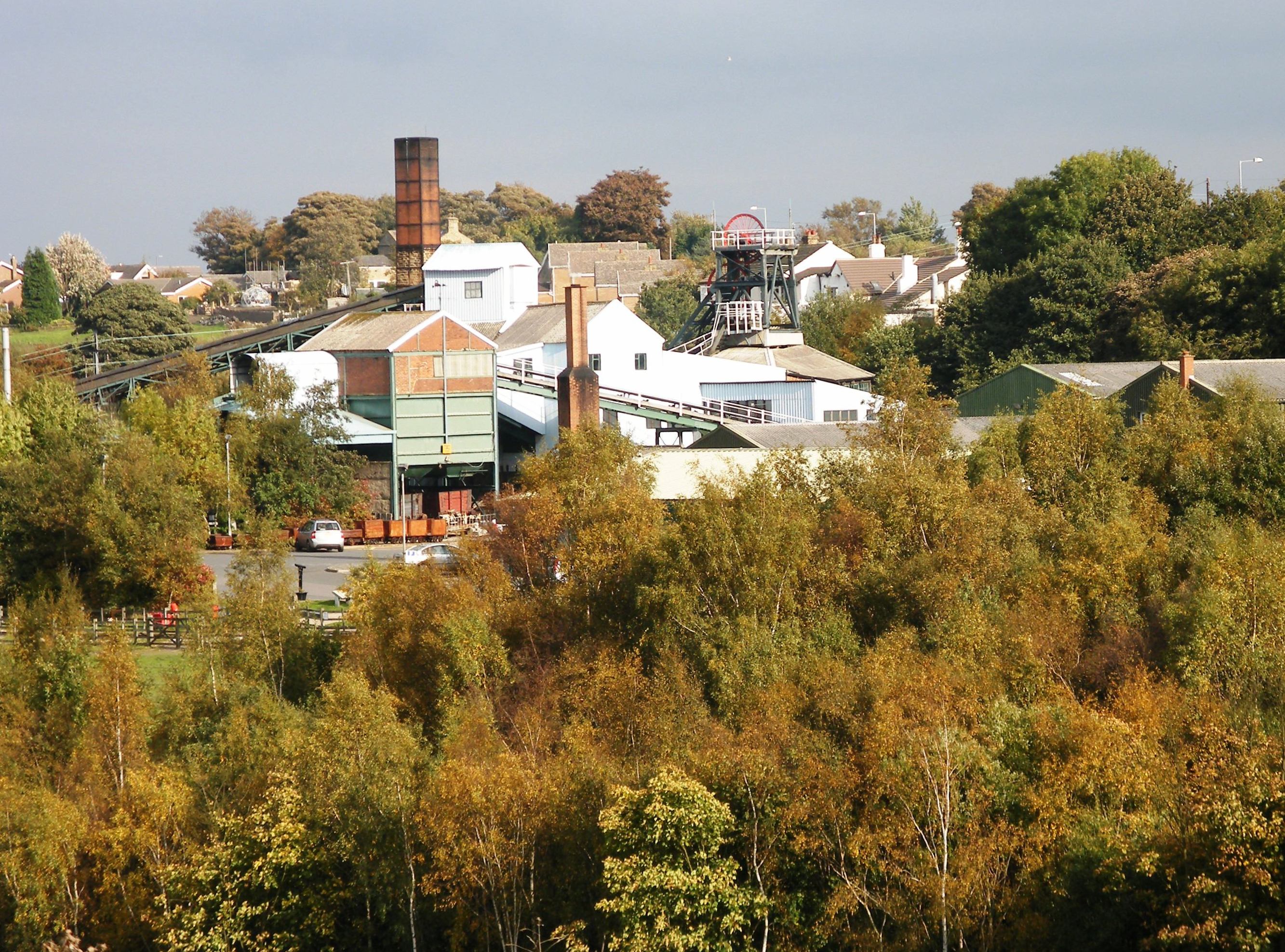
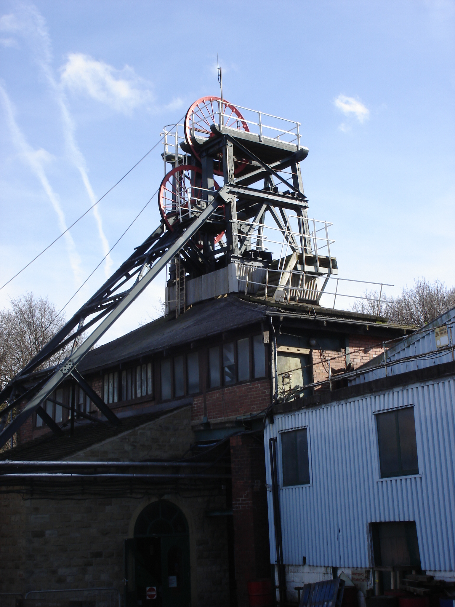
The National Coal Mining Museum for England is based at the site of Caphouse Colliery in Overton, Wakefield, West Yorkshire, England. It opened in 1988 as the Yorkshire Mining Museum and was granted national status in 1995. History Caphouse Colliery was sunk in the 1770s or 1780s and the Hope Pit in the 1820s. Sir John Lister Kaye of Denby Grange took over James Milnes' leases the mineral rights in 1827 and his pits became the Denby Grange Colliery. The boiler house and stone and brick chimney at the museum are Grade II listed structures built around 1876 for Emma Lister Kaye along with the steam winding engine house, boiler yard, heapstead and ventilation shaft which are Grade II* listed. The boiler house has two Lancashire boilers and powered the winding engine. The timber headgear at Caphouse and the wood framed screens building at Hope Pit date from between 1905 and 1911. Pithead baths and an administration block were built between 1937 and 1938. Lockwood and Elliott who ... [...More Info...] [...Related Items...] OR: [Wikipedia] [Google] [Baidu] |
City Of Wakefield
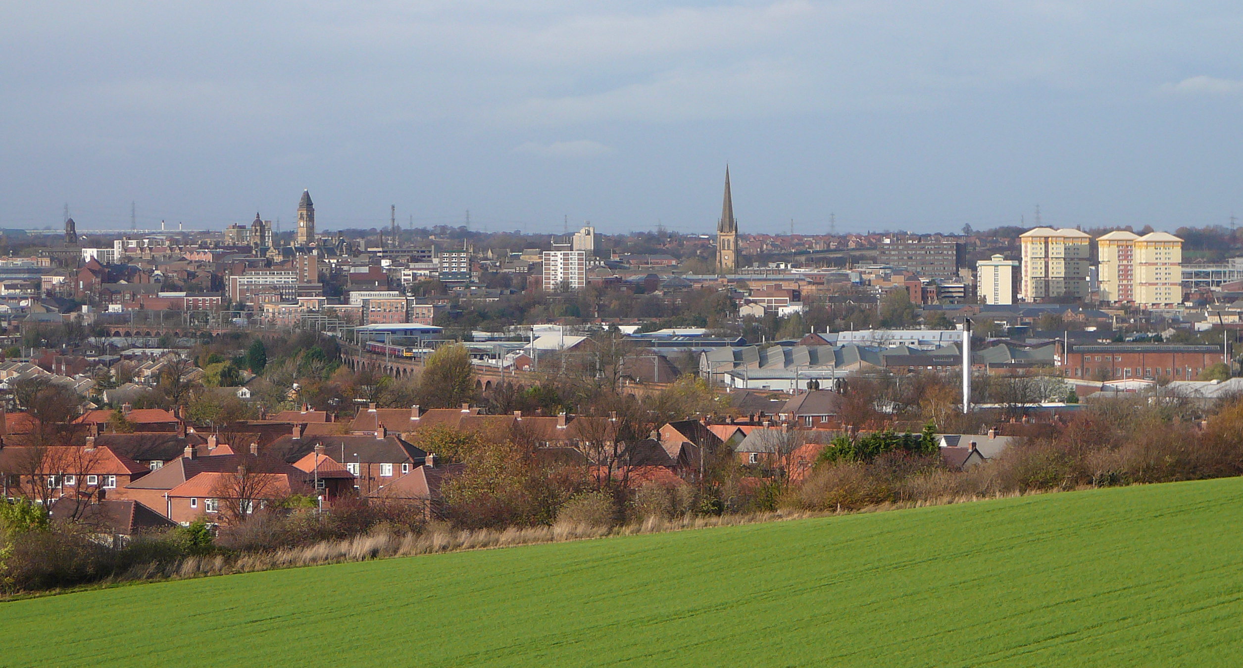
The City of Wakefield is a local government district with the status of a city and metropolitan borough in West Yorkshire, England. Wakefield, the largest settlement, is the administrative centre of the district. The population of the City of Wakefield at the 2011 Census was 325,837. The district includes the ''Five Towns'' of Normanton, Pontefract, Featherstone, Castleford and Knottingley. Other towns include Ossett, Horbury, Hemsworth, South Kirkby and Moorthorpe and South Elmsall. The city and district are governed by Wakefield Metropolitan District Council from headquarters in County Hall. In 2010, Wakefield was named as the UK's third most musical city by PRS for Music. Economy The economic and physical condition of several of the former mining towns and villages in Wakefield District have started to improve due to the booming economy of Leeds – and an increase in numbers of commuters to the city from the sub-region – and a recognition of undeveloped ass ... [...More Info...] [...Related Items...] OR: [Wikipedia] [Google] [Baidu] |
Netherton, Wakefield
Netherton is a village in the City of Wakefield metropolitan borough of West Yorkshire, England. It lies about 4 miles south-west of Wakefield, 3 miles south of Ossett, 1 mile south of Horbury. The village is in the Wakefield Rural ward of Wakefield Metropolitan District Council. The village name is shown on map "Dvcatvs Eboracensis pars occidentalis" from 1646. The ''h'' was dropped from nearby Shitlington and Sitlington was adopted in 1929 with the approval of the county council. History Netherton, originally Nether Shitlington was, with Over Shitlington ( Overton) and Middle Shitlington ( Middlestown), part of the township of Shitlington in the ancient ecclesiastical parish of Thornhill in the wapentake of Agbrigg and Morley in the West Riding of Yorkshire. A Mesolithic axe was found near the Star Inn in 1963. Shitlington was probably settled in Anglo-Saxon times and was recorded in the ''Domesday Book'' as ''Schellingtone''. Netherton Hall, a Grade II* listed manor house, ... [...More Info...] [...Related Items...] OR: [Wikipedia] [Google] [Baidu] |
England
England is a country that is part of the United Kingdom. It shares land borders with Wales to its west and Scotland to its north. The Irish Sea lies northwest and the Celtic Sea to the southwest. It is separated from continental Europe by the North Sea to the east and the English Channel to the south. The country covers five-eighths of the island of Great Britain, which lies in the North Atlantic, and includes over 100 smaller islands, such as the Isles of Scilly and the Isle of Wight. The area now called England was first inhabited by modern humans during the Upper Paleolithic period, but takes its name from the Angles, a Germanic tribe deriving its name from the Anglia peninsula, who settled during the 5th and 6th centuries. England became a unified state in the 10th century and has had a significant cultural and legal impact on the wider world since the Age of Discovery, which began during the 15th century. The English language, the Anglican Church, and Eng ... [...More Info...] [...Related Items...] OR: [Wikipedia] [Google] [Baidu] |
Civil Parish
In England, a civil parish is a type of Parish (administrative division), administrative parish used for Local government in England, local government. It is a territorial designation which is the lowest tier of local government below districts of England, districts and metropolitan and non-metropolitan counties of England, counties, or their combined form, the Unitary authorities of England, unitary authority. Civil parishes can trace their origin to the ancient system of Parish (Church of England), ecclesiastical parishes, which historically played a role in both secular and religious administration. Civil and religious parishes were formally differentiated in the 19th century and are now entirely separate. Civil parishes in their modern form came into being through the Local Government Act 1894, which established elected Parish councils in England, parish councils to take on the secular functions of the vestry, parish vestry. A civil parish can range in size from a sparsely ... [...More Info...] [...Related Items...] OR: [Wikipedia] [Google] [Baidu] |
West Yorkshire
West Yorkshire is a metropolitan and ceremonial county in the Yorkshire and Humber Region of England. It is an inland and upland county having eastward-draining valleys while taking in the moors of the Pennines. West Yorkshire came into existence as a metropolitan county in 1974 after the reorganisation of the Local Government Act 1972 which saw it formed from a large part of the West Riding of Yorkshire. The county had a recorded population of 2.3 million in the 2011 Census making it the fourth-largest by population in England. The largest towns are Huddersfield, Castleford, Batley, Bingley, Pontefract, Halifax, Brighouse, Keighley, Pudsey, Morley and Dewsbury. The three cities of West Yorkshire are Bradford, Leeds and Wakefield. West Yorkshire consists of five metropolitan boroughs ( City of Bradford, Calderdale, Kirklees, City of Leeds and City of Wakefield); it is bordered by the counties of Derbyshire to the south, Greater Manchester to the south-west, La ... [...More Info...] [...Related Items...] OR: [Wikipedia] [Google] [Baidu] |
Huddersfield
Huddersfield is a market town in the Kirklees district in West Yorkshire, England. It is the administrative centre and largest settlement in the Kirklees district. The town is in the foothills of the Pennines. The River Holme's confluence into the similar-sized River Colne, West Yorkshire, Colne to the south of the town centre which then flows into the River Calder, West Yorkshire, Calder in the north eastern outskirts of the town. The rivers around the town provided soft water required for textile treatment in large weaving sheds, this made it a prominent mill town with an economic boom in the early part of the Victorian era Industrial Revolution. The town centre has much neoclassical Victorian architecture, one example is which is a Grade I listed building – described by John Betjeman as "the most splendid station façade in England" – and won the Europa Nostra award for architecture. It hosts the University of Huddersfield and three colleges: Greenhead College, Kirk ... [...More Info...] [...Related Items...] OR: [Wikipedia] [Google] [Baidu] |
Dewsbury
Dewsbury is a minster and market town in the Metropolitan Borough of Kirklees in West Yorkshire, England. It lies on the River Calder and on an arm of the Calder and Hebble Navigation waterway. It is to the west of Wakefield, east of Huddersfield and south of Leeds. Historically a part of the West Riding of Yorkshire, after undergoing a period of major growth in the 19th century as a mill town, Dewsbury went through a period of decline. Dewsbury forms part of the Heavy Woollen District of which it is the largest town. According to the 2011 census, Dewsbury had a population of 62,945. History Toponymy The ''Domesday Book'' of 1086 records the name as ''Deusberie'', ''Deusberia'', ''Deusbereia'', or ''Deubire'', literally "Dewi's fort", Dewi being an old Welsh name (equivalent to David) and "bury" coming from the old English word "burh", meaning fort. Other, less supported, theories exist as to the name's origin. For example, that it means "dew hill", from Old English ''d� ... [...More Info...] [...Related Items...] OR: [Wikipedia] [Google] [Baidu] |


.jpg)
